Create your first map or collecting project !
Give us some information about your work and get a personalized demo.
Oops! Something went wrong while submitting the form.

GIS Cloud Blog
Latest news on feature and product releases, success stories, tutorials, courses and webinars

Grounded Innovation: Reflections on GEO Business & Digital Construction Week 2025
By Andrew Loveless, CRO, GIS Cloud It’s been an energising week for the geospatial and construction tech community. With parallel at GEO Business and Digital Construction Week, one thing became crystal clear: location intelligence is now a core pillar of how we build, maintain, and manage our world. It was great to see a robot...

We Welcome Andrew Loveless as Our Chief Revenue Officer
Driving Strategic Growth and Expanding Industry Impact With over 300 clients in 60+ countries, we’re entering a new phase of growth at GIS Cloud, and we’re excited to share that Andrew Loveless has joined us as our Chief Revenue Officer. Andrew brings more than 20 years of leadership experience in the geospatial...

Take Your GIS Expertise to New Heights with Our Advanced Courses!
Ready to take your GIS skills to the next level and stand out as a leader in the industry? The wait is over—GIS Cloud’s Advanced Courses are back! 🚀 This course is your chance to dive deep into GIS Cloud tools, master advanced workflows, and become a Certified GIS Cloud expert. Whether you’re...

GIS Solutions: Optimizing Fire Hydrant Inspections
Being a cloud based GIS solution doesn’t stop with a mobile application. GIS Cloud has other tools that can be used to improve your team’s fire hydrant inspection routine. We will show you how GIS Cloud’s online solutions can solve your fire hydrant inspection frustrations. Many of these solutions will solve these headaches...

Transform Water Operations Asset Management & Field Services
In a time when water utilities are grappling with the dual challenges of climate change and growing demands for water services, the urgency for effective asset management is at an all-time high. Water utility operators, consultants, and managers face a wide range of problems, from old infrastructure to increasing water losses that don’t bring...

From Paper to Digital: Water Valves Exercise Logs
Are your operators using paper maps to track their routine water valve exercises? Do they have company issued smartphones? It’s time to upgrade the workflow. We are going to show you how easy it is to inventory your valve exercises with a mobile app. It doesn’t matter if you have an Apple...

Transform CCTV Inspections with the Mobile Data Collection
The Mobile Data Collection application is your winning ticket. The app could be worth a million dollars to you and your organization. It is the key to a successful field operation. The application works on iOS and Android devices. Clients of ours, like Pipe View America, use the application. How many thousands...

GIS Mobile Applications for Leak Detection
Leaks occur frequently in water utility systems. They result in water loss and high repair costs. Pipe and valve leaks demand attention from important staff members and are a distraction. Detecting hidden leaks can also be expensive and take crucial funds from the budget. These issues can be tracked, analyzed, and even...
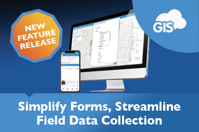
Streamlining Your Data Entry with Grouped Form Items
Suppose the first step to improving your data collection workflow was to move from pen-and-paper to a digital solution. The next big step is improving the quality of your workflow for project managers and data collectors in the field. In GIS Cloud’s Mobile Data Collection Portal and Map Editor, grouping form items is...
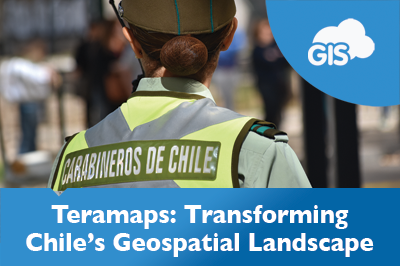
Teramaps – Partner Use Case
Teramaps is a GIS Cloud partner that offers technical solutions for their clients’ geography needs. They integrate QGIS’s desktop applications with GIS Cloud’s online solutions to deliver valuable tools throughout Chile and across South America. Their clients range from a variety of industries, including municipalities, power and gas companies, the Chilean military, universities,...

Organic Certification of Smallholder Farmers
ADDA, Agricultural Development Denmark Asia, and partners have enabled 300 smallholder farmers in Northern Uganda to obtain an EU Organic Certification through digitization with GIS Cloud. Soybeans have gone from being an alternative crop to a global market mover. This shift in agriculture has given small Ugandan farmers a stage on the world...

Beyond Maps: How GIS is Redefining Utility Field Operations
How can modern GIS technology improve the efficiency and decision-making in utility management? We see utility sectors facing challenges like old infrastructure and caring for the environment. This article looks at how GIS Cloud’s tools – Mobile Data Collection app, Map Editor, Map Viewer, and Map Portal – make mapping better and change the...

The Ultimate GIS Guide: Things You’re Doing Wrong and How to Fix Them!
Have you ever felt like you’re navigating a maze when dealing with Geographic Information Systems (GIS)? Well, you’re not alone. GIS is a fascinating world, full of potential, but it can also be a bit overwhelming, especially if you’re starting out. But fear not! This guide shines a light on those common GIS pitfalls...

Transforming Government Work with GIS Cloud
In an era where quick and smart decisions are key, governments at all levels – local, state, and federal – are embracing Geographic Information Systems (GIS) in the cloud. This move is not just about keeping up with technology; it’s about reshaping how government departments work together, make decisions, engage with communities, and plan...

From Data to Insight, Exploring the Datagrid – Webinar Recording
Making Data Exploration Simple Our recent webinar focused on the GIS datagrid, a tool that goes beyond a typical table. It opens the door to deep data exploration. We showed how this tool helps you spot patterns and trends essential for various tasks, from infrastructure planning to market analysis. Unlocking Spatial Data’s Potential...
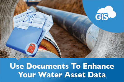
Optimize GIS Water Asset Management with Document Linking
As GIS Analysts, Specialist, Data scientists, and Technicians we are the holds of a lot of information. Many of us are the go to person for all sorts of questions. How deep is that sewer line buried? What infrastructure is within 50 feet of this road? What do documents say? How many feet...

Navigate To Feature: Map Your Way To Your Assets
GIS mobile applications allow you to map your water assets. Map mobile applications provide you with directions on the go with improving reliability. GIS Cloud has combined these features under one awesome Mobile Data Collection application. The Navigate To Asset Feature saves travel time, especially during scheduled maintenance and routine inspections. ...

Becoming a GIS Cloud Pro: December Advanced Courses
It’s still October, but let’s talk end of the year plans! We’re rounding off this year with one last Advanced Education Course for 2023, so if you’ve missed the Summer Bootcamp, this is your chance! Our intensive two-day online training program provides a solid foundation in essential GIS Cloud tools. It equips you...

Manage Water Resources Using GIS Cloud Solutions
Water is a source of life. There is a reason why major cities are adjacent to water. Management of this precious resource is important in sustaining these populations. Geographic Information Systems (GIS) organize spatial data into tables of dynamic information. This data can be presented in easy to use maps and web applications....

Mastering Field Data Collection Efficiency and Best Practices: Webinar Recap
Field data collection stands at the forefront of many sectors, from infrastructure and environmental monitoring to asset management. But often, data collection faces inefficiencies due to outdated methods, limited resources, and tight budgets. To provide insights into improving the efficiency, quality, and cost-effectiveness of data collection processes, GIS Cloud recently hosted a webinar...

Critical Telecommunication Assets Supported with GIS
Data centers, fiber optic lines, and towers make up the telecommunication networks that connect people from around the globe. These physical assets are the critical assets that enable us to live our digital lives. So, how can GIS safeguard these assets during disasters? We will explore the roles each plays and how...

PSD Citywide & GIS Cloud New Integration Partnership
London, Ontario & Zagreb, Croatia – September 21, 2023 – PSD Citywide® is pleased to announce its new integration with GIS Cloud, a leading European provider of GIS mapping working in more than 50 countries worldwide. Fully integrated with Citywide GIS, current and future clients can access a wealth of new public mapping options...

Never Miss a Data Point: Offline Data Collection for GIS Professionals
Working at a site without cell service shouldn’t prevent you from getting the job done. GIS Cloud’s Mobile Data Collection (MDC) application simplifies editing and gathering field data. It lets you and your team capture data from your job sites and update the databases remotely. The MDC application removes the need to...

GIS Powered Telecommunication Network Maintenance
Maintaining your telecommunication network is a critical part of your operation. A digitized network backed by GIS will improve your maintenance workflows with the introduction of applications like GIS Cloud’s Map Viewer and Mobile Data Collection app. In a recent post, we discussed the analyzing capabilities of GIS Cloud and your digitized telecommunication network....

Telecom Digitization, Service Coverage and Gap Analysis
How much does your telecommunication network cover? How many customers are within your reach? Where are your oldest assets? A quick analysis in Map Editor can provide you with all the answers. A service coverage and gap analysis can identify the areas your telecommunication network covers. It will also show you the...

Simplifying Data Analysis: A Guide to Filtering the Datagrid
It’s been two months, but we’re still buzzing from the release of our new Datagrid! So, we wanted to take this opportunity to show you some more ways in which you can fully take advantage of this major upgrade. Gone are the days of sifting through endless rows and columns to find the...

Are You Ready to Digitize Your Telecom Critical Infrastructure?
In today’s rapidly evolving telecommunications industry, staying competitive and reliable requires more than selling superior systems or software. It necessitates a comprehensive approach encompassing all aspects of a vendor’s operations. One crucial area that telecoms and operators must focus on is digitizing their critical infrastructure. By digitally transforming and maintaining their critical assets, organizations...
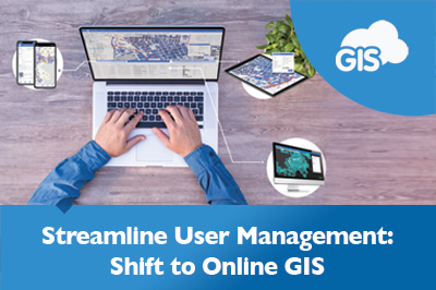
Managing Users in a GIS Online Solution
Managing users and licenses for your GIS software shouldn’t be a hassle. Project scopes and roles may change from project to project and require flexibility. Adapting to these changes in a production environment needs to be quick without costing a fortune. Making adjustments to user accounts and licenses shouldn’t require a phone...
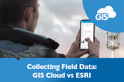
GIS Cloud’s Mobile Data Collection vs. ESRI’s Field Maps
If you have collected field data in the past decade, you probably used ESRI’s Field Maps or Collector application. Over 10 years ago, GIS Cloud created its Mobile Data Collection (MDC) application based in a cloud environment. A recent debate on the high cost of enterprise GIS has brought attention to other GIS...

Preserving Archaeology in Rural Landscapes Using GIS
You don’t have to be Indiana Jones to impact archaeology positively. You can be a student equipped with a smartphone. Selin Akdeğirmen Ercan is a Ph.D. candidate from the Yildiz Technical University. For her thesis, she focused on documenting and preserving historic sites in a rural Turkey region. Using GIS Cloud, she...
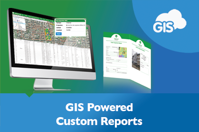
Streamline Reporting with GIS Cloud Custom Reports
Imagine it is that time of year again. Your quarterly reports to the government are due. Your field biologists have been working hard to collect the necessary field data all season. Rain or shine, they were out there inventorying nesting bird data. But now it’s time to organize the data for reporting....
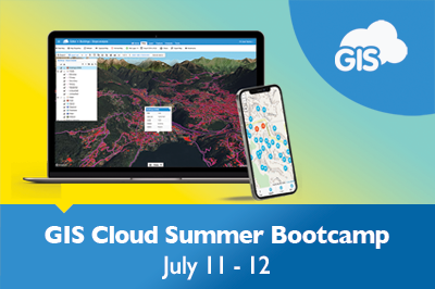
GIS Cloud Summer Bootcamp: Unleash Your Geospatial Potential!
Are you ready to take your GIS Cloud expertise to the next level? Look no further! We are thrilled to announce new dates for our GIS Cloud Advanced Course! Taking place in early July, the GIS Cloud Summer Bootcamp is an intensive, 2-day online event designed to help you unlock your geospatial potential. ...

AI Meets GIS: Reshaping Data Analysis
Artificial intelligence has recently hit the mainstream with tools like OpenAI’s ChatGPT and Midjourney. These AIs are improving workflows worldwide. GIS and spatial analysis have now integrated AI into their systems. With the latest developments in AI, you can leverage GIS and AI together. We will explore how AI can use GIS and...

Datagrid Reinvented – Powerful New Filters & Customizations!
This is HUGE. You’ve been waiting for this. It will change how you work with Data. We are so excited to share that a major release is out – a new Datagrid! It comes packed with powerful filters, including date range and other queries, neat table view customizations to help you easily analyze...

GIS Cloud And The Different Data Types
GIS data comes in many forms and file types. Making sure your GIS platform is compatible with the different types is important. Clients and data providers may send you the information in all forms, from shapefiles, to KMLs, to Excel tables with coordinates. We will go over some of the GIS data...

Using GIS for Vegetation Management in Electric Utility
Managing vegetation around power lines is a significant challenge for electric utilities worldwide. Overgrown vegetation can cause power outages, fires and even endanger public safety. Traditional vegetation management methods, such as pen and paper inspections, are often time-consuming and costly. However, GIS technology can help electric utilities efficiently manage vegetation, allowing for a...

Addressing the Solomon Islands Postal Corporation Challenge
The Solomon Islands Postal Corporation is undertaking a large challenging project. They are embarking on mapping and developing a National Address database for the country. This is a large-scale geospatial project, even for a country of only 700,000 people. There are many challenges in developing such a system, but having the support...

GIS Cloud and Civil Engineering
Civil engineering covers various disciplines, from impressive structures to critical water distribution infrastructure and sensitive environmental resources. Each of these play an important role in society. Failures in either could have a devastating impact on society and the environment. Properly constructing and maintaining these assets is essential. Let’s explore how GIS Cloud...

GIS Cloud and Water Utilities
Imagine having all the answers at your fingertips. What size water line is running down this street? What material is it made of? How deep is it buried? Do I have legal rights to install a service line running off this water main into that adjacent parcel? If so, where? With your utilities...

Does Enterprise GIS (such as ESRI) Need To Be That Expensive?
Geoawesomeness posted an interesting article exploring the costs of GIS solutions. The article explores the pricing model of legacy GIS companies and the challenges of implementing open-source GIS tools at scale. It also highlights the trend towards hybrid open-source solutions, such as QGIS for desktop processing and startups like GIS Cloud or Mapbox...

Making Informative Maps and White-labelling Apps
Have you ever looked at a map and immediately, from the get-go, were able to understand what the author wanted to show? GIS allows us to interact with data more efficiently and make precise decisions and actions based on the representation of spatial data through maps. Data visualization is one of the crucial...

GIS Cloud Solutions in Telecom Industry
GIS, much like telecommunication, has come a long way. Telecommunications have developed from smoke signals to fiber optic lines and long-range wireless data connections. GIS has gone from hand-drawn maps to as-built plans to 3D models that are accurate to the hundredths of an inch. Bringing telecommunication networks into a GIS...

Road Maintenance Webinar – GIS and Power BI Integration
Last week, GIS Cloud hosted InfraTrace for a webinar discussing Road Maintenance use case with GIS and Power BI integration. InfraTrace’s Roland Christen showcased its methodologies in collecting data from the field, analyzing data, and leveraging GIS Cloud with Power BI. They develop informative dashboards and comprehensive reports for the local communities they...

GIS Cloud and Power BI – Infrastructure Management with InfraTrace
GIS is a powerful tool being used worldwide. Maps have become an effective tool for communicating information to people. In recent years, maps have been frequently used to show the widespread pandemic and the impacts of natural disasters. Maps and GIS communicate with minimal losses in translation about what is happening, where it...

Improving Road Infrastructure in Australia with Online GIS (Case Study)
The District Council of Mallala, now known as Adelaide Plains Council, in South Australia, has been using GIS Cloud for over eight years. The Adelaide Plains Council area covers over 350 square miles off the St.Vincent Gulf. Despite being a small community with fewer than 10,000 people, the Council uses smart and modern...

Key Benefits of Using GIS Cloud’s Map Portal
Discover the essential benefits of GIS Cloud’s Map Portal, a dynamic and user-friendly platform revolutionizing the way GIS professionals and enthusiasts interact with mapping technology. This article delves into the core advantages of Map Portal, offering an in-depth look at why it stands out in the GIS community. Key Benefits of Map Portal...

GIS Cloud Benefits: Super-fast High Definition Maps
The GIS Cloud team takes great pride in having accurate and detailed super fast high definition maps. Aside from providing remarkable map visuals where every pixel is rendered at high definition, our map engine significantly improves the speed at which a large number of map features are generated. Working on our high-resolution maps,...

Offline Mapping and Data Collection
GIS Cloud’s offline maps feature has proven to be a helpful tool not only in remote areas with poor signal but in cases where using mobile data to connect your app can make a substantial bill for the company. GIS Cloud’s platform provides a single-click solution for companies looking to improve their productivity. Our...

Custom Popup Style and Grafana Integration
Author: Marko Polovina, Frontend Developer at GIS Cloud Info popup is one of our standard UI components to visualize feature data. By default, the component is available in any GIS Cloud application. But sometimes, we want to customize popups to adjust the style or to integrate with other apps. In that case, we can...

GIS Cloud Integrations
The GIS Cloud team is proud to be a part of the group of platforms that offer a better user experience with diverse integrations and a user-friendly interface. GIS Cloud is a fully scalable, pay-for-what-you-use online platform with no desktop installation required. With our platform, there is no limit to showing relations on a...

Benefits of GIS Online Solutions
For years now, online GIS solutions have been improving the efficiency of thousands of organizations in their day-to-day operations. The benefits of these solutions go beyond time and cost savings. GIS Cloud has been around since the first migration to online mapping. Our company is centered on providing its users with the benefits...

Online Solution for Digital Mapping
One of the main benefits of any GIS software has become sharing data and collaborating on maps in real-time. GIS Cloud’s platform offers a single-click solution for sharing maps and data with clients or the public. With GIS Cloud publisher for QGIS, any GIS user can quickly publish and share their maps without changing...

Master GIS Cloud In-Depth!
At GIS Cloud, we always do our best to ensure that our apps are user-friendly and used by GIS and non-GIS users alike. Our team of customer support specialists and expert consultants is always on hand to offer support and guide you to an optimal workflow within GIS Cloud. However, if you want to...

Woodland Survey – Evolving Forests Use Case
Delighted for the opportunity to design and deliver a woodland survey focused on Dartmoor commons, our client Evolving Forests joined the ‘Healthy Trees for Tomorrow’ project. A joint venture with Dartmoor National Park Authority, Foundation for Common Land, and the Lottery Heritage Fund, realized by volunteers. Dartmoor on their doorstep and in their...

Create a GIS Project in 3 Easy Steps
Starting a GIS project has always seemed like a hassle to non-GIS users and even beginners in this field. However, creating a map that anyone can access and use should be done in a few steps that anyone can understand. GIS Cloud offers a real-time solution where the whole team can collaborate on...

Cost-effective Solutions for GIS Users
Imagine a world where small and medium-scale businesses can get a taste of the megacorp technological resources for a fraction of the price. Is a low-cost approach even possible in the GIS market? The answer is Yes! Consequently, these reasonably-priced GIS products have been recognized as convenient solutions for small businesses across...

3D – Exciting New Feature Release
For most, summer is a time for some rest and relaxation. We have decided to develop a cool new feature that will change how you look at your data. So without further ado, we are excited to release our newest feature: 3D visualization. We’ve heard your feedback and are implementing a 3D view into...

GIS Cloud – The Best Solution for Non-GIS Users
GIS software is constantly improving the process of how digital cartography benefits consumers with consistent and accurate personalized information at any moment. The wide variety of functions makes GIS a powerful tool for any enterprise. However, learning the software poses many obstacles for the average person to overcome. Implementing and learning GIS solutions...

Using 3D in GIS
Most GIS users, whether an expert or a novice, are familiar with maps and data based on two dimensions. You have your coordinates – your longitude and your latitude- the basis for your points, lines, polygons, and raster data. However, mapping the world in two dimensions doesn’t always give you the complete picture, and...

GIS Cloud at FOSS4G 2022
Two years ago, we presented a new plugin on our platform that allows users to transfer and edit maps from QGIS to GIS Cloud, giving you the best of both worlds. With GIS Could publisher for QGIS, you can transfer and update maps or even specific layers effortlessly, making it a single-click solution for...

Form Translations – New Feature Release!
One of the great things about data collection projects in GIS Cloud is that you can fully customise them to suit your needs. This also means that you can create projects in any language you want by simply defining the field names or any preexisting values in the language of your choice! We’re...
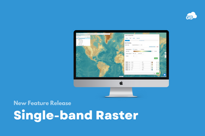
Single-band Raster – New Feature and Webinar!
Raster data has always been a big part of our users’ workflow – from adding drone imagery to maps in order to keep track of changes on construction or development sites to monitoring crops, from watersheds to monitoring water leakage. You can always add a basemap – they are a great, easily available resource...

Improving Workflows in Telecom Industry – Sotetel (Use Case)
As the telecommunications industry is one of the fastest-growing GIS markets in the world, we want to showcase the benefits of implementing the GIS Cloud solutions to provide an effective tool for making data-driven decisions. Companies use GIS Cloud for multiple purposes, from managing field operations to performing spatial analysis, network planning, deployment,...

Mobile Data Collection & New Form Builder Overview Webinar
Mobile Data Collection is a simple but extremely powerful application that enables you to create custom forms, control data access for your teams, organize crews and ensure the best data quality you can get. And most importantly, you do not have to be GIS professional to be able to set it up. It can...

H3 Visualization Spotlight
We are happy to announce that we have made some improvements when it comes to importing your csv/xls files to GIS Cloud. Until now, you have been able to upload only based on Lat/Long coordinate fields, and now we have brought you H3 and Well-Known-Text. H3 If you have ever seen hexagon...

Educational Infrastructure Maintenance Management using GIS Cloud
Our partner Global Code Technology from Costa Rica which also operates in other countries of the region successfully finished a field data collection of educational infrastructure for their client, Unidad Gerencial de Mantenimiento (UGM) in Peru. Unidad Gerencial de Mantenimiento (UGM) is a maintenance management unit, part of the Peruvian National Program for...

Management and Monitoring of Green Spaces using GIS Cloud Solutions | Nestorio, Greece
Our partner NubiGroup from Greece, helped the Nestorio Municipality, a small mountainous Municipality in Northern Greece, acknowledge the benefits of new technologies and implemented GIS Cloud solutions into its workflow to monitor and manage the municipal green spaces. NubiGroup is our partner and a company that creates a new generation of geo-services, research, and products by exploiting geospatial information...

A brief overview of GIS Cloud Industries & Partner Use Cases
As we have mentioned in our previous blog post, GIS Cloud works with numerous companies and organizations worldwide, coming from different backgrounds and government bodies. With this blog post, we wanted to showcase the industries and use cases where GIS Cloud has been successfully used. Check out this webinar recording on the benefits...

Become a GIS Cloud Partner
GIS Cloud is one of the leading cloud-based (online) GIS providers in the world! We work with numerous global companies and organizations coming from different backgrounds and industries. Primarily, those industries base their data on a location component. We dare to say that more than 80% of their data is location-based! Across the globe, they...

Mini School: Custom Applications
With GIS Cloud, you can build your custom, branded GIS applications on top of our robust platform, and what’s best, you don’t need to be a developer to learn how to do it. This Mini School focuses on just that, to show you how easy it is to white label applications within the...

PowerApps & GIS Cloud – New Integration Release!
Written by: Dr. Jonathan Stanger – PhD (Mech. Eng.), BSc (Phys., Chem.), Spatial Partners It is a general rule of life that you cannot perfectly satisfy everyone at the same time; this being particularly true for software products. The popularity and sizable subscription base for the PowerApps platform show that Microsoft products have struck...

GIS Cloud PowerPlus – Technical Overview & Components
“Power Apps is a suite of apps, services, and connectors, as well as a data platform, that provides a rapid development environment to build custom apps for your business needs.” Microsoft Docs In our recent blogs, we’ve written about how you can use the GIS Cloud platform to build new or extend...

NEW Developer Documentation Released
Building custom spatially-aware applications has never been easier with the GIS Cloud platform, especially because you don’t even need to know how to code, as explained here. That said, there’s a whole new world available for organizations and individuals who want to leverage Javascript and REST API for extra control and customization. GIS...

Multi Labels – New Feature Release
We are continuing with improvements related to data visualization, and we wanted to introduce the latest new feature that will enable having multiple labels activated for your data. Sometimes, when it comes to data visualization, you need to add an extra value that will provide your users with direct information without even clicking...

GIS Cloud Track – Complete Feature Overview
During the last month, we have introduced our newest product: GIS Cloud Track which is fully integrated with the entire GIS Cloud platform. Now the time has come to go in-depth with all the functionalities and insights to the solution itself. Check out how easy it is to track the real-time location of...

Sharing Maps: Best Practices for Web & Mobile
When sharing your maps with other people and looking for the right tool for the job, it’s important to define who the end-user will be and how they access the map. Do you plan on making your maps available to the general public? Are you sharing critical information with stakeholders and require their feedback?...

Mini School: Data Analysis
There is more to GIS than just visualizing the data you are working with. The real power lies in the ability to perform analysis and how to interpret the results for better planning and work optimization. In the past, that kind of analysis was better off left to the specialists to work on....

Data Collection & Crew Tracking in a Single Solution
We can all agree that one of the most significant improvements you can make for your projects is to go digital with your data collection. Having a tool that will save you time by removing the step of transferring data from paper to digital while also enabling you to get real-time feedback from the...

Field Maps with GIS Cloud
Field Maps is a term that finally gets a lot of attention due to the increasing need to enable field crews with location-based business applications that operate in remote environments. These applications are primarily used to improve situational awareness, increase operational visibility, reduce costs, and enable data collection crews with tools that communicate with...

Copy Symbology – New Feature Release
When it comes to data visualization, we can all agree that it takes a while to classify the data just the way you want it. Don’t get us wrong, this is an essential part if you want to get the most out of your maps and make them more presentable to the others...
GIS Cloud Track: Key Benefits of Real-Time Tracking
Since the beginning, all GIS Cloud applications have been built and are still being improved by considering our users’ feedback. And it’s not any different with the new product – GIS Cloud Track. For instance, many organizations asked if there is an application that can track their data collection crews in the field to...

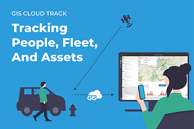
GIS Cloud Track – New Product Launch! Tracking fleet, people and assets
GIS Cloud Track – Get Early Access After many (many!) months of hard work, we are so excited to finally present our newest product: GIS Cloud Track! Having the location of your crews and assets in the field is one thing, but knowing the information on whereabouts, movement trends, and the status of...

Mini School: Map Data Visualization Guide
Unlike paper mapping, GIS provides a far richer and more flexible medium for portraying spatial data visualization. GIS allows us to interact with maps more easily and make more precise decisions and actions based on the representation of spatial data. When visualizing the data, it’s essential to keep in mind the person who...

Field Data Collection: Best Practices
Every field project is a bit different in a way. Even if you’re working in the same industry and on the same site for years, there will always be something you’ll need to tweak and adjust to make it work. A big part, that’s pretty much always lacking, is the time and resources you...

GIS Cloud Advanced Course and new certification opportunities!
A new year brings a new round of GIS Cloud Advanced Courses and a new certification opportunity! Our team of expert consultants and support specialists is always just a message, email, or call away to make sure all your questions are answered, but if you’re looking for an in-depth program that will help you master...

Unique Values in Data Collection Forms – New Feature Release
To further ensure the quality of the data you’re collecting in the field, we have added yet another feature to our Mobile Data Collection and Map Editor applications called Unique values! This feature enables users to avoid any duplicate data from being collected by defining which form items or columns in your table...

Webinar Recording – Turn your QGIS map into a data collection project
Last year we released a new QGIS Publisher which turned out to be a game-changer for a lot of our existing customers. But we didn’t stop there. Since then, we had a lot of new version updates that improved the tool significantly and helped users uncover new workflows that they thought were not possible...

Manage Your Geospatial Data Live with GIS Cloud and Desktop Integration
Spatial data integrity with WMS and WFS – setting up “Single Source of Truth” environments Talking to our customers, we found that there’s a whole range of different users that benefit from having an online GIS system in place, but many of them still use a desktop GIS solution, such as QGIS for...

Create a custom dashboard using the GIS Cloud API
Author: Marko Polovina, Frontend Developer at GIS Cloud Spatial planning can be hard without a dashboard application where we can connect our map with filters, graphs and tables. Using GIS Cloud API in the Map Portal application we will show you how to create your custom dashboard and enable better data overview...

Map Engine: Super-fast High Definition Maps!
We are excited to announce a major update on our map engine technology! Maps are now rendered at high quality utilizing every pixel on screen to deliver crisp rendering of geometry and labels. Besides providing stunning map visuals, this update significantly improves speed in rendering large amounts of map features and provides...

Beekeeping and Reforestation in Response to Climate Change – WeForest (Case Study)
In response to climate change, WeForest promotes forest landscape and ecosystem restoration in their projects. As a part of the Katanino Forest Restoration Project, they provided an alternative source of income from forest-friendly activities such as beekeeping and tree nurseries! With the help of GIS Cloud, they mapped the beekeeping areas and...

Optimizing Operations with Online GIS in Sustainable Forestry (case study)
Gozdno gospodarstvo Les from Ljubljana, Slovenia manages over 2000 ha of the estate consisting of forests. It is largely owned privately with few exceptions of company-owned forests. Using online GIS, they have complete IT support for their core business – planning, marking the trees to be felled, harvesting and selling the round wood. In...

Managing Recyclable Waste With Online GIS
Our Partners NubiGroup from Greece helped the “GreenPoint – Mob” project collect the data on mobile waste containers in remote areas in different countries and create a spatial database on waste and recycling bins, as well as monitor the status of the “GreenPoint-Mob” containers. This significantly improved waste management, saving the project time and...

GIS Cloud Services
To ensure your success while using GIS Cloud platform, we are launching GIS Cloud Services! Having an abundant portfolio of diverse GIS apps that are easily customizable, as well as a rich API allowing you to integrate or develop your own solutions within GIS Cloud, we decided it is time to put our...

Using GIS Cloud With External Databases
Author: Jonathan Stanger, Phd Spatial Partners, Australia – GIS Cloud partner Using GIS Cloud out-of-the-box provides most users with a cloud mapping application that fits all their business needs. While all platforms have limitations to their functionality, GIS Cloud is somewhat unique due to its willingness to offer integration opportunities via REST...

Geomarketing and GIS for Real Estate: Finding Potential New Hotel Locations in Zagreb (Croatia)
Ines Akrap, a Geoinformatics student at the University of Zagreb, created this case study and wrote the accompanying text on creating a geomarketing map using GIS Cloud and QGIS applications. Location Is The Most Important Thing in Marketing This interactive map aims to help potential investors analyze and visualize the possible locations...

Online GIS In Road Work Inspections And Maintenance
GIS technology has been enabling the Road Work Industry since the early beginnings. It is proven that the power of location enhances operational efficiency. Online GIS helps you obtain different data from different systems into a single easy-to-use platform. You will start using smart custom maps to plan, manage and maintain your road infrastructure to...

Data Management in Viticulture Using Online GIS (Case study – Croatia)
Ana Jantoš a Geography – GIS student from the University of Science in Zagreb wrote this case study to show how online GIS can make a crucial improvement in vineyard management. Besides creating an online database for inventory management and decision making, she states that GIS also helps to identify areas that can...

Certified GIS Cloud Advanced Course
Advanced Course is designed to offer deep and valuable insight into GIS Cloud workflows for more experienced platform users. Save your seat and become a certified GIS Cloud expert! The intention is to introduce and demonstrate the diversity of advanced GIS Cloud app features to clients. The course is meant to power...

Disaster Response and Risk Assessment in Vegetation Management – Use Case
Recently we held an exciting webinar on Online Solution for Vegetation Management! We touched upon some critical pain points of everyday vegetation management workflows and had an interesting poll where we found out that some companies still use paper forms or don’t collect their data in any way yet! GIS Cloud...

New Release – Share & Embed Maps From Your Custom Map Portal
Map Portal is a customizable GIS Cloud application that gives you a public overview of your daily mapping efforts and helps you visualize, export and publish geospatial data. To make your map sharing even more convenient, we created a new user functionality to share a specific view of the map you need to convey to...

Webinar Recording – GIS Cloud Solution for Vegetation Management
Dear Vegetation Management Specialists, we are happy to announce that the recording of our highly anticipated webinar on Online Solution for Vegetation Management is here! In this webinar, our Growth Department team touched upon some of the critical pain points in everyday vegetation management workflow like: Work scheduling, prioritization and coordination Tree maintenance, disease and...

Mapping Parking Zones, Garages and Free Parking in Zagreb (Croatia)
Each year the number of cars in the city grows, causing traffic jams and lengthening the time spent looking for a parking place. That leads to dissatisfaction and stress among drivers. Marija Milanović, geodesy student at the University of Zagreb, created an interactive Map Portal of parking zones and no fees parking spaces...

New Release: Add Electronic Signature to Your Digital Forms!
Our development team has been working on one of the key features for digital forms and delivered the Electronic Signature, an indispensable feature to support users in the field and make GIS Cloud solution for data collection even more powerful. This form field allows you to capture an electronic signature on your survey...

GIS Cloud Educational Workshop With Indigenous Mapping
Introduction to Field Data Collection Empowering the Everday Workflow With Online GIS We are thrilled to announce that we have partnered with the Firelight Group for an educational workshop session on their Indigenous Mapping Workshop platform, the largest international geospatial conference for Indigenous Nations and organisations on Indigenous-led geospatial research. Firelight Group and...

GIS Cloud Solution For Vegetation Management
We have held a free webinar/live demo showing you how to organize your vegetation management project. It was a step-by-step guide on the best field and office workflow with live examples and suggestions for organizing your vegetation management, crew & job coordination within the GIS Cloud platform. Including these processes and online collaboration...

New Year, New GIS Cloud Monthly Crash Courses!
We are happy to announce a new series of Crash Courses in February, starting with: Intro to Mobile Data Collection – February 4, 2021 – 3PM CET. Intro to Map Editor – February 11, 2021 – 3PM CET. The intention is to introduce the diversity of GIS Cloud...

Top 10 Most Read Articles And The 2020 Review
2020 has been a challenging year for all of us. Despite the lockdowns, and earthquakes that affected our region in Southeastern Europe, we have been working diligently, to improve GIS Cloud platform and provide the best services for our users! Throughout the year, our team has been focused on releasing a lot of...

Vegetation Management For Electric Utilities
Managing vegetation is crucial for the utility industries, especially for the power and electricity sector. Negligence to maintain vegetation results in destructive wildfires, and dangers of tree falling hazards on utility infrastructure. This brings considerable expenses to the budget and economic loss for both power companies and end customers, not to mention liability issues...

GIS Day Contest 2020 – Apply Now
While the Geoawareness week is in the full swing, thousands of Geogeeks worldwide focus on the importance of geography and celebrate the International GIS Day! Like every year we are joining the celebration by launching yet another GIS Day Contest to promote initiatives and project ideas that influence advancement and sustainability in...

Attach Media Files, Documents and Much More to Your Map Data in GIS Cloud
GIS Cloud is a versatile platform and allows you to import and attach various files to your collected and imported data easily. There are 2 ways to add files to your data. The first one is data collection with Mobile Data Collection app where you can add photo and audio files to your...

GIS For Vegetation Management
Every year vegetation management companies inspect vast amounts of areas where trees and different types of vegetation require care and trimming to avoid potential utility threats and other hazards, like fires or invasive species. In some regions of the world, there are strict laws and guidelines that require vegetation maintenance to comply with...

Spatial Visualization with Animated Graphs Using GIS Cloud Map Portal and D3.js
Author: Marko Polovina, Frontend Developer at GIS Cloud GIS Cloud API is, and always was, flexible and open for interaction with other frameworks and libraries. D3.js (Data-Driven Documents JS library) is not an exception. Using D3.js we are able to create interactive graphs and consequently better understand the data we are consuming. ...

GIS Cloud is Launching Monthly Crash Courses!
Educational Crash Courses – Starting November 2020! GIS Cloud had numerous educational workshops with clients and partners from around the globe. In our efforts to respond to such a huge interest and empower people with GIS knowledge, we are launching Monthly Crash Courses for our most popular apps! The intention is...

Mapping Water Taps to Ensure WASH Infrastructure and Safe Drinking Water for the Entire Population of Kumba (Cameroon)
Ensuring safe and clean water for the people across Africa is one of the greatest problems on the continent. Water sources are often miles from towns and villages, so people are forced to spend hours each day simply finding and transporting potable water back to their homes. In the city of Kumba (Cameroon),...

Power Your Workflow With Online GIS Apps: From Data Collection To Collaboration And Sharing, Integrated With Desktop Solutions – Webinar Recording!
On September 18th 2020 we held a live webinar in collaboration with Geospatial Awareness Hub on the topic of Powering Your Workflow With Online GIS Apps. Igor Farkaš, our business Development and Partners Manager touched upon significant Desktop GIS challenges and how harnessing the powerful GIS Cloud platform and apps will help empower...

Mapping Public Transportation after the Earthquake in Zagreb (Croatia)
Martin Malović, Geography/GIS student at the University of Zagreb, Faculty of Science made an interactive Map Portal with the help of GIS Cloud apps, representing changes in public transportation due to earthquake damages to facilitate daily movements for people in the city. Maps that are created as a part of this project...

GIS Cloud Online In-Depth Certificate Program – Apply For New Series Of Learning Sessions!
We are continuing with the series of GIS Cloud Online Education Programs! By now, we’ve had numerous educational workshops with our clients and partners from around the globe who have completed the program and received a Certificate for Online GIS Cloud Advanced Learning Program! With this Certificate, you become a proper GIS...

COVID 19 Surveillance and Community Mapping Project Using a Real-time Web GIS Platform in Philippines
COVID 19 is quickly spreading in the Philippines at an alarming rate. At this point, efforts to contain the virus depend on a contact tracing technology. The University of Cordilleras – Research and Innovation Office (UC-RIO) in Baguio City has developed a system powered by GIS that enables real-time reporting, inter-agency data sharing and...

GIS Cloud Launches Learning Center!
With the immense effort of our Customer Success and Support team, we have created a new and improved Learning Center that offers everything you need to know about GIS Cloud applications and platform! There are plenty of new materials that will guide you step by step in creating a unique GIS...

Use WFS and WMS to View and Edit GIS Cloud Data in Other Apps (New Release!)
We are excited to announce a new feature release which allows you to consume your GIS Cloud data via Web Feature Service (WFS) and Web Map Service (WMS) in third-party apps! This will also significantly improve the workflow for anyone who wants to collect data in the field using Mobile Data Collection, and view...

QGIS North America: Collect Field Data Directly into QGIS and Publish Maps Online
Last year GIS Cloud was happy to participate in the QGIS North America 2020 virtual conference on July 24th. We presented the GIS Cloud Publisher for QGIS, and its possibility to publish QGIS maps online preserving symbology, and how to use WFS to consume and collect data directly into QGIS via GIS Cloud, in real time! In our 20...

Virtual Conference “Power-Ops Security Nigeria” presenting a case on: “Fighting Electricity Theft with GIS Cloud”
A virtual conference “Power – Ops Security Nigeria” held by Agora Nexus in collaboration with GIS Cloud will be carried out on Wednesday 22nd July 12.00-13.30 (BST) / 13:00-14:30 (UTC) in Lagos. Uche Anyalewechi, Manager of GIS Projects at Enugu Electricity Distribution Plc will be leading a session on “Fighting Electricity Theft with GIS Cloud”. If...

GIS Mapping and Benefits of Online Solutions
GIS is a software that helps users create interactive smart maps that visualize spatial information and help make better and wiser business decisions that are important for the organization of work. Sometimes you can’t read your data and visualize it at the same time. GIS is the right solution to help you achieve that...

Mapping Entire Liberia To Bring Clean Water to Everyone – GIS for NGOs (Case Study)
Water is one of the Earth’s most valuable resources. Some of us take drinking water for granted, while millions of people across the globe can’t even imagine having everyday access to clean water. This is a success story about a project in Liberia that began in 2015, where nonprofits joined forces to map the...

Connect External ORACLE Database – New GIS Cloud Release!
We are happy to announce that our developers have implemented a new feature regarding external connections in our Database Manager. In the GIS Cloud Map Editor web application, it’s now possible to connect and view the data from your external ORACLE database! So far, it has been possible to connect only the PostGIS database in GIS...

Archive and Restore Maps – New GIS Cloud Release!
We have great news regarding our Map Editor and Mobile Data Collection Portal web applications: From now on you can archive and restore your maps and projects! Instead of the “Delete Map”, you will find a new “Archive Map” option. The idea is to give users the option and possibility to archive their maps...

GIS Cloud Online In-Depth Certificate Program – Apply for new round of learning sessions!
Last month we launched the first in a series of GIS Cloud online education programs, and we received more than 1300 applications from across the globe! We thank you for all the kind words and praises about our online education program! In our efforts to respond to such a huge interest and...

Landslide Prediction Mapping for Safe Housing and Construction Planning Using GIS
Landslides in the Kivu region (DRC, Africa) caused significant socio-economic destruction and have highly impacted the population. BEGE-RDC, a nonprofit organization, integrated its desktop and online workflow and created a heatmap with GIS Cloud apps that would emphasize the hotspots of the landslides and help predict development risks of this region. How can mapping...

GIS Cloud In-Depth Online Certificate Program: Enroll Now!
GIS Cloud is launching a two-day in-depth online education program, starting on the 29th and 30th of April. An opportunity for non-GIS professionals as well as proven GIS practitioners, to extend their knowledge and become certified specialists in GIS Cloud solutions and technology! As our contribution to the “stay at home” global initiative,...

QGIS Plugin: GIS Cloud Publisher – Why we made it and what can You do with it? (Webinar)
Two weeks ago we held a live demo webinar about the QGIS plugin we recently released; the GIS Cloud Publisher for QGIS. This plugin allows you to publish and update your QGIS maps online, preserving your symbology. In this webinar recording (below), you will learn how to easily transfer entire maps or only...

STOP Corona! Crowdsourcing App Uses Heatmap Analysis to Predict Coronavirus Outbreaks
Together with our partners, volunteers and organizations across the world, we launched the STOP Corona! App, to anonymously collect symptoms from the public! This crowdsourcing application is completely free, using location data and relying on people around the world to report their symptoms. The goal is to detect potential hotspots of the spreading of...

GIS Cloud Offers Technology and Support for Free to Projects Fighting to Contain Coronavirus
As we all know, Coronavirus is quickly spreading globally, and organizations and communities need to consume a lot of geospatial data changing from one minute to the other, to understand the patterns of the pandemic, and to plan how to organize staff and contain the virus. In the last couple of days, some...

Digital Transformation of Field Operations in a Water Utility Company Using GIS Cloud (case study)
Digitizing the process of field data collection and infrastructure data management utilizing the GIS Cloud platform, Liburnian waters achieved a multilevel collaboration with local governments, increased their data accuracy, and reduced job timeframe by eliminating paper forms. The implementation of field inspection via surveys on mobile phones had the biggest impact on their workflow,...

GIS Cloud Publisher for QGIS Released!
After extensive testing and listening to your ideas and needs, we are excited to present you with the GIS Cloud Publisher for QGIS! This QGIS plugin allows you to transfer maps from QGIS to GIS Cloud in a matter of minutes, preserving your symbology. You can also update all changes to your QGIS maps...

Using Crowdsourcing to Restore the Historical City Center of Mantova, Italy (Case Study)
The historical city center in Mantova, Italy, has been deteriorating for some time now. The buildings are not being properly maintained, and some of them are abandoned, despite the fact they are a cultural heritage recognized by UNESCO. But the Municipality of Mantova is trying to fix things with an urban regeneration project, a coordinated...

Using Mobile Apps for Field Operations in Water and Sewer Utilities (Case Study, Australia)
This case study shows how a utility company, Smith Brothers Group, improved the efficiency of inspecting asset conditions and field data collection by 30% with the GIS Cloud mobile apps for water utilities. The Smith Brothers Group operates in Australia and works on various water and sewer utility projects for local government units. They...

Monitoring a Mosquito Infestation with GIS Cloud (Case Study)
The Invasive Species Center is trying to mitigate the mosquito infestation plaguing the Istrian peninsula. They are trying to keep the infestation from spreading and stop any new mosquito species from entering the ecosystem. To coordinate the vast amount of fieldwork and to monitor the mosquito sources, they utilized the GIS Cloud platform. Read...

Accessibility Map of Zagreb for Persons in Wheelchairs (Collecting Lines Case Study)
The main project goal was to create a map that shows sidewalk accessibility and wheelchair obstacles in the center of Zagreb to help people with disabilities. The case study also shows how mobile apps helped the Department of Geography to transform a paper-based field workflow into a digital one. People in wheelchairs face...

Mapping the Geothermal Resources of Croatia
Geothermal energy is getting traction as a renewable energy source and an alternative to solar and wind farms. To better understand the geothermal potential of a country and to raise awareness, it’s best to present the geothermal resources data with interactive maps. That’s why Lea Petohleb, a graduate geologist from the University of Zagreb,...

Turn Your Map Into a Cloud-based GIS App
In this article, we’ll show you the fastest and easiest way to create an online GIS app with the App Builder. We’ll also weigh in on the benefits of online GIS apps over desktop GIS. If your company uses maps and field data daily, you probably have a person in charge of the...

Raising Awareness About Geoheritage With a GIS Portal
To better understand how the planet Earth has formed and how life on it evolved, it is necessary to take a look at the evidence we have about those processes. The rock records are the evidence. To understand and study those records, it is necessary to raise public awareness to keep the rock records...

Supporting a Swim Marathon With an Interactive Map Portal
Our partners Smart Cloud are supporting a swim marathon by tracking activities via an interactive map portal. The marathon is taking place around the archipelago in southern Croatia. Read more about the project and the maps we created. The marathon is organized by Domagoj Jakopović ‘Ribafish’, known to the public as a gourmand,...

How to Create a Hydrological Map Portal
Hydrology databases make it possible to map, track and observe water resources. Monitoring and modelling the data is essential in creating a sustainable system for managing the public water supply. Having to find and track down needed information manually is inefficient and unreliable, especially when taking into consideration that all assessments and analyses are...

Smart City Apps for Utilities
Smart city apps are an effective solution for getting data and feedback from your customers (citizens), contractors, or local governments. But, most of the smart city solutions are expensive and take ages to deploy. In this article, we’ll show you that’s not always the case. Keep reading and learn how to create a smart...

GIS for Electric Utilities
GIS software has been empowering the electric utility industry for decades. It provides a robust framework for asset and workforce management as well as tools for planning and analysis. Today, the landscape is filled with desktop solutions like those from ESRI, open-source software like QGIS, but also a host of online GIS solutions. ...

Mineral Resources Map of Croatia
Every country wants to make use of its mineral resources in the best way possible – economically, but also environmentally. It is necessary to monitor permits for exploitation, represent potential exploitation fields for new investors and easily keep track of every mineral resource. Their smart management is, therefore, highly important. That’s why Domagoj...

Mapping Villages in Southern Bangladesh to Improve Healthcare Interventions
The project is a part of a larger initiative that tries to tackle the spread of disease caused by extreme air, water, and soil pollution in Bangladesh. The initiative plans to establish a disease surveillance system and conduct a spatial analysis to determine high-risk areas. This is a pilot project and covers the first...

GIS for Oil & Gas industry: Sharing Oil Field Maps Online (Case Study)
We bring you a case study from the oil and gas industry that demonstrates the benefits of GIS for sharing mapping data with clients. Following a short inquiry with CORE Geomatics, we can see how the requirements in the Oil & Gas industry are met with the GIS Cloud solution. CORE Geomatics is...

Collecting all property data in Zarcero Canton in less than 2 months (Case Study from Costa Rica)
The crew from Global Code Technology successfully finished the field data collection of infrastructure, land use and property in less than two months. It was a project for the Zarcero Canton that needed to get their housing census database in order. The housing census enabled the canton to plan infrastructure projects more efficiently, like...

Cutting Administrative Costs With Online Maps for Lewis County (Case Study)
Lewis County is a small community located in the State of New York. Its county officials wanted to create an online mapping system so that the public and businesses get easy access to public data (cadastre, tax maps, utilities, zoning, etc.). The idea was to implement an online solution that would be both affordable...

GIS in Archaeology: Mapping Roman and Byzantine Ruins (Case Study)
Over the last ten years, using GIS in archaeology has become one of the essential practices. For archaeologists, GIS has changed not only the data collection and visualization but also the perception of space itself. It’s been said that the combination of GIS technologies and archaeology is something like a perfect match – acknowledging that...

How to add items in bulk to a select list in Mobile Data Collection form via JSON
Some of our customers wanted to add a large number of items to a Mobile Data Collection select list. It would take them ages to do it manually, adding one item at a time. So we helped them do it all at once by using JSON. To make things easier for customers in...

New MDC Features: Read-only Fields, Navigate to Feature and Audio Recorder
The new Mobile Data Collection app update is up and running. We have upgraded the audio recording, added read-only fields to forms and enabled navigation links on map features. Let’s dive in. Read-only fields We recently added a new type of form item – a field that is read-only. This means that...

GIS Cloud as an Alternative to Google Fusion Tables
You have probably heard the news that Google is shutting down Fusion Tables next December. This simple tool for data visualization will start to see errors in August 2019, as the Fusion Tables Layer in the Maps JavaScript API v3.37 will no longer be supported. If you have already started looking for Google Fusion...

Pool Service Software for Maintenence Companies
Many pool maintenance companies are still tracking their daily jobs, workers in the field and data on pool equipment status on paper. We are providing an online pool service software which allows fieldworkers to fill out simple survey forms on their mobile phones about the daily tasks on each pool. Managers in the office...

Satellite-based leak detection solution from Utilis powered by GIS Cloud field data collection and overview system
(San Diego, Utilis Innovation Summit) Utilis Ltd, a company founded with a goal to find leaks from space, developed a one-of-a-kind solution using satellite imagery to detect underground water leaks in urban and non-urban water supply systems to reduce water loss. Recently Utilis partnered with GIS Cloud to power their unique technology...

Malaria Risk Map: Using GIS to Combat Malaria Disease in Nigeria
The case study is based on the project “Geospatial modeling of malaria risk areas and vulnerability (severity) using environmental, climatic and socio-economic factors” and it’s an example of using GIS technology as a tool to combat the malaria disease. The project was created by Ayodele Adeyemo, a geogeek looking for ways to leverage...

Showcasing the GIS Cloud solution for precision agriculture at AgTechDay-Brazil
Last year our partners from Brazil, 99GEO, launched the cooperation with Coplacana, one of the largest cooperatives of sugarcane and ethanol producers in the world. The project resulted in a Copla-GIS mapping solution for maintenance of sugar cane plantations. 99GEO will showcase the solution during November 29th and 30th at AgTechDay. In addition, on...

Mapping handicap parking and other assets to improve the mobility of people with disabilities (Case Study)
A group of enthusiastic and engaged geography students wanted to recognize and enable people with disabilities in the City of Zagreb. To achieve this goal, they devised a project ‘Mobility for everyone’, focused on mapping the city infrastructure that helps people with disabilities, resulting in a publicly accessible map portal. Students Lucija Dreven,...

Firefighters of Chile Used a Dynamic GIS Solution for Strategic Planning and Fieldwork Coordination (Case Study)
Firefighters of Chile are an admirable organization, always investing in education and technology to provide the best possible service to their community. In 2017 they faced massive fires across the country, in many distant locations at the same time. To coordinate teams and respond as quickly as possible, they decided to implement a GIS...

Vegetation Survey of Lake Gaston (Case Study)
Citizens of Lake Gaston wanted to take care of the lake ecosystem. The invasive plant species were spreading out of control, so a vegetation survey was required to determine the best way to fight the invasive flora. This case study is a great example of volunteers working on vegetation management for an entire...

Webinar Recording: Fighting Electricity Theft with GIS Cloud
We bring you a success story about fighting electricity theft. Our guest is Uche Anyalewechi, Manager for GIS projects at Enugu Electricity Distribution Company. He explaines how he utilized GIS Cloud to fight electricity theft in Nigeria. The webinar is based on a user story from the Enugu Electricity Distribution Company (EEDC) based in Nigeria, who...

Sharing Large Raster Maps and Drone imagery with GIS Cloud
We wanted to find out what is the greatest problem geospatial experts face when trying to share raster maps or drone imagery. So, last year we held a poll for a crowd of GIS power-users. Take a look. The poll from last year’s webinar about sharing rasters. More than 50% of...

Tram Station Asset Management in the City of Zagreb (Use Case)
When waiting at the tram station, it can be bothersome if you don’t know when the next tram comes. Some tram stations in Zagreb, Croatia have a digital display showing information about arriving trams (their line number, direction and the estimated time of arrival). Geography student Matija Ostović decided to explore which tram...

Traffic Maintenance Using GIS Cloud: Pedestrian and Bicycle Crossings Management (Use Case)
If you are a company in charge of maintaining traffic signalization, taking care of utility management or simply leading a field data collection project, online GIS solution can be of great help for your workflow. Learn how to assign your fieldworkers permissions to collect and update data about asset condition, to efficiently maintain...

Improving Crop Inventory And Crop Scouting With GIS Cloud Apps (Use Case)
In many parts of the world, farmers are still struggling to improve farming techniques and ensure profitable and efficient crop production. Environmental problems such as pests and diseases, cause significant losses to farmers but are avoidable if using GIS solutions that include crop scouting apps and an easy tool for managing the crop inventory. ...

GIS Cloud Webinar: Line & Polygon Data Made Simple
Discover the enduring importance of lines and polygons in GIS through our informative webinar. As we explore the world of mobile data collection, we uncover its important role in today’s data-driven landscape, offering a glimpse into the seamless integration of these fundamental spatial elements with cutting-edge technology. The Significance of Lines and Polygons...

Mapping and Planning of Electricity Distribution Network (Use Case)
The electricity distribution system is one of the main parts of electric power systems. It’s important to transform existing systems and utilize the latest technologies to overcome issues such as power theft or poor distribution of power supply. Learn how the new line collecting feature in GIS Cloud can be of help in electricity distribution...

How to collect polygon features with Mobile Data Collection app
With increasing demand on natural resources, GIS technology can maximize management, planning and decision-making processes for various disciplines such as agriculture, forestry, soil science, hydrology, electricity etc. With a powerful set of GIS tools and software capabilities, the stakeholders can gain insights into issues and problems to provide a more efficient decision-making process for environmental...

How to collect lines in the field using Mobile Data Collection app
We introduced a brand new feature in GIS Cloud Mobile Data Collection app – Line & Polygon collection! In this post we are going to explain how to set up a line collecting project and highlight options and tools that can be useful for your field collection project. Line collection in the field...

New Release: Collect Lines & Polygons with Mobile Data Collection!
We are happy to inform you that as of today, you can collect lines and polygons, as well as points with your Mobile Data Collection app! We know this is great news for all of you working in utilities collecting data on electric power lines or water and sewer infrastructure, for urban planners, for...

Webinar Recording: Data Visualization and Classification (Hands-On Tutorial)
Last week you had a chance to join our step-by-step guided hands-on webinar, an excellent occasion for GIS novices as well as for experienced users to get some handy tips for data visualization. In this session, we showed you how to create maps by uploading data, change symbology, classify data by attributes to make quick...

Mapping Land Use With Drones To Help Build A Hospital In Tanzania (Case Study)
One of the largest hospitals in Tanzania needed a land use map to help them build a new hospital extension. To improve medical care in this area and speed up the development of the community, an NGO provided engineers to plan the extension and the drone survey. Yet, their hands were tied on account of...

How to Use Mobile Apps for Water Utilities in Inspections and Surveys
As a utility provider in the water and sewer industry, you know that effective field operations are the backbone of an accurate asset repository as well as efficient and precise condition inspections. To make your field operations team as efficient as possible, it’s a good idea to equip them with mobile apps designed with...

Webinar Recording: Mapping Entire Liberia to Bring Clean Water to Every Single Person – NGO User Story
If you are leading large data collection and inspection projects, and organizing teams in the field, this webinar recording is a must see! Darrel Larson, International Director of Sawyer Products water filter company and co-organizer of this fantastic data collection project, explains all the steps in the process of delivering water filters and tracking...

Maintenance of Sugarcane plantations in Agriculture with Copla-GIS mapping solution (Brazil)
Coplacana, one of the largest cooperatives of sugarcane and ethanol producers in the world, and 99GEO (GIS Cloud representative in Brazil) started a Copla-GIS project at the 2018 Copla Campo event in the Piracicaba City of São Paulo. The result of their partnership is a specific GIS technology, a solution that aims to improve the...

Mapping Advertising Assets on Trash Cans (Use Case)
Every organization, no matter public or private, should aim to build a precise inventory of all its assets, which includes location, condition, and a photo. Information is all around us and collecting that information is a big challenge, which can be easily overcome by using the right tools. Read a use case about the mapping...

Mapping The Most Popular Exhibits In Museums Across Europe (Use Case)
Museums are central institutions for culture, education, and tourism, preserving history and art for generations to come. Interactive online maps can help people discover and navigate to the closest cultural attraction in the area. Scroll down and try an interactive map of 140 most visited museums across Europe, including their famous exhibits. According to...

How To Use The Mobile Data Collection App For Soil Sampling in Agriculture
The Mobile Data Collection app replaces messy field paperwork with easy-to-use mobile forms. After you fill the form at a sampling location, the data immediately appears in Map Editor, where you can edit and analyze the data. In the past, farmers would spread the fertilizer evenly across the entire field. But with geospatial...

Live User Story: NGO Maps Out Entire Liberia and Brings Clean Water to Every Single Person (Webinar)
Join our next webinar, a live user story about an amazing data collection and management project realized in Liberia, Africa, with the initiative and organization of our webinar host Darrel Larson, International director for Sawyer products and founder of the Give Clean Water non-profit organization. Register below for April 12th. Learn how nonprofits joined forces...

Mapping World Kindness with GIS Cloud Crowdsourcing Solution
Life Vest Inside, one of the winners of the GIS Day Contest 2016, used GIS Cloud Crowdsourcing solution to engage people in pledging acts of kindness worldwide Our Crowdsourcing solution, which allows people to send data on a map in real-time, is used by nonprofit organizations for various purposes. Engaging the community and increasing...

Crowdsourcing for NGOs and Nonprofits: Webinar Recording
Watch our webinar and learn how to use map-based Crowdsourcing solution and Map Portal to attract sponsors, support microvolunteering practices and engage communities in various projects. If you work for a non-profit or NGO organization, gaining visibility for your project, attracting sponsors, engaging volunteers and communities as well as delivering results are probably common...

How To Create A Public GIS Portal – An Example from Lewis County, NY
Many NGOs, local governments, smart cities and city agencies have enabled the public to access spatial and nonspatial information through GIS. With the right technology and initiative, sharing information on assets and resources with City Map Portals can improve city management, enable collaboration across city departments, engage citizens and build their trust in city...

Collecting Field Data For A Water Distribution System In California
Lack of affordable housing is a growing problem in California. Combined with the severe droughts that have afflicted the state in the last few years, this problem only grows worse for the residents in areas such as Tulare County. To alleviate this problem, organizations such as Self-Help Enterprises (SHE) are continually working together with low-income...

Achieve Higher Precision in the Mobile Data Collection App with External GPS Receivers
In industries like utilities and insurance, the project workflow demands both a solution with high precision capabilities as well as a solution for attribute data collection. To get rid of paper forms and keep the high-precision you can combine the Mobile Data Collection app with your high-precision GPS device. When performing field data collection,...

7 Ways Online Maps Can Empower Your NGO or Nonprofit
Nonprofits and NGOs face many common challenges when trying to promote and achieve sustainability, equality or develop smart solutions for various causes. For example, finding funds for an ambitious project can be demanding, never mind living up to donors’ expectations, or getting the word out about the awesome projects you’ve been working on. Connecting with...

Conquering the South Pole: Davor Rostuhar’s Interactive Map
Once we heard that the renowned Croatian adventurer Davor Rostuhar had taken it upon himself to conquer the South Pole on foot, we didn’t hesitate much before deciding to support the adventure by doing what we are best at – mapping the expedition. The expedition was tracked from the Antarctic shores to the South Pole,...

Webinar: Crowdsourcing Solution for NGO and Non-profits
Register for a free webinar for nongovernmental and nonprofit organizations on Wednesday, February 21 and learn how to use Crowdsourcing technology for different projects around the world. Crowdsourcing can be a perfect tool for obtaining real-time data and engaging your community in various initiatives at the same time. For example, you can collect data on...

GeoAid: Mapping Humanitarian Solidarity Network in Athens (Case Study)
For the last 8 years, Greece has been experiencing a deep recession that has brought immeasurable consequences to the country’s economy. Searching for ways to cope with the pressures local communities were facing, experts from the National Technical University of Athenns, Dr. Labropoulos and Ms. Andrianesi, worked on the GeoAid project, one of the winning...

Map of Business Structure and Activity in City Districts of Zagreb
This is a case study about mapping business units in the city district of Dubrava in the City of Zagreb. The project was made by a Geography student, Stipica Šarčević, who also wrote this blog report. He explained the process of data collection, visualization, and publishing, done by using GIS Cloud apps. Over the...

How GIS in the Cloud Helps Utility Organizations in their Digital Transformation
The discussion panel around this topic took place during the Australian Utility Week in November of 2017, where leaders of the energy sector in Australia and New Zealand gave their opinion on the future of data collection and management. If you know anything about Australia and New Zealand’s infrastructure, you are aware of the large...

GeoMeetup Zagreb – Shaping the GEO Community in 2018
After a very successful GeoMeetup series in 2017, we’re entering the new year full of optimism and enthusiasm! With your great support and interest, the GeoMeetup platform is growing in numbers and quality of the program. Our goal for 2018 is to position the platform as a central place for gathering experts, companies, and...

Webinar Recording: Crowdsourcing for Utilities
Which problems can be solved by crowdsourcing spatial data from your clients and co-workers? If you missed our latest webinar from December 12th, now you have a chance to find the answer to this and many other questions that will allow you to take advantage of the Crowdsourcing solution in the utilities industry. The...

Meet Ana, a New Member of GIS Cloud Frontend Team
The end of the year has brought many outstanding people to the GIS Cloud Team, the most recent being Mario who joined our Backend Development. Meanwhile, our Frontend Development team also got a new member whom we are thrilled to introduce – Ana Babić. Ana doesn’t recall the exact point in time when she...

Fighting electricity theft in Nigeria with GIS technology (Case Study)
Electric utility companies across Nigeria struggle with electricity theft. The illegal connections to the power grid generate huge losses and are a hazard for locals. GIS technology can help mitigate the problem by enabling real-time insights and proper electric network visualization. Learn how Enugu Electricity Distribution Company utilized GIS technology to tackle electricity...

GIS Cloud Pop-up Workshop in Whangarei, New Zealand, on December 15
As a response to a growing interest for GIS Cloud solutions from our community in New Zealand, you are invited to join us for yet another free workshop, held in Whangarei this Friday, as a bonus pop-up event. Except for our local community there, the workshop in Whangarei is also a good opportunity for...

Free GIS Cloud Workshop for Local Governments in Greece
GIS Cloud partners from Greece, NubiGroup, will hold a free GIS Cloud workshop in Athens, Greece, on December 15 (9.30 am – 15.30 pm). The workshop, “GIS Cloud Solutions for the Public Sector – Learn How to Integrate Spatial Data Into the Workflow of your Organization”, will be held at the INFOREST company premises...

Free GIS Cloud Workshops in New Zealand
As a part of the GIS Cloud Australia and New Zealand tour, the GIS Cloud team will organize a number of workshops in Australia and New Zealand in collaboration with our partners from Spatial Vision. New Zealand workshops will be held in: Wellington (December 7) – Copthorne Hotel Wellington, Oriental Bay 100 Oriental Parade Wellington 6141 Auckland...

Learn about GIS Cloud Non-profit Use Cases at AidEx in Brussels (15-16 November)
Darrel Larson, one of GIS Cloud’s clients who is doing an exquisite job within his non-profit organization Give Clean Water (where he is the founder and chairman) and The Last Well, another non-profit he is working with in Liberia, will be showcasing his projects at the AidEx event in Brussels in November. AidEx (Aid Expo) is the leading platform for professionals...

Restoring Mediterranean Dry Stone and Educating Public About Its Heritage Through Interactive Maps (Case Study)
We had the pleasure to work with 4 GRADA DRAGODID, an NGO working on restoring and preserving the dry stone in Croatia. We got to know them during the GIS Day Contest 2016 where they won the special award, GIS Cloud solution for field data collection, map editing and a public map portal. GIS...

Attend Free GIS Cloud Workshops in Australia (Melbourne, Sydney, and Brisbane)
This November, as a part of the GIS Cloud Australia and New Zealand tour, the GIS Cloud team will take part in various activities, including the exhibition at Australian Utility Week and meetings with clients and users all around the continent. We will also organize a number of workshops in Australia and New Zealand in collaboration...

GIS Cloud Solutions for Electric Utilities: Webinar Recording
Learn how to harness the power of real-time insight into your electricity network infrastructure, distribution lines, and daily maintenance and management. On October 26th, we held a webinar on how to create a more efficient workflow, make better decisions, and save time and money using GIS Cloud solutions for electric utilities. To access the...

UrbanGIS Presenting GIS Cloud Solutions at Kortdage Conference in Denmark
GIS Cloud solutions will be showcased at Kortdage 2017 Conference in Aalborg, Denmark (November 8 to November 10). Kortdage, or “Map Days” 2017 is the annual national GIS Conference in Denmark, organized by Geoforum Danmark. The event gathers up to 700 attendees, discussing the latest developments and research as well as national strategic use of...

INTERGEO 2017: Cutting Edge Technologies Fueling the Growth of Geospatial Industry
This year’s INTERGEO in Berlin, which took place at the HINTE Messe from 26 to 28 September 2017, was very successful for our team exhibiting at Booth B5.027. Aside from the fair, we also held a free workshop in Berlin. With the motto “Knowledge and action for planet Earth”, the event gathered more than...

GIS Cloud Exhibiting at the Australian Utility Week in Melbourne in November
We are happy to announce our upcoming exhibition at the Australian Utility Week, taking place in Melbourne, Australia (29-30 November) at the Melbourne Convention & Exhibition Centre. Our participation and exhibition at the Australian Utility Week is a part of GIS Cloud’s Australia and New Zealand tour in November. We consider this a great...

Teramaps Presenting GIS Cloud Solutions at the Expo Seguridad in Chile
GIS Cloud solutions will be showcased at the Expo Seguridad in Santiago de Chile (October 23 to October 25). Expo Seguridad is one of the most comprehensive exhibitions for suppliers that offer products, technology, equipment and services for Civil Security, Security for Emergencies and Disasters, and Labor Security in Chile. The expo is organized...

Learn about GIS Cloud Solutions at Geoespacial Chile 2017
GIS Cloud will be showcased at the conference Geoespacial Chile 2017 that will be held in Santiago de Chile, October 12 to October 13, 2017. Teramaps, GIS Cloud’s official partner for Chile, Colombia, and Peru, will present GIS Cloud solutions at the conference exhibition as well as in a talk by the Teramaps Country...

Webinar Recording: Turn Your Maps into Apps with App Builder
On September 20th, we held a webinar on how to build an entire geo application in a form of an interactive map portal, without writing a single line of code. To access the webinar recording, please fill in the form below. “Don’t Code, Configure: Turn Your Maps into Apps” webinar recording includes an introduction...

Join Us For a GeoMeetup in Zagreb on October 4th
On October 4th, we are organizing GeoMeetup Zagreb, with a goal to bring together Croatian geo-community in order to meet and exchange ideas on a regular basis. We are excited to kick off a new series of monthly geo meetups in Zagreb with the idea of getting together, hang out, share ideas & knowledge,...

GIS Cloud Will be Showcased at Geomapplica in Greece
GIS Cloud solutions will be showcased on the Geomapplica Workshops | Drones & UAVs – Scientific applications & social implications event in Piraeus, Greece. The event will be held from September 29th to October 1st. Geomapplica is an event organized by the Laboratory of Computer Science Applications in Spatial Planning, that is a part...

New Member Joins GIS Cloud Team: Welcome Mario
We are happy to announce that a new team member, Mario Brkić, has joined GIS Cloud. Mario has been excited about computers and technology since childhood, working in BASIC on an old Schneider CPC 464 while he was still in elementary school. Mario’s passion for computers and software development followed him throughout his education,...

Introducing Teramaps, an official GIS Cloud Reseller in Colombia, Chile, and Perú
We are happy to announce that our partnership with Teramaps, a company based in Santiago, Chile is expanding to include the markets of Colombia and Peru, where Teramaps will distribute and promote GIS Cloud solutions to clients from various industries. In the words of Igor Farkaš, a Business Development and Partners Manager at GIS...

Successful Workshops Across US East Coast and FOSS4G as a Growing Platform for GIS Community
As you already know, this year at GIS Cloud we are focusing all our resources on reinventing our platform and making all our solutions even more intuitive, as well as adding some new features that will make a huge impact on different workflows around maps. That is why we decided to spend a significant...

Free GIS Cloud Workshop in Berlin, Germany on September 28th
Following our participation and exhibition at INTERGEO 2017 in Berlin, we will hold a comprehensive GIS Cloud workshop in Berlin. The workshop will take place at Rent24 coworking space, Potsdamer Strasse 182 Berlin on 28 September, from 10 am – 3 pm (CET). The number of seats is limited, so make sure to register...

Webinar: Turn Your Maps into Apps with App Builder
Given the excellent feedback that followed our presentation “Don’t Code, Configure – Turn Your Maps into Apps” at FOSS4G 2017 in Boston, we decided to host a webinar on 20 September, and give you, our community, the opportunity to participate in an online version of the presentation and ask us any questions you might have....

GIS Cloud Exhibiting at the INTERGEO 2017 in Berlin
We are happy to announce that we will be exhibiting at the INTERGEO 2017, taking place in Berlin, Germany from 26 to 28 of September 2017. INTERGEO is one of the world’s leading conference trade fairs for geodesy, geoinformation and land management, with more than 17, 000 professional visitors from more than 107 countries....

GIS Cloud Workshop in Syracuse, New York on 22nd of August
As a part of our East Coast US Tour, we will hold a GIS Cloud Workshop in Syracuse, New York, on Tuesday, 22nd of August at 10.00 am. The workshop entrance is free for the first 25 registrants, so make sure to fill in the registration form as soon as possible. Attendees will get a...

GIS Cloud Training Sessions On August 15th in Boston
GIS Cloud is organizing a co-located Training Event alongside the FOSS4G 2017 Conference. Attendance is free, even for non FOSS4G visitors. It will be held on Tuesday, August 15th in Boston, MA at the Seaport Hotel and Trade Center (Harborview 3) from 9 am – 3 pm. You can register for the event below the schedule. Learn first hand about cutting-edge mapping...

Webinar Recording: Extend Crowdsourcing Solution with a Custom Workflow
Last week, we held a webinar showing how to make the best of your crowdsourced data using GIS Cloud. You can access the webinar recording by filling in the form below. In the webinar, you will hear a short overview of the GIS Cloud Crowdsourcing solution shown in the previous webinar, a demo...

GIS Cloud Expanding to Brazil
This May, GIS Cloud team sponsored and participated at the MundoGEO#Connect Latin America conference in São Paulo, Brazil. We were extremely busy at our booth in the exhibition space, where a lot of attendees from different industries have shown interest in collaborative mapping. As a result of the MundoGEO#Connect conference, 99GEO, a company specialized in...

Attend GIS Cloud Workshop at FOSS4G 2017 in Boston
Recently, we announced our participation and sponsorship at FOSS4G 2017, the largest annual geospatial open source event in the world. Among other activities such as conference presentation and exhibiting, we will also take part in the workshop program. Dino, our CEO, will hold a workshop “Real-time Collaborative Mapping with GIS Cloud,” scheduled for Monday,...

The added dimension of location – this is where it gets interesting: An Interview with our Mobile Apps Architect
We talked to Nenad Filipović, our Senior Frontend Developer, and Mobile Apps Architect. He shared some insight into his daily work routine and shared advice to young developers who want to dive into the world of GIS and mapping apps. 1. Can you describe your regular working day and responsibilities in working with GIS...

Cool maps by GIS Cloud Users
In GIS Cloud Map Editor, you can often stumble upon interesting public maps created by our users who utilize GIS Cloud apps for a wide variety of purposes. So, we made a selection of a few cool maps that caught our eye. There will be more interesting maps to come – don’t hesitate to drop...

GIS Cloud at FOSS4G 2017 and East Coast in August
In August, we will be in the US on the East Coast in New York and Boston. We will be sponsoring the FOSS4G 2017 conference in Boston, participating in the program, workshops and other activities. Our visit to the East Coast is an excellent opportunity to schedule a meeting with our team and learn about...

GIS Cloud as a Solution for Urban Tree Management
Urban tree management and maintenance can be very useful for increasing the quality of life in urban areas. For example, optimal tree density and distribution is an essential part of every modern urban planning strategy as trees have various benefits on humans and the environment. Arborists create the urban tree management plan and...

Supporting Small and Medium-Sized Mining in Chile Through Interactive Maps
The mining industry in Chile produces more than one-third of government income by exporting Copper. Other important mining products include gold, silver, molybdenum, iron, and coal, while most of the mining products are located in the Atacama Region. At this mining region small and medium-sized mining operations make a significant part of the mining...

Engaging Citizens with the GIS Cloud Crowdsourcing App
Every organization needs to gather and manage data, especially location-based data which can be represented visually on a map. Crowdsourcing apps are used to collect data from a large number of users using a single app on their mobile devices. Administrators control the information and decide whether it will be accepted and visible publicly, in a crowdsourced...

Watch the Sharing Large Raster Data with GIS Cloud Webinar Recording
On Thursday, 1st of June, we held a webinar showcasing the benefits and a demo on the topic of sharing large raster data with clients, stakeholders and organizations using GIS Cloud. Topics covered in the webinar were: The cloud benefits for remote sensing and sharing drone data with clients Success stories from GIS Cloud users...

GIS Cloud Crowdsourcing Solution Released
Dear GIS Cloud Community, We are happy to announce that GIS Cloud Crowdsourcing solution has been officially released. The Crowdsourcing solution will enable cities, local governments, and other organizations to easily and quickly get anonymous feedback and problem reports from their citizens. The application will be fully branded and personalized, which means that you will...

WeForest – Improving the Forest Restoration Process in Zambia with GIS Cloud
In the Copperbelt, Zambia’s most densely populated region, forests have been disappearing rapidly. The WeForest team, who strives to restore forests, has identified that making the indigenous forest economically viable was a major problem in one of the districts, Luanshya. We talked to Matthias De Beenhouwer, a project manager at WeForest who is...

Attend GIS Cloud Workshop at GEO Business Show on May 24th
GIS Cloud team is currently at the GEO Business Show in London, the annual geospatial event that takes place at the Business Design Centre from May 23rd to May 24th. Tomorrow, on May 24th at 9,30 am, our team will hold a workshop demonstrating GIS Cloud collaborative mapping solutions in the Facility No. 5. This...

GIS Cloud Visualization in Planning of the New Administrative Boundaries for the Zadar County
This project was done by a geography student Branimir Bilandžić, who collected and visualized data with a goal to make a proposal on the topic how to rationalize local government structure in Croatia. As a result, map portal was created, showing a proposal for the new municipality structure. This project was done using the example...

GIS Cloud Presentation at MundoGEO#Connect Latin America
Today, 12th of May 2017, GIS Cloud team will give a talk and show a demo at MundoGEO#Connect 2017 about “Building Intelligent Cities by Engaging Citizens Through Collaborative Solutions” at 15h, Auditorium A. During the conference, you can visit GIS Cloud stand (No. 072) in the exhibition space, try our solutions or request...

Watch the Tree Maintenance Made Easy Webinar Recording
On Monday, 24th of April, we held a webinar “Tree Maintenance Made Easy” focused on presenting GIS Cloud solutions for Tree Management. Thanks to all of you who attended the webinar. The central part of the webinar included the live demo showcasing various GIS tools for Tree Maintenance followed by a Q&A session, where...

Case Study: Using GIS Cloud for Efficient Inspection of Hydroelectric Reservoirs in Brazil
This use case features Socioambiental Consultores Associados, a company located in Florianópolis, Brazil. They use GIS Cloud for inspecting and overseeing the Permanent Protection Areas of the Hydroelectric Power Plants reservoirs located on the Uruguay River. The reservoir inspection project The Socioambiental Consultores Associados provide solutions for planning, utilizing and protecting natural resources...

Visit GIS Cloud Booth and Attend Collaborative Mapping Workshop at GEO Business Show 2017 in London
In May, GIS Cloud team will exhibit and hold a workshop at the GEO Business Show in London. GEO Business Show is the annual geospatial business show with over 3000 visitors from more than 50 countries that will take place at the Business Design Centre in London, from 23rd to 24th of May. This...

GIS Cloud at the MundoGEO#Connect Latin America 2017
This year, we are proud to sponsor the MundoGEO#connect Latin America conference, taking place in São Paulo, Brazil, from 9 to 11 of May 2017. The seventh edition of the conference hosted by MundoGEO will be held at the Centro de Convenções Frei Caneca in São Paulo, bringing together more than 3, 200...

GIS Cloud and Jal Technology at the Oman Geospatial Forum (April 10-11)
GIS Cloud Partners for Oman, Jal Technology, will be showcasing GIS Cloud at the Booth No. 18. at the Oman Geospatial Forum. The event will be held in the Oman Convention Centre in Muscat from 10 to 11th of April 2017. The fourth edition of the Oman Geospatial Forum is organized by Geospatial Media...

Mapping the Italian Heritage – A Story about GIS Cloud Implementation for the Proditerr@ Project
Maria Laura Scaduto and Andrea de Tommasi told us about how they set up the Proditerr@ project, dedicated to creating a cooperative web platform for promoting the typical local food products of the Belìce river Valley in the Western part of the Sicily. The “Proditerr@ Project – Products, Identity and Territory” started in September...

Webinar Recording: GIS for Tree Inventory and Inspection
We are pleased to share the recording of the “GIS Cloud for Tree Inventory and Inspection” webinar. In case you missed the webinar, or you want to rewatch it and share with your team, fill in the form at the end of this post and access the recording. The main topics that were...

GIS Cloud Showcased at the Locate 17 in Australia
Spatial Vision, GIS Cloud Partners for Australia and New Zealand, will showcase GIS Cloud at the Locate 17 conference in Australia. The Conference will be held from 3rd to 6th of April 2017 at the new International Conference Centre Sydney. This year, the conference is joined with the 10th International Symposium on Digital Earth....

Increase Efficiency In Tree Inventory And Inspection With GIS Cloud
We bring you a 5-step workflow that can help you improve your tree inventory and increase tree inspection efficiency. Tree Inventory and Inspection is one of the most important tasks in the workflows of Arboriculture and Urban Forestry workers. While Arborists are more focused on the care of individual trees, those who work in...

Improving Tree Inspections With Mobile Apps for Arborists (Case Study)
Taking care of several trees differs from more extensive projects, which include carrying out a tree inventory, tree inspection and subsequent tree care plans. Managing the care of individual plants and trees on a larger scale demands a lot of administration and field paperwork. This case study outlines tools and workflows, as well as...

GIS for Water Resource and Watershed Management (Webinar Recording)
This webinar recording is dedicated to GIS for Water Resource and Watershed Management. The recording contains a presentation as well as a discussion that includes some of the questions asked by attendees during the webinar. Webinar contents: What is Watershed Management? Main Questions for Water Resource Management Roles and Basic Workflows Use...

Mapping Illegal Landfills in the City of Zagreb (Use Case)
This use case describes the project done by a GIS student Morana Labović, who collected data on the illegal landfills in Zagreb to create an interactive map for raising citizen environmental awareness. Due to the increasing quantity and its harmful effects on the environment, waste is one of the most significant environmental problems of...

Combating Homelessness with GIS In St. Louis
The City of St. Louis Point-in-Time committee collects data about the homeless population as a part of the Point-in-Time Count project. They survey the entire city to establish a continuity of care for people experiencing homelessness. The field survey is a great deal of work so the committee wanted to improve day to day field...

Watershed Management with Cloud GIS
Watershed management is one of those topics that come up in the public discourse usually in case of natural occurrences and disasters such as floods, droughts, problems with a water supply or the infrastructure. Recent problems with the Oroville Dam in California, where the heavy rain was a cause for concern in case...

Monitoring Rainfall In Orange County, California with GIS Cloud (Case Study)
Rainfall and watersheds monitoring can be quite demanding. It includes various tasks and challenges, from having updated information on the amounts of water at any given time, to organizing teams acquiring the data and integrating new online GIS solutions with existing desktop GIS tools. Read a case study on how Orange County transformed...

Webinar Recording: Why Become GIS Cloud Partner?
Last week, we held “Why Become GIS Cloud Partner?” webinar, with a goal to offer insights into the benefits of the GIS Cloud Partners program. The webinar recording is now available online, accessible via the form below. So, if you are interested in learning more about GIS Cloud Partners program, this is a...
Using GIS in Tourism – Tourist Map of Solta
We bring you a case study about creating a Tourist Map of the Island Šolta, a project done by a Geography student Ana M., who is also the author of this article. Over the last few decades, tourism as an industry has become one of the fastest growing economic sectors in the world, according to...

How Secure Is Your Data In The Cloud And Other Safety Tips
It is important to know the basic facts about cloud security. That is why we decided to let you know the answers to common questions on the safety of your data in the cloud and the difference between public and private cloud servers. Is It Safe To Store Personal Or Business Data...

Crime Risk Map – Carabineros de Chile (Case Study)
Police departments around the world are increasingly using online GIS for a variety of tasks, including emergency response, analyzing and predicting crime rates, tactical planning and daily coordination, to name a few. Read about Police of Chile (Carabineros de Chile) who choose GIS Cloud to create crime risk maps with real-time information. Police departments...

Webinar Recording: GIS in the Railroad Industry
What are the uses of GIS in the Railroad Industry? The answer to this and many more questions can be found in a recording of last week’s webinar, held by Tomy Brown, the owner of Geomobiliti Inc. Tomy Brown, who has worked with numerous clients from the Railroad and Real Estate Industry, presented a several...

Using GIS in Disaster Management in Jakarta
As we are approaching this year’s Geo Awareness week, we wanted to look back at an amazing project from one of the GIS Day 2015 project winners. We already covered a story about Malaria Risk Map project as well as Mapping Tribal Burial Grounds in New Zealand (Te Orewai Wahi Tapu), and now...

MetaSUB Use Case: Building Healthier and Smarter Cities with the Help of GIS
One of the cloud-based GIS applications in creating a smart city and a more responsive and sustainable environment is in public health. Increasing urbanization and a significant growth of international transport of people and goods creates unique challenges for the disease control and prevention in urban areas. These challenges are not new, nor are the...

FIDA &CO. Studios presenting GIS Cloud at the Intelligent Cities Exhibition & Conference
GIS Cloud’s partners, FIDA & CO. Studios (F&CS) are exhibiting and promoting GIS Cloud solutions at the leading smart and sustainable cities event in Egypt – Intelligent Cities Exhibition and Conference (ICEC 2016). The event is taking place at Fairmont Heliopolis Hotel in Cairo, Egypt, 28 – 29 of September, 2016. The two day exhibition...

Geospatial Technology for Building Smarter Cities
What is the role of geospatial technologies in building smarter cities? The concept of smart cities became one of the most frequently mentioned buzzwords in the terms of building and designing sustainable urban environments in the 21st century. But, this does not necessarily mean that we all understand what exactly a smart city is, and...

Cemetery Map: Creating Online Burial Records of Maori Tribe (New Zealand)
In the digital age, many cultural practices important for local communities are facing the threat of being forgotten. One of our most inspiring user stories, demonstrating the great potential of GIS Cloud mapping technologies, comes from Pipiwai, Northland (New Zealand). Delaraine Armstrong, Betty Cherrington, and Margaret Tipene, who won the 2nd prize in the...

FOSS4G 2016: Three days of great talks and cool hangouts
The 2016 FOSS4G was a very successful and eventful gathering, which completely justified the ‘Building bridges’ theme, chosen for this year. Even though there was an extensive list of technical talks, as well as talks about Open Data, Remote Sensing for Earth Observation, Land information and Disaster management, numerous social events and hangouts (such as...

Offline Maps for Mobile Data Collection and Map Viewer Released
We have released latest versions of our mobile applications, Mobile Data Collection and Map Viewer, with one big addition: access to Offline Maps feature that is now available to all GIS Cloud users. When collecting data in the field, there is always a risk that you will have a spotty Internet connection in some...

Meet Us At FOSS4G 2016 In Bonn!
As we announced in February, we will be sponsoring this year’s FOSS4G Conference in Bonn, Germany (August 24-26th). We will have a booth at the exhibition space where you can meet our core team in person and check out first glimpses of our new platform that we are preparing to launch later this year. Also, Dino, our CEO...

Mapping Your Workflow – GIS for Roadworks Live Demo
On July 14th, we held a GIS Cloud live demo “GIS For Roadworks – See How it Works.” Thanks to all who attended and participated in a discussion. Your feedback means a lot to us. This demo recording will be useful to all our users and those who are interested in GIS Cloud...

Discover the world of Geo-Marketing: FiDA & Co. Studios
Geo-marketing is one of those cloud/web mapping applications utilized by businesses all across the digital sphere, usually by marketing managers and staff in organizations of all sizes and profiles. If you are doing anything marketing related, you know that knowing a perfect location for placing a billboard, pitching your tent or opening a new shop or...

Solutions for Road Infrastructure and Maintenance
On June 20th, we held a webinar “Solutions for Road Infrastructure and Maintenance.” Thanks to all of our attendees who have shown a great interest and participated in a discussion. For those who weren’t able to attend last week’s webinar, we have prepared a recording, accessible upon request through the form below. ...

Webinar: Solutions for Road Infrastructure and Maintenance
Next Monday (June 20th) we will host a short 30-minute webinar showing an effective way to collect, manage and visualize data for road administration and maintenance. When we talk about road maintenance, field data collection is one of the essential parts of road management. The most important data collected for road maintenance purposes...

Collect Data Without Internet Connection – Offline Maps
Numerous field collection and maintenance workflows seek offline conditions. Whether there is no internet connection or the GPS signal around the area is low, bringing all of the mapping data offline is a huge advantage in different environments. Offline maps feature helps you to deal with unexpected situations by providing you to access...

‘Beyond Fieldwork’ Webinar Recording Available Online
Last week we held Beyond Fieldwork: What’s Next After Data is Collected? webinar, focused on adding extra value to field data through GIS Cloud apps. A recording demonstrates how to efficiently analyse, update and communicate using collected data. A recording also includes use cases and a live demo showing how to easily manipulate data in...

GIS for Water Utilities: Efficiently Mapping Water and Sanitary Infrastructure
Online GIS is of great value in terms of planning, managing, and maintenance of utility infrastructures such as water resources and services. Efficient and smart use of high-quality spatial data becomes imperative in a competitive economy for many electrical, gas and water utilities. Locating facilities, tracking jobs, planning operations in utilities relies on having...

Cloud GIS is a Key to Efficiency in Data Sharing and Collaboration
One of the greatest advantages of cloud based GIS solution is its unmatched data sharing and collaboration potential for a wide variety of businesses, especially data and service providers. When it comes to industries such as oil and gas, where maps are usually rich with land, infrastructure, wells and distribution data, cloud GIS solution is...

Beyond Fieldwork: What’s Next After Data is Collected?
You eased your paper-based data collection workflow with the help of Mobile Data Collection app. All the relevant information is in place and although your data collection process is now much more efficient, there is still a lot of work to be done. So, what’s next? Following the last month’s webinar dedicated to the benefits...

Paving Company Efficiently Managing Operations Using Online GIS in Construction Industry
“In operations, we’re always looking for ways to take a process and make it better and faster. For me, GIS has helped to speed up the job tracking process that would normally require massive amounts of paperwork and organization.” Geospatial intelligence plays an important role in construction industry. In the words of Brad Rouse, the...

Video: Collect, Inspect and Visualize Data with Minimal Effort
On April 28th we held a webinar focused on exploring the benefits of Mobile Data Collection for organizations and businesses of different profiles, including the live demo. Watch it here: Find out about different types of fieldwork and data collection environments, how to transform your daily workflow and what are the real-life examples of using...

Mapping the Disease: Using GIS for Improving Malaria Interventions in Nigeria
25th of April was World Malaria Day, an international observance commemorated every year. This year, the main theme is “End Malaria For Good”, building on the progress made in the last 15 years, with malaria mortality rates decreased by 60%. Despite the successes made in defeating malaria, there is still a lot to work on...

Meet the People of GIS Cloud: An Interview with Antonija Netolicki, Sales Manager at GIS Cloud
GIS Cloud Sales team takes care of our user accounts and does an irreplaceable job of consulting and advising organizations and individuals in making the most of our solutions. Therefore we decided to talk with Antonija Netolicki, a Senior Sales Manager. Tell us a few words about yourself: why did you choose geography as your...

How to Transform Your City Public Works in a Few Simple Steps?
Last week (March 31st) we held a webinar “How to Transform your City Public Works in a Few Simple Steps?” This webinar was a part of GIS Cloud Smart Cities series, with a focus on Public Works, Infrastructure and Roadworks Departments in local governments as well as different organizations and businesses dealing with infrastructure maintenance...

GIS is Radically Transforming Non-Profit Interventions Around The World
An Interview with Darrel Larson (Give Clean Water Initiative) Darrel Larson, as a chairman and founder of Give Clean Water Initiative, shared his experiences and daily challenges working with a non-profit initiative. Read about his insights on the game-changing role of GIS in his area of work and how technology is becoming more and...

Importance of Open Data for Local Governments
How can local and federal governments contribute to the digital transformation, citizen engagement and information transparency? Some of these questions were in focus last weekend (4.-6. of March), when CodeAcross and OpenDataDay events were held in Zagreb. Events included different panels focusing on information science curriculums and the importance of open data for governments and...

GIS Cloud on CodeAcross and OpenDataDay in Zagreb
We are happy to sponsor CodeAcross and OpenDataDay events in Zagreb this weekend (4.-6. of March). A week of civic innovations encourages citizens, software developers, designers and activists to work towards strengthening transparency in local governments and communities across the world. Saturday, March 5th is the International Open Data Day which is gathering citizens all over the world...

A Webinar Recording : GIS Cloud Smart Cities – City Portal
Dear GIS Cloud Community! Last week you had an opportunity to attend our webinar “GIS Cloud Smart Cities – City Portal”, the first one from a series of Smart City short webinars we plan to host in the future. For those of you who couldn’t attend we prepared a video recording: City Portal is a...

GIS Cloud Map Viewer for Mobile Released
Take your maps and projects with you wherever you go! We are happy to announce that GIS Cloud Map Viewer has been released. Map Viewer for Mobile is available for Android and iOS devices on GooglePlay and App Store. Application offers an easy way to access private, shared or public maps and data from your mobile...

Introducing GIS Solutions for Smart Cities Webinar Recording
Dear GIS Cloud Community, we are happy to present “GIS Solutions for Smart Cities of the 21st Century” webinar recording. A response for the webinar last Thursday (January 28) was great. We want thank to those who attended. For those who have missed an opportunity to attend, we prepared a recording. Also, some of our...

Fighting The Snow With A Fleet Management Solution in the Cloud (Case Study)
For city winter services, speed and efficiency are crucial when snow plowing an entire city. A more advanced planning system is necessary so the fleet management solution for managing snow plow trucks is a requirement! We bring you an example of how to make city snow plowing more efficient with simple online GIS-based software,...
GIS Cloud at FOSS4G in Bonn
We are happy to announce that GIS Cloud will be sponsoring FOSS4G 2016 conference in Bonn (August 24-26). FOSS4G is OSGeo‘s annual global event focused on Free and Open Source Software for Geospatial. A FOSS4G includes talks, code sprints, bird-of-a-feather sessions, workshops, social events and lots of other attractive smaller and larger happenings. This year,...

“Sharing Drone Data: Next Step – Collaboration” Video is Now Available Online
We have prepared a video presentation covering the topic of “Sharing Drone Data: Next Step – Collaboration” webinar, hosted on December 10th, 2015. This video is a separate recording that was created after the original presentation. Following topics were covered: Reasons for a rapid expansion of a drone market Using Drone Data – a regular...

4 Main Reasons Why Governments Choose Cloud Based GIS
One of recent trends in the process of digitalization within local governments infrastructure such as city councils, governmental agencies and departments is a growing use of cloud-based software solutions which are improving their functionality in many segments. Since most of the paperwork, statistic and public data is now digitized and more easily accessible by both...

Risk Management in Agriculture (Use Case)
Combining Remote Sensing & Online GIS Technology is the Future of Risk Management in Agribusiness According to FAO, the growth rates of global agricultural production and crop yields have slowed in the last couple of years, raising fears that the world may not be able to grow enough food and other commodities to...

The Challenges of Drone Mapping
Utilizing Drone Imagery – From Spatial Data to Spatial Knowledge Contemporary mapping landscape is changing rapidly. Over the last few decades, most of the surveyors worked with total stations and GPS receivers for point to point data collection on a day-to-day basis. A usual workflow would end with using collected data for generating 2D...

Using GIS to strategically treat contaminated water and prevent disease outbreaks (Chennai, India)
In 2015 the Chennai district in India experienced severe flooding. To quickly eliminate the threat of disease outbreaks from contaminated water across the district, volunteers decided to use online GIS and strategically apply a sanitation agent.We talked to one of the volunteers included in the Chennai Silver Lining – A Sanitation Drive project. Read a...

Landfill Maintenance and Management: A Remediation Project Case Study
Maintenance and management of solid waste disposal sites includes various tasks such as landfill inspection, reporting, planning and monitoring. Recent advancements in contemporary mapping technology enabled easier management of these activities, as we can see in various landfill management projects. One example is drone mapping which is used for capturing high-quality and up-to-date spatial data...

Visualizing Customer and Census Data for Telecommunication Providers (Consulting Case Study)
GIS Cloud lets us offer our clients a new and exciting visualization tool to better understand the data they report. Technologies Management Inc. Technologies Management, Inc. (TMI), a leading provider of Form 477 support services for telecommunication US clients nationwide, offers a service that displays the 477 results – text files with information...

Reinvent your workflow: GIS Cloud as an Alternative to Google Maps Engine
It’s old news that Google Maps Engine will shut down its services on January 29, 2016. Soon after the announcement, a question about the alternatives was set in motion within and beyond the GIS community. Google Maps Engine was mainly a platform which provided businesses cloud based services for editing and storing their geographic data...

Sharing the 3D Drone Mapping Imagery With Clients: A Report from South Africa
Drone technology has revolutionized the contemporary mapping landscape. It reinforced the use of evolving 3D mapping photogrammetry technologies, but also brought some new challenges to master. Luke Wijnberg from 3DroneMapping sums up the key changes drone technology brought to aerial mapping concluding that costs of the projects are now 20 times cheaper, with the...

Explore Map Portal Webinar: Discover Key Benefits and Features!
We’re excited to invite you to a special viewing experience. In this blog post, we’ve embedded our webinar, “GIS Cloud’s Map Portal” brought to you by our experts. Get ready to be impressed by the capabilities of Map Portal, a tool that’s changing the way we use digital mapping. What is Map Portal?...

Engaging The Citizens In District Heating Management (Case Study)
The City of Cluj and other parts of Romania face severe challenges because, in the last decade, more than 50,000 apartments have disconnected from the district heating system and switched to micro-heating units. That’s why Mihai Iepure from the Faculty of Geography at the University of Cluj-Napoca wanted to modernise the district heating network...

Exploring the City of Darwin Map Portal
Geographic information system tools increased popularity in local government projects toward its citizens demonstrates this premise, and City of Darwin took advantage of this insight creating an admirable City Portal for its residents.
City of Darwin map portal, powered by GIS Cloud, was conceived as a web map on which City of Darwin citizens could find the information on city infrastructure and facilities.

Environmental Consulting Case Study: Watching Over Natural Hazards with the help of GIS
A lot of environmental issues are regularly addressed and solved by environmental consulting companies. Their scope of influence spreads within the range of environmental management, assessment, dealing with environmental crisis and strategic planning for both governments and commercial clients. Air, land and water contamination and assessment are in their area of expertise, and this is...

University in the Clouds: GIS For Academic and Educational Purposes (Part II.)
Why use cloud-based applications in your institutional workflows? We opened the first part of the discussion on GIS for Academic Purposes with an overview of basic usages of geospatial technologies at institutions primarily engaged in education and research. The merit of interdisciplinary research projects at universities and research centers is a successful collaboration between departments...

GIS Solutions for Government – Data Publishing Case Study
Many governmental departments just recently started to discover how to benefit fully from geospatial technologies. This particularly affects the planning, public works, and services departments that need to have adequate tools for data visualization. Having all of that on a custom map in real time might be a game-changer in terms of creating...

University in the Clouds: GIS For Academic and Educational Purposes (Part I.)
How to research, collaborate, educate and optimize institutional workflows with the help of mapping technology? Interdisciplinarity is a common word in the world of contemporary education. At the institutional level, it highlights one of the most important facets of increased flow of information and ideas – collaboration. Literally, interdisciplinarity signifies working between diverse academic disciplines,...

Land Administration And Parcel Management in the State of New York (Case Study)
Data visualization makes our lives easy and simple. It is not a new thing, but the way we do it improves and upgrades daily. Just recently we were still drawing maps, filling forms manually and collecting GPS locations as a single point, with no media associated. With the boom of free data that...

Benchmark (Surveying) Case Study: Monument Inventory in Orange County, CA
We did an interview with the Orange County Public Works about their Monument Inventory project. Their Geodetic Unit is responsible for maintenance of the Horizontal and Vertical control networks. Responsibilities include updating, revising and distributing the most accurate and current data available. Background GC: Can you tell us some basic information about the project you...

Using Drones and Online GIS for Precision Agriculture in Greece – Case Study
NubiGroup is our partner and a company that creates a new generation of geo-services, research, and products by exploiting geospatial information and cloud computing. Their focus is on real-time, informed collaboration between clients and their customers. In this particular pilot project, they dealt with precision agriculture and farming in Greece. More...

Cloud Solutions for your Local Government GIS
Using GIS in Governments, whether local, State, or Federal, has become a must. It helps departments work together much faster; it improves the decision-making process, engages the community, and improves day-to-day operations and long-term planning. Local Government incorporates a lot of different departments, that all use GIS in a different but also similar way...

Connecting GIS Cloud with SFTP Clients
In this video we show you how to upload and export your data by connecting to GIS Cloud with Secure File Transfer Protocol (SFTP) clients.

Getting Started with Mobile Data Collection
In this video, we show you three basic steps to start using mobile data collection. From creating a custom form in MDC Portal, sharing your project with your coworkers and collecting data using your mobile device. GIS Cloud solution for the field data collection makes your workflow sync across all the devices in real-time and...

Getting Started with Map Editor
We present you a short video that contains all the needed info and steps on how to get started with GIS Cloud Map Editor. Check out the 4 basic steps to start your GIS Cloud mapping adventure: Create a map Upload (drag and drop) your data Style your data (classify, change colors, set your...

Geotagging Photos in GIS Cloud
GIS Cloud has implemented the possibility of adding geotagged photos to your point data, where the latitude and longitude attributes (metadata) automatically create a point and zoom into the location of the photos taken. We invite you to take advantage of this cool feature and create many awesome and interesting maps filled with images...

Supporting raster data in .ECW, .IMG, .SID, .JP2 formats
Rasters are getting to be equally important as vectors. So naturally we strive to support as many raster formats and constantly work on getting that list bigger and wider. Another important part about both vector and raster data is the map performance when dealing with large data sets and large data volume. We are...

GIS For Real Estate – Display Your PostGIS Database In GIS Cloud
Over the years, GIS rapidly changed the Real Estate Industry with advanced and accurate information of assets. Real estate companies are aware that successful problem solving is connected with a detailed understanding of their spatial information. GIS provides an accurate and visual representation of properties that real estate professionals or clients wish...

Geomobiliti Inc. Interview – Using GIS Cloud in Railroad Industry
We did an interview about Railroad GIS with Tomy Brown, owner of Geomobiliti Inc. and a Railroad GIS expert. What are the trends in the Railroad Industry from the GIS perspective, and his experience in using GIS Cloud are all covered in this interview. GC: Tomy, can you tell us a bit about yourself and...

GIS Cloud Geocoder: Your Guide to Easy and Accurate Mapping
Geocoding should be straightforward, and it is with our GIS Cloud Geocoder. Accompanied by an easy-to-follow video tutorial, it’s the perfect tool for anyone looking to effortlessly transform addresses into detailed maps. Step-by-Step Geocoding The video takes you through the process: Prepare Your Data: Learn to set up your data table correctly. Start...

Video Blog: Adding WMTS To Your Maps and Projects
A Web Map Tile Service (WMTS) is a standard protocol for serving pre-rendered georeferenced map tiles over the internet or in other words WMTS provides a standard based solution to serve digital maps using predefined image tiles. In the video below we are showing you steps on how to add WMTS to your maps in...

Orange County Interview – Fighting Droughts and Watershed Monitoring
With the recent severe drought happening in California, we wanted to do an interview with one of our users from the area, Grant Sharp, Environmental Monitoring Section Manager with the OC Watersheds Division of OC Public Works in Orange County, California. We wanted to get his thoughts on the matter and find out what is...

Video Blog: Adding WFS To Your Maps and Projects
What is WFS? The Open Geospatial Consortium Web Feature Service Interface Standard (WFS) provides an interface allowing requests for geographical features (points, lines, and polygons) across the web using platform-independent calls. As we are covering how to use the OGC standards in GIS Cloud, in this video we are showing you how to add a...

Oil and Gas Case Study: Providing Client Mapping Data Online
With the upcoming webinar, where we will show you some of the GIS Cloud user success stories, we wanted to present you a Consulting success story from the Oil and Gas industry. We did a short interview with CORE Geomatics, asking them to describe what their projects are about and how has GIS Cloud helped...

Video Blog: Introducing MDC Dependent Fields
The new Mobile Data Collection version introduces Dependent Fields, available for android and iOS devices. Once you are in MDC Portal, you can set up your custom forms with the brand new Dependency menu. To get more information on how to use Dependent Fields, click here or watch the video below.

Why Go GIS Cloud? Alternative for GME or Simply a Better Solution?
Instead of saying what GIS Cloud can do for you as an alternative or how it can replace ‘certain players’, ones that shall not be named :), let’s focus on what GIS Cloud does as GIS Cloud, and does it better. Better Map Performance Better Pricing Structure Better Collaboration and Functionality Better Integration...

Public and Private Access?
Public or private maps? Which way to go? Why not both? If you have a need to have either public or private maps we’ve got you covered. The possibilities that GIS Cloud’s permission and role management offers you are endless. Here are some of the frequent questions our users ask us about what having private...

Lewis County Case Study: Small Community Cloud Solution
With the ongoing discussion on the topic of cloud computing phenomena and what it means for the GIS industry, we wanted to give an overview of just how wide the spectra of cloud dimensions is. The big players are well endowed in the Cloud and cloud solutions, but what about the small players and small...

Using Maps to Identify Homeless Population in Milwaukee (Case Study)
Over 100 million people around the world have no shelter whatsoever. With the turbulence in the global economy, homelessness is becoming an increasing problem all over the world. The growing rate of the homeless population especially concerns American society. One of the ways to begin resolving this problem is to create a specifically designed...

The Future of Your GIS Workflow
Then… Not so long time ago, we were still manually drawing maps, populating survey forms in the field with a pen and inputting collected data manually in Excel as a part of an extensive paper based workflow. And what about if ‘heavens forbid’ we had to review the data…off we go back to the field...

GIS Cloud Learning Center and Support
Every successful GIS story begins with great GIS tools! Our mission is to make your GIS journey user friendly as much as possible by helping and assisting GIS Cloud users every step of the way. We believe that learning and exploring new applications and products shouldn’t be tiring and hard but exciting and fun....

Cloud Mapping (Rev)Solutions continue…
At GIS Cloud, we were always inspired to push online mapping to the next level, beyond its borders. There is a reason why there is the Cloud in GIS Cloud…the Cloud is said to make your life easier, and then…so can GIS Cloud. Benefits that Cloud offers are growing more and more, and Cloud related...

GIS Cloud at INTERGEO Conference
We are happy to announce that GIS Cloud is attending INTERGEO conference in Berlin from 7th to 9th of October. INTERGEO is the world’s leading conference trade fair for Geodesy, Geoinformation and Land Management. With over half a million event website users and over 16,000 visitors from 92 countries at INTERGEO itself, it is one...

Mobile Data Collection Update Release
We have updated the Mobile Data Collection app with a bunch of cool things that are now available for iOS and Android devices. What’s new with this release: High quality photos – collect high resolution photos Log in with Google, Twitter, Facebook or Salesforce Improved queue management Feature ID visible within the app Switch projects...

Consulting Solution: Environmental Management Case Study
Tracking changes over time has become a necessity in various fields in environmental management. By keeping track of data records, different patterns can be distinguished which can be relevant for decision making. For instance by displaying annual data for fire activity on a map, patterns can be observed as to which locations are more distressed,...

Easy Information Sharing And Data Collaboration Through Entire Organization
Managers and decision-makers always have collaboration challenges on projects within numerous company departments. Presenting and exchanging the data collection and information between operatives is crucial for achieving business goals! Since the beginning, we’ve introduced a single GIS platform for data collection, management, and access that helped thousands of users exploit the advantages of...
GIS Cloud Manager
In the fast-paced world of geospatial technology, professionals constantly seek streamlined solutions to manage their projects and client relationships effectively. Recognizing this need, the GIS Cloud Team has innovated a powerful tool to simplify your workflow and enhance operational efficiency—introducing the updated GIS Cloud Manager. GIS Cloud Manager is not just an application;...

Using GIS In Pest Control And Management – Tulare County CA (Case Study)
Online GIS is becoming an essential platform for pest control and management worldwide. Collecting data, creating maps, and conducting geospatial analysis on a large scale helps prevent the spread of pest disease. It is used to interpret and analyze patterns to understand spatial interaction between pests, soil, and vegetation affected by...

Roadworks Solution: Damage and Maintenance Reports for the City of Amsterdam
The city of Amsterdam is the capital and most populous city in the Netherlands. It is considered to be an alpha world city by the Globalization and World Cities (GaWC) study group. With ranking 3rd in innovation by 2thinknow in the Innovation Cities Index in 2009, search for cloud computing solutions took its momentum in...

Road Infrastructure and Maintenance Solution: Odsherred Kommune Case Study
Odsherred is a peninsula in the north-western part of the island Zealand (Sjælland) in Denmark, stretching from the Sjællands Odde in the north-west to the now drained fjord Lammefjord in the south. It covers an area with a wide range of the most typical Danish landscapes such as long sandy beaches, small rolling hills and...

Collect data in only 5 steps!
Hey GIS Cloud Community, As Spring has just started and with the field season coming up for many, it is time to focus on what GIS Cloud can do better for you while being outside the office. This month we would like you to start enjoying the advantages of our apps in the field, create...

Volunteer Watershed Cleanup Events: Orange County CA Case Study
Orange County California is comprised of eleven watersheds which drain to 42 miles of sparkling blue coastline and sensitive wetlands such as Upper Newport Bay and Bolsa Chica. There is a lot of interest in protecting and preserving the health of these resources and volunteer cleanup events have become an important part of this effort....

Traffic Management Solution: City of Amsterdam Case Study
The City of Amsterdam is one of the most bicycle-friendly large cities in the world and is a center of bicycle culture with a good cyclist infrastructure. Therefore there is a pressing need for a quality maintenance of bike lanes, racks, poles and different types of bike infrastructure on regular basis. Learn how they...

Map Export: High Resolution Maps
Export map function has been upgraded and improved! Maps are one of the most informative ways to share the information about how our world works. Let’s say you want to share your map for a project with your colleges, prepare a map for your upcoming monthly report, or you need your maps ready for printing...
Data Publishing Solution Case Study: City of Canton
City of Canton is the county seat of Cherokee County, Georgia in Unites States. With the increasing population and development of the city, the need for fast, efficient and affordable GIS solutions have emerged. The majority of spatial data City of Canton has is in the form of ESRI shapefiles, so the idea was to...

Build Your Personalized – White Label GIS Application
A white label application is a branded digital product or service you can use as an in-house user solution or a product targeted for end-clients. There are many different benefits to adding a custom branded GIS application to your core business. Some of the benefits of custom white label GIS apps are enormous opportunities...
Orange County, CA Adopts GIS Cloud
Orange County, California (OC) with the population of over 3 million people, is the third most populous county in California, behind only Los Angeles and San Diego counties. The County is famous for its attractions such as Disneyland and Knott’s Berry Farm, its beautiful beaches along more than 40 miles (64 km) of coastline, and...

Map as a lifesaving tool: Map of Cholera by John Snow
In the 19th century, a severe outbreak of cholera occurred in London in the area of Broad Street (now Broadwick Street). There were over 500 fatal attacks of cholera in 10 days within the 250 yards (0,2 kilometers) from the spot. British doctor John Snow couldn’t convince other doctors and scientists that cholera, a deadly...

Mapping the Emerald Ash Borer infestation in Maple grove (Case Study)
The City of Maple Grove had a serious problem with an Emerald Ash Borer infestation. The first project the City undertook was to measure the condition of the public trees to identify the pest threat that has been severely affecting the trees in that area. Before the city could start the emerald ash borer...
GIS Cloud Spotlight: Web Map Service (WMS)
Consume WMS URL of your maps in various third party software such as: QGIS, Google Earth, ArcMap and many more...
Mobile Data Collection: Create Custom Forms
Before you start collecting data you need to create a map, a point layer where you will send your data from the field and create a custom form according to your needs.
GIS Cloud Mobile Data Collection App Released!
GIS Cloud Mobile Data Collection is a tool for today’s mobile devices which enables you to collect data and conduct field surveys faster and easier than ever before...
GIS Cloud Spotlight: Heatmap Analysis
In Map Editor all spatial data included in a project can be analyzed by using various analysis tools such as...
Release of the free GIS Cloud Publisher extension for Esri ArcMap
A single click solution to get your maps from Desktop to the Cloud. The GIS Cloud Publisher for ArcMap extension enables you to publish your maps from ArcMap to GIS Cloud with only one click. It automatically uploads your data, symbology, layer structure and spatial references. The idea is that what you see in your desktop GIS is instantly replicated on your GIS Cloud account. Once your maps and data are on GIS Cloud, they are easily published to the public or embedded into your website/blog without a need for having your own servers.
Connect GIS Cloud Directly to an Outside Database
We've enabled direct connections to outside PostgreSQL databases. You can use your data directly in GIS Cloud, without need to previously upload or import data. Allow external connections to the database, create a new connection, set database settings to establish the connection, and you're ready to create maps. It is simple as that.
GIS Cloud Starts HTML5 Mapping Revolution!
The biggest issue in GIS throughout the years has been bad user experience. If you were not a professional user using such a system was often not easy. Finally with HTML5 and the next generation of visualization technologies we are going to deliver a new level of GIS user experience. By making GIS attractive and easy to use it can become a much more valuable tool in organizations than it has been until now.
Realtime Map Tile Rendering Benchmark: Vector tiles vs. Raster tiles
When working with maps in a system like GIS user usually needs to create maps and see results fast. Most of desktop GIS engines do this quite good, but today we can see that there is great need of such experience in web browsers too. GIS Cloud with it's mission of moving GIS from desktop to web through a cloud environment focuses on visualizing maps faster.
Follow GIS Cloud
Products
How it Works
Mobile Data Collection
Map Editor
Map Viewer
Map Portal
Crowdsourcing
Publisher for QGIS
Publisher for ArcMap
Geocoder
Terms of use & Privacy policy © GIS Cloud Ltd