

The City of Cluj and other parts of Romania face severe challenges because, in the last decade, more than 50,000 apartments have disconnected from the district heating system and switched to micro-heating units. That’s why Mihai Iepure from the Faculty of Geography at the University of Cluj-Napoca wanted to modernise the district heating network by implementing GIS Cloud technology.
Improving The Heating System Is The Biggest District Challenge
The District Heating Maintenance and Upgrade, in charge of the supply of heating and hot water in the City of Cluj, required improvements.
To make the system more efficient and preserve the district heating infrastructure, improving the maintenance and monitoring systems was essential. The central idea was to assist Cluj-Napoca’s citizens in managing their own district heating with an interactive overview of the heating infrastructure.
It was essential to improve the district heating system’s overall efficiency. This meant upgrading the network, modernising boilers, pipelines and insulation, diminishing heat loss, and improving overall efficiency.
“If we were to look at the GIS implementation in local administration in Cluj-Napoca, the second-largest city in Romania, there is not much to see. The institutions are not very eager to invest money in something they do not believe in. They see only the financial part of the investment, but not the results and benefits this new technology brings. The same thing goes with the Autonomous Administration for District Heating (AADH).
Mihai Iepure, University of Cluj-Napoca
The Online GIS Solution For The Heat Network Management
The best solution for this type of challenge is an interactive web-based map.
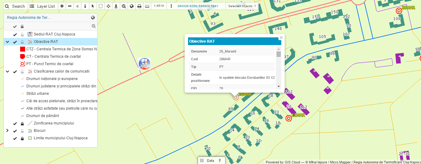
It was essential to gather information about the district heating power plants, like:
- exact position (GPS)
- address
- WGS84
- stereo 70 coordinates
- water temperatures
- contact information in case of emergency
- pipe types
- isolation material used for the pipes
- other types of data provided by the AADH
The next step was to acquire a graphical database from the local GIS and cartography company, MicroMapper SRL. The dataset was then edited in a local ArcGIS environment and uploaded to the GIS Cloud platform, using our Publisher for ArcMap extension. The upload was fast, and most importantly, it didn’t alter the symbology which was really important due to the complexity of the project.
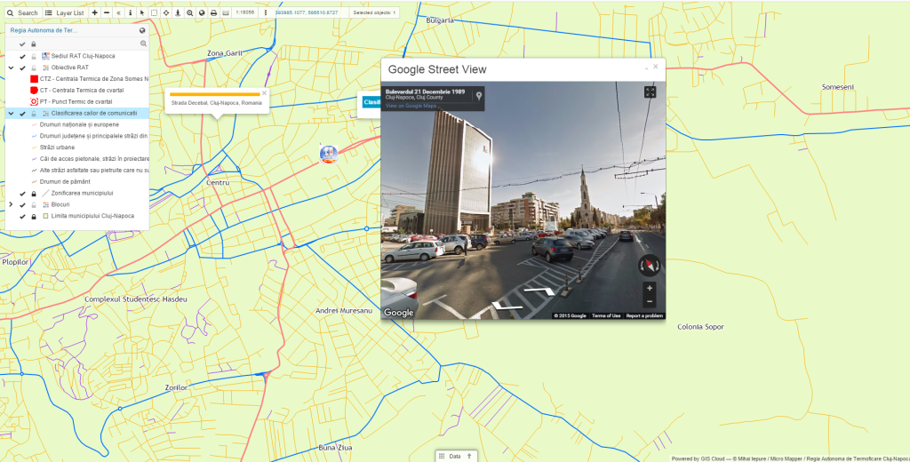
The map was further improved with the Map Editor web application, where they had the possibility of real-time editing and sharing the information.
Click for the results of the project.
The project resulted in an interactive online map which was easy to access and navigate by any of the Cluj-Napocas residents. Now they could effortlessly find the data they needed by simply searching their building by street address in the application, zoom in and get the info they needed.
For example, if they have a hot water or heating system failure, they can find out which station they are connected to, and immediately know who to call about the issue.
“At the moment, AADH does not use any GIS, even though large amounts of money have been invested in the development, modernisation and keeping up-to-date the public heating network in Cluj-Napoca.
Having this in mind, I thought why not create an application for everybody to use to ease somehow the “relationship” between the AADH, as the provider of service, and the population.”Mihai Iepure, University of Cluj-Napoca
This project also has the potential to be further utilized for district heating monitoring and maintenance. It could be used for an overview of the infrastructure and technical parameters required for different types of operations like:
- number of blocks or flats assigned to the power plant
- technical info (working temperatures, pressures, fuel type, modernization date)
- contact info in case of emergency
Mihai Iepure said that this project highlighted all the benefits of implementing GIS Cloud technology, such as:
- facilitating access to information of public interest for citizens or access to project’s data to clients
- online-based platforms support having a large number of simultaneous users in applications
- system implementation costs are relatively low
- the introduction, maintenance and updating of data is centralised and in real-time
If you are interested in utilising GIS Cloud as a solution for your project, Sign up for the free 14-day trial!
You can also contact our Solution Consultants to help you set up a desirable, customised GIS Cloud solution for your specific needs and workflow!