The case study is based on the project “Geospatial modeling of malaria risk areas and vulnerability (severity) using environmental, climatic and socio-economic factors” and it’s an example of using GIS technology as a tool to combat the malaria disease.
The project was created by Ayodele Adeyemo, a geogeek looking for ways to leverage geospatial technologies as solutions for human, social and environmental challenges. Ayademo and his team – Ojumu Tijesu, a full-stack web developer Eyo O Eyo and Ogunbanwo Olumide, specialized in electronics, won the 1st prize in GIS Day Contest 2016, awarding project ideas focused on doing valuable work in local communities with the help of geospatial technologies.
The Malaria Epidemic in Nigeria
In the last 15 years malaria mortality rates decreased by 60%. Despite the successes made in defeating malaria, there is still a lot of work to do – over the last century, there have been dozens of resurgences of malaria in countries around the world. Many of this cases are directly linked to decreases in funding to fight the disease.
Knowing that 35% of malaria deaths occur in just two countries – Nigeria and the Democratic Republic of the Congo, the potential impact of their efforts can be a valuable part of the worldwide fight in ending malaria for good.
This case study demonstrates how to use GIS technology as a tool for solving global health problems, like the problem of the malaria epidemic.
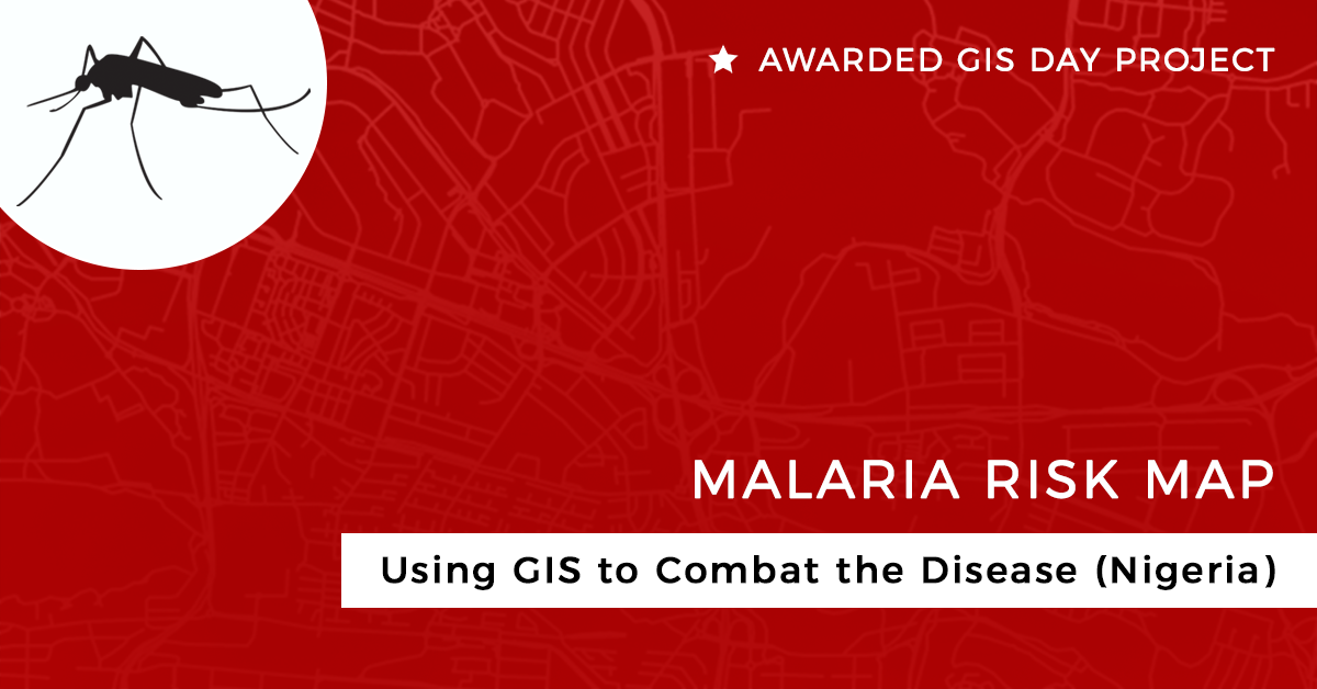
The Project: Malaria Risk Map
The initiative for the project was drawn from a number of ideas that arose in collaboration between Ayodele Adeyemo and his geogeek partner Tijesu, during their internship at the National Space Agency of Nigeria. Tijesu continued to work on the idea for his final year project, and this helped us to understand the dynamics of GIS in the public health.
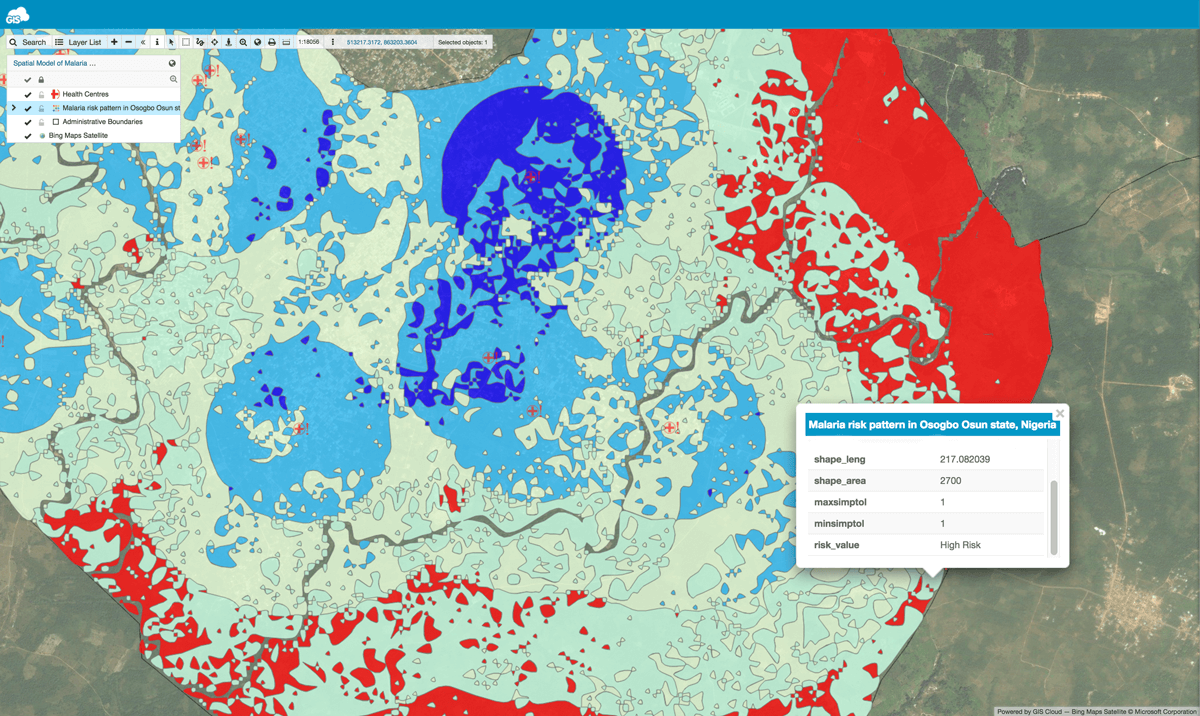
Malaria risk map.
Looking at the concrete problem – Malaria, we can say that it is a big challenge in Sub-Saharan Africa, based on the percentage of people that have fallen victim as well as the number of lives that are being claimed by malaria across African communities. It was important finding out the number of intervention programmes focused on malaria as well as the number of grants that have been pushed into the system. On the project side, a plan was developed to help people across communities find out about the malaria risk areas. It was accomplished through an interactive malaria risk map, and also with the help of the internet and SMS for people without an internet connection. For intervention programmes, a dashboard was created so they can know where, when and what type of intervention is needed.
The team is still working on the project and are trying out different models for integration while looking for sustainable partnerships that would help them to make the project a greater success.
Challenges in Completing the Project
The main challenges were data acquisition and finding funds to provide incentives for the volunteers involved in the programme as well as covering a part of the operational costs. The partnership with GIS Cloud has alleviated over 60% of the software licenses costs. The primary challenge was getting enough funds to bootstrap the project.
In the later phases of the project, the team made a call for volunteers to gather the data. But it is worth noting that, at the start, they had to scale down the project to a small geographic area, so a pilot project was done with limited resources to prove the concept. The team later engaged a few partners who helped with the funding.
Project Impact and the Role of GIS technology
Individuals across communities got access to real-time information about the risk of contracting malaria, so they can protect themselves more efficiently by knowing the best time to use the anti-malaria drugs. The platform also helps intervention teams by providing information about the best places to focus their aid (based on the malaria risk indices of the communities). This goes a long way when trying to increase the accuracy of interventions per time.
The relevance of GIS for public health, in this case, cannot be overemphasized because it provides us with the ability to conceptualize and visualize public health data while having a tool for us to understand the spatial trends and patterns of diseases and epidemics.
Ayodele Adeyemo
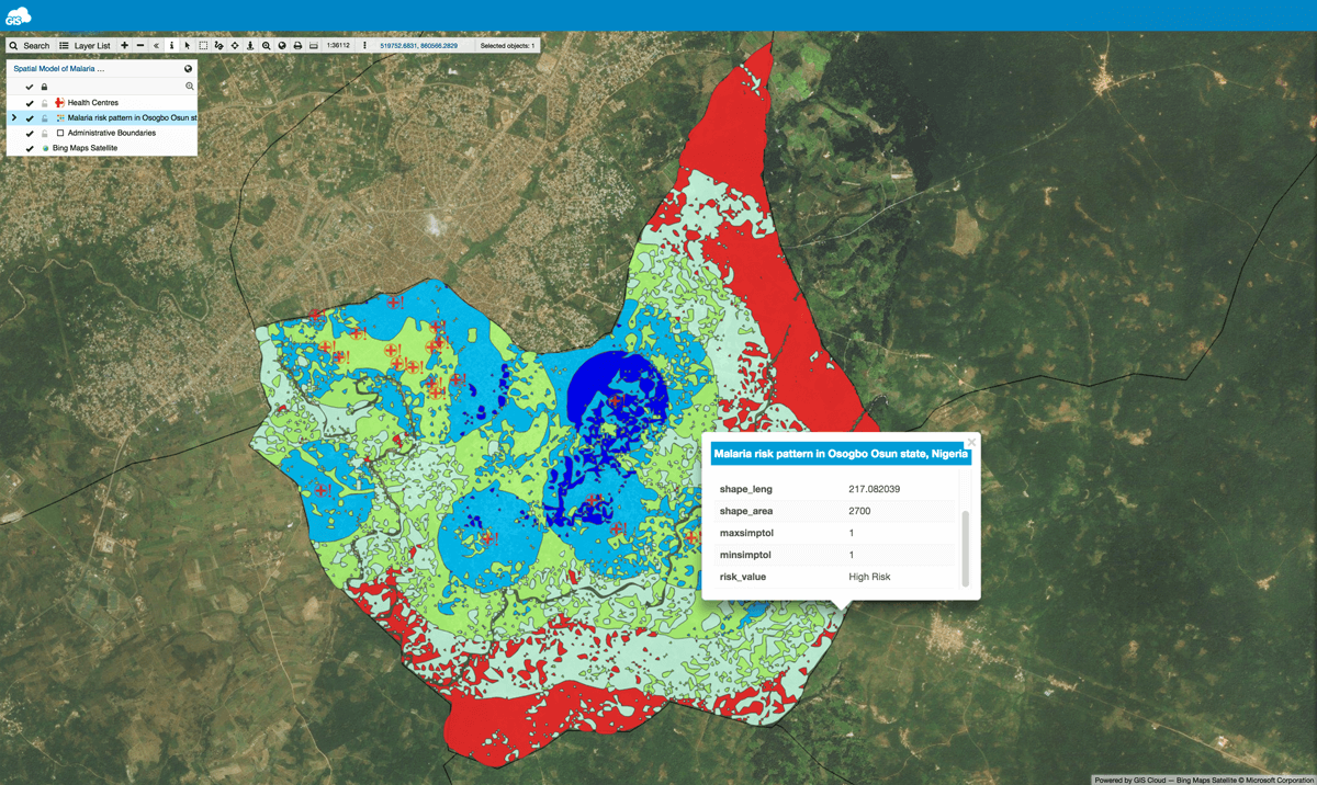
Malaria risk map zoom in.
For instance, GIS was used by Médecins Sans Frontières (MSF) International during the Ebola case in Africa in 2014. Also, by using GIS Cloud tools health officers can now gather field data efficiently. In the malaria case, GIS provides us with a platform that enables combining different thematic layers and also creating visualizations together with running predictive model algorithms that will help build an informed health community.
Future Plans in Combating Malaria
Malaria is still epidemic in Nigeria, especially in the rural communities due to many factors ranging from socioeconomic situation to climate, etc. There are a number of NGOs, civil societies and health communities that are focused on providing aid for areas prone to malaria. Nevertheless, most of the interventions are not data-driven, these organizations have a schedule of operations and they mostly focus on distributing treated mosquito nets to individuals across communities. On the other hand, there are some organizations that support operations that use a data-driven approach like Ehealth Africa.
If organizations will start looking into a data-driven approach for solving health problems and partnering with tech startups with solutions focused on the social processes, then we can have a more efficient and effective public health system around the world.
Ayodele Adeyemo