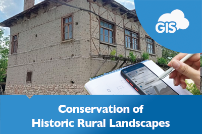
Over the last ten years, using GIS in archaeology has become one of the essential practices. For archaeologists, GIS has changed not only the data collection and visualization but also the perception of space itself. It’s been said that the combination of GIS technologies and archaeology is something like a perfect match – acknowledging that archaeology is concerned with the temporal dimension of human behavior, for which the spatial dimension of research is essential.
It especially concerns the fieldwork, where it is important to have precise documentation of the survey work. GIS capabilities are used as a decision-making tool to prevent loss of relevant information that could impact archaeological sites and studies.
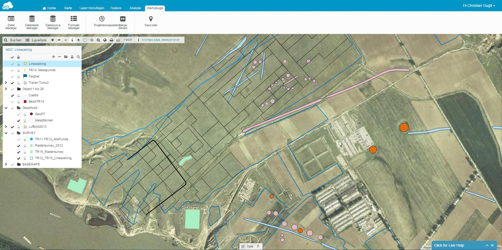
We are happy to present you a case study that demonstrates a successful collaboration between an archaeological survey and GIS applications in the field.
The Project
We got an insight into the project and its workflow from Dr. Gugl at The Institute for the Study of Ancient Culture in Austria. They have been using GIS Cloud in their research of Roman Military Camp – Municipium – Late Antique and Byzantine Fortification.
“GIS Cloud proved to be a solution that satisfied all the prerequisites for this project to be achieved effectively and accurately.” — Dr. Gugl
The location of the survey is in Romania, close to the modern city of Tulcea, on the site of Troesmis. It was a Roman and Byzantine city located on the lower Danube. In 2011, the Austrian Academy of Sciences started an archaeological field project on the site, in close cooperation with the Archaeological Institute of the Romanian Academy of Sciences and the Institute of Archaeology of the University of Innsbruck (Austria).
The project partners performed different tasks on this huge archaeological site which is one of the largest archaeological settlements in Romania, including a Roman legionary fortress (2nd century AD), a Roman town (2nd/3rd century AD) and two other fortifications dating from the 4th to the 13th century AD.
The Challenges
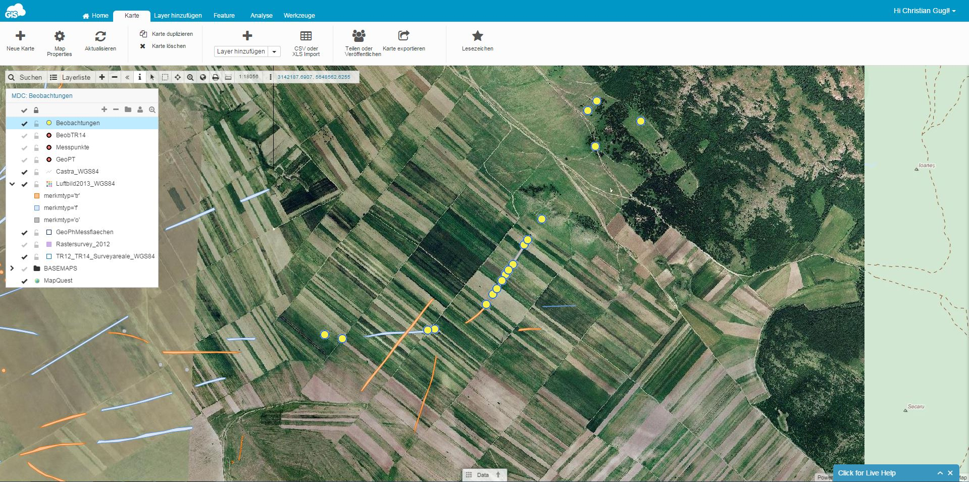
At this huge site, different kinds of information were collected by the project partners. Some of them were air photo and satellite photo interpretation material, airborne laser scanning, geophysical prospection, archaeological field surveys and the documentation of archaeological traces, still visible on the site using CAD-software and photogrammetry.
The key challenge was to find a way to do the documentation work, using a survey technique called line walking (4 to 6 archaeologists arranged in a line were walking over the accessible fields) in a large area of approximately 35 km².
Projects of this kind often don’t get sufficient funding for field surveys so one of the main challenges is to get as much field data for the lowest cost. Archaeologists had to deal with a remote area in which a desktop solution for GIS applications would be impractical, and also expensive because of costly GIS field computers. Having in mind that this remote archaeological site is not in range of wireless networks, using mobile devices for data collection as an alternative to desktop solutions, would also require being able to work in offline mode.
Also, being located on the site consisting of a steppe-like landscape, it is important to determine your position in relation to known archaeological features, for instance, crop marks which are mostly not visible from the ground. So, the challenge was to find a way for archaeologists to have a good overview of the site together with an orientation tool for occasions in which field crew intends to map new features or artifacts.
In brief, the challenges presented to us by The Institute for the Study of Ancient Culture were to:
- lower the costs by replacing expensive desktop solutions
- make the documentation process simple, and data collection more effective and accurate
- find the best way for field crew to orient on the site
- work in a remote area with no internet connection
GIS Solution for Archaeology Projects
There was a need for a field data collection solution that would enable data collection in remote areas with low or no internet connectivity. We offered Mobile Data Collection app which is equipped with all the necessary features. It significantly lowered the costs of the survey because there was no need for expensive GIS desktop computers in the field.
Dr. Gugl shared some insights about the MDC application:
- user-friendly application for effective data collection with the possibility to provide different teams with the same mapping tools
“GIS Cloud apps are easy to use. Most people are familiar with smartphones and within a short time, they can handle the device. The data collection app provides an elaborate functionality so that each team had a mapping device in their hands. (…) It is possible to provide both base maps and vector data to the different teams which are essential for evaluating archaeological features on the ground.”
- great orientation tool for the field
“In an open scenery like in Troesmis where you are facing a steppe-like landscape, it is important to determine your position in relation to known archaeological features, for instance, crop marks which are mostly not visible from the ground. This additional information is made available via the GIS Cloud, which is extremely helpful if you intend to map new features or artifacts.
- good use of cloud solutions even in the remote areas
“Even in a rural landscape like in this part of Romania, where you are in between the meandering watercourse of the Danube and the slopes of the Măcin Mountains, data acquisition via the internet worked surprisingly well. The GSM network coverage is mostly sufficient, and even if you are moving in a remote area, we had no problems because of the buffer storage of the devices.”
Moreover, all the data collected with the help of Mobile Data Collection app was instantly visible on a web map. GIS Cloud Map Editor provided all the necessary GIS tools and symbology for marking the artifacts and having a good overview of the situation in the field.
This way, archaeologists were able to map the Troesmis area in the shortest possible time frame, using effective and easy to use cloud-based GIS solution.
Interested our GIS Cloud solution for archaeology projects? Try out the 30-day free trial or contact our sales consultants and schedule a live demo.