
Taking care of several trees differs from more extensive projects, which include carrying out a tree inventory, tree inspection and subsequent tree care plans. Managing the care of individual plants and trees on a larger scale demands a lot of administration and field paperwork.
This case study outlines tools and workflows, as well as arborist mobile apps that help improve productivity in the field and cut down on paper-based inspections.
Online Maps as Administrative Tools for Arborists
All of those who do a lot of fieldwork know that it is not easy to have a clear and updated oversight of the projects without the use of proper administrative tools like arborist software. Managing a tree inventory and carrying out tree inspections on a large scale demands just that.
Let’s see how the Vivaldi Arborists from Sweden improved their projects and increased productivity with the help of Mobile Data Collection application, following the feedback from arborist and group leader in Stockholm, Sean Grant.
“GIS Cloud has allowed me to streamline the administrative side of workflow which allows me to work more effectively and provide tree care of a higher quality.” – Sean Grant
The need to Improve Tree inspection and Tree Inventory Practices
Fieldwork in arboriculture usually consists of short-term as well as of long-term projects. Taking care of one individual tree differs from the larger projects, which include carrying out tree inventories and subsequent tree care plans. On this scale, it is necessary to collect the information on tree health evaluation, species, vitality and risk class on a daily basis.
Dealing with administrative tasks in these conditions can be very time-consuming and it may shift the focus from a primary goal (tree care) to secondary activities such as unnecessary paperwork.
Real-time mapping applications often offer the best solutions for some of these daily burdens, being able to instantly gather, sort and analyze the data from the field.
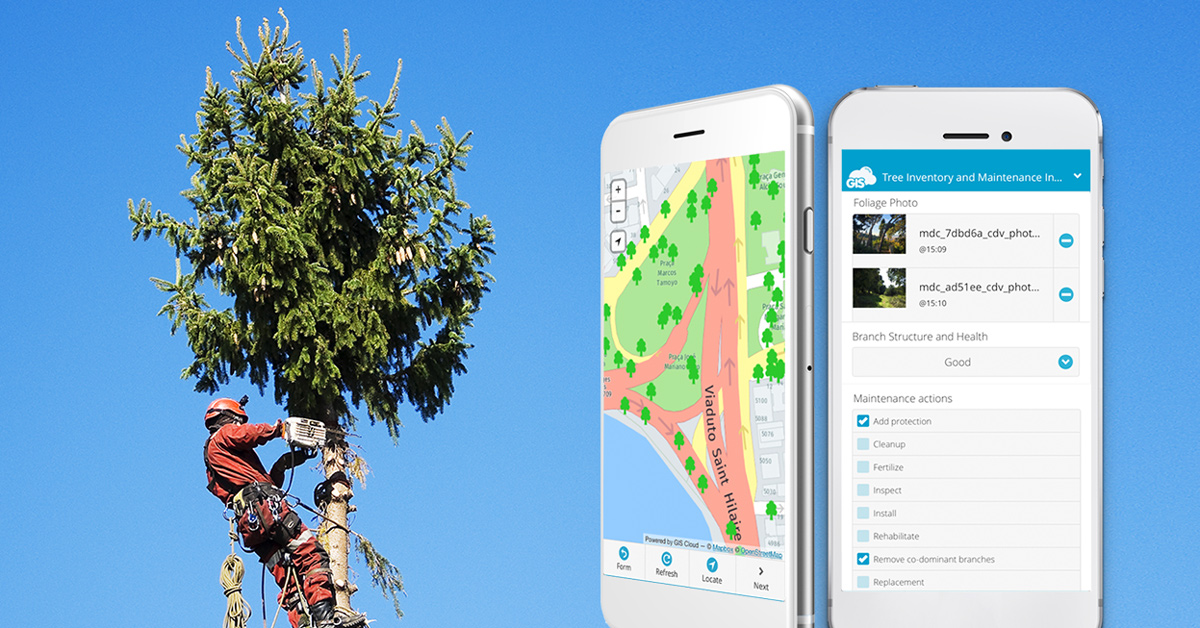
Having these problems, the Vivaldi Arborists were looking for an application which would enable them to gather the data quickly and accurately. It was necessary to have a photo database of injuries to the trees to be followed up, together with the other visual information which may prove valuable.
The Problem of Weak GPS Signal During Tree Inspections
At the moment, mobile devices are the most practical tool for data collection but dependence on the GPS function alone can cause problems. In some situations, the accuracy of the data may be unsatisfactory because of satellite unavailability. Vivaldi Arborists wanted to overcome these challenges and find a solution that can improve location precision in case of poor GPS reception.
According to all the problems noted before, The Vivaldi Arborist needed a reliable mapping application for quick and accurate data collection, which is not dependent on the GPS function alone.
Complete Online Solution for Tree Inspections
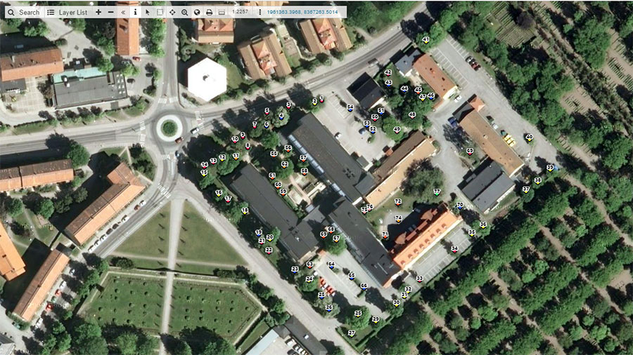
GIS Cloud offered Mobile Data Collection application, which Vivaldi Arborists use on a daily basis to collect tree information and photos.
My workflow is much more efficient when using the GIS Cloud as a basis for my quotes and work orders and collection of all field data. I can easily find the geographic data I need regardless of when it was collected and allows me to focus more on care for the trees themselves and less on keeping track of all of the data. – Sean Grant
The MDC applications photo function also solved the problem with accessing and sorting a great number of photos about a specific tree. Tracking of photos ceased to be a time-consuming task because attaching them to a location means you can find the spread of pictures through time in a matter of seconds.
When leaving quotes to customers, I find that a picture or map, in this case, speaks louder than words and with GIS Cloud I can produce maps quickly to be attached to a written quote, so there is no question about what is to be carried out. This map is also used as a base to work orders so the correct work is carried out on the correct trees (important when felling trees for obvious reasons.) – Sean Grant
The Pinpoint Tool in Mobile Data Collection guaranteed the precision of location data, hence solving the problem of dependency on GPS whose precision is determined by the current mobile device and satellite availability. Pinpoint tool increases the precision of your data because you can position the pointer on the exact location and mark it down with the highest accuracy.
After we have seen how the MDC application solved the problems with using mobile devices for tree inspection, we can conclude with a final, sound recommendation from Sean Grant:
I can recommend GIS Cloud for those who don’t have an advanced understanding of GIS (such as those out collecting data) as it is a user-friendly platform and can be accessed from any computer with an internet connection or any mobile device with the downloaded app. I can recommend GIS Cloud where photos attached to geographic location can be helpful in keeping track of asset data. I can recommend GIS Cloud to clearly convey information to customers or employees to avoid mistakes and misunderstandings.
Interested in the GIS Cloud mobile app for arborists? Try out the 30-day free trial or Contact us.