How can modern GIS technology improve the efficiency and decision-making in utility management? We see utility sectors facing challenges like old infrastructure and caring for the environment. This article looks at how GIS Cloud’s tools – Mobile Data Collection app, Map Editor, Map Viewer, and Map Portal – make mapping better and change the way utility companies work. Let’s see how these tools change utility field operations, making them smarter, quicker, and more efficient.
The Changing World of GIS in Utility Management
In the past, GIS was about putting some points on a map. Now, it’s a vital tool for dealing with the complex problems of utility management. As the sector handles issues like old infrastructure, environmental care, and customer needs, GIS gives the data and insights needed for smart decision-making.Transforming Field Data with GIS Cloud’s Mobile Data Collection App
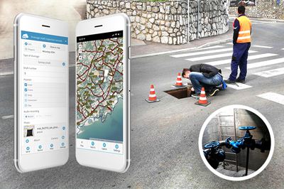
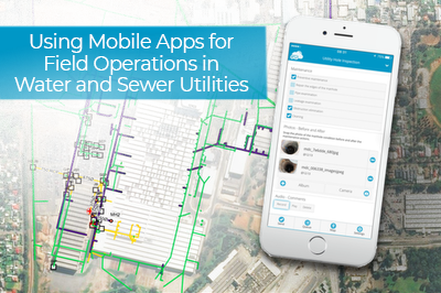
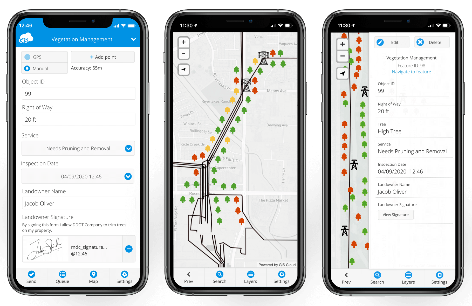
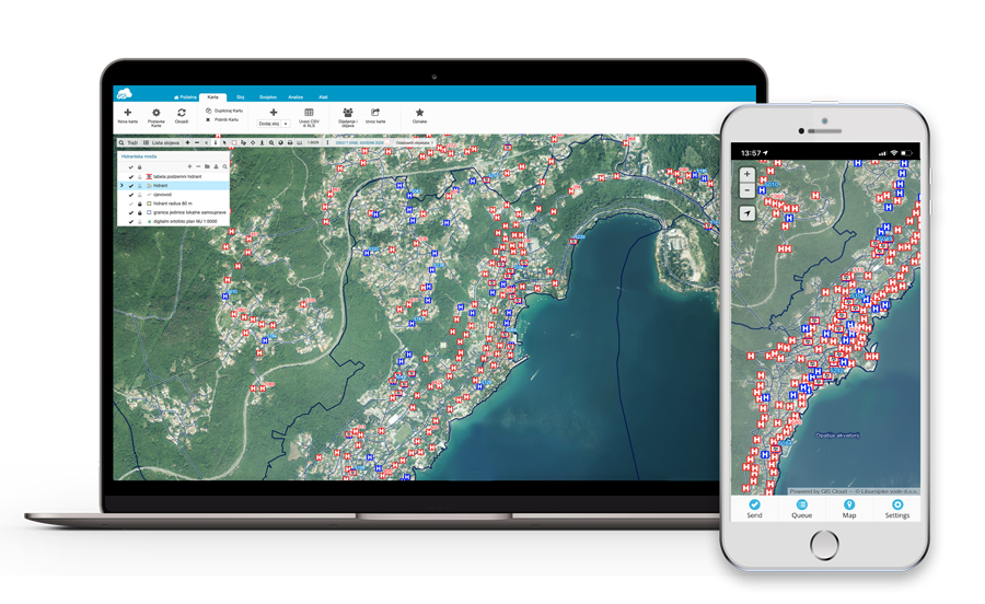
Collecting field data, once a hard job with paper maps and manual entries, is changed by GIS Cloud’s Mobile Data Collection app. Field Technicians can gather data directly on their devices, making sure it’s accurate and efficient in real-time. The app’s easy interface and custom forms allow fast data entry, picture taking, and GPS tagging, making field operations much smoother.
With this real-time data flow, Utility Managers benefit as they can make decisions and respond faster. The Mobile Data Collection app doesn’t just gather data; it changes how field operations are done, leading to more efficient, quick, and informed utility services.
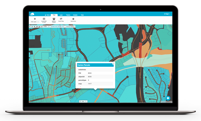
Improving Planning and Analysis with the Map Editor
The Map Editor is a big change for Utility Managers and Data Analysts. They use it to make and change detailed maps, adding different data layers to see utility networks fully. It’s not just a mapping tool; it’s a key place for planning and analysis.
With the Map Editor, professionals can see complex data, spot trends, and make smart choices about resources, infrastructure, maintenance, and services. Being able to add different data types is key for planning in today’s complex utility environments.
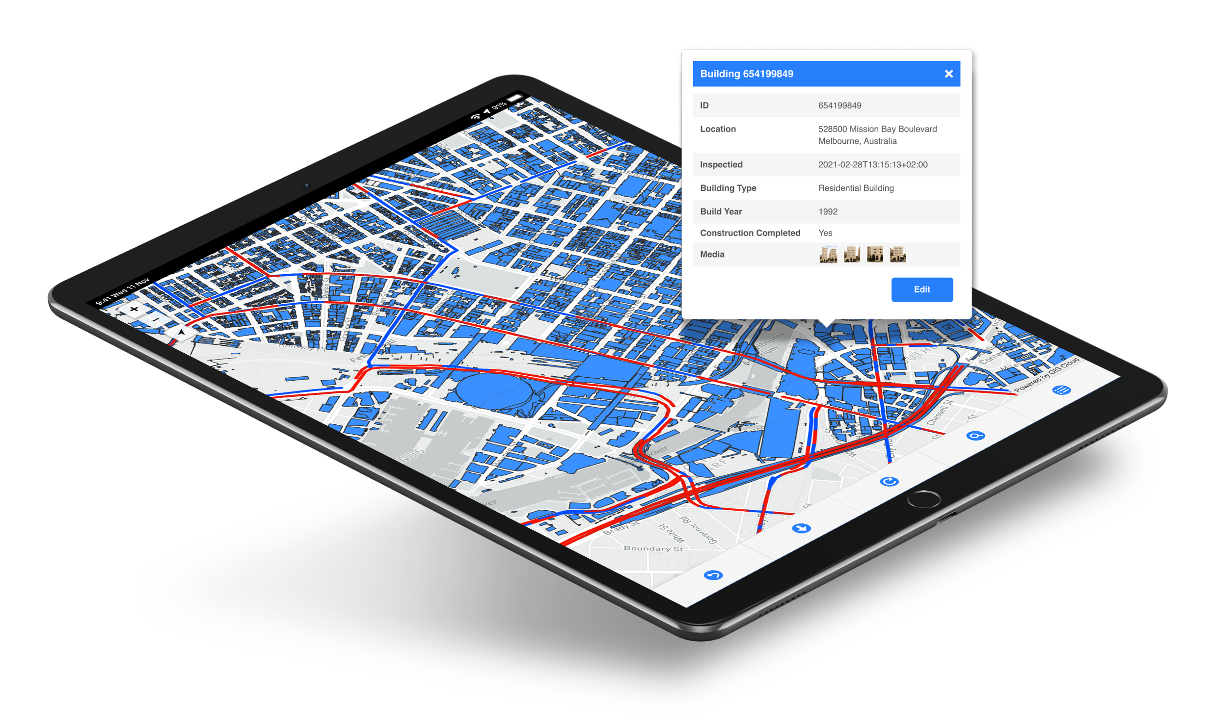
Getting Operational Insights through the Map Viewer
The Map Viewer gives a real-time look into field operations. It’s made for Utility Managers and Field Technicians who need a clear, up-to-date view of their utility networks and assets. The tool’s real-time data showing lets you see operational status, problems, and progress right away.
This instant access to information improves teamwork, leading to more effective field operations. The Map Viewer is more than a visual tool; it helps everyone stay on the same page, making sure field activities match strategic goals.
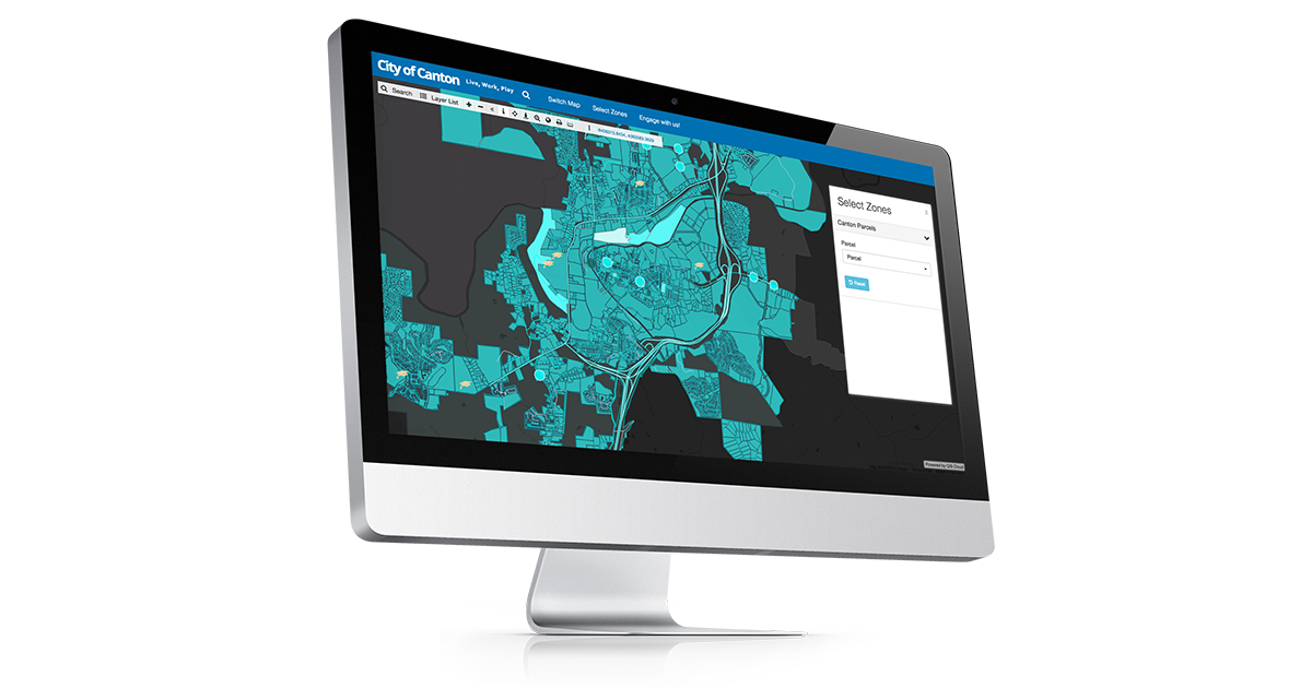
Bringing Data Together with the Map Portal
The Map Portal is a central place for data access and working together. It’s really useful for Urban Planners and Environmental Specialists who need a central platform for sharing and viewing data. This tool helps combine different data sources, giving a combined view vital for good urban and environmental planning.
Working together is central to the Map Portal. It lets different people access, share, and look at data, creating a cooperative environment. This combined approach makes workflows smoother and ensures all decisions are based on the latest and most complete data.
Case Studies and Success Stories
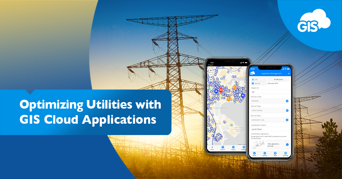
ENUGU Electricity Distribution Company: Dealing with electricity theft and resource losses, ENUGU, Nigeria’s biggest electricity distributor, used GIS Cloud’s Mobile Data Collection app. The result was better field data quality, real-time monitoring of the electricity network, and improved decision-making in managing assets and customer service.
Liburnian Waters: This Croatian water utility company solved problems with old infrastructure data and ineffective field operations by using GIS Cloud’s Mobile Data Collection app. The result was better data accuracy, shorter job times, and better cooperation with local governments and citizens.
Smith Brothers Group: For better ways to collect asset checks and field data in water utilities, Smith Brothers Group started using GIS Cloud’s mobile apps. The result was a 30% improvement in field operation efficiency, less paperwork, and better data accuracy and gathering.
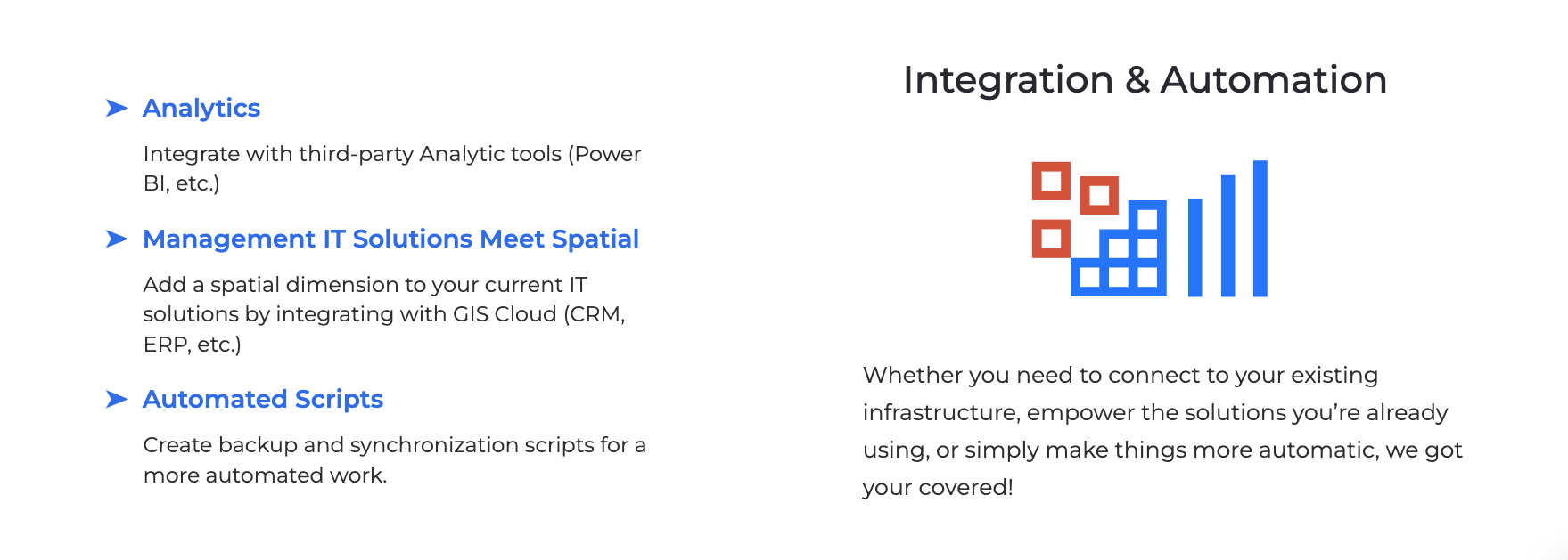
Integrating GIS Cloud with Other Systems
GIS Cloud’s and its apps’ major advantage is its smooth integration with various systems, boosting its usefulness in different operational settings. This integration is vital for utility management, where different software tools like QGIS, PowerBI, PowerApps, and external databases are often used together.
Firstly, integrating GIS Cloud with QGIS, a well-known open-source GIS platform, is easy. This allows for the transfer of spatial data and maps between the two systems, enabling users to use the advanced analytical capabilities of QGIS with the intuitive interface and cloud-based features of GIS Cloud. This integration is particularly useful for detailed spatial analysis, complex map creation, and data collection.
Furthermore, GIS Cloud’s compatibility with PowerBI offers significant data visualization and business intelligence benefits. Users can import GIS Cloud data into PowerBI to create detailed dashboards and reports, combining spatial data with other business metrics for a complete view of operations. This integration is especially useful for utility managers and analysts who need deep data analysis and reporting capabilities.
Additionally, the ability to link GIS Cloud with PowerApps allows the development of custom mobile and web applications. This integration enables field technicians and other users to interact with GIS data through custom apps, improving data collection and operational efficiency.
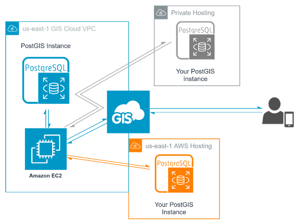
Finally, GIS Cloud’s capability to integrate with external databases ensures easy import and synchronization of data from various sources. This feature is crucial for maintaining current and accurate data and is essential for effective decision-making in utility management.
GIS Cloud’s integration with systems like QGIS, PowerBI, PowerApps, and external databases significantly boosts its usefulness in different operational contexts. This interoperability ensures that GIS Cloud can be a central part of a complete utility management system, aiding better data management, analysis, and decision-making.
The Future of GIS in Utility Operations
Looking ahead, GIS’s role in utility operations will become even more important. New developments in GIS technology, especially in real-time data analysis and AI, will keep pushing what’s possible in utility management. GIS Cloud is leading this change, always updating its tools to meet the changing needs of the utility sector.
Conclusion
GIS Cloud has changed utility field operations, moving beyond just mapping to become a key part of planning, data analysis, and operational efficiency. For Utility Managers, Field Technicians, Data Analysts, Environmental Specialists, and Urban Planners, these tools offer not just data but insights and efficiencies that can change how utilities work. As the sector keeps changing, GIS Cloud’s applications are ready to meet its new needs, making sure utilities are not just managing their operations but making them better.
Want to see how GIS Cloud can help your utility management? Sign up for our 14-day free trial and try it out yourself, or contact our Solution Consultants for a product demo HERE.
Find out how GIS Cloud can make a difference in your work today!