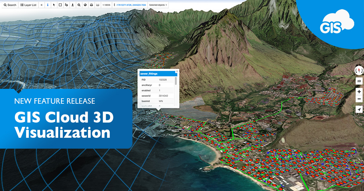
For most, summer is a time for some rest and relaxation. We have decided to develop a cool new feature that will change how you look at your data. So without further ado, we are excited to release our newest feature: 3D visualization.
We’ve heard your feedback and are implementing a 3D view into our applications so that you can better understand your data and make more informed decisions. We strive to provide our users with the best mapping experience possible. We believe we’ve taken a big step forward with this feature release.
Check out this webinar recording and see how adding the third dimension (3D) provides a better insight into the world around you.
GIS Cloud 3D will enable you to use the predefined 3D model, your data, and any basemap you set. You’ll also be able to add your own Digital Elevation Model to provide more accurate data for your local area.
There are many solutions out there that enable you to view the data in 3D. But how many of them can give you the option to dynamically add your data on top of it, collaborate with in-office and field crews to enrich your 3D models, and share it with others in real-time?
These are vital steps for turning your data and solutions into better products that improve your daily workflows and raise your understanding of physical assets through a digital world.
Applications of 3D mapping are found in a variety of industries, including engineering, construction, architecture, urban planning, utilities, and local government.
There are many benefits of using 3D in GIS, some of which are listed below:
- It helps you understand the world better
- It helps you make better decisions
- It helps you communicate your ideas better
- It enables you to visualize data in a more efficient way
- It allows you to analyze data more effectively
- It will enable you to create more realistic models
- It allows you to understand the interrelationships between different features
In the end, we’re used to seeing things in 3D, so sharing your data in a way that enables a 3D view is a very intuitive method to communicate what’s going on in the field to users who don’t necessarily need to be GIS or tech experts.
We are excited to offer this new feature to our users, and we hope you find it as helpful and insightful as we do!
In the meantime, if you want to use 3D functionalities in your workflows and projects, make sure you Sign Up for a 14-day free trial. Of course, if you have any questions or feedback about GIS Cloud, you can contact our consultants at info@giscloud.com.
So what are you waiting for? Start mapping in 3D today!


