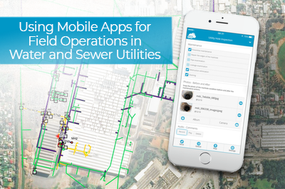
As a utility provider in the water and sewer industry, you know that effective field operations are the backbone of an accurate asset repository as well as efficient and precise condition inspections. To make your field operations team as efficient as possible, it’s a good idea to equip them with mobile apps designed with the water utility professional in mind.
In this article, you can learn all about the GIS Cloud mobile apps for water utilities and how to make your field operations super efficient.
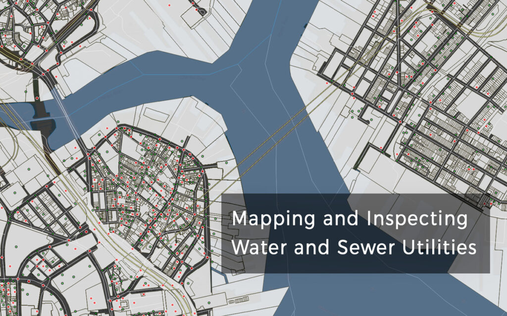
Constant urban growth is an ongoing trend in almost every city in the world. Rapid urbanization leads to an increasing development of underground and ground utility networks which requires frequent and accurate inspection and a robust monitoring system. The most significant challenge for public service providers is to acquire accurate and updated information on the location, characteristics, and condition of water utility assets (hydrants, manholes, culverts, etc.).
Surveying and inspecting water utility assets can be time-consuming for two reasons: mapping a large number of assets and the use of out-dated paper-based methods for field data collection. Locating, aggregating, and searching through these paper survey forms to detect and inspect the condition of a single asset is an ineffective and unproductive process.
With advances in GPS, utility mapping apps, and GIS mapping technology, it becomes easier to monitor the condition and manage maintenance activities for different water utility assets. With Mobile Data Collection (MDC) app, field crews can accurately mark and store location data or update any changes to location or characteristics of a single water utility asset.
Find out how one of our clients, Liburnian Waters, implemented GIS Cloud mobile apps to map the water and sanitary infrastructure.
KEY DATA COLLECTION FEATURES FOR WATER UTILITY INSPECTIONS
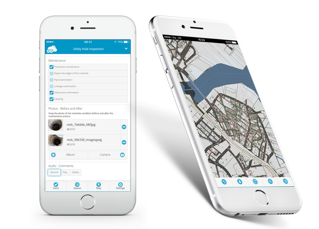
- CREATE CUSTOM INSPECTION MOBILE FORMS
Rather than struggling with paper forms, with MDC app you can create a custom online survey forms with different types of questions and attribute fields. When field crews need to perform various kinds of field operations such as asset inspection, condition assessment or leak detection surveys, they can switch between various survey forms in one click in a dropdown list. If you need to make changes to some parts of the survey form or add a question, with MDC, you can quickly update the form, and the changes will be registered immediately with the Auto Sync function.
- WORK ONLINE OR OFFLINE. ACCURATE GPS DATA
MDC app allows you to collect data in real time with mobile devices. If you’re inspecting assets in areas with low cellular coverage, you can download the map, collect data in offline mode and sync the data whenever you want. Field collectors can precisely mark the location of the utility asset using mobile device GPS, or by pinpointing the exact location on the map. You can also increase your GPS accuracy with external centimeter-accurate GPS devices.
- CUSTOM FORM FIELDS. DEPENDENCY OPTION
MDC app offers a range of different types of form items you can use to create questions for the data collection survey forms. You can set up single or multi-choice questions, numeric or textual inputs or capture geotagged photos or audio files. One powerful feature in MDC can make your utility data collection process even faster and easier; the dependency function. It allows you to set up rules to control the display of the following survey question. If the rule is not satisfied, the next survey question won’t be visible, which makes your data collection faster and reduces errors.
- COLLABORATE. SHARE USER PERMISSIONS
Managing your organization and workforce has never been easier. Build your organization in the Manager app, create a single user or define a group of users. Share the inspection survey forms to your field teams using different permissions. You can organize teams in a way they only collect new asset information, or you can set up teams with a task to update existing records. Updates and edits will be visible instantly and you can review the entries in the office.
- VIEW PREVIOUS ENTRIES. UPDATE EXISTING ASSET INVENTORY
Access and view the collected data from your mobile device or the GIS Cloud web app. If you click on the feature in a map, the pop-up info window will open with all the collected information and documents on a single asset. In MDC app, you can use the search tool to search for asset name or ID number and get detailed asset information as fast as possible. You can search for the data collector’s name to track and supervise daily performance and activities. You can also edit and update information for your existing data, both in mobile and web app.
Find out how to integrate GIS Cloud solutions in Water Resource and Watershed Management in the following article.
We hope you find this article useful. If you are interested in using GIS Cloud technologies for the water utility collection, inspection and maintenance process, contact us or sign up here.