
A group of enthusiastic and engaged geography students wanted to recognize and enable people with disabilities in the City of Zagreb.
To achieve this goal, they devised a project ‘Mobility for everyone’, focused on mapping the city infrastructure that helps people with disabilities, resulting in a publicly accessible map portal.
Students Lucija Dreven, Katarina Plancutić, Mateja Crneković, Martina Kušan, Morena Varga, and Mateo Grdjanić from Zagreb, Croatia applied for GIS Cloud contest last year and their project idea was recognized as a valuable endeavor, winning free licenses to execute their plan. They envisioned this project with a goal to collect all relevant data in the city which facilitates daily activities of people with disabilities. Read their report.
Mapping Project: ‘Mobility for Everyone’
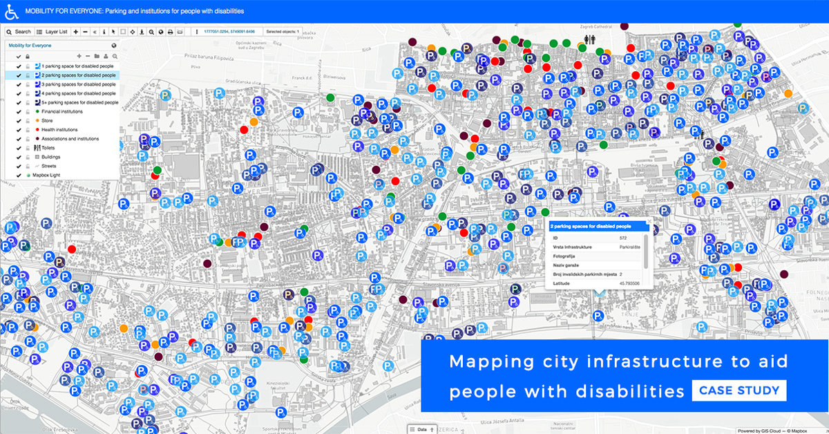
For people with disabilities performing everyday activities within the city requires significant effort due to traffic jams, lack of supporting infrastructure, lack of specialized building access, and so on. It is imperative to help them in overcoming these difficulties. This is especially important for the City of Zagreb due to lack of data regarding the existing infrastructure. Our idea was to gather data regarding the location of handicap parking spaces reserved for people with disabilities as well as locations of public institutions and to present it using an interactive digital map.
We have applied our project proposal for the “GIS Day Contest 2017” and were awarded third place. We were therefore given free access to GIS applications for gathering, processing and visualizing spatial data on maps, intended for use by people with disabilities and those who are helping them in performing everyday activities.
Planning and Organization of the Project
The goal of our project is to help people with disabilities in their everyday activities within the city limits.
To get acquainted with problems faced by people with disabilities, we’ve devised a specialized questionnaire which we sent to various associations as well as directly to people with disabilities. By analyzing the feedback, we’ve decided to limit the area, to be covered by the project, to 4 city districts: Donji Grad, Trnje, Trešnjevka Jug, and Trešnjevka Sjever.
We’ve discovered that there is a lack of specific information regarding the location of parking spaces reserved for people with disabilities and have decided to address this problem through our project.
Data Collection Process Using Mobile Phones
The most time-consuming activity was mapping out the required data using the Mobile Data Collection application on our smartphones. A simplified interface and automatic GPS tracking greatly added to the efficiency and precision of our data gathering activities with Mobile Data Collection. We’ve divided the spatial and other specific data into several categories:
- handicap parking spaces
- financial and health institutions
- shops
- associations
- institutions.
By splitting into 3 teams, each consisting of two people, we divided the 4 districts into smaller, more manageable blocks. After two and a half months of mapping and data gathering, we’ve mapped out 800 points, of which 500 were parking spaces. We significantly improved our organizational skills with efficient teamwork.
Since the data gathered with Mobile Data Collection was immediately available for editing, we began our work editing data using the Map Editor shortly after our field mapping activities. This flagship GIS Cloud app for data editing provides many data operations, as well as styling symbology and data analysis. There was a certain amount of redundant data which was easily corrected or removed. Since the most relevant data was that on parking spaces we highlighted them using a given symbol and mono-colored gradient while other objects were marked with circles of various colors. Briefly, work in Map Editor provides the most creativity for cartographers and GIS analysts.
Sharing Maps With the Public to Aid People With Disabilities
Our goal was to allow people with disabilities to easily access data on parking spaces and other information of interest to facilitate their mobility around the city.
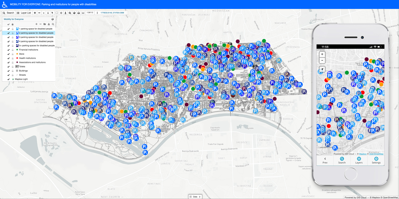
For end-user sharing, we have chosen to create a public Map Portal using our map as a basis, a simple app which enables featuring more maps in one place. Due to advanced but simple data settings, zooming into a map enables better visualization using data optimization. We also branded the portal with a color and a logo.
Open the ‘Mobility for everyone’ Map Portal interface.
The significant advantage of the Map Portal is that the data can be filtered, which simplifies the work with a map. However, since the data overview was already straightforward, we didn’t have the need to include a filter on a map.
Working GIS Cloud applications we learned they are characterized by simplicity and ease of use, and without GIS Cloud, our project couldn’t be realized.
Finally, the users of the mobility map can shorten the time and planning of their activities, and thus the map portal facilitates getting around the city. We are glad that the project has come to an end and that we have contributed to public well-being, and we hope it will make a difference in the lives of people with disabilities, improving their mobility.
If you want to try GIS Cloud mapping solutions and complete a project of your own, sign up and start mapping for free.