
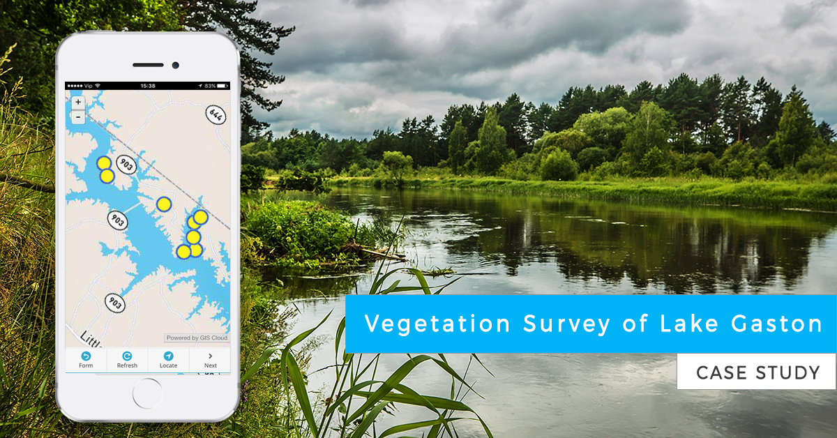
Citizens of Lake Gaston wanted to take care of the lake ecosystem. The invasive plant species were spreading out of control, so a vegetation survey was required to determine the best way to fight the invasive flora.
This case study is a great example of volunteers working on vegetation management for an entire lake shoreline.
About Lake Gaston
Lake Gaston spans the Virginia and North Carolina border and is a man-made lake with over 22,000 acres and 350 miles of shoreline that provides recreation, power generation, flood prevention and water supply for Virginia Beach, VA, and is home to over 10,000 full and part-time residents. The lake draws visitors and residents from Raleigh, NC and the Washington DC area as well as people from Norfolk and Richmond, VA.
Lake Gaston is utilized not only by lakeside property owners, but by anglers, boaters, and other visitors. That’s why the vegetation management activities have the potential to significantly affect:
- access to outdoor activities such as swimming, boating, skiing, and angling
- property values in and around the lake
- local businesses
- the county tax base
- water quality
- the environmental health of the system
- tourism
The Lake Gaston Association (LGA)
The LGA is a citizens’ organization that actively promotes the interests of Lake Gaston and its households, users, and businesses. The LGA is a volunteer and a non-profit organization that collaborates with state and local officials that have management authority on and around Lake Gaston.
The LGA lake survey program, using 65 volunteers and three technicians from NC State University (NCSU), is one of the largest all-volunteer efforts on a lake the size of Gaston in the southeastern United States. The All-volunteer effort, the technology and tools of sampling had to be designed to easily organize, train, use, and collect the data. All 350 miles of the lake are sampled.
Vegetation and shoreline survey project
The LGA association has surveyed the lake on an annual basis for over seven years to determine the presence of healthy vegetation as well as evaluate the levels of invasive species and quality of the water.
LGA partner NC State University’s Aquatic Crop Science Dept. and Lake Gaston Weed Control Council can determine what type of treatments are needed and where treatments should be done in the following year.
The lake has some federally listed noxious invasive species which include Hydrilla and Lyngbya. Hydrilla is a highly invasive aquatic weed, able to propagate by fragmentation and through tuber production.
The primary function of the LGA GIS vegetation and shoreline survey program is to research, monitor and communicate findings concerning Lake Gaston’s environment; including water levels, water quality, biological impacts, and general aesthetics on land and water. The survey program allows the LGA to stay informed and maintain rapport with all appropriate groups involved in the decision-making process for each of these issues.
350 miles of shoreline mapped by volunteers
This annual survey is invaluable in determining water clarity and what aquatic plants, good and bad, are growing in and around Lake Gaston. The lake survey commences every year on September 1 and lasts through the end of October. Training is made available to over 65 volunteers in August at various locations to show the volunteers how to do the survey.
The biggest challenge the LGA has in achieving the annual project goals is getting sufficient volunteers to do 350 miles of shoreline; thus the software and the process must be simple for a wide variety of users.
The primary objective is ease of use, training, management of the survey teams, and accuracy of the maps as well as the ability for the maps to also be shared with other governmental and research entities. The volunteers also include high school students looking for community service credits as well as other volunteers who do not want to spend lots of time learning computer use and functions but want to learn how to do a vegetation survey.
LGA was looking for a hand-held system (Android, iOS) for vegetation sampling to evaluate where Hydrilla, Lyngbya, and other nuisance aquatic plants are located along the shoreline.
Mapping the vegetation with smartphones
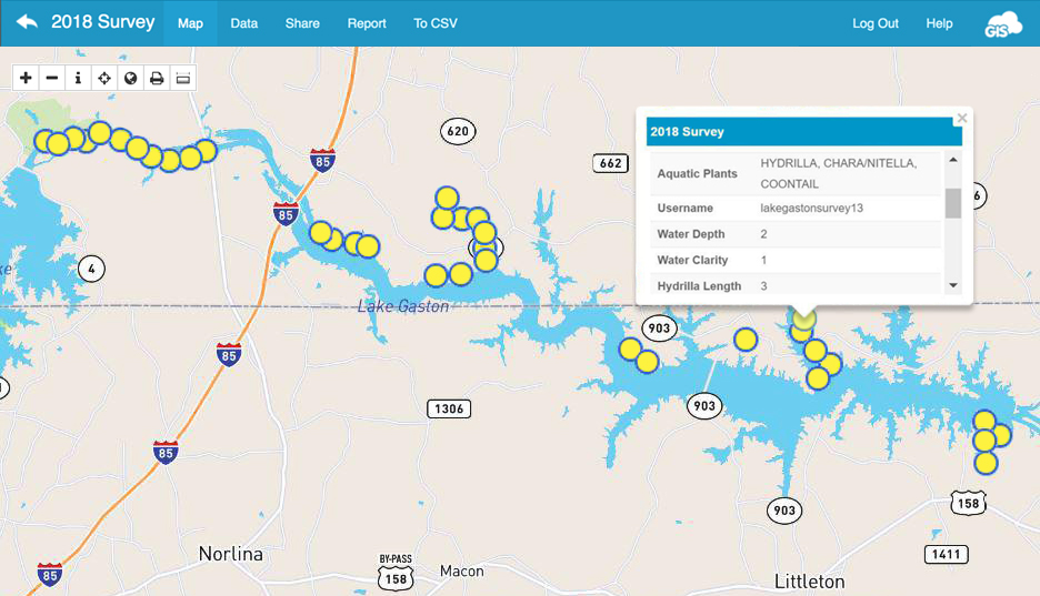
The vegetation is surveyed with the Mobile Data Collection App, a cloud-based application that provides simple mapping and survey forms that can be easily loaded on a variety of operating systems.
LGA uses a number of different brands of tablets and smartphones based on the Android and Apple operating systems. The Mobile Data Collection App works on Android and iOS so the volunteer can select the type of hardware that is most convenient for them. Convenience and flexibility are important because the volunteers use pontoon boats, canoes, kayaks and other watercraft when collecting field data.
The Mobile Data Collection App also allows volunteers to quickly view and edit their work if a mistake in vegetation sampling is made and also review how many samples they have completed. The sampling can be easily seen on a map of the lake to be sure that volunteers have completed their assigned area of survey.
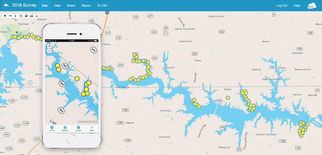
*The map shows only 20% of the survey
The survey workflow is straightforward as well. With the Mobile Data Collection Portal you create a surveying project and the mobile collection forms. Then you just need to share the app licenses to field workers and they can start collecting data.
If you want to know more about Mobile Data Collection App, don’t hesitate to contact us. Also, you can try it out with the 30-day free trial.
Vegetation survey results
The LGA vegetation survey has resulted in a significant reduction in Hydrilla over the past three years. Data now show that much of the lake area where this invasive species was found is now free of Hydrilla. The introduction of sterile grass carp has been instrumental in the control of this noxious aquatic weed.
Lyngbya is now also being evaluated for possible management strategies by NCSU and Clemson University. LGA expects that continued survey of the lake will allow the researchers to assess the impact of current and future treatment options and carry out a complete evaluation of the shoreline environment. The future surveys will help enable lake management to identify possible shoreline conditions that give rise to the newly growing forms of invasive plants.
Future plans
LGA plans on extending the use of survey data to include future nutrient surveys of the lake environment as well as surveys of sediment and other environmental conditions that can be added to the survey forms for future use.
LGA is also thinking on expanding the survey process to include aerial geospatial surveying of shoreline plant species. LGA plans to extend the work to use aerial geospatial evaluation of the shoreline as possible ways to extend the information and provide more detailed geospatial maps. The surveying efforts will also review areas of the lake where other invasive species have been found, particularly Lyngbya, a cyanobacteria and algae.
If you want to know more about the GIS Cloud solution for vegetation management, contact us.