The Invasive Species Center is trying to mitigate the mosquito infestation plaguing the Istrian peninsula. They are trying to keep the infestation from spreading and stop any new mosquito species from entering the ecosystem. To coordinate the vast amount of fieldwork and to monitor the mosquito sources, they utilized the GIS Cloud platform. Read on and learn how to use mobile apps and web-based GIS for ecological monitoring.
About the Invasive Species Center (ISC)
Invasive species center (ISC) is situated in the small city of Poreč in the coastal region of Croatia. The main goals of ISC are actively performing scientific research and mapping of invasive plant and animal species. They also encourage all relevant institutions in Poreč and beyond, as well as children and citizens to get involved in the preservation of health and the unique natural heritage of Istria.
Education is a big part of the ISC’s work, like citizen science projects and raising public awareness about the environmental impact of the invasive species. The typical workweek in ISC is a mix of mapping of invasive animals and plants at the field, scientific research and writing, creative thinking and brainstorming, planning new projects and providing educational workshops for local citizens and tourists.
The Invasive Species Problem
The Istria region has a combination of a mild Mediterranean climate and moderately continental climate. It is on a crossroad of many different habitats, which is why invasive species appear very often. In Istria, the last decade was marked with significant changes in biodiversity and spreading of invasive species such as marine Mnemiopsis leidyi or plant species Ailanthus altissima. So, out of necessity for a coordinated approach to determine and map the invasive species, the ISC started this project.
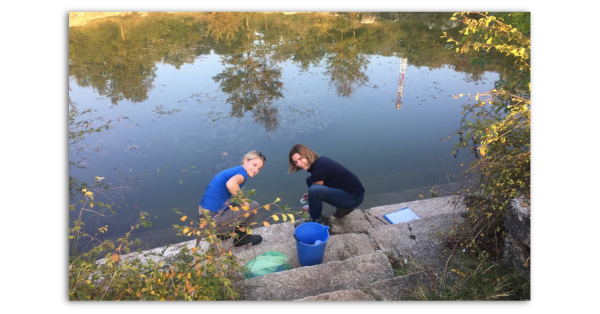 The ISC team collecting samples
Currently, several invasive species are the greatest threat:
- tiger mosquito species (Aedes albopictus)
- sea grapes (Caulerpa cylindracea)
- tree of heaven (Ailanthus altissima)
The ISC is conducting ecological monitoring of the several mosquito species and the Mediterranean ponds as well as artificial sources. The project aims to prevent new species from entering the ecosystem as well as stopping the spread of current species.
Fighting the Mosquito Infestation With GIS Cloud Apps
The ISC started mapping the invasive species with Google Maps and simple free tracking apps. While working in the field, they struggled with data collection, GPS locations, data export, and data visualization. Only rough data was available, with no possibility to create or edit maps. They realized that GIS software was needed.
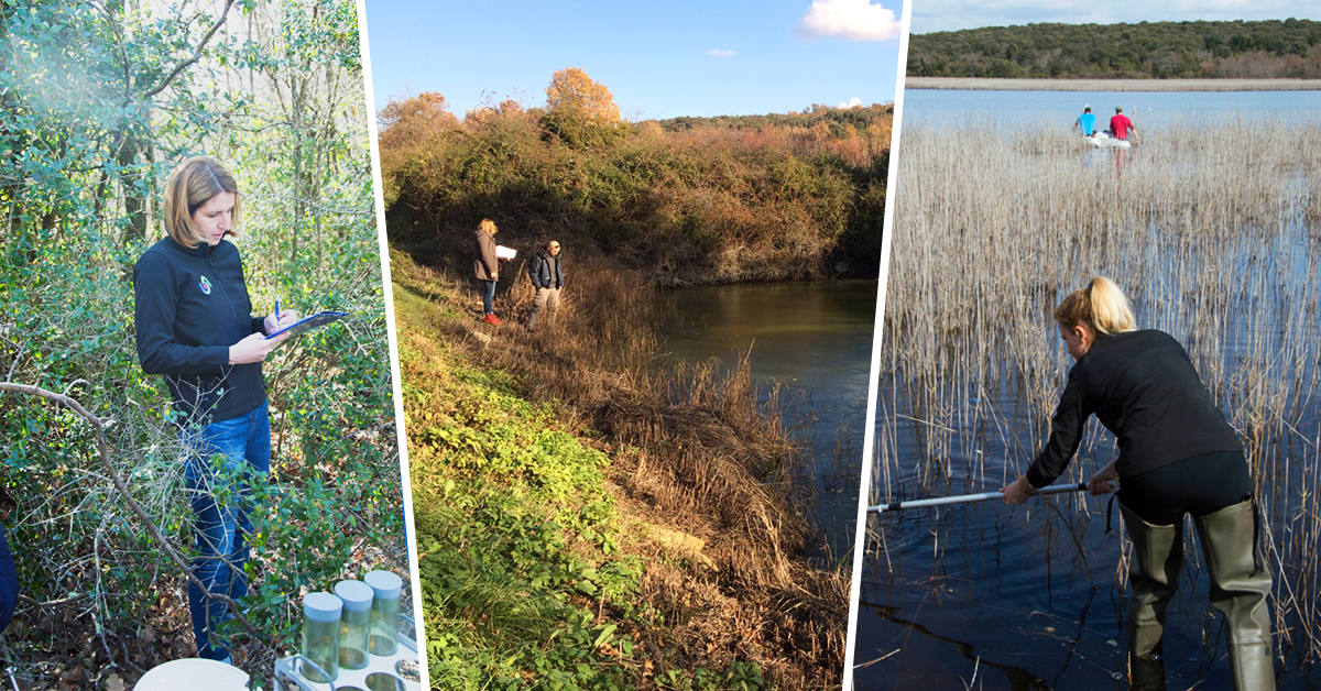 Monitoring mosquito sources
We needed a GIS tool suitable for fieldwork with options for visualizing the collected data. — Mirela Uzelac, Invasive Species Center
They chose GIS Cloud because it provided a set of user-friendly apps for field data collection, map editing, and analysis. The GIS Cloud apps also helped them create an effective field workflow.
The daily workflow starts in the ISC office where they create the data collection form. The form is used to evaluate and monitor mosquito sources like ponds, swamps and lakes.
The form usually contains many entry fields:
- photos,
- location description,
- infestation level of mosquitos,
- the density of invasive species population,
- date and time,
- biodiversity assessment and
- others.
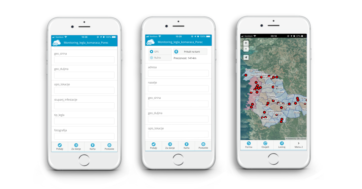 The collection form and map view in the Mobile Data Collection app
When the form is completed, it’s time for fieldwork. The ISC field crew collects the field data with smartphones equipped with Mobile Data Collection apps. The field data populates an online map in Map Editor as soon as they fill out the form. It’s important to mention that they use the apps in remote areas with no internet connection and sync the data later.
When the fieldwork is done, the ISC team creates a cartographic product in Map Editor for internal and public use. The Map Editor makes it easy to edit and publish maps with a lot of great options for map visualizations. These maps are usually posted on social networks, the ISC website, or forwarded to relevant local institutions and the press.
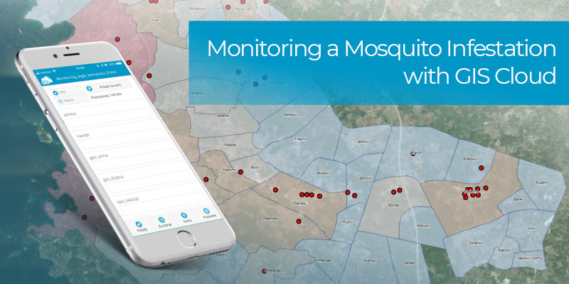
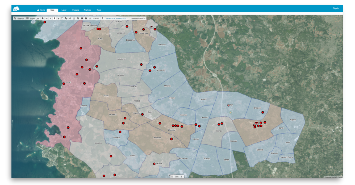 Monitored mosquito sources (red dots).
“The main benefits of GIS Cloud for ecological monitoring and analysis are: user-friendly apps that work online and offline, the possibility to import and export data and data visualization.” Mirela Uzelac, Invasive Species Center
The science team from ISC also say that this kind of GIS technology could be used on a national level as a unique tool for ecological research.
Project Results and Future Plans
The ISC told us that there are direct and indirect results of using GIS Cloud tools in the project. Direct are extensive maps and databases, visualized in a simple, user-friendly way. Indirect would be the successfully established new collaborations and projects that are a product of the maps the ISC designed with Map Editor. You can explore the publicly available map here.
The ISC plans to expand the field of research and increase the number of monitored invasive species and collect new data. The data will be used for analysis and preventing the introduction or spread of new invasive species. Also, to raise public awareness through workshops, citizen science actions, and social media.
Interested in trying out the GIS Cloud apps? Try out the 30-day free trial or contact our sales consultants and schedule a live demo.