
To better understand how the planet Earth has formed and how life on it evolved, it is necessary to take a look at the evidence we have about those processes. The rock records are the evidence. To understand and study those records, it is necessary to raise public awareness to keep the rock records intact. That’s why Martina Puljko, a graduate geologist from the University of Zagreb, created a geoheritage GIS Portal that shows the locations, as well as the description of geoheritage sites in Croatia.
About Geoheritage
Geoheritage is a surface and subsurface part of the lithosphere whose understanding is essential for the interpretation of the geological processes that shaped the planet Earth and the entire course of evolution. It’s also called geological heritage.
Geoheritage diversity includes geological and geomorphological diversity. Geological diversity consists of different types of rocks, minerals, fossils and relief forms, different underground and surface structures. The geological and geomorphological heritage of Croatia is very rich and diverse. The unique value is a vast diversity in a relatively small area that has a scientific, cultural, landscape, economic, and personal worth that needs to be preserved.
Intensive construction and industry could irretrievably erase evidence in the form of rock records, both about the evolution of the plant and animal world, as well as human evolution and the creation of our planet. To prevent it, we need to be aware of its importance and protect it in the best possible way.
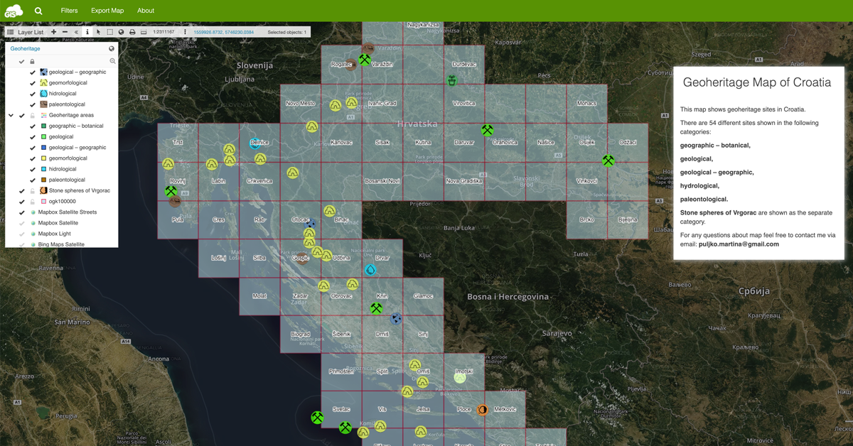
In this map portal, the geoheritage sites are shown in the following categories: geographic – botanical, geological, geological – geographic, hydrological, and paleontological. Stone spheres of Vrgorac are shown as a separate category.
Creating the Geoheritage Map Portal
Preparing the Data
The first step in creating a map is gathering the data. To create this map portal, Martina used the data from the State Institute for Nature Protection. She processed 54 different geoheritage sites.
Changing the Symbology
The data was in the form of three shapefiles, one polygon, and two point shapefiles. Information about every site, such as geoheritage categories, subcategories, name, description, coordinates, photos, etc. was added through the datagrid with the Map Editor application.
Geoheritage localities in both polygon and point shapefiles were grouped in the categories mentioned above. For a better visibility, Martina placed a point shapefile with the same attributes above the polygon shapefile. To each category, she added a specific symbol.
Creating the Map Portal with App Builder
App Builder is used for organizing and editing the Map Portal layout. It is possible to set a default map, manage toolbar buttons, add items to the top menu (such as filters, map export, etc.), manage different panels, manage datagrid visibility and edit homepage options.
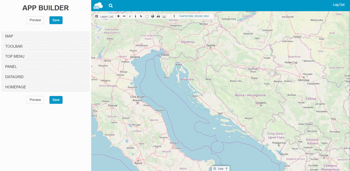
Filters were added to the default map to provide an easy way to view different geoheritage categories. For easier understanding, the info window with the map description was added.
Map Portal is an excellent tool for delivering geospatial data to the public. It makes it easy to visualize various types of data on a public GIS portal you can customize. It allows you to insert a lot of useful features to make your maps stand out.
The Results
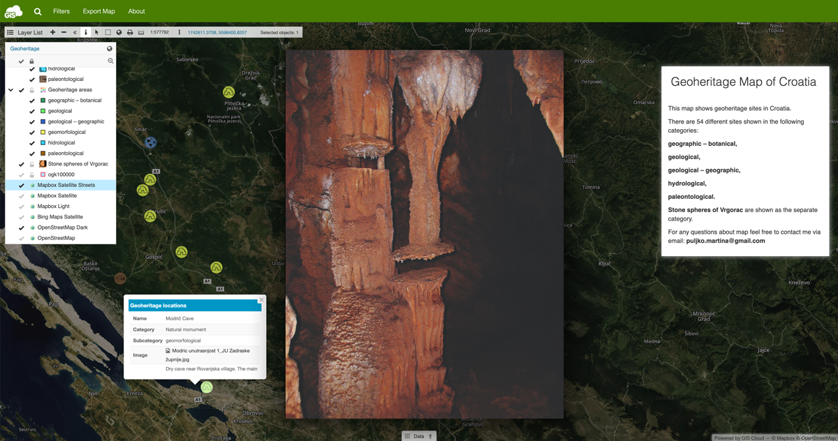
Steps described above resulted with an interactive map portal which enables an overview of 54 geoheritage sites in Croatia. By clicking on each site, a window appears with all the data about that specific location.
This map portal enables more efficient management of protected areas in the Republic of Croatia and provides access to information to the general public. The map combines geoheritage and geodatabase information in one place.
Interested in creating your own Map Portal? Send us a message and we’ll help you get started.