Field Maps is a term that finally gets a lot of attention due to the increasing need to enable field crews with location-based business applications that operate in remote environments. These applications are primarily used to improve situational awareness, increase operational visibility, reduce costs, and enable data collection crews with tools that communicate with existing systems and support advanced workflows.
It’s great to see that change as organizations have been locked in their desktop GIS and mapping environments for decades, but with cloud technologies, maps are finally ready to be included in the next era of business apps. Well, to be fair, many organizations are already there as they’ve been using cloud and field maps technologies for years now with GIS Cloud.
Field Maps as an Initiative
Field maps is also an initiative for organizations to free themselves from locked-in, costly, and heavy GIS systems and introduce more flexible, adaptive, configurable, integration friendly, solution agnostic, and, above all, cost-effective environments. That doesn’t mean that you’ll use field maps applications to replace your existing systems but extend their use by building bridges between GIS environments and business non-GIS users.
For that to be true, you need to have an option to integrate field maps apps with any proprietary, open-source, or custom-built GIS and non-GIS application that you already have in place. Locking yourself into environments that don’t support 3rd party tools & different data formats or restrict you from sharing your resources with others in secure conditions is a big step back. It’s also one of the main reasons why organizations had only 20% of their employees using spatial apps before switching to GIS Cloud. With field maps apps, you can finally bring that to 100%.
Another significant field maps benefit is that organizations should be able to use these apps as standalone tools in case they don’t have an existing system in place or they need to build quick projects without the concern of bypassing their IT regulations. You need to do your job without spending countless hours learning IT procedures and without worries about what will happen if you push your data to the field. Field maps should also cover the security and workflow aspect of that challenge.
Field Maps Applications
Here at GIS Cloud, we’ve been developing these kinds of apps for more than ten years now. The supporting values mentioned above were and still are, our bread and butter when building business applications based on spatially aware cloud technologies.
Improving Operational Visibility with mobile Map Viewer
Before anything else, field crews need to know how to get to the destination, what they can expect at a location, and understand the surroundings in which they need to work. All of that will then have a significant impact on their decision in terms of equipment, time, and money they need for the job. Organizations have learned that they can significantly improve their fieldwork by putting a live map into the hands of their employees that gives them important information like:
- Route to the destination
- Location of all the assets on and underground.
- Attribute information about all the assets, including media files like PDF, videos, audio, etc.
- Real-time environment and asset condition and more
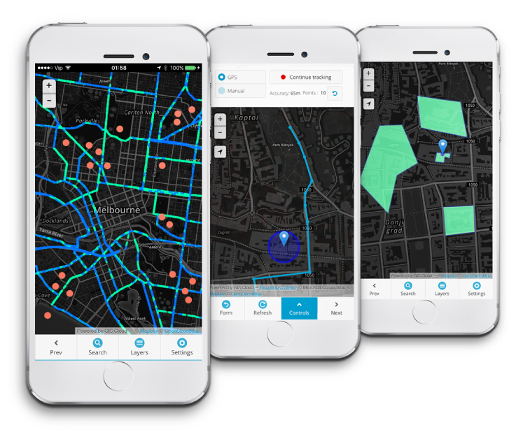
GIS Cloud’s Map Viewer is an easy way to view and access maps and data on your mobile device in online and offline environments. And it’s fully optimized for non-professionals who need the solution ready now without spending a fortune or worrying about hidden costs.
From Paper to Digital with Mobile Data Collection
In addition to improving operational efficiency, Mobile Data Collection also enables crews to provide feedback from the field via iOS and Android devices. We’ve written a lot about our data collection tool and best practices, but it all comes down to providing your field crews with a tool they immediately understand and controlling the quality of data that comes into your database. Again, it works in online and offline environments, and you don’t need to worry about hidden costs. We can’t stress that enough.
Give it a try, and let us know your thoughts!
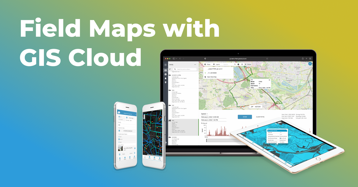
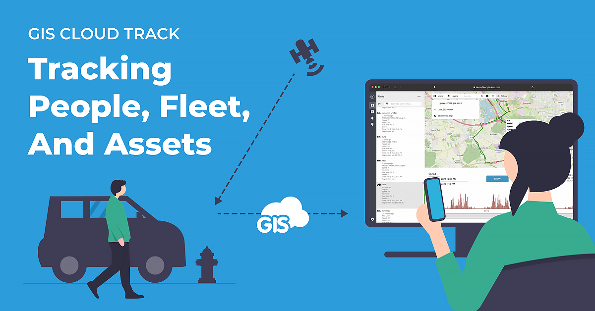
Optimizing Costs and ensuring Safety with Track
GIS Cloud’s latest product comes in nicely in the whole Field Maps segment. It provides extra functionality like tracking smartphones (and other devices like GPS units) to get insights into the real-time location of people, vehicles, fixed assets, and IoT.
Having the location of your crews and assets in the field is one thing, but knowing the information on whereabouts, movement trends, and the status of anything you manage in real-time is a game-changer.
Find out more here and try it out.
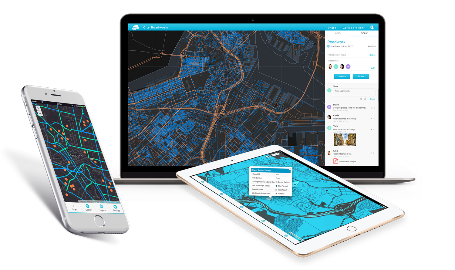
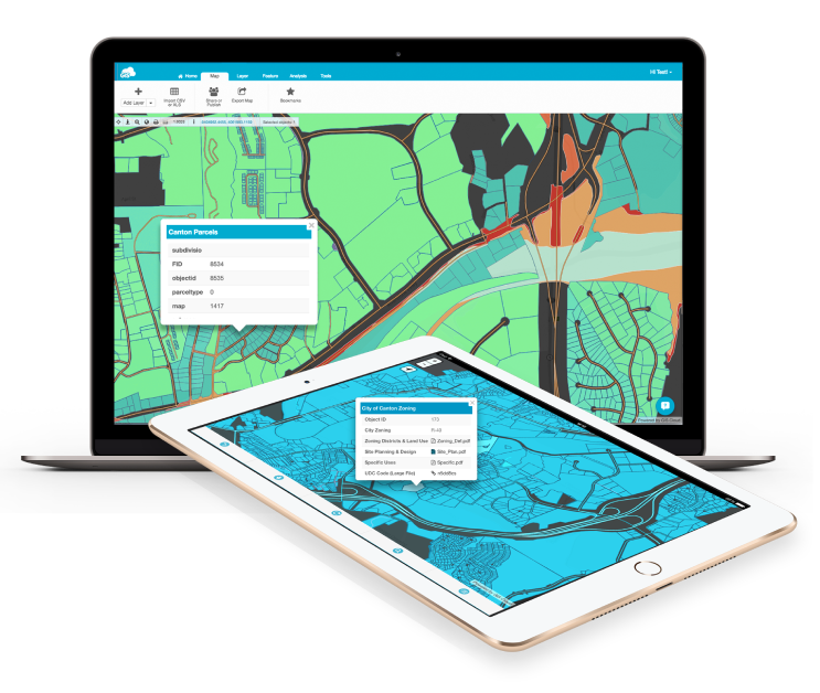
Supporting Field Workflows with Map Editor
We like to say that Map Editor is a true GIS tool but built entirely in the cloud. I want to argue that the definition could be a bit better as letters GIS can often imply that you need to be a proficient GIS professional to know and understand how to use the app properly. Today, we have users of all skill levels using Map Editor for building and sharing maps, analyzing data, creating collaboration environments, centralizing all spatial and non-spatial data into a single point of truth environment, and more.
In short, Map Editor is a powerful cloud-based map tool built for GIS professionals and non-GIS users who can adjust the tool to their needs and skill sets to support their field workflows.
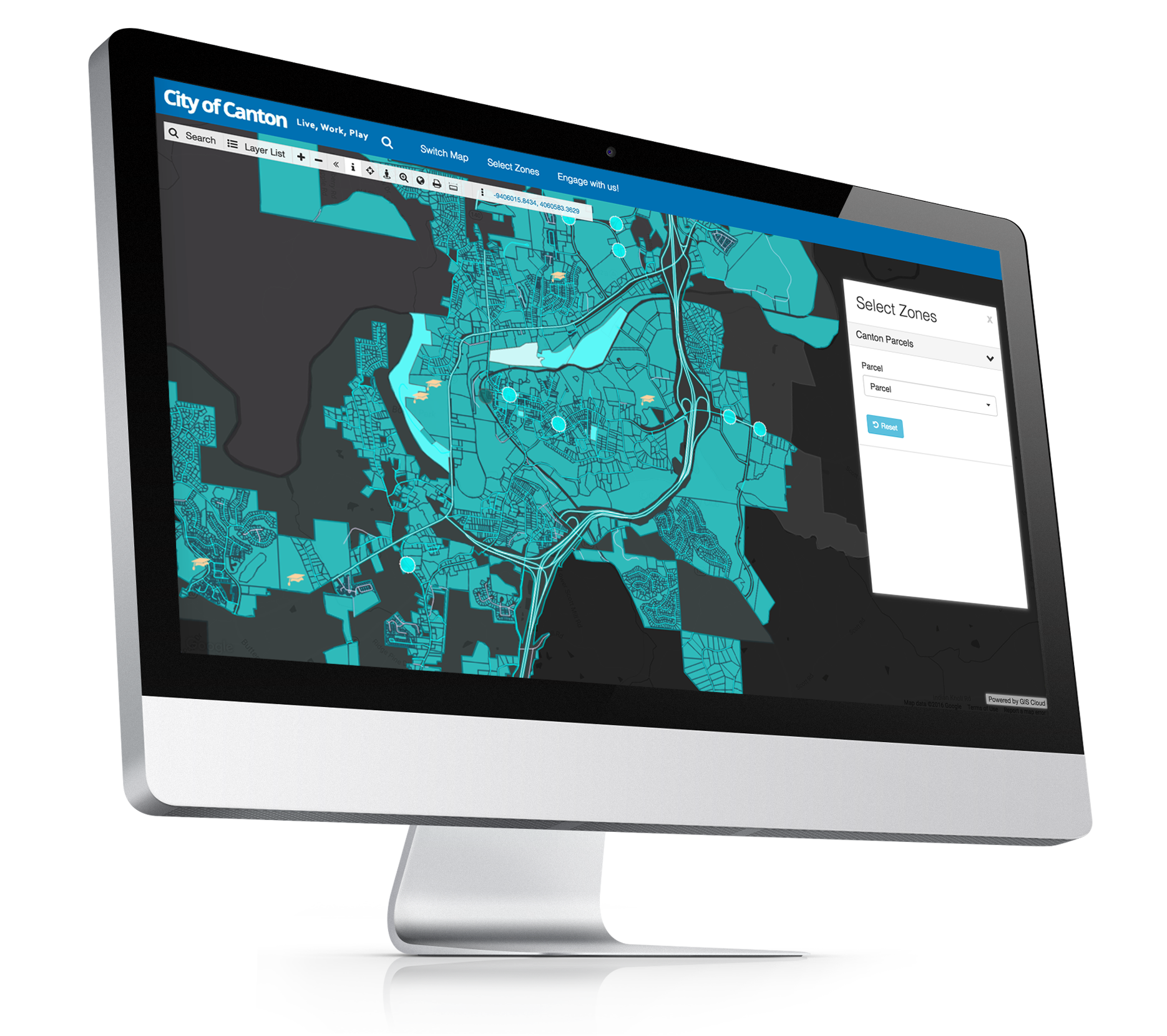
Understanding and Sharing with Portals and Dashboards
Every project needs to be presented and delivered in a format anyone can view and understand. For that purpose, GIS Cloud Map Portal and custom dashboards give you the ability to publish interactive maps, charts & graphs and allow your viewers to search, visualize, and explore media enriched data with just one click.
In summary, field maps have been in GIS Cloud’s focus since the beginning. Only cloud technologies can enable the development of multi-tenant, configurable, easy-to-use, and cost-effective solutions that are finally getting the attention they deserve.
We’ve known that for years and have been working on it since the beginning. And we’d love to help you create your field maps environments with GIS Cloud, so feel free to contact us or create an account and start your free trial.