
Ines Akrap, a Geoinformatics student at the University of Zagreb, created this case study and wrote the accompanying text on creating a geomarketing map using GIS Cloud and QGIS applications.
Location Is The Most Important Thing in Marketing
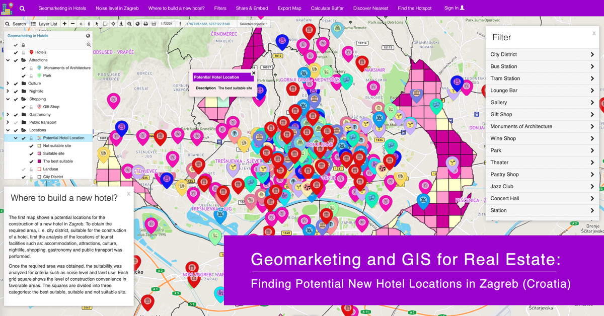
This interactive map aims to help potential investors analyze and visualize the possible locations for building a new hotel in Zagreb.
Geomarketing is a discipline that uses geolocation in the process of planning and conducting marketing activities. The main task of geomarketing is to analyze locations based on available data and discover where such ‘optimal locations’ are for specific services.
Research has shown that location data increases the effectiveness of marketing campaigns by up to 80%.
Geomarketing data is used to determine customer and visitor behavior based on their habits. The data describes places tourists visit most often based on their interests. This data helps hoteliers improve their marketing.
Preparing And Gathering The Marketing Data
Data used in this project was downloaded online and is publicly available. The official website of the Zagreb Tourist Board hosts information on all the recommended tourist locations for visiting Zagreb.
To gather the mentioned location data, it is enough to copy all of the addresses in the Excel table and load them into the GIS Cloud Geocoder to obtain the coordinates of individual objects used for further analysis. Also, the data of the locations and objects can be easily collected using the Mobile Data Collection Application.
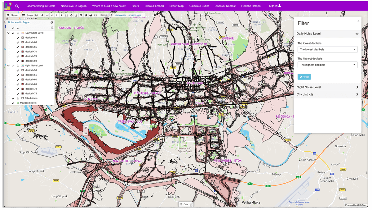
For building a new hotel, it is necessary to obtain the noise level and land use data in Zagreb. This data can be downloaded from the website of the Ministry of Economy and Sustainable Development.
Finally, it is necessary to gather the public transportation data, which can be downloaded from the Open Street Map.
The gathered data was uploaded into the QGIS for further analysis. The analysis was conducted using arbitrarily selected criteria defined in the following section:
- The maximum distance of the new hotel from the tram or bus station must be less than 700 meters
- The maximum distance of the new hotel to architectural monuments, concert halls, theaters, museums, souvenir shops, or galleries should be less than 5 kilometers
- The maximum distance of the new hotel from the park is less than 7 kilometers
- The maximum distance of the new hotel from the airport, the main train station, or the bus station is less than 10 kilometers
- The maximum distance of the new hotel from restaurants, lounge bars, or patisseries is less than 2 kilometers
- The distance from another hotel must be more than 2 kilometers
- The maximum distance of the new hotel from nightclubs, jazz clubs, wine shops, pubs, or cocktail bars must be less than 3 kilometers
- The new hotel must not be in the high noise zone and must not be in the industrial and economic zone
In QGIS, tools such as buffer, intersection, dissolve, difference, union, grid, rasterize, and raster calculator were used in obtaining the potential locations for building a new hotel.
After performing the analysis and adding custom symbols in QGIS, the results were uploaded to GIS Cloud using GIS Cloud Publisher for QGIS. The plugin allows you to transfer maps from QGIS to GIS Cloud in a matter of minutes, preserving your symbology.
It’s a single-click solution for sharing maps and data from the most popular open-source desktop GIS with the rest of the world!
Editing The Marketing Data
The map can be edited in the Map Editor web application. Mapbox Streets was added for the background using the Tile Map Service.
“New folder” option in the layer list helps organize and divide the layers into categories. For example, museums, concert halls, theatres, and galleries were categorized as Culture. In the Map Editor, the classification can be done using the “Wizard Tool” and selecting “Distinct or Continuous” values.
The classification of the following layers:
- Potential Hotel Location
- Daily Noise Level
- Night Noise Level
was performed by selecting and double-clicking each layer to open the “Layer Settings,” choosing the “Wizard Option”, and selecting the values.
In this particular project, the “Distinct Value Classification” option was used. Classifying attributes based on distinct values means that all the attributes with the same values will be classified into one category.
GIS Cloud also offers the ability to select a column or color by which to classify values.
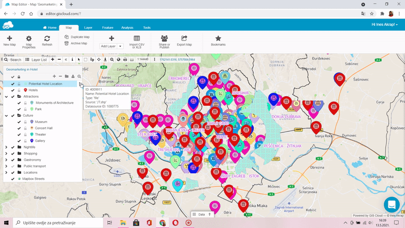
In the Attributes tab, you can determine all the attributes of individual layers that will be displayed on the map. It is possible to display attributes immediately by checking the “Use info window to display attributes” option. Different markers like name and address were added on the map using Tooltip and Labels tools.
In “Map Properties”, it is possible to define a map bound. Map bound option saves coordinates of your current view or manually imputed coordinates. Every time you open your map or click on the “View entire map” option in the Toolbar, you get the view extent of a map you set the bound to.
Visualizing And Marketing The Data
The last step in creating a map is presenting it to the public, stakeholders, or investors. The easiest way to publish your map is with the Map Portal. Map Portal is a simple and easy application that supports map visualization and data publishing in a friendly and accessible way.
This particular Map Portal consists of two maps:
- Geomarketing Hotel
- Noise Map in Zagreb
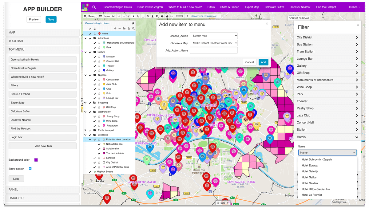
With GIS Cloud App Builder, you can easily and quickly customize your Map Portal according to your needs. In App Builder, you can customize and brand the layout of your map with the help of tools such as:
- setting the default map
- adding tools to the toolbar
- changing the logo
- ribbon colors
- info window pop up
- data grid
- and much more
Also, you can analyze the data on the map with tools like:
- Buffer
- Nearest Analysis
- Hotspot Analysis
Add numerous filters for a fully customized and optimized Geomarketing Map Portal. Find information on App Builder in this free webinar recording.
Layers on the map are visualized by simply clicking on the checkmark next to the layer name. You can search for various information using the filter field. All maps can also be printed. Numerous analyses can be easily conducted. For example, you can find the area where most of the hotels are located with Hotspot Analysis.
The completely branded Map Portal can be shared with users and investors to search, visualize and explore the data with adequate information to make their decisions.
Identifying crucial information and pain points will help them with cost optimization and customer reliability.
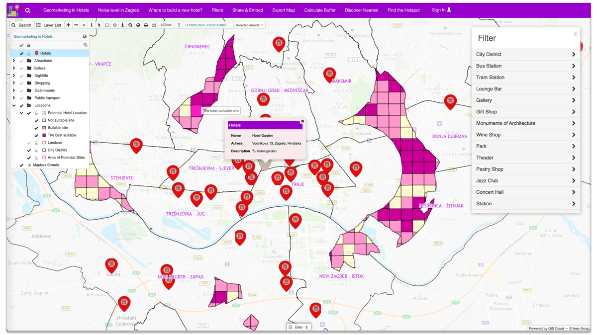
Explore this amazing Geomarketing Portal. Try all the filters and find your optimal location for building a new hotel in Zagreb!
Geomarketing Is Fundamental For Finding, Understanding, And Targeting The Location
More and more tourists come to Zagreb each day. The development of hotel marketing is essential because of that. The goal of this case study is to find new potential locations for hotels using geomarketing tools.
Geomarketing enables faster and more efficient business decision-making through location and human behavior analysis. With the help of analysis and visualization tools, Maps can help with spatial planning and construction of new facilities such as shops, cinemas, schools, etc.
GIS Cloud applications and platform greatly help with collecting and visualizing all of the data on a map. It is possible to use different applications to accomplish your project. Mobile Data Collection App for field data collection, the Geocoder to utilize the downloaded addresses, Map Editor to edit and visualize the data, and Map Portal to share the data to the public, investors, or stakeholders.
The benefit of using the GIS Cloud platform is the ability to bridge the gap between the desktop GIS solutions like QGIS and ArcGIS and make your maps visible online with just a couple of clicks!
After performing the analysis using desktop GIS tools, you can get a better and more precise visualization of the project in GIS Cloud with the help of Publisher for ArcMap and before mentioned GIS Cloud Publisher for QGIS.
The map presented in this project is just one example of how you can utilize the GIS Cloud platform for geomarketing analysis.
On these links, you can find numerous similar successful projects that used the power of GIS and location in marketing decision making:
Discover The World Of Geo-Marketing: FiDA Co. Studios
This map was designed for geolocation and tracking of billboards, outdoor signages, retail, and other types of assets in real time.
Map Of Business Structure And Activity In City Districts Of Zagreb
Using this interactive map, any business investor can see where the best places for opening a new business unit are.
Using GIS In Tourism – Tourist Map Of Šolta
Interactive Tourist Map of island Šolta demonstrates how to combine GIS technology with tourist guidebooks for everyday use.
If you want to build your own Map Portal app and learn more about GIS Cloud apps and services, Sign Up for the free 14-day trial.