
Every country wants to make use of its mineral resources in the best way possible – economically, but also environmentally. It is necessary to monitor permits for exploitation, represent potential exploitation fields for new investors and easily keep track of every mineral resource. Their smart management is, therefore, highly important.
That’s why Domagoj Grgurić, a Mining Engineering student from the University of Zagreb, created a map of mineral resources and exploitation fields in Croatia. Here’s the Map Portal where you can explore the map.
Overview Of Mineral Resources In Croatia
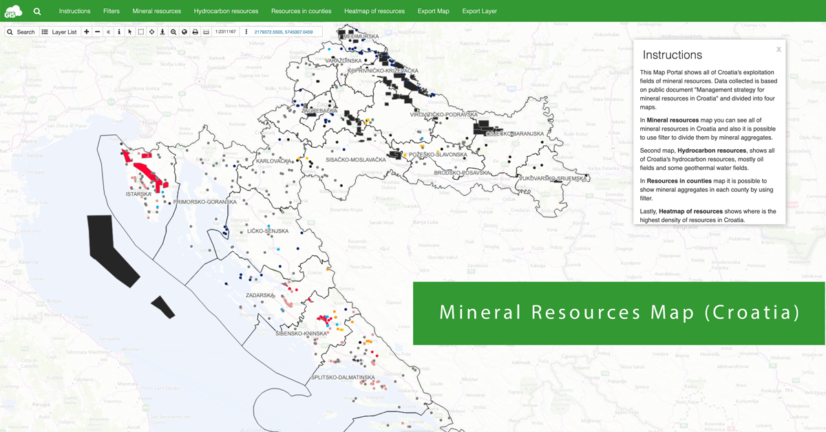
This map represents all of Croatia’s exploitation fields of mineral resources. Exploitation fields represent the areas where mining activity is legally allowed. Data we’ve used for the project is based on a public document “Management strategy for mineral resources in Croatia.”
Geologically speaking, Croatia is divided into two regions – Inner Dinaride Belt and Outer Dinarides. A majority of those two regions consists of sedimentary rocks like limestones, dolomites, and other unconsolidated sedimentary deposits.
Most of the exploitation fields in Croatia are crushed stone aggregate. It can be used for the construction of roads, production of concrete, groundwork for the construction of railways, building dams and also as an aggregate for the production of construction materials. The second highest number of exploitation fields are construction grade sand and gravel. A large amount of these fields are located around river Drave, an area that offers almost endless amounts of high-quality sand and gravel. Their primary use is in construction of roads and tunnels, but also for the production of concrete. On the third place is the dimension stone. It is represented in the southern part of Croatia, the region called Dalmatia. Since, geologically, limestones are most common, the area abounds with quarries for the production of dimension stone. Later on, after exploitation and processing, dimension stone is used as a decorative element in interiors or exteriors.
Creating the Map Portal
In these three steps, we are going to show you how Domagoj designed a map and then built a custom Map Portal.
- 1. Preparing the Data
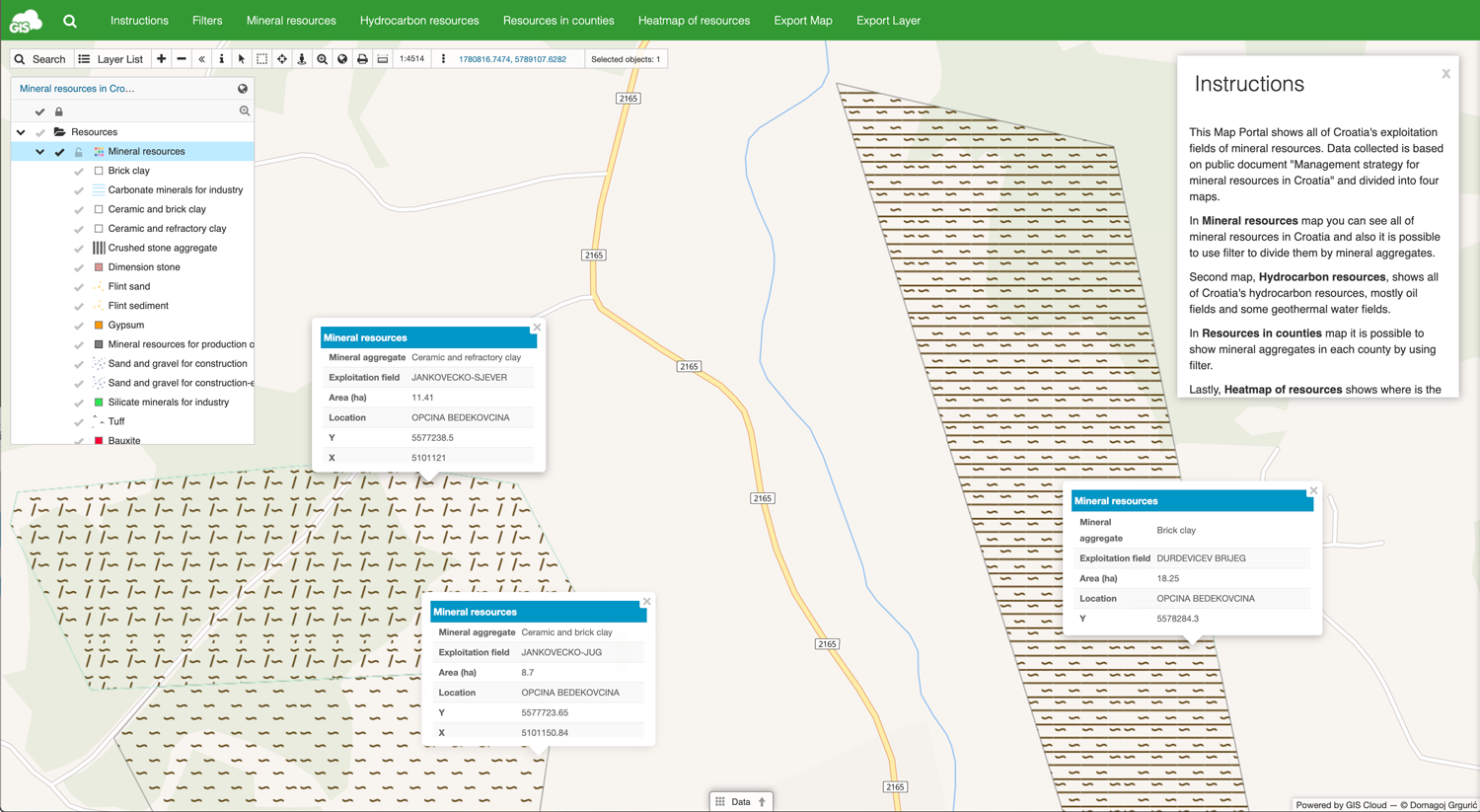
As it was mentioned before, the basis for this map was “Management strategy for mineral resources in Croatia” document. The first step was to use already created polygons from the mentioned document and using Map Editor recreate them on our map. Apart from polygon’s geometry, all of the available information was also used, like the type of mineral resource, area dimensions, county, and owner information. Collected data for every polygon was easily inserted through the data grid.
- 2. Changing the Symbology
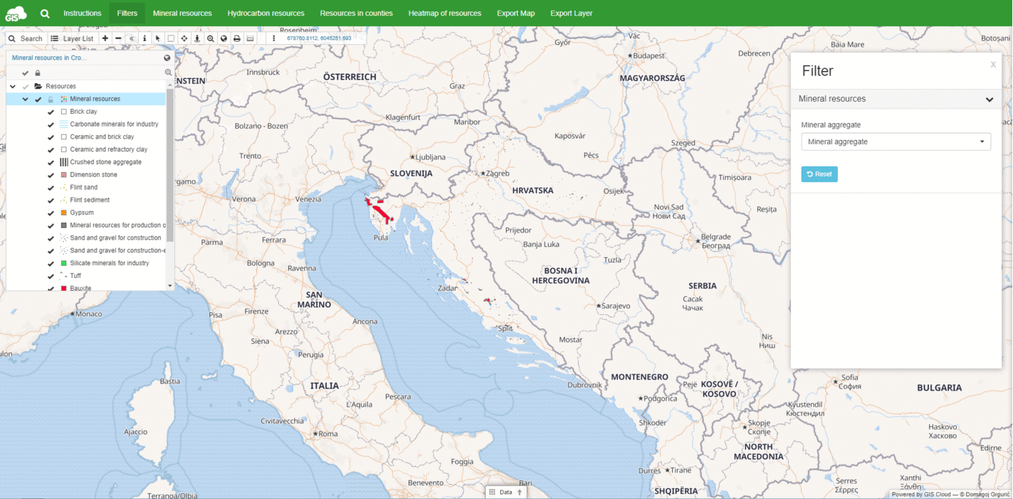
Polygons were then grouped based on the type of mineral resource they represent. Using Map Editor, their symbology was changed in accordant to the mining engineering standards. To create a better view of polygons on “Resources in counties” map, out of every polygon, we created a point and turned off the visibility of points after some zoom level. This way on lower zoom it is possible to see the position of every polygon, but after a specified level of zooming the points will disappear. After fixing some redundant data and adding some new, as the name of exploitation fields, coordinates, and location, the map was ready for the next step.
- 3. Creating the Map Portal using App Builder
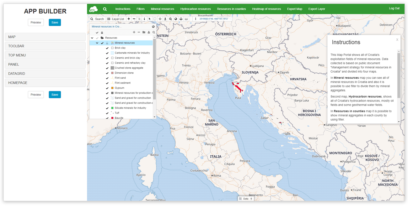
We decided to create four different maps out of one map. Publishing those maps on Map Portal was intuitive and easy with App builder. The first step in creating a custom Map Portal was to pick a default map. After that, we have added three more maps. On two of them, we created dropdown filters, which was both easy to create and easy to use. The introduction text was added for new users on how to use the Map Portal properly. Lastly, details like background color were changed and our Map Portal was ready for publishing.
The Results
Result of this project is an interactive Map Portal with four distinct maps. In the Mineral resources map it possible to get an overview of every mineral resource which is under exploitation. Hydrocarbon resources map shows only Croatia’s hydrocarbon exploitation fields. The vast majority of them are oil fields owned by one company, but also there are some geothermal water fields. In the Resources in counties map, by using the filter, mineral aggregates are represented by their location in counties. Lastly, we have the Heatmap of resources; it is a statistical map where red areas show a high density of exploitation fields, while blue areas show low density.
Map of resources in Croatia can be used in educational purposes during classes on nature science and related schools or faculties. Its significant advantage is that it is easy to use and easy to filter through. Aside from education, the map can be used by government authorities to manage the system of the mineral resource, monitor their usage and to analyze the data.
Are you interested in creating a GIS Cloud Map Portal? Contact us.