

Drone technology has revolutionized the contemporary mapping landscape. It reinforced the use of evolving 3D mapping photogrammetry technologies, but also brought some new challenges to master. Luke Wijnberg from 3DroneMapping sums up the key changes drone technology brought to aerial mapping concluding that costs of the projects are now 20 times cheaper, with the technology safer and more accessible to surveyors.
With quick deployment times and low maintenance costs, we can map pretty much anywhere, at any time. Drones allow us to use all kinds of payloads such as near infrared cameras to map vegetation chlorophyll levels for agriculture. Not only do drones make things cheaper and faster for a surveyor, but they also make our job safer. We can now survey areas remotely that perhaps have some environmental risks to them such as quarries, cliff edges, polluted areas, etc.
We bring you a story about a 3DroneMapping project in Hammarsdale, South Africa. We will start by an introduction about how they started their mapping expedition.
3DroneMapping began with drone mapping in 2014., making the most of their experience in terrestrial and conventional aerial survey to create a modern approach to undertaking survey, using drone technology. This decision enabled them to offer a service with a very quick turnaround time and low environmental impact, safer and more cost efficient than services with traditional approach using aircraft vehicles.
The Project Workflow
The Hammarsdale project consists of mapping a large scale (600ha) development area in Hammarsdale, South Africa. 3DroneMapping staff has a task to fly the project every week to produce a high-resolution orthophoto and contours.
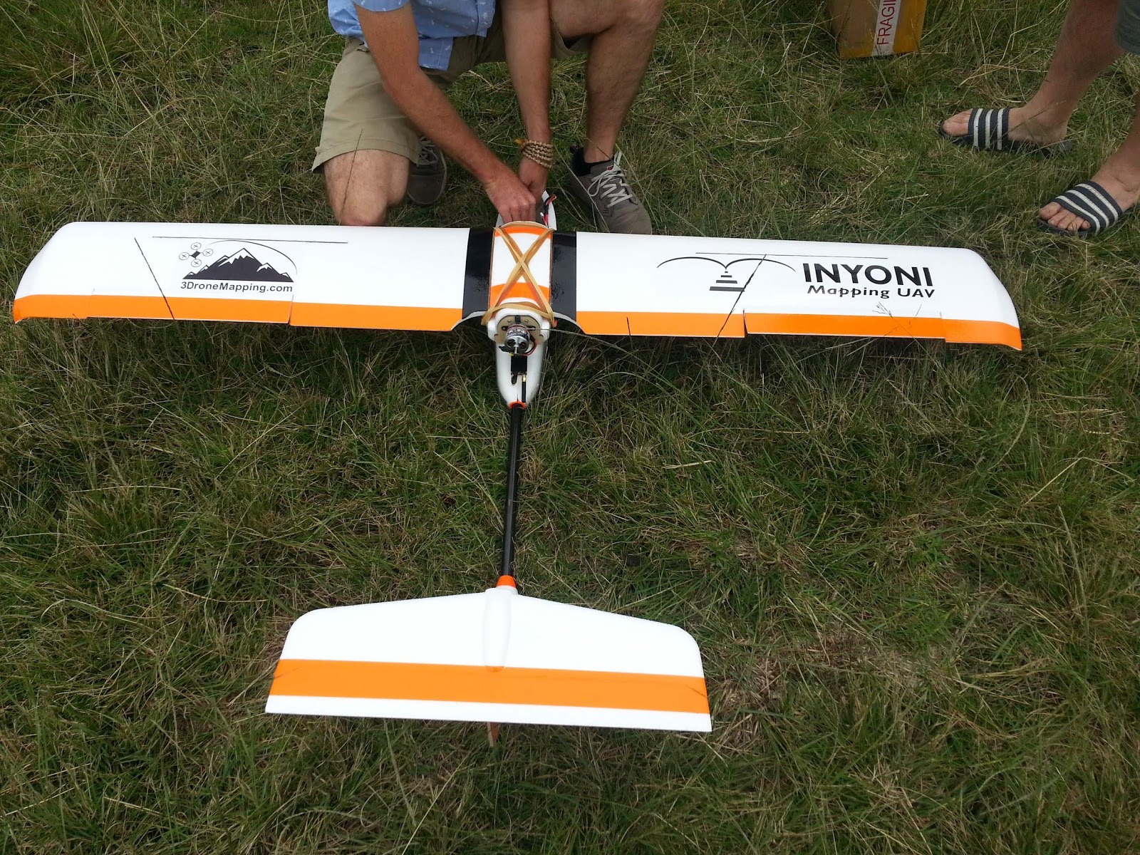
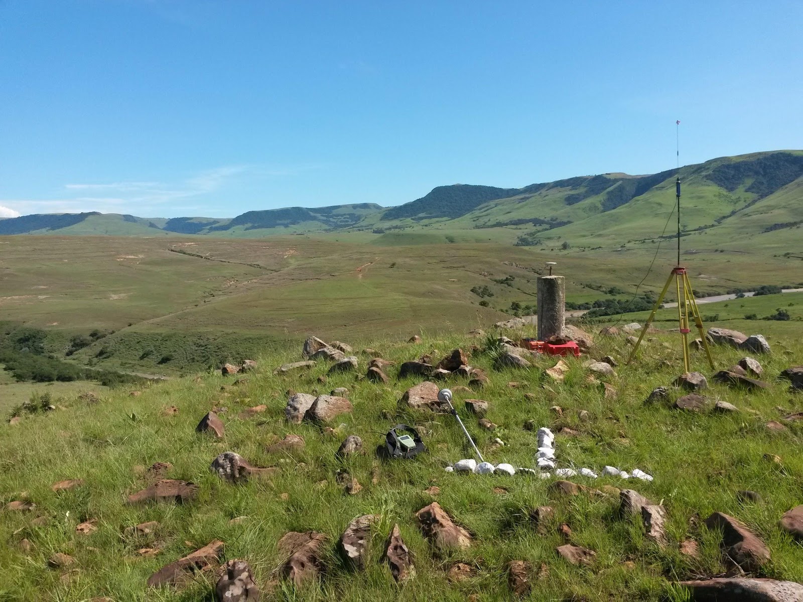
Here are a few photos of Luke and his team launching drones.

Their regular workflow consisted of these steps:
-
-
- flight planning
- flying over the area planned
- collecting images taken at specific intervals
- processing and referencing the images photogrammetrically
- generating 3D models,
- generating orthophotos and contours,
- uploading the data to GIS Cloud.
-
During the bulk earthworks part of the project, following this workflow they could accurately issue volumetric reports from week to week for selected areas.
What was the challenge?
A variety of end users needed access to mapping data, such as managers, clients and their various shareholders, subcontractors and other consultants.
However, the biggest challenge by far, according to Luke Wijnberg, was to educate people on how to operate GIS Software and to extract information from it. Both of these challenges needed a solution that would make their workflow as efficient as possible.
Summed up by Luke Wijnberg, what they needed was being able to:
- let everyone have the latest copy of our data
- manage different permissions for accessing the sensitive data for each user
- to enable the permanent remote connection between our clients and the project so they could keep track of on-site progress
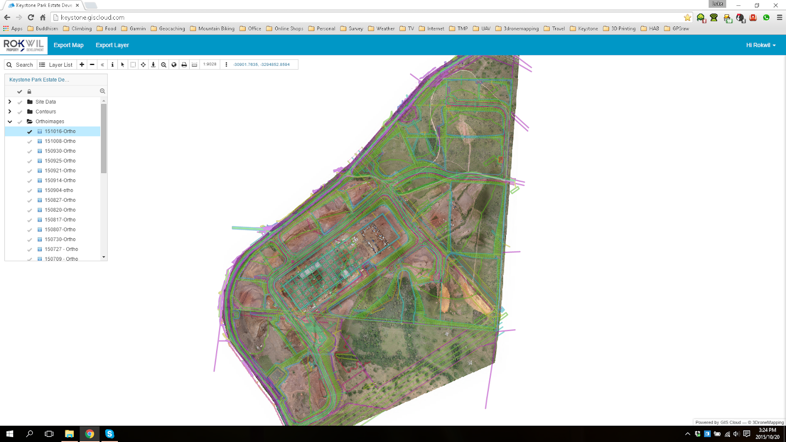
The GIS Cloud solution
3DroneMapping needed a reliable cloud solution for sharing their field data, both efficient in handling large data sets and easy to use.
“With GIS Cloud’s easy to use interface on the Web Portal, even the most inexperienced user could measure distances, print maps and query layers. It allowed us to give detailed information to our customers and not have to worry about software licenses/maintenance on their side.”
They chose the GIS Cloud Map Viewer so that they could share and present the field data to their clients. The interface was easy to cope with, so they didn’t have to worry about educating the users. In their own words: “Have all this data on the cloud meant that the shareholders in Dubai and London could easily track the progress of the construction from their offices and raise their concerns at the weekly meetings.” It enabled them to make their workflow more efficient and simplified the presentation of survey results.
“Using a cloud solution allowed everyone to see the entire site as it evolved from a remote location and always have the most up to date data.”

3DroneMapping recommends using GIS Cloud’s Map Portal and Map Viewer for:
- ease of use as a data publisher as it is simple to setup a professional looking map.
- ease of use on the client side as little knowledge of GIS is required to do basic calculations and view results
- sharing large raster datasets as the client does not need any specialized software to view our work.
If you want to know more about GIS Cloud, don’t hesitate to contact us. Also, try out the 30-day free trial.