
Urban tree management and maintenance can be very useful for increasing the quality of life in urban areas. For example, optimal tree density and distribution is an essential part of every modern urban planning strategy as trees have various benefits on humans and the environment.
Arborists create the urban tree management plan and conduct fieldwork, but their research or workflow is often interrupted by inefficient tools and poor visualization of field data. They also face problems while doing fieldwork, such as using paper maps and forms that decrease data quality and require additional data entry work back in the office. Modern data collection and visualization starts with an online mapping tool that guarantees an efficient field workflow and better data quality.
Visualizing And Planning Spatial Distribution Of Trees
In terms of urban planning, arborists need to assess and evaluate adequate sites for new tree cultivation projects. Proper tree density can be achieved if the spatial distribution is properly visualized, analyzed and monitored. With Map Editor, arborists can easily visualize and determine which parts of the city lack tree cover so they can propose a new urban tree management program.
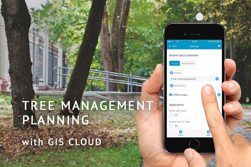
Mobile Data Collection enables arborists to easily map and collect data on particular city areas or trees using smartphones. It’s possible to customize categories for data collection, collect and upload data online and offline. The data is later visualized in Map Editor, where it is easy to detect the areas with suboptimal density using the buffer tool, as well as view the data from the field.
On the other hand, the new GIS Cloud Crowdsourcing solution offers a possibility to include a local community in planning new tree cultivation process, where collaborators can anonymously suggest areas that would benefit from tree planting.
Highlighting Features That Require Maintenance
Arborists, or even non-experts, can collect data about trees that present a potential danger to public safety. Often trees extend over roads or power lines potentially endangering people and infrastructure. Information about damaged and unhealthy trees can be easily and quickly recorded with Mobile Data Collection by a tree maintenance crew. It’s also possible to supervise the field workers.
Also, GIS Cloud Crowdsourcing solution enables city residents to highlight trees requiring immediate maintenance so during extreme weather conditions public safety is maximized.
Utilizing these data collection methods saves a lot of money – as it costs less if trees are regularly maintained.

Creating An Urban Tree Inventory
Urban forests provide benefits in terms of life quality, environmental and economic stability, as well as having a long-term effect on global climate. Creating an updated urban tree inventory would open a new approach to the problem of tree management in cities. Creating the inventory can be challenging if arborists have a small budget and not enough workforce. To see how arborists can overcome these challenges, watch the Tree Inventory webinar. It highlights the benefits of mobile and web apps for large tree inventory projects.
For more efficient management and review of collected data, it’s best to create a public urban tree inventory using Mobile Data Collection and Map Portal. With the Mobile Data Collection, it’s easy to map features and view them on an interactive Map Portal in real time. The Map Portal can also provide information to the public about all the trees planted and their current condition. Such urban tree inventory would help educate the public about the importance of arboriculture, as well as teach younger generations about preserving trees and urban geoecology system. Also, it would provide transparency in budget spending for local governments.
Preventing Disease Spreading
Urban forests are very fragile ecosystems, and arborists often have problems when uncontrolled diseases start spreading. If there is a pattern of disease spreading sources, using outdated techniques like paper forms and maps, is not nearly as effective as web-based tree mapping software that provides an opportunity to collaborate and work on projects in real-time.
With GIS Cloud apps you can highlight contaminated trees in situ and quickly prevent disease spreading with timely maintenance interventions. Map Editor offers you a possibility to create heat zones of infected trees that can help detect a pattern of disease spreading.
To sum up, an efficient and up-to-date urban tree management is necessary for urban areas and can assist in planning spatial distribution of trees, preventing diseases, creating urban forest inventory, and highlighting trees that need maintenance or pose a threat to public safety.
GIS Cloud works well as a tree mapping software that facilitates collecting, categorizing and visualizing data, as well as effectively coordinating workforce.
Interested in trying the GIS Cloud solution for tree management? Sign up here.