We are happy to announce that our developers have implemented a new feature regarding external connections in our Database Manager. In the GIS Cloud Map Editor web application, it’s now possible to connect and view the data from your external ORACLE database!
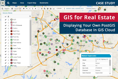
So far, it has been possible to connect only the PostGIS database in GIS Cloud. However, many companies, especially public and government sectors, use Oracle database software and technology solutions as key-solutions to solving the problems of information management.
Here at GIS Cloud, we continuously strive to provide an efficient, dedicated and innovative level of service and support to our clients. This is a big step towards the integration of external GIS database solutions and the consolidation of data management.
At the moment, we offer a read-only solution, meaning you won’t be able to import or create new data. This means that users won’t be able to edit the table structure and existing attribute data inside the GIS Cloud web app. However, you can visually represent the data on a map, access all the connected information as well as perform classifications and primary selections.
Follow these easy steps to connect to your External Oracle Database:
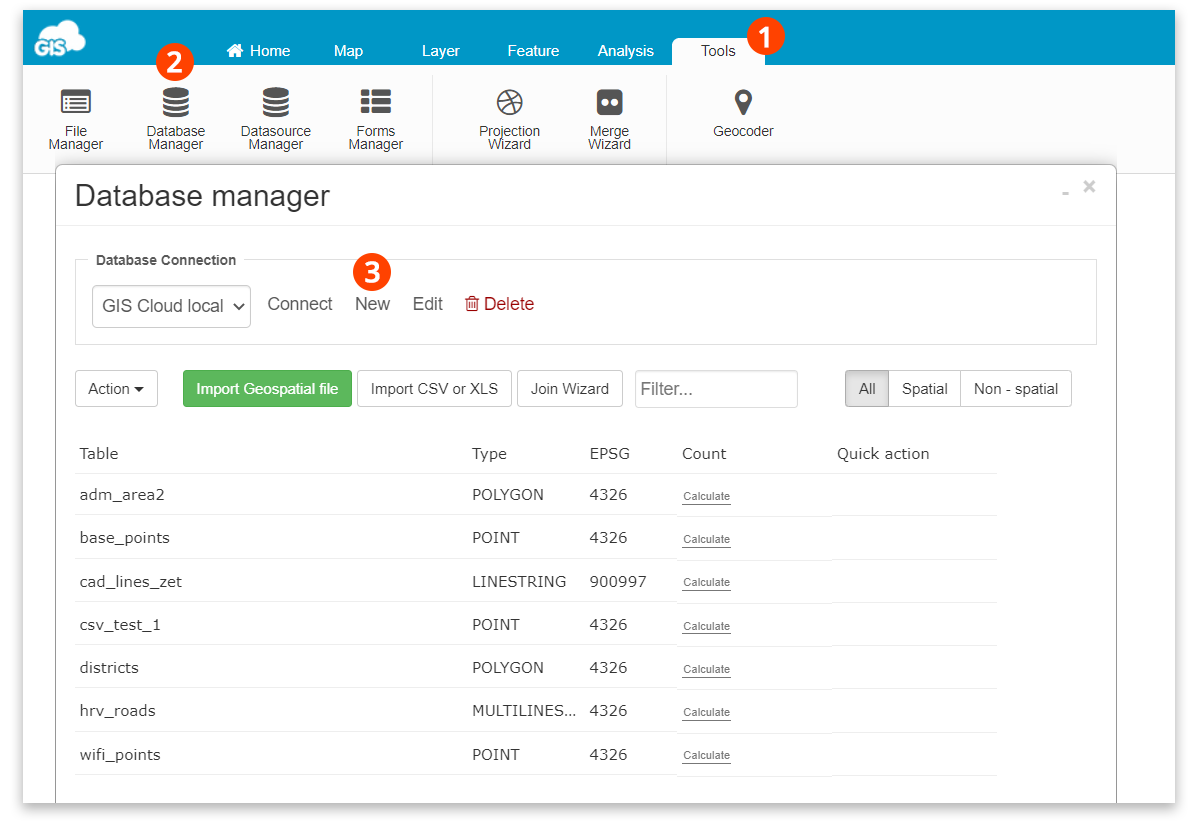
1. Open Tools tab
2. Open Database Manager
3. In the Database Connection section, click “New”
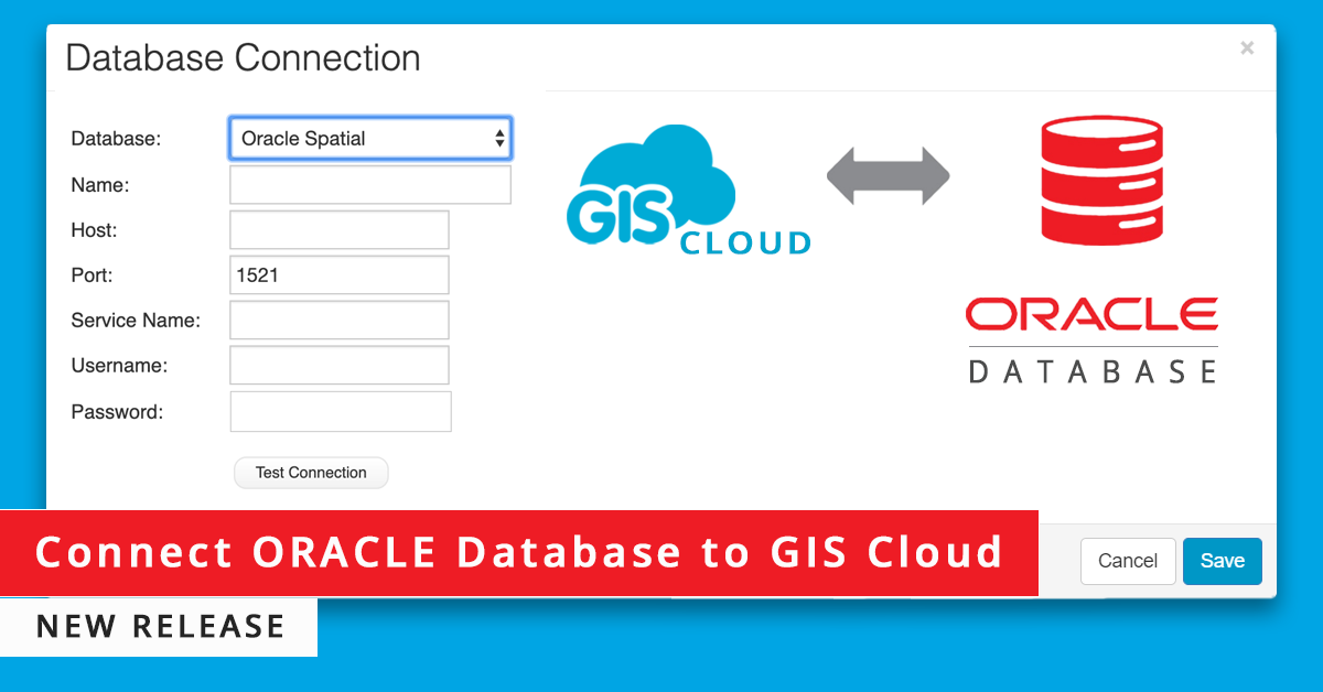
A new window will open where you can choose from the dropdown menu list “Oracle Spatial”. Please fill in the connection information and press “Save” to connect to your external Oracle database.
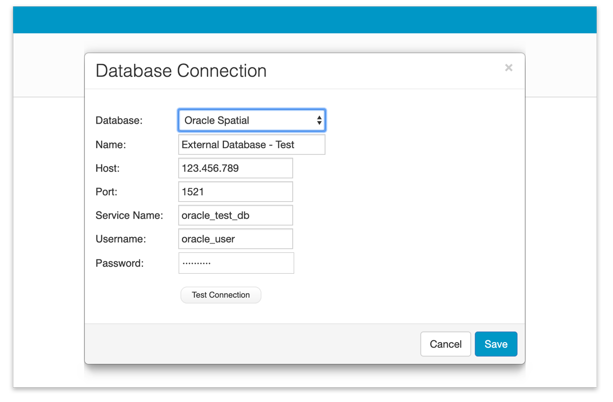
Note: Feel free to test your connection before saving the database parameters to make sure everything is in the right order. You can always edit your database connection parameters afterward.
Database Connection
You need to enter the following information to connect to Oracle Database connection:
Host – this is presumably your IP address. This has to be a public IP address, reachable from the Internet, not a private one (if your address is 10.x.y.z, 192.168.x.y, that won’t work).
Port – keep the default port 1521, unless you have explicitly set the database differently.
Service name – SID of your database.
Username – this is the name of the database user that connects to the before-mentioned database. Please note that this option is case sensitive.
Password – This is the database password. Please note that this option is case sensitive.
Besides Oracle Spatial, we offer a connection to the external PostGIS database with read/write permissions. This gives you more control over your data within GIS Cloud apps.
If you wish to try this new feature, please Log in or Sign up.