
Firefighters of Chile are an admirable organization, always investing in education and technology to provide the best possible service to their community.
In 2017 they faced massive fires across the country, in many distant locations at the same time. To coordinate teams and respond as quickly as possible, they decided to implement a GIS solution which provides real-time information on the closest and active firefighters, as well as the status and location of necessary equipment to handle the fire events.
How Firefighters of Chile became the most trustworthy organization in the country
According to the ICREO study ‘Trust – the challenge of humanizing businesses and brands’, Firefighters of Chile (Bomberos de Chile) were chosen in 2018 as the most trusted brand in the country for the fourth consecutive year. The study measures the level of trust that citizens and consumers have in companies and institutions in the country, based on five dimensions: honesty-transparency, responsibility, empathy, support, and closeness.
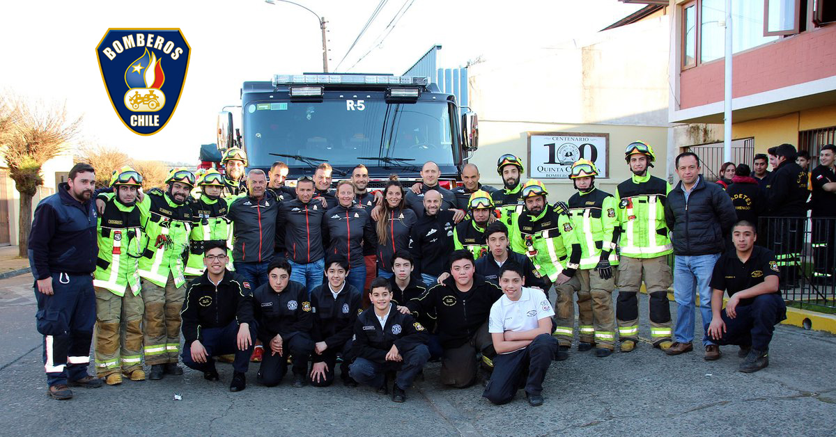
Photo credits: https://www.bomberos.cl/
The National Fire Chief of Chilean Fire department, Raúl Bustos Zavala, stated on the occasion:
The trust has been gained in the 167 years of service to the community, provided through our national territory. It has been won on the street, in direct contact with our people, in the work of each emergency or catastrophe. Today this is visible in the fact that the Republic of Chile and its citizens entrust the protection of their lives and property to an institution of voluntary service, which seeks to increase their professional quality at all times, through adequate training and investment in equipment, in order to provide a professional and efficient service.
Fire Departments restructured their organization to coordinate firefighters on a national level
At end of the 1960s in Chile, the financial situation of most fire departments in the state was critical. They were lacking in vehicles and equipment, which resulted in low motivation and hindered the recruitment of new volunteers. Superintendent of the Fire Department of Santiago at the time, Guillermo Morales Beltramí, initiated the idea of giving Fire Departments of Chile a national structure to coordinate their efforts.
In 1970 the so-called Coordinating Board emerged, which later adopted the name of the National Board of Firefighters of Chile, known today as Firefighters of Chile (Bomberos de Chile).
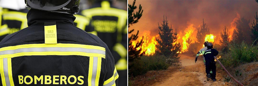
Photo credits: https://www.bomberos.cl/
The objective of the institution, together with the departments, is to develop an efficient firefighter volunteer service across the country, which guarantees the safety of lives and property of the citizens in the event of fires, natural disasters, traffic accidents, emergencies with dangerous substances and other situations.
To achieve their goals and continue being an innovative and disciplined organization, Firefighters of Chile are organizing permanent training in the form of the National Firefighters Academy, with regional headquarters dedicated to teaching, research and training.
Map as a means for effective strategic planning and execution
Chilean Firefighters put a lot of effort into strategic planning in order to facilitate the fulfillment of the mission of this organization.
In 2013 they started working on creating a strategic map in a form of charts, which would allow an overview of the results the institution was trying to achieve, as well as to be up-to-date with internal processes and competencies which allow to achieve them.
They also designed a set of actions, each one associated with a different aspect of the organization, to improve internal processes and increase efficiency. The project was important for coordinating firefighters in case of major disasters.
How firefighters resolved challenges in handling multiple simultaneous fires across the country
Faced with massive forest fires which devastated Chile during January and February of 2017 in many locations across the country, firefighters were struggling to handle many disparate large fire events which erupted at the same time.
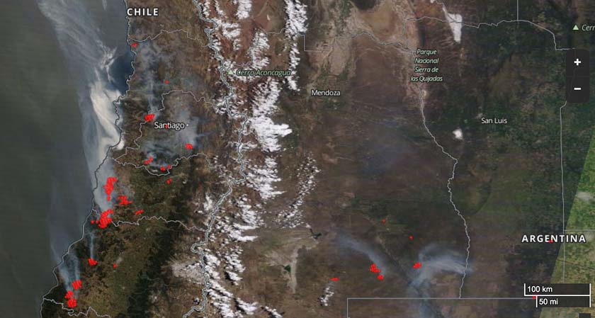
Photo: The red dots on the image represent heat at fires in Chile and Argentina detected by a satellite January 21, 2017. NASA photo, taken from wildfiretoday.com/fires-in-chile.
Fires took place in the central and southern zones of the country, between the regions of Coquimbo and Los Lagos, with greater intensity in the regions of O’Higgins, Maule, and Biobío. They also flared up across distant centers in the region of Magallanes and the Chilean Antarctic (southern area of the country).
To obtain an insightful visualization of the territorial distribution of large fires they needed a reliable GIS software. At the same time, the solution had to help firefighters to establish a precise workflow. The right geospatial system would allow fire departments to quickly estimate the closest manpower with necessary equipment ready for an emergency response. It was also necessary to generate automated reports of used resources.
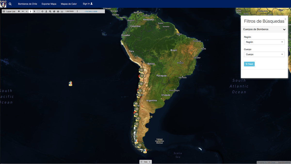
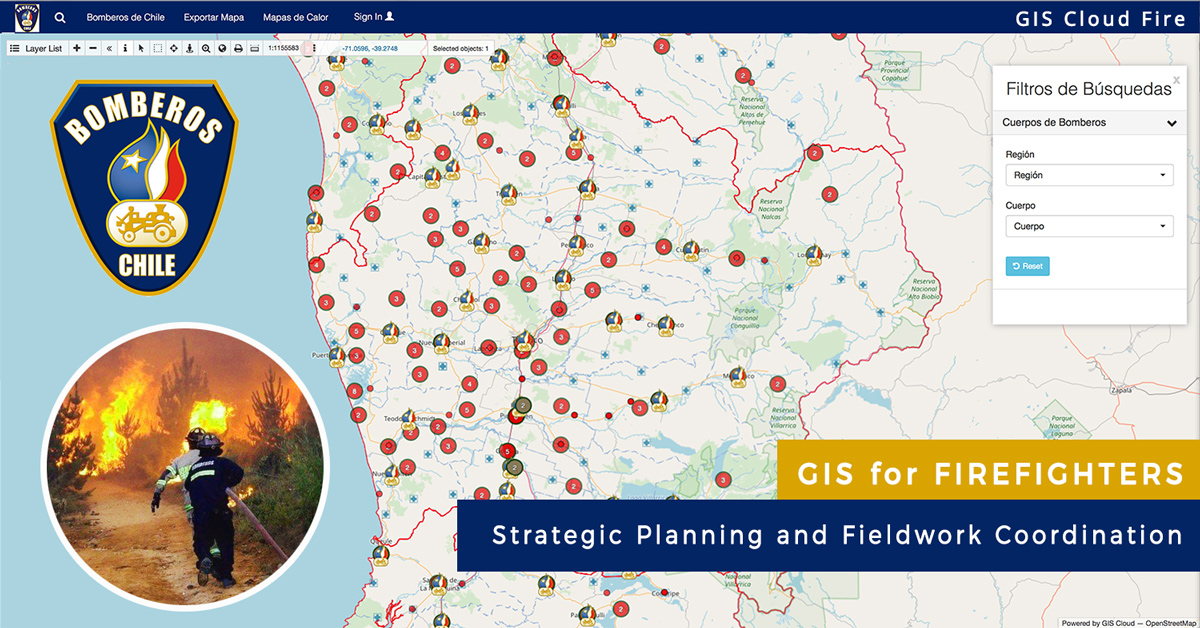
Implementing GIS Cloud mapping system to organize workflow in the field
To be able to respond to emergencies in multiple localities at once, coordinate teams, and have an instant access to real-time data regarding human resources and equipment, Firefighters of Chile decided to start a GIS project. The main goal was to implement a dynamic GIS solution that provides real-time information on the status and location of the majority of equipment and firefighters, shown on a map.
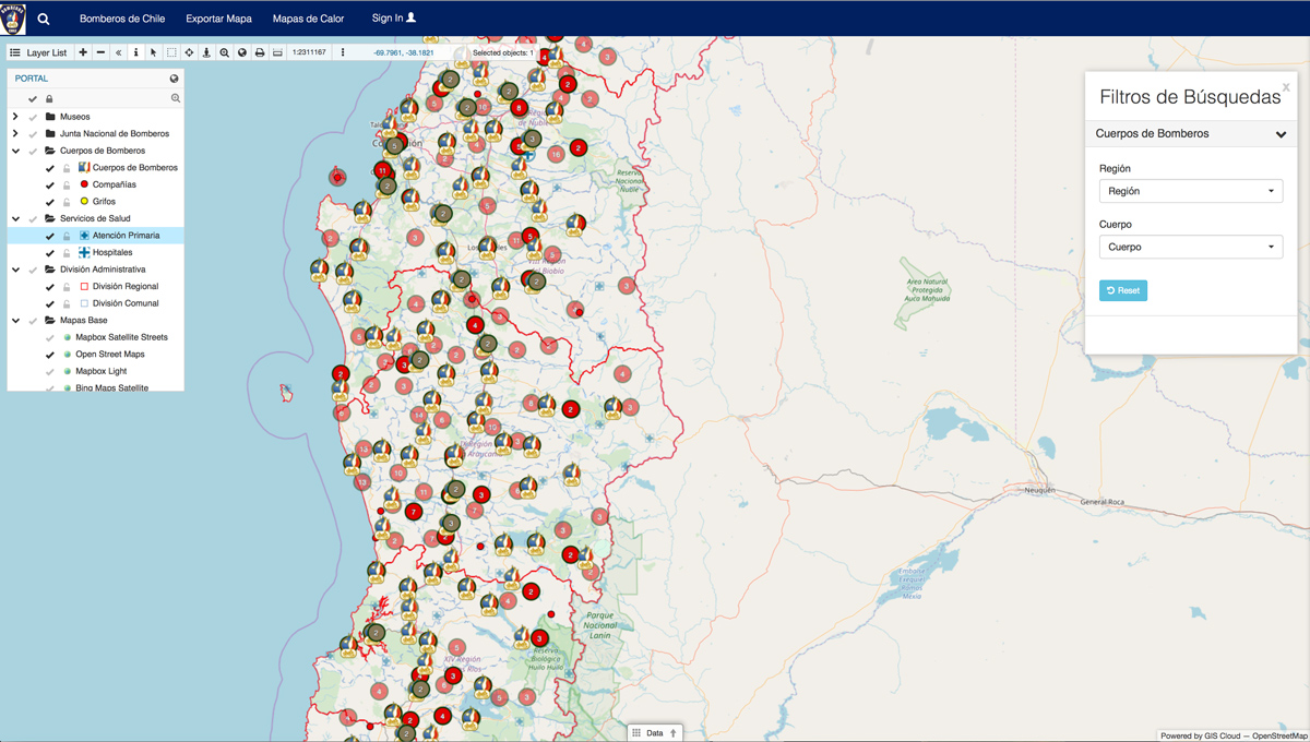
That is why it was essential to integrate their existing system with GIS Cloud, which sends the most recent data back to the firefighter’s system using PostGIS. This integration was crucial to create a dynamic platform which is always up-to-date, equipped with current information on the available material and equipment, as well as on active firefighters who can immediately attend major incendiary catastrophes. This solution was named GIS Cloud Fire.
Benefits of using GIS solutions to fight fire emergencies
Firefighters of Chile stated that with GIS Cloud Fire, they were “able to georeference their information and centralize the data. It allowed them to work with the geographic information system in the cloud, obtaining benefits such as speed, simplicity, and safety”.
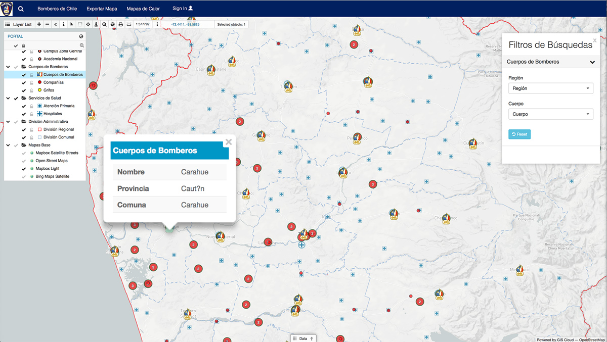
To have relevant data at their disposal in one place, they used Map Editor to create a map with all the static information about firefighters, such as bodies, companies, police units and acts of services in previous years. Since it is important that institution, as well as all fire departments, have access to the information at all times, the map was made into a public Map Portal of Firefighters of Chile, branded with their colors and logo. This is a simple GIS Cloud app deployed within 30 minutes (learn more), which is available not only to the firefighters but also to citizens of Chile and other interested parties.
Due to the climate change, periods of the fire seasons increased, as well as the number of wildfires, which raised the need for territorial management. GIS Cloud provided Firefighters with tools which bring real benefits when facing big emergencies in large territories. The system allows a quick emergency response, security, and has a great performance in data deployment.
Stay tuned for a story about firefighters in Croatia, who also use GIS Cloud Fleet to track all their fire trucks and manpower in the field.
If you want to know more about GIS Cloud solutions for emergency response and learn about all the possible options for your organization, contact us and we’ll help you find the perfect solution for your workflow.