

You don’t have to be Indiana Jones to impact archaeology positively. You can be a student equipped with a smartphone.
Selin Akdeğirmen Ercan is a Ph.D. candidate from the Yildiz Technical University. For her thesis, she focused on documenting and preserving historic sites in a rural Turkey region.
Using GIS Cloud, she set off for the mountainous regions of Antalya, Turkey.
The Mission of the Project
Selin’s thesis project aimed to document and develop conservation proposals for historical findings. Her area of concentration is where the Taurus mountains and the plains of the Elmali valley meet.
This area was specifically chosen due to the need for more archaeological efforts. It has required citizen efforts to map and preserve the region’s history.
The area was a key establishment of the ancient Lycia province. It served as a trading post on the Lycian Way trading route. It connected the mountains to the Mediterranean Sea.
The rural villages of Elmali, like others in the Antalya region, contain a history dating back to the Bronze Age. Documenting the historic sites was the first step in preserving that history.
Challenges of Preserving Historic Structures
Protecting archaeological finds is challenging under the best circumstances. These old structures scattered in Elmali need cataloging and digital preservation.
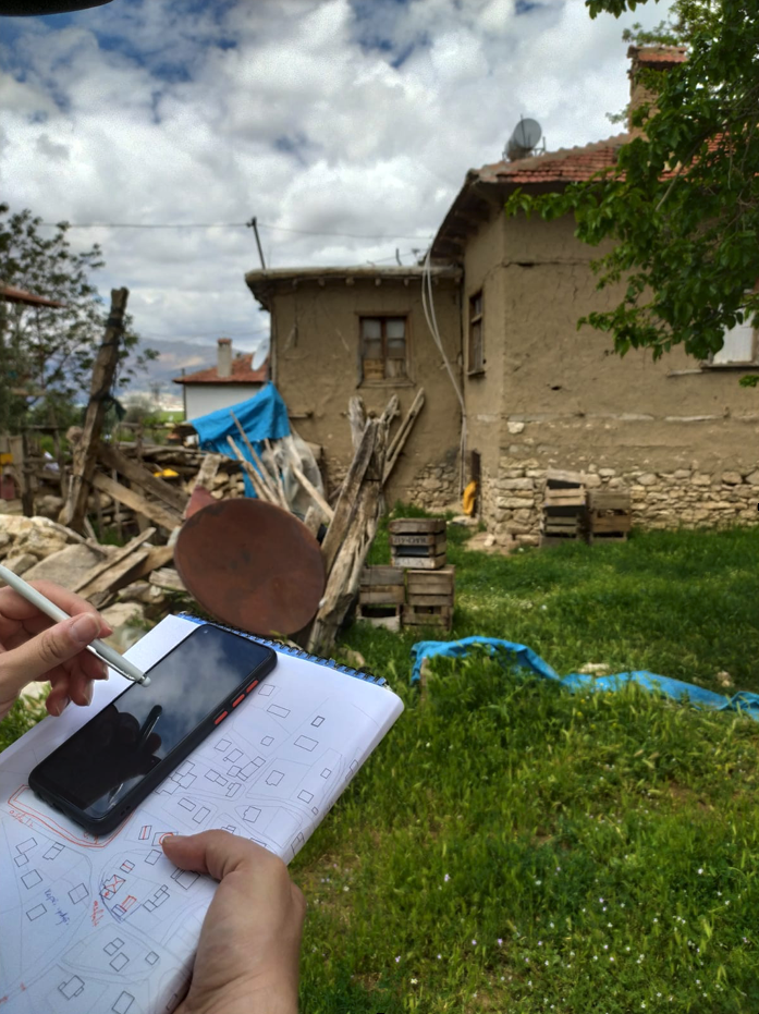
Past documentation efforts were conducted using hand drawn paper maps. These efforts proved to be time consuming and challenging due to the large project scale, an area of over 340,00 acres.
Efforts in the past drew every structure in the area by hand. The drawings included the buildings and the existing identifying features. Expanding these noble attempts to over 10 villages produced piles of unorganized documents.
Even though organized, the challenges remained.
The documents could not be shared between colleagues without large scanners and printers. Mail also delays the frequent collaboration required for unearthing additional information.
These challenges could be solved with the right piece of equipment and technology. Being in a remote location requires the ability to function properly offline.
Moving beyond pen and parchment to using the latest GIS technology on their smartphones was critical for documenting, cataloging, photographing, and ultimately preserving the important history left by the region’s people.
GIS Solution
Archaeological conservation efforts begin with documenting what exists in the area. Mapping data on the go with accuracy and reliability was crucial.
Selin decided to use GIS Cloud’s online GIS solutions because, as she discovered, it “is the most convenient, easy, and fast platform for carrying out digital documentation.”
She knew she would be using Map Editor for editing maps and layers. With the Mobile Data Collection app on her smartphone, she would be collecting data.
The ability for reliable offline use was especially important since cell service can be spotty in the Elmali area.
After making the 700 mile trip from the university to Elmali in southwest Turkey, Selin was ready to capture data.
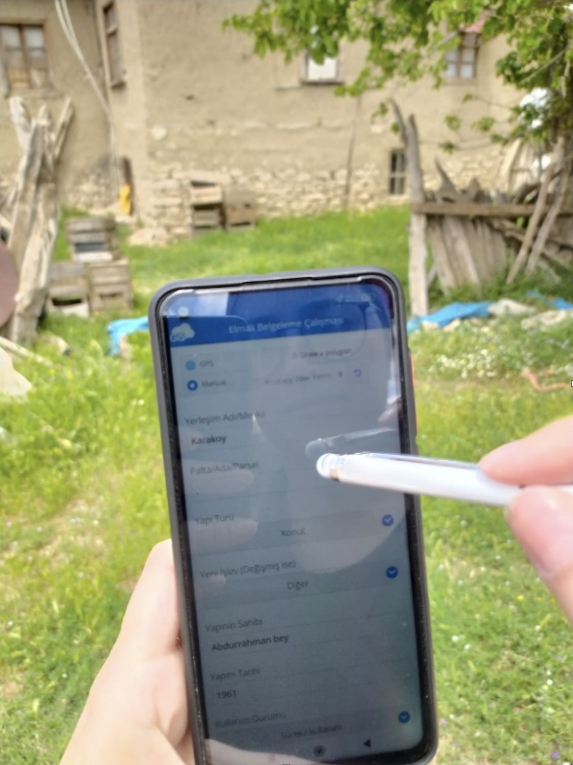
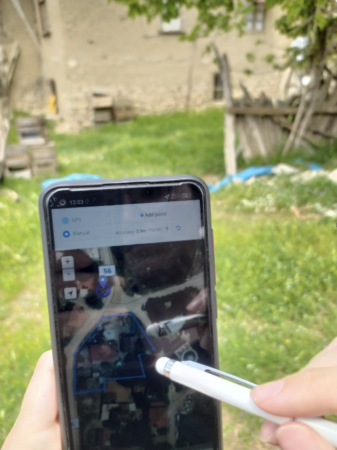
On the MDC app, she captured building outlines and locations. In some locations, she had to hand draw. In others, she would stake the corners and drop points.
The application then collected the attributes of the building. This included:
- Village Name
- Location
- Type
- Material
- Year Built
- Owner Info
- Photos of the structure
If you are not an English speaker, don’t fear! GIS Cloud apps are available in many languages, including Spanish, German, Japanese, French, and many others.
Selin created her forms in Turkish.
After completing the field data collection, the data was synced to the MDC Portal. This updated the data with any offline data collected.
Back in the office, the shapefiles could also be viewed in the Map Editor.

In the Map Editor, last minute edits could be made. If any features were mapped incorrectly, Selin was able to improve the data and align it to the latest aerial imagery.
All the data is now ready to be used for the next step: Creating proposals on the best methods for preserving the structures.
The data can now also be exported into custom forms for reporting.

Conclusion
After completing her thesis, Selin plans to expand the documentation project and share the data with others. The data can be shared and collaborated on within a custom GIS Cloud portal.
A portal gives others access to the GIS data on a worldwide scale. There are archaeological efforts across Turkey and the world. GIS Cloud solutions can bring all these discoveries together for collaboration and analysis.
If you want to learn more about GIS Cloud and our solutions, sign up for our free 14 day trial. You can use our premium tools to map and share your historical findings with friends and colleagues across the globe.