

Our partner Global Code Technology from Costa Rica which also operates in other countries of the region successfully finished a field data collection of educational infrastructure for their client, Unidad Gerencial de Mantenimiento (UGM) in Peru.
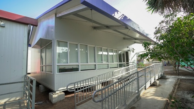
Unidad Gerencial de Mantenimiento (UGM) is a maintenance management unit, part of the Peruvian National Program for Educational infrastructure (Programa Nacional de Infraestructura Educativa – PRONIED), that manages public educational infrastructure for the benefit of the community, in a concerted, planned, regulates and efficient manner. Their goal is to expand, improve, replace, rehabilitate, and/or build public educational infrastructure for primary education and pedagogical, technological, and technical-productive higher education, including its maintenance and/or equipment.
PROBLEM
Global Code Technolgy crew was brought on board to improve and optimize data collection processes for UGM-PRONIED, to upgrade monitoring, evaluation of progress, and work execution processes of key educational infrastructure maintenance. UGM-PRONIED needed to upgrade the collection data methods so that locals could get involved, which would speed up the management’s decision-making time to efficiently target locations in need of infrastructure maintenance.
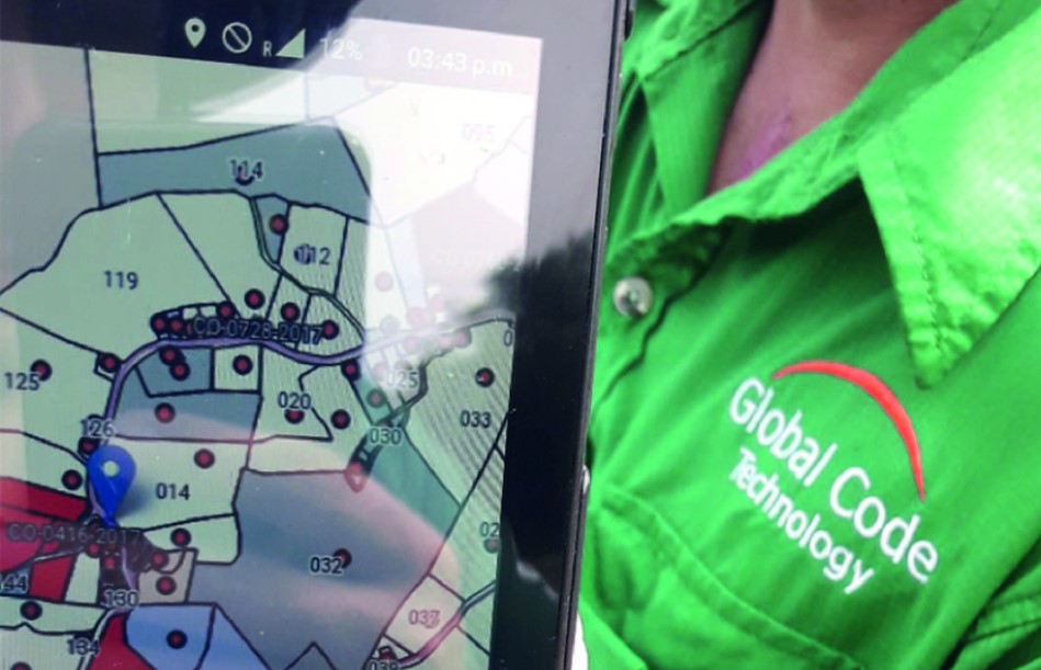
The biggest challenge for Global Code Technology was creating a new digital form due to the size of the database previously collected and stored on paper. With around 1300 fields, they split the first project into 7 different layers, each with its own mobile data collection database, which was then downloaded on an excel spreadsheet for further processing. In the past, UGM-PRONIED had at one moment, an active map with 800 fields, which they could not edit. Their field teams would have to fill out their paper-based forms and make a report for each location, which took a lot of time. That data was then processed and analyzed and inputted into a geographical database for decision-making.
So the real challenge was to design the new digital field workflow with a new digital data collection form.
Another challenge was getting field crews used to mobile-based data collection apps, as not everyone has an affinity for using cell phones or tablets. To solve this, providing continuous support and training, exams, and drills were essential for this project.
SOLUTION
To solve a challenge, Global Code Technology worked on improving three key project points:
– Digitalization and organization of previous paper-based forms into GIS Cloud forms
– Improve database and data collection input
– Data validation and report automation and optimization
GIS Cloud platform was chosen as a solution of choice due to its capability of integrating data collection, editing, visualization and sharing of data on a cloud-based platform. GIS Cloud provided a paperless solution with which data can quickly be inspected, collected, and processed, giving project managers the ability to speed up decision-making time and prioritize workflow.
The three key advantages of GIS Cloud solutions were:
- Cloud based GIS Cloud platform for data collection, processing, editing, and further visualization and sharing
- Multi-user and multi-app usage with solid support
- Easy to use, intuitive interface
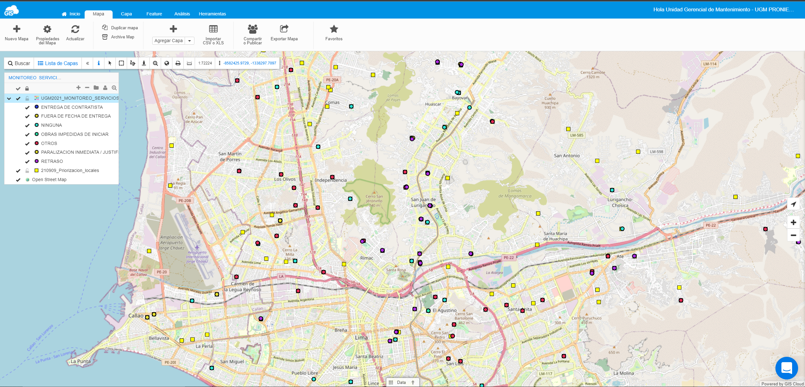
The specific apps they used were the Mobile Data Collection, Map Editor, and Map Viewer, with a specific amounts of storage for each project, depending on the workflow and needs.
RESULTS
As a result, GIS Cloud solutions digitized and improved the UGM-PRONIED data collection process, and provided the management unit of the project the ability to make decisions faster and in real time.
Having a digital data collection form was a major benefit for the project. With the Mobile Data Collection app, data collection was made a lot easier and faster, with the Auto-fill option being especially beneficial. During the whole project, Global Code Technology worked on adjusting the data collection form so that data can be collected via Mobile Data Collection more productively and efficiently.
The result was quicker data collection, better monitoring and evaluation of the situation in the field, and progress in the execution of infrastructure works. The management unit was able to have swift data control and gather essential feedback from the field teams, which allowed them to make quick real-time decisions. Data collection in real time in different key locations is a significant asset to the public and private sectors. Combined with a georeferenced platform for visualizing essential information for making better and quicker decisions is an innovative and efficient way to analyze database information in every area of the workflow.
The Map Editor enabled Global Code Technology to create a customized map with the data they wanted to visualize so that the management unit of UGM-PRONIED can share it with the quality and control division via Map Viewer. Being able to upload and send media from the field increased the speed of information circulation. Project managers were able to assess and control data in a more timely manner. The result was better monitoring and evaluation of the situation in the field, and progress in the execution of infrastructure works. The management unit was able to have swift data control and gather essential feedback from the field teams, which allowed them to make quick real-time decisions.
ABOUT
Global Code Technology has professional experience in the management of geoinformation projects, with a strong focus on applying new technologies that bring specialized solutions closer to the real needs of clients. They offer intelligent technological solutions, technical advice, and project management within a framework of the IoT. Global Code Technology diagnoses the situation and proposes a range of services designed to improve clients’ workflows and meet the project’s needs.
If you want to meet the Global Code Technology team, you can do so at Smart Cty Expo LATAM Congress in the city of Merida, Mexico, today and tomorrow. The seventh edition of SCELC22 will focus on ideas and projects being implemented in the cities and territories of Latin America. The goal of the SCELC22 is to find innovative solutions that can help us transform our societies and environments through the collaboration of public organizations and private companies. You can also follow congress virtually.

GIS Cloud is a fully scalable online platform with no desktop installation required. If you are interested in using GIS Cloud, sign up for the Free Premium 14-day trial.
Also, be free to contact our Solution Consultants and set up a desirable, customized GIS Cloud solution for your specific needs and workflow!