
Last year we released a new QGIS Publisher which turned out to be a game-changer for a lot of our existing customers. But we didn’t stop there. Since then, we had a lot of new version updates that improved the tool significantly and helped users uncover new workflows that they thought were not possible at the time.
The biggest challenge QGIS users faced was how to overcome the issue of having outdated and incorrect data they used for supporting their business. Obviously, the first step for solving the problem was to turn their desktop maps into online ones to make them more accessible and open to feedback.
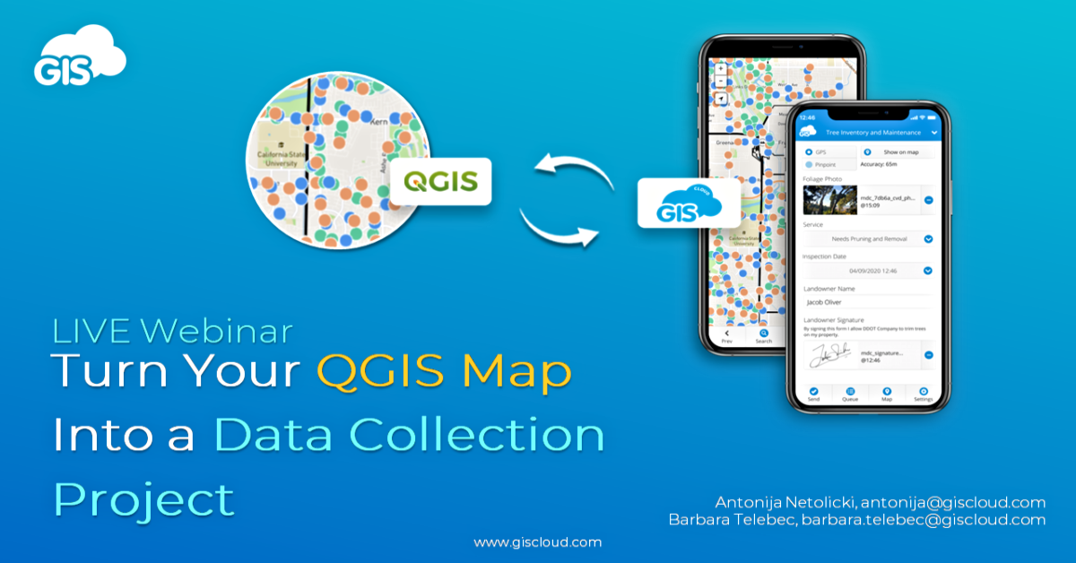
The next question, and a more complex one (at the time), was how to receive that feedback and data from others while still using the QGIS environment. Can I still use QGIS (or any other desktop GIS tool) and turn my map into a real-time data collection project?
If you missed our live webinar where we addressed those questions and discussed workflows that help support your business both on desktop and in the field, we’ve got you covered!
Take a look at our recording and find out everything you need to know about:
- making your QGIS map available online with a single click
- enabling field crews to start collecting data for your, now, live map
- and working with newly collected data directly in the QGIS environment in real-time.
You’ll get to see the full workflow in action, but stay tuned until the end as well as we answer some of your most pressing questions.
If there’s something we didn’t cover or you’d like to discuss your specific project requirements, we’d love to hear from you, so feel free to send us an email at info@giscloud.com.
In the meantime, create your GIS Cloud account, find the GIS Cloud Publisher for QGIS among QGIS plugins, and test it out, it’s free!