
2020 has been a challenging year for all of us. Despite the lockdowns, and earthquakes that affected our region in Southeastern Europe, we have been working diligently, to improve GIS Cloud platform and provide the best services for our users!
Throughout the year, our team has been focused on releasing a lot of new features and completed many interesting projects. We supported and covered a variety of different case studies, use cases and other mapping projects.
Last year, amongst important projects we would highlight creating extensive GIS Cloud Certification programs and Learning Center to help our clients and users resolve their crucial workflow issues.
At the beginning of the year, we released the GIS Cloud Publisher for QGIS along with WMS and WFS features to consume GIS Cloud data in third-party apps. We’ve implemented a connection to the external ORACLE database and released an option to Archive and Restore your maps!
We also supported many nonprofit projects that used GIS Cloud platform as a solution for helping their local communities.
In case you were wondering, we are planning lots of new features, webinars and interesting projects in 2021 and we can’t wait to present them to you, so stay tuned!
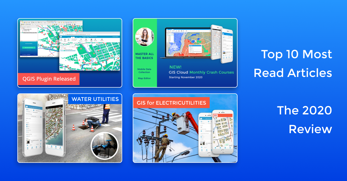
If you missed some of our articles last year, check out the top 10 most read blogs of 2020.
1. GIS for Electric Utilities
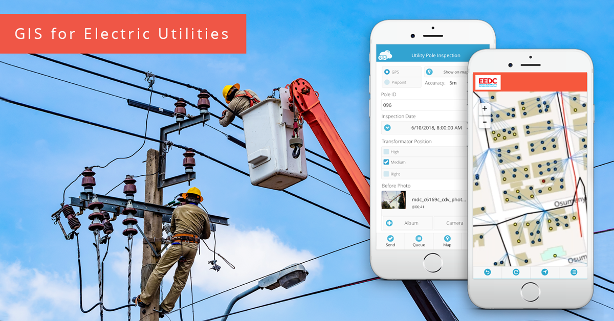
GIS software has been empowering the electric utility industry for decades. It provides a robust framework for asset and workforce management as well as tools for planning and analysis. In this article, we give you an overview of the uses of GIS for electric utilities and provide a real-life example from an electricity distribution company.
2. GIS Cloud as an Alternative To Google Fusion Tables
Since August 2019, people have been looking for an alternative for Google Fusion Tables. GIS Cloud has been recognized as an exceptional solution and in our article, you will find out how to easily create a map, analyze location data, embed and export data from GIS Cloud.
3. GIS Cloud In-Depth Online Certificate Program!
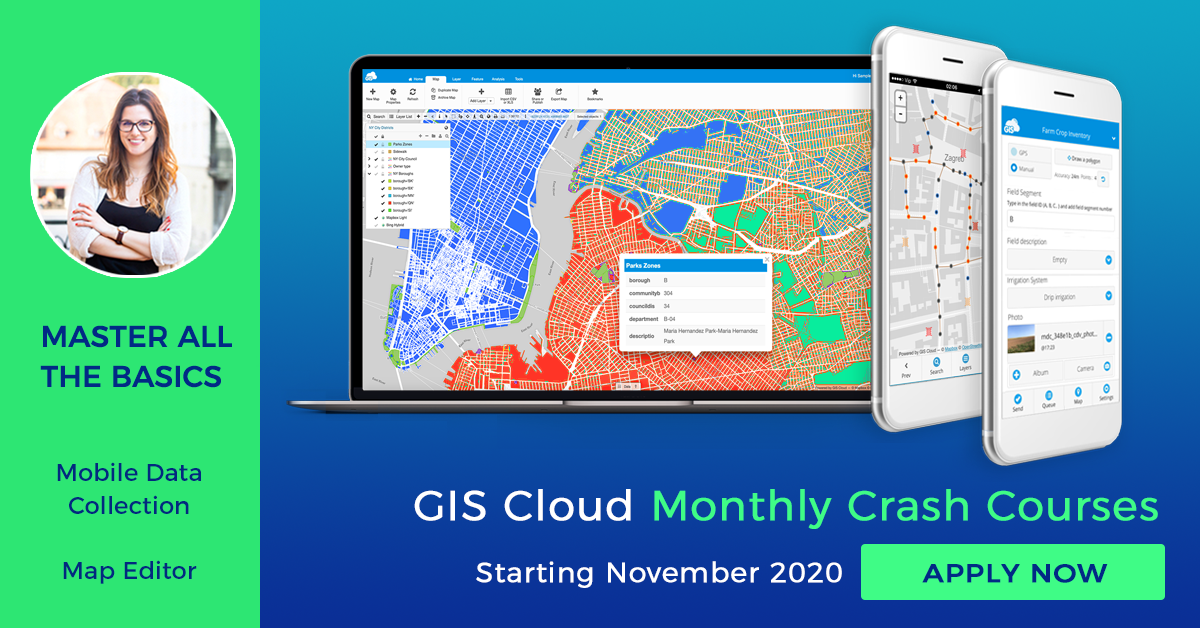
In April, as a contribution to “stay at home” global initiative, we started the GIS Cloud Certificate Program, to help GIS professionals extend their knowledge and become certified specialists in GIS Cloud solutions and technology. This program began to expand with a series of Crash Courses as a part of GIS Cloud Online Education program. Along with these courses as an introduction to GIS Cloud, in 2021 we will also launch Advanced courses.
Thanks to the initiative and the immense effort of our Customer Success and Support team, we have also launched a new GIS Cloud Learning Center.
4. Mapping and Planning of Electricity Distribution Network (Use Case)

GIS Cloud mapping technologies play a central role in planning, management and monitoring operations within the electric utility information system where powerful visualization and analytics tools can resolve data accessibility issues and improve the decision making process. Learn how to resolve challenges that distribution network operators and electric utility engineers face to supply, assure and enhance power system sustainability and efficiency.
5. GIS Cloud Offers Technology and Support for Free to Projects Fighting to Contain Coronavirus
As Coronavirus quickly started to spread globally in March, we offered GIS Cloud platform and technology for free to organisations and communities to help them understand the patterns, and plan the interventions to contain the virus. We’ve also developed our own free crowdsourcing solution STOP Corona!, to anonymously collect symptoms from the public to help detect potential hotspots of the spreading virus and help authorities gain insight on the Coronavirus.
6. Turn Your Map Into a Cloud-Based GIS App
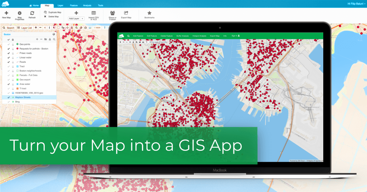
With this easy to follow and straightforward guide, we’ll show you the fastest and easiest way to create an online GIS app with little or no coding, using the GIS Cloud App Builder. You’ll also learn about the benefits of online GIS solutions over desktop GIS.
7. GIS for Water Utilities: Efficiently Mapping Water and Sanitary Infrastructure
Online GIS is of great value in terms of planning, managing, and maintenance of utility infrastructures such as water resources and services. Efficient and smart use of high-quality spatial data becomes imperative for many electrical, gas and water utilities. In this interesting case study, you will find out how Liburnian Waters, a utility services company in Croatia, are using GIS Cloud for collaboration with local government units, together with data collection, field inspections, and an infrastructure overview, maintenance and planning.
8. Digital Transformation of Field Operations in a Water Utility Company Using GIS Cloud (Case Study)
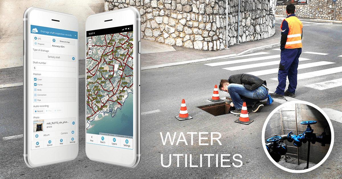
As we mentioned above, digitizing the process of field data collection and infrastructure data management. This article is an in-depth analysis and explanation of the Liburnian Waters operational system with examples of their daily workflow, reducing the job timeframe and eliminating all the unnecessary and outdated paper forms.
SmartAqua application, specialized in water utility data management, became an important asset in everyday field operations, team management and regulatory compliance for water utility companies.
9. How to Create a Hydrological Map Portal
Hydrology databases make it possible to map, track and observe water resources. A hydrogeology student from the University of Zagreb, created this project to bring the hydrology data of the Karlovac Municipality, to civil engineers, geo-technicians, hydrogeologists, scientists and others who can make good use of the data. This comprehensive hydrology inventory was made public via a map portal powered by GIS Cloud.
If you wish to create interactive graphs and understand the data better, you can create your map portal integrating the D3.js with GIS Clouds API.
10. GIS Cloud Publisher for QGIS Released!
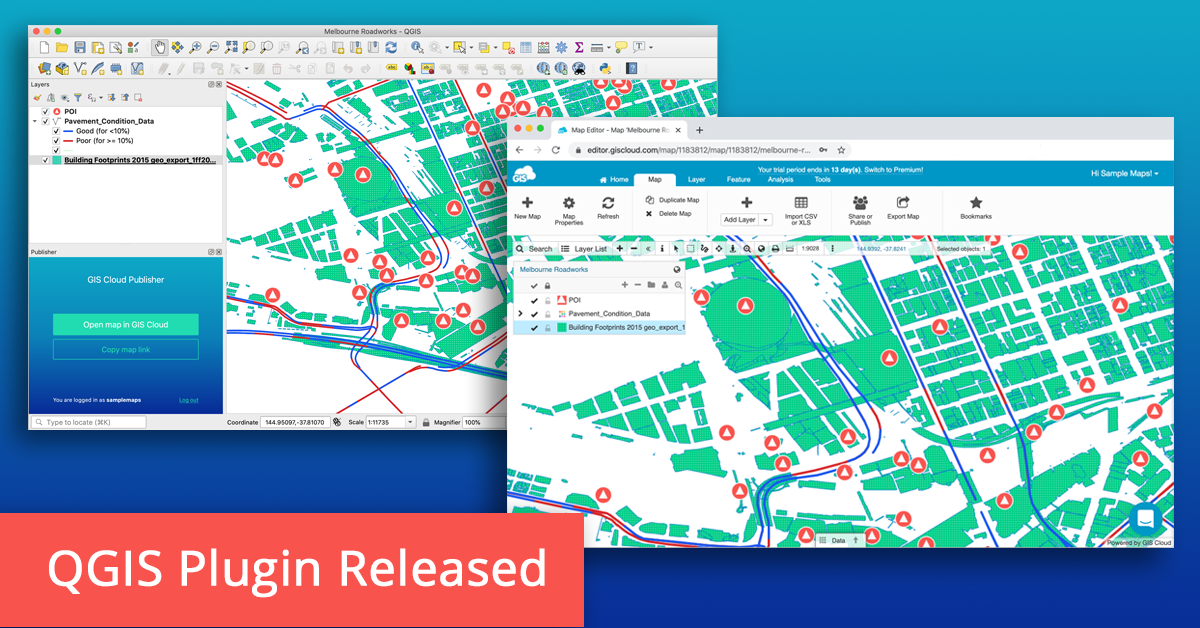
We were really proud and excited when we presented the GIS Cloud Publisher for QGIS! It allows you to transfer maps from QGIS to GIS Cloud in a matter of minutes, preserving your symbology. This was great news for all the GIS professionals in need of a quick and affordable way to share ‘heavy’ maps and datasets with clients or make the data public. There’s no need to export the dataset from QGIS and then import it manually to GIS Cloud, the publisher does this for you now completely free.
If you wish to expand your workflow and consume or even collect field data directly into QGIS, you can use new WMS and WFS features. Follow this webinar to learn how.