
As we are approaching this year’s Geo Awareness week, we wanted to look back at an amazing project from one of the GIS Day 2015 project winners.
We already covered a story about Malaria Risk Map project as well as Mapping Tribal Burial Grounds in New Zealand (Te Orewai Wahi Tapu), and now it is time to present the Jakarta Flood Support for Better Preparedness.
Adityo Dwijananto, Elida Nurrohmah, and Ranie Dwi Anugrah wanted to help the local community by using gis in disaster management and creating flood maps. 13 rivers that flow through Jakarta, making the capital of Indonesia prone to severe flooding. The primary challenge for the local and regional disaster management agencies was in setting up an effective and efficient reporting system.
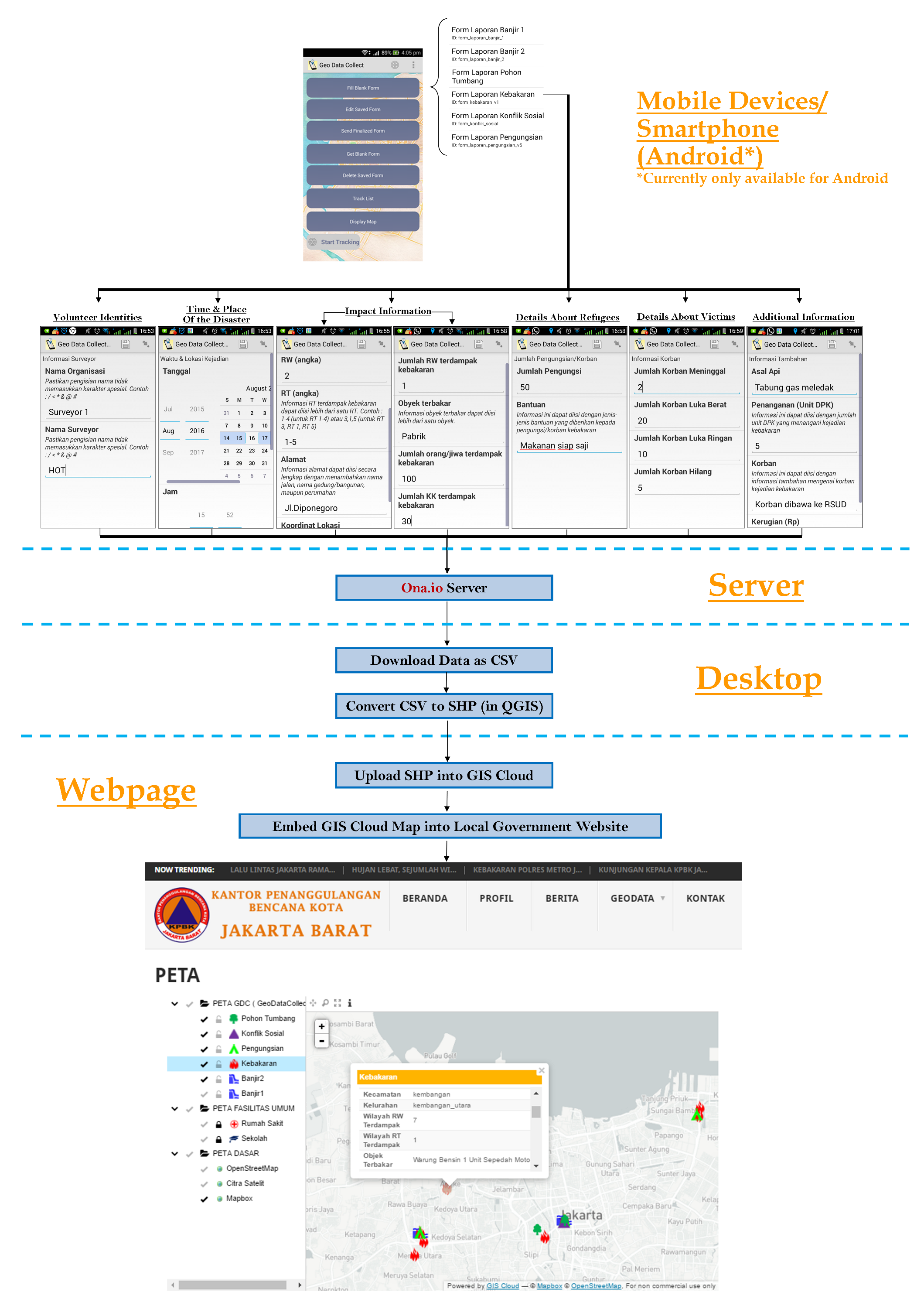
The Disaster Management Workflow
The disaster reporting system works on a volunteer basis. People who participate in the project first need to download GDC in order to collect the current status of the disaster in the location for which they are responsible, on the sub-district level. For now, the system allows them to report events such as flood, fire, fallen trees and social conflict.
In addition to the location and type of disaster, volunteers also have to provide info about their identities, causes of the disaster, and the responses given by other institutions. Other options for the volunteers are to report the location and current status of a shelter/IDP camp together with the info about victims and help/aid needed in a specific shelter/IDP camp. The report submitted by volunteers is stored in ona.io server.
With this system, data is available only for specific people who have the permission to log in to the system. So, their main challenge was to find a way to open this data for the public use.
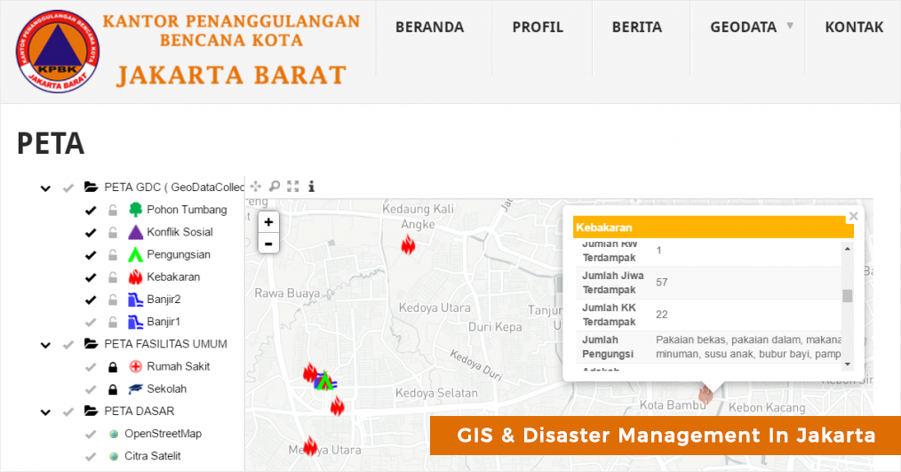
This is where GIS Cloud steps in to solve this gap. The team decided to use GIS Cloud platform to publish the map online.
Here a quick overview of their workflow:
- 1. Download the data stored in ona.io as CSV format
- 2. Convert CSV into SHP format with QGIS
- 3. Upload the SHP into GIS Cloud using Map Editor.
- 4. Publish map on Map Portal
- 5. Embed to website
The map was opened to the public using GIS Cloud Map Portal solution and embedded in KPBK Jakarta Barat website. The map is accessible by anyone interested in having real time information in cases of disaster, from any device, complete with the attribute data.
For a more detailed description of the workflow click on the picture below.
Results
Adityo, Elida and Rainie reported that, by integrating GDC and GIS Cloud, disaster reporting in Jakarta became faster and more precise than before.
Efficient, fast and precise disaster response translates to better decision making and prioritizing, which means that more people are being saved during natural disasters such as floods. It also means that the awareness of the local community can be significantly improved by providing access to important facts in real time such as when, where and what disaster events occur in their area.
Stay tuned up for more GIS Cloud news for the incoming Geo Awareness Week!