The GIS Cloud team is proud to be a part of the group of platforms that offer a better user experience with diverse integrations and a user-friendly interface. GIS Cloud is a fully scalable, pay-for-what-you-use online platform with no desktop installation required. With our platform, there is no limit to showing relations on a map and bringing spatial data into a perception that is accessible and visible in real-time!
GIS Cloud is equipped with desktop integration, data integrations, and external database integrations, making it a unique alternative for ESRI’s whole platform.
In the last decade, cloud-based GIS platforms have proven to be an essential tool in improving the workflows of many companies. They provide efficient solutions for two major challenges related to GIS systems: quality field data acquisition and real-time collaboration and data sharing.

Because of the numerous advantages of cloud-based GIS platforms, organizations worldwide are moving their geospatial features to the cloud. Moreover, in cases where GIS platforms are underperforming, a simple solution is integrating either other software or datasets into the GIS. These integrated web-based GIS platforms can:
- improve management and decision-making within an organization,
- make real-time updates on data,
- supply on-demand service of geospatial data and online maps from external databases.
GIS Cloud integrations:
- QGIS Publisher
- Power BI Integrations
- PowerApps Integrations
- External database integrations
- PostGIS database
- Oracle database
GIS Cloud Publisher for QGIS
We found through our customer’s feedback that many companies work on desktop GIS software but cannot share data privately or publicly, which is often needed.
GIS Cloud Publisher for QGIS allows you to work on a desktop GIS software from which you can easily transfer and publish entire maps while preserving your symbology. With QGIS Publisher, you can turn a QGIS map into a data collection project by uploading the collected data via Mobile Data Collection from the field, in real-time, onto a QGIS map.
Usually, the challenge is combining the two key elements and maintaining the data’s integrity on both desktop and cloud. GIS Cloud enables you to work both ways by sending data back to QGIS using a Web Feature Service (WFS). WFS provides you access to your data from different platforms, real-time information and acts as a single data source. Using WFS as a server, you can see your QGIS data transferred to GIS Cloud and ready to use.
Power BI and GIS Cloud Integrations
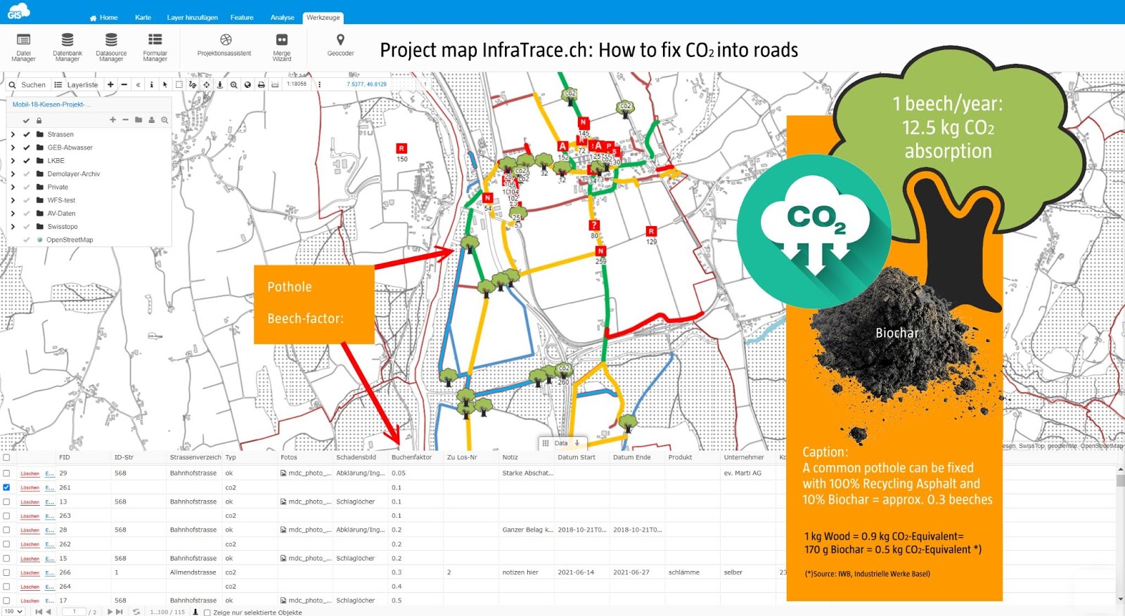
Microsoft Power BI uses exported data, like CSV, Excel, and databases, from the GIS Cloud Map Editor and makes it instantly visible on a map. This powerful web app instantly uploads all of the data collected by the field workers.
The data from the GIS Cloud CSV export goes into Power BI, which, together with additional formulas in Excel, can produce a live-calculation tool.
Power BI Integration is a great tool that can be used for filtering, calculating, and visualization of feature attributes data from any map designed in Map Editor. With Mobile Data Collection App, you can add field data collection to the project.
Find out how InfraTrace, a Swiss innovation roadworks maintenance and consulting company, integrated Power BI with GIS Cloud to empower team collaboration and create a live calculation tool focusing on the accurate data model!

GIS Cloud and PowerApps Integrations
The GIS Cloud and Microsoft PowerPlatform collaboration introduced the spatial component to the PowerApps environment. Spatial Partners designed the PowerApps integration and propelled it from a collection of Office 365 products into a comprehensive platform created to fill the gap between entirely bespoke software and out-of-the-box solutions.
Using Microsoft’s official framework, Spatial Partners embedded a GIS Cloud map within a PowerApps Canvas app. Via the Mobile Data Collection form, they enabled REST API to perform in Canvas apps or PowerAutomate, without writing a code! This has been packaged together as the GIS Cloud PowerPlus solution.
GIS Cloud and External Database Integrations
Unlike other platforms, GIS Cloud’s eagerness to offer integrations with REST API, JavaScript library, and external databases makes it unique.
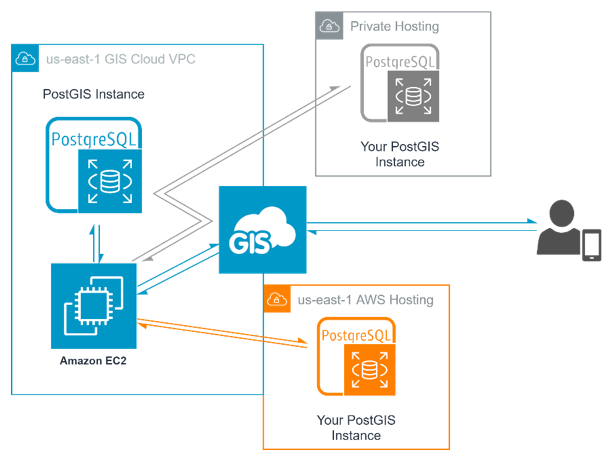
Every Map Editor license includes a cloud-hosted database, thus making your data secure. But, access to the database server is restricted and can be bypassed by configuring GIS Cloud to retrieve data directly from a server you host, such as AWS RDS for PostGIS.

If you want to see the possible benefits or learn a few hints about making the process easier, check out the blog written by one of our colleagues from Spatial Partners. Also, if you’re interested in connecting to an external database like PostGIS or Oracle, you can check out our user manual.
If you wish to try one of our integrations or apps, you can Sign up and try them for free during the trial period. Also, if you have any questions or feedback about our products, don’t hesitate to contact us at info@giscloud.com.


