City of Canton is the county seat of Cherokee County, Georgia in Unites States. With the increasing population and development of the city, the need for fast, efficient and affordable GIS solutions have emerged. The majority of spatial data City of Canton has is in the form of ESRI shapefiles, so the idea was to find an easy way to publish existing ArcMap projects to cloud in a public map portal under their own logo and domain. Prerequisites were to have custom options for a search tool, possibility to export maps and pack that all up in a form of a simple user interface suitable for larger audiences.
Challenges
- Need for a fast and cost effective GIS solution
- Possibility to publish existing ArcMap projects and shapefiles to cloud
- Easily available and accessible way to display data to large audience
- Custom option to export map and data
- Custom search tool for searching queries
- Publish data under their own logo and domain
- Supported media enriched data (photos, video, URL-s…)
- Allow access on web & mobile devices
Solution
 Publish existing projects from ArcMap to cloud
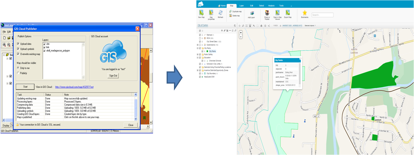
In the need of a more affordable and efficient solution, City of Canton adopted and deployed GIS Cloud Data Publishing Solution in matter of minutes. By using ArcMap Publisher Extension, previously created projects in ArcMap were easily published to cloud. A map containing now published data from ArcMap along with the new data and base maps was created in Map Editor. With the possibility of our map wizard and powerful label management, City of Canton was able to create visually attractive, fast and responsive maps. In order to publish the map to larger audience, a City of Canton Map Portal was created. With the addition of customizing options (white labeling, search tool and export map…), map portal became an interactive tool for their users who are now able to visualize, export and publish geospatial data.
Results
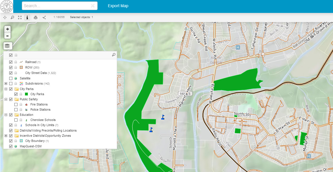
City of Canton interactive Map Portal
GIS Cloud Data Publishing Solution was ideal for City of Canton, as it provided a fast of the shelf solution, utilizing existing GIS Cloud extensions and applications. By using our fastest vector based engine in the world, customizing options and premium support, the result was ready in matter of minutes.
You can deploy your public or private map portal today! Contact us.