
NubiGroup is our partner and a company that creates a new generation of geo-services, research, and products by exploiting geospatial information and cloud computing.
Their focus is on real-time, informed collaboration between clients and their customers.
In this particular pilot project, they dealt with precision agriculture and farming in Greece.
More specifically, they were using NIR (Near Infrared) images acquired by a drone (eBee, Geosense company Greece) in order to monitor cornfields and to compare different spectral transformations with crop growth and crop yield.
Furthermore, they were also able to investigate the performance of different cultivars under different fertilization treatments.
Since this was a small-scale pilot project and the spatial data had to be shared with different groups of interests in a short period of time, NubiGroup started to explore GIS Cloud Apps and Services.
They needed scalable and flexible, ready-to-go apps that would allow them to create custom maps and track the collected data for real-time map analysis!
Collaboration and the exchange of spatial and attribute data were also important parts of this project because NubiGroup needed to connect different teams of people like agriculture professionals and farmers through an interactive map!
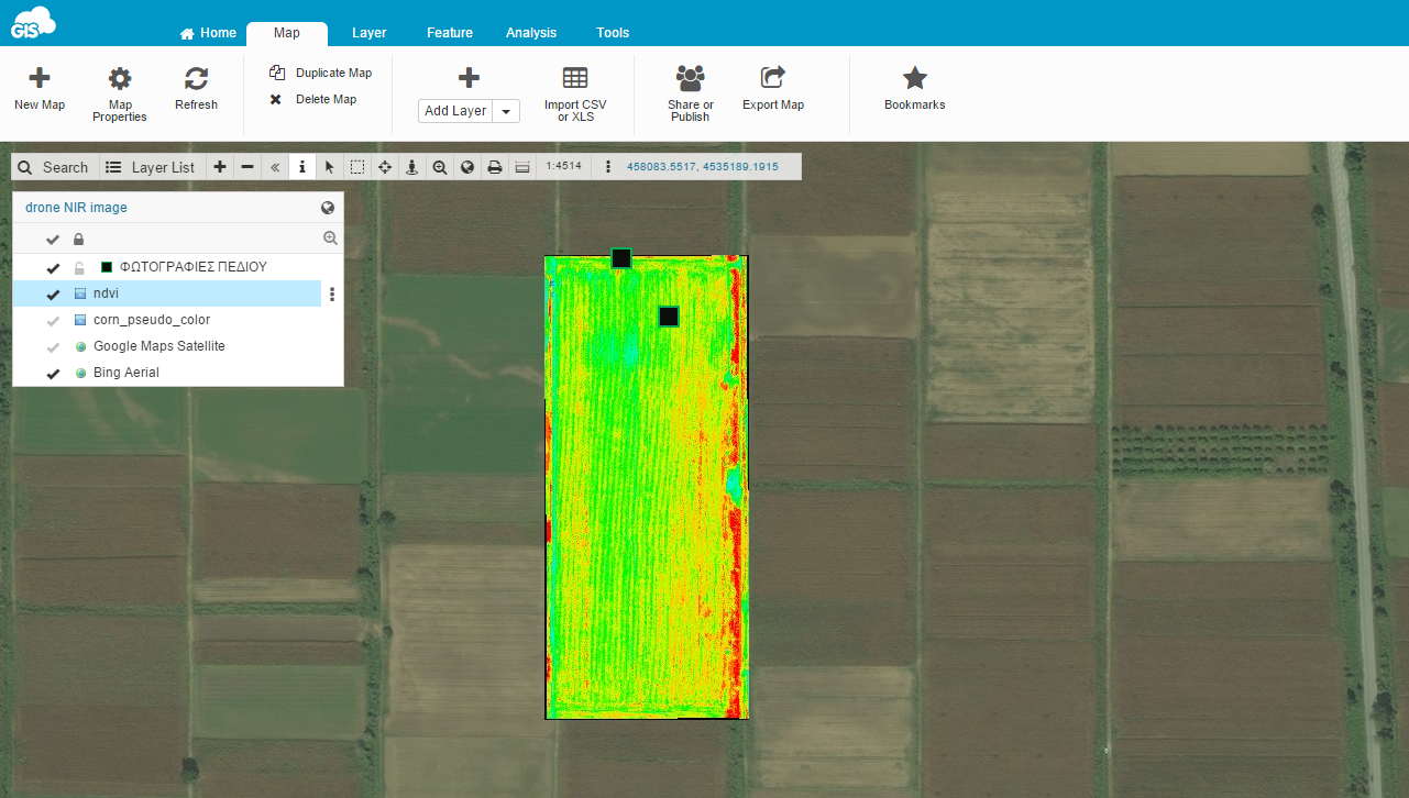
NDVI image – Quick assessment of the crop condition. Light blue pixels denote bare soil and light green pixels depicts low crop growth, in contrast with yellow and red pixels
In this project’s structure, the main challenge was to optimize and track field data collection. With the Mobile Data Collection app (MDC) were able to record the crop data on custom form templates where they would precisely mark and locate field information, in online or offline mode!
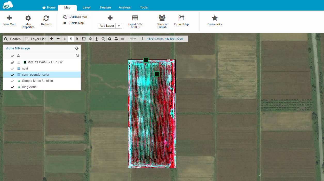
NIR drone image (6cm pixel size), false-color composite (RGB: NIR/R/G). Light blue pixels denote low crop growth
With Map Editor they established a direct connection and collaboration between the groups of people who were involved in this project and weren’t located in the same region.
They were able to create a map to track collection progress with the possibility of importing and editing new data for analysis!
Analyzing and understanding the data in real-time is crucial for smarter responses in precision agriculture and farming.
NubiGroup overcame the challenge of regular in-person meetings and the hardcopy jobs of printing maps, photos, and paper surveys for field work.
They transformed the entire workflow from paper to digital within minutes!
GC apps provide an easy-to-use interface that can be used even by non -“GIS experts”.
For example, the MDC with predefined forms can be used easily by farmers in order to provide us with accurate field data.Konstantinos Ntouros – NubiGroup
Generally, these types of projects require the involvement of people with different expertise. Spatial data exchange between them is absolutely critical!
With the help of GIS Cloud apps and Services, NubiGroup managed to achieve team collaboration from a distance, within their budget, and without investing in hardware, software and maintenance.
They were able to search, visualize and explore the data with adequate information and make essential decisions.
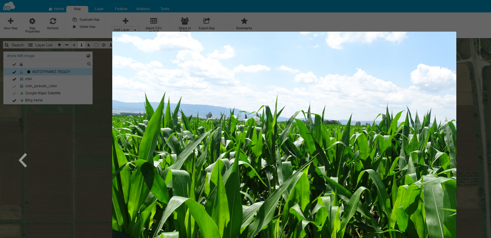
Kostas field photoField survey crop field photo – Corn plantation Recommendation
With GIS Cloud applications and services we got great performance, affordable cost, and ease of use for our clients!
Konstantinos Ntouros – NubiGroup
Contact our Consultants to help you set up a desirable, GIS Cloud solution for your specific needs and workflow!