
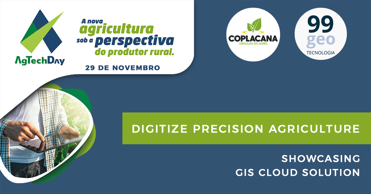
Last year our partners from Brazil, 99GEO, launched the cooperation with Coplacana, one of the largest cooperatives of sugarcane and ethanol producers in the world. The project resulted in a Copla-GIS mapping solution for maintenance of sugar cane plantations.
99GEO will showcase the solution during November 29th and 30th at AgTechDay. In addition, on November 28 they will hold a workshop, where you can get an in-depth and hands-on demonstration of the Copla-GIS solution for precision agriculture.
About AgTechDay
AgTechDay aims to promote and enable digital agriculture and solve the challenges of connecting the different players of the innovation ecosystem in Brazilian agribusiness. The event is organized by Avance hub, a platform that sprung out of Coplacanas vision to create an accelerator for business and entrepreneurs. It brings together companies not only from Agribusiness but also from sectors such as Health, Telecommunications, Mining, Financial, Animal Husbandry and Security.
The Avance hub aims at linking leading-edge technology companies, startups and consolidated ventures with more than 10,000 members of the Coplacana (Cooperativa dos Planadores de Cana de São Paulo).
On this year’s AgTechDay our partners will showcase GIS Cloud applications and solutions. Gabriel Camarinha from 99GEO will present the GIS Cloud platform on the second day of the event, 29th November at 16h.
Find more info and news about the AgTechDay on the Facebook page of Avance hub.
99GEO Workshop
On November 28th, a day before the AgTechDay, our partners from Brazil 99GEO, have organized a hands-on workshop to demonstrate the Copla-GIS solution and other GIS Cloud applications.
Learn everything about creating projects and collecting data using your smartphones and tablets. Also, learn how to deploy various data collection projects for effective uses in agriculture through existing case studies and live hands-on demos. You will also get an insight into all the possibilities of a powerful Map Editor after data is collected.
Copla-GIS workflow for precision farming
Precision agriculture is often associated with technologies such as GPS, GIS, drones, mobile data collection applications, remote sensing, and other technological advances intended to provide farmers with a better decision making process.
Digital, interactive maps display spatial correlations and patterns are important for sugarcane production management, pest control, soil quality, moisture content and much more.
The Copla-GIS workflow is excellent for the development of the agricultural sector, which in this case also responds to the renewable energy sector in the production of fuel ethanol. For instance, in Brazil, nearly all vehicles work with both gasoline and ethanol, and the use of ethanol reaches almost 100% in some regions of the country.
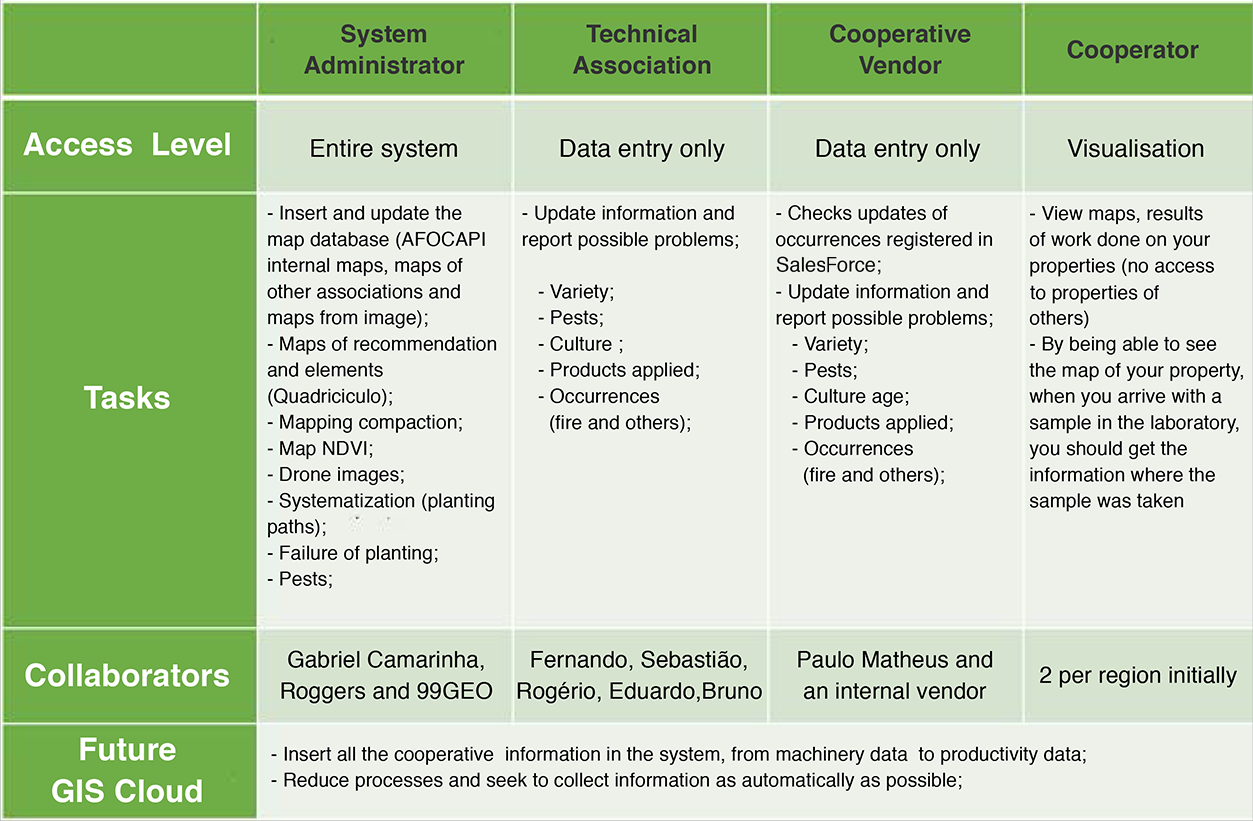
Workflow scope divided by areas – COPLA-GIS (99GEO):
Key benefits in precision agriculture for sugarcane industry:
MAPPING FIELD DATA WITH HIGH GPS ACCURACY
The first step to improve the understanding of a farm’s productivity is to map and collect necessary information about soil nutrient levels and crop characteristics, accompanied by exact GPS locations to provide a base layer of information.
REAL-TIME SHARING AND SUPPORTING DRONE IMAGERY DATA
Large raster data obtained by drone mapping, satellite imagery or aerial photography can derive important spatial data such as orthomosaic maps, elevation models, or contours. Sharing and supporting large raster data in real-time, with different stakeholders and different privileges, is the most important factor when it comes to time efficiency in the farming industry. If you are interested in this topic, check out post about supporting large raster data in GIS Cloud.
FIELD REPORTS AND COLLABORATION
Adopting a cloud-based GIS solution as a farm management tool can help farmers and land managers to keep track of day-to-day activities such as the application of chemicals, fertilizers, and water. They can also track the costs of harvesting, hauling, fertilizing and labor, and predict current and future fluctuations in precipitation, temperature, crop output, etc.
Want to try GIS Cloud apps and see what they can do for you? Request a demo or sign up.