
Gozdno gospodarstvo Les from Ljubljana, Slovenia manages over 2000 ha of the estate consisting of forests. It is largely owned privately with few exceptions of company-owned forests. Using online GIS, they have complete IT support for their core business – planning, marking the trees to be felled, harvesting and selling the round wood.
In addition, they spend 50% less time on orientation in the forest, have reduced errors by 90% when locating their borders for marking trees process, and increased control by 100% over auction tree candidates’ location and habitat trees’ locations.
Marija Jakopin, their CEO, told us that their business includes manufacturing round wood and selling it to resellers or end-users such as saw mills and local wood product manufacturers. They also manage forest cultivation, maintenance and construction of skidding trails, renting the grasslands to local farmers, etc, which they all now manage in GIS.
For their everyday processes, they needed an adequate and precise GIS solution as an alternative to the slow and outdated Garmin GPSMAP 64 with uploaded forestry administration parcels.
Using GIS Cloud apps, they obtained an accurate location intelligence workflow without paperwork and achieved real-time collaboration with different stakeholders and teams providing forestry services in Slovenia.
Now we no longer depend on paper, there are fewer phone calls describing to the harvesters/forest cultivators where and what has to be done, I don’t get lost in the forest anymore, there are no more situations where we mark the trees to be felled over our borders as we know where the borders are, we have a profound process and support for planning.
Marija Jakopin CEO of Gozdno gospodarstvo Les
Table of Contents:
- Facing the Modern Forest Management Challenges
- Finding the Right Online GIS Solution
- Transforming the Forestry Operations with GIS Cloud
- Reducing the Costs and Increasing Company’s Incomes
Facing the Modern Forest Management Challenges
Forest management dates back from the early 7th century with the German tribe known as Visigoths. They instituted regulations because they were concerned with the preservation of oak and pine forests facing an ever-increasing shortage of wood.
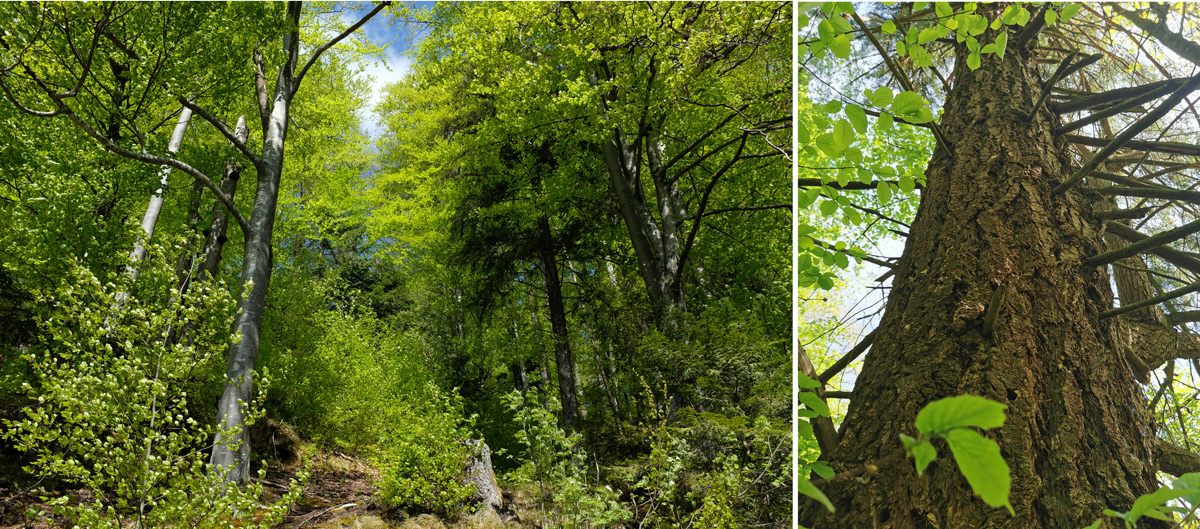
Modern forest management as we know it today is a complex and broad range of objectives with demanding business criteria. From the provision of timber, fuelwood, natural and wildlife habitat, biodiversity management, to erosion control, and much more.
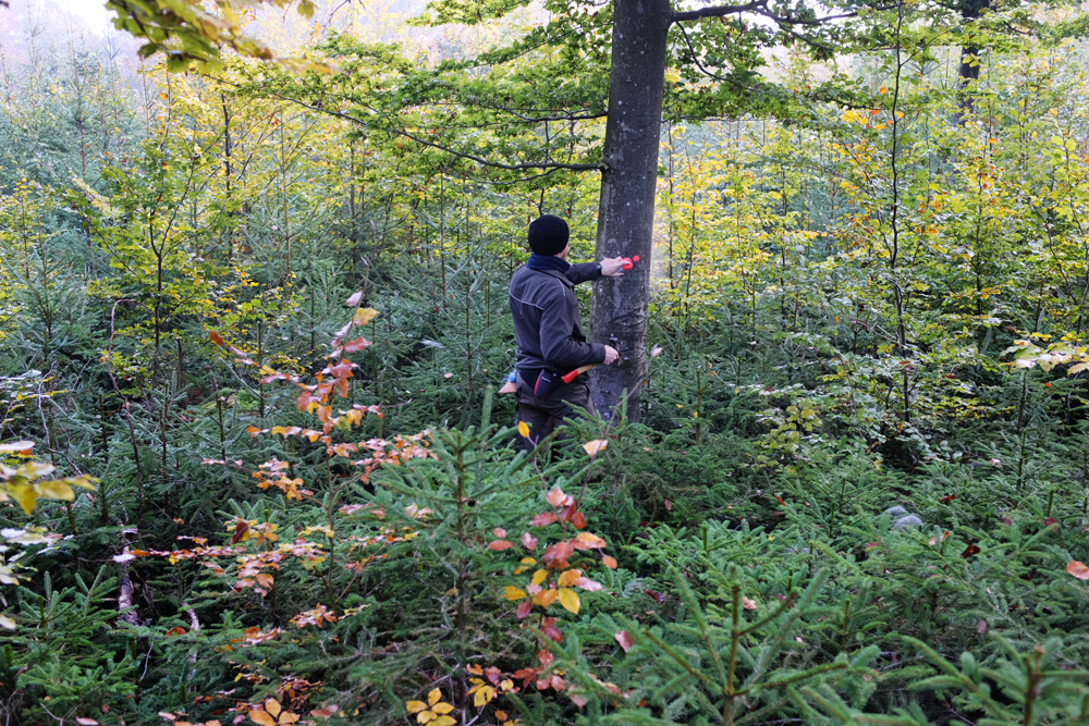
The typical day at Gozdno gospodarstvo Les starts by communicating with the Slovenia forest service to obtain permission for harvesting. They select the trees that are later felled.
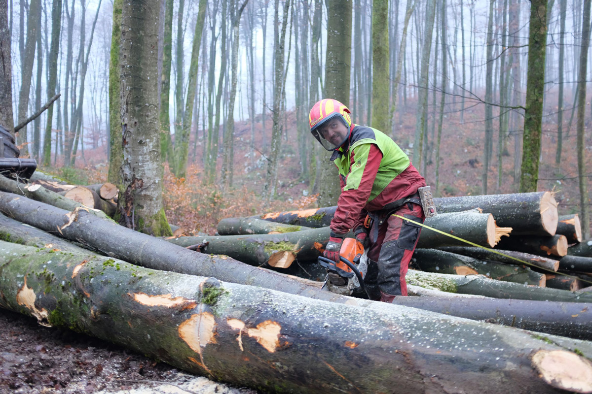
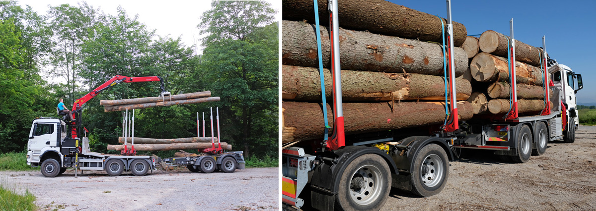
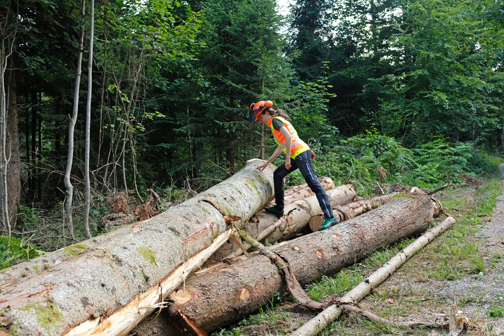
On the locations where the manufacture is in progress, they monitor the harvesting progress and coordinate with round wood resellers where they measure and rank logs for shipment.
Numerous meetings with different parties like grassland renters, hunters, neighbors, farmers, scientists, environmental organizations are just typical day-to-day activities for them. It’s all done in person or by the phone while doing the hard labor of field data collection and monitoring.
Finally, when the fieldwork is done, they head back to the office to work on planning and accounting of the tasks.
All of this work insists on a properly arranged workflow so that all of the business processes can be in sync and mutually correlated.
Marija together with Gozdno gospodarstvo Les realized that with the help of Online GIS they can maximize the value of their assets, improve forest management, reduce day-to-day costs and enhance communication between different stakeholders and teams.
Finding the Right Online GIS Solution
With quite a few natural disasters that hit them in the past, like wind and ice breaks and bark beetle gradations, Gozdno gospodarstvo Les didn’t plan much ahead and needed to upgrade their forestry planning process.
Our need for GIS started as soon as I joined the company (in 2017) as a CEO. There was no adequate digital geographical solution. The first problem was orientation, the second was planning and the third locating the borders of the estate parcels.
Marija Jakopin – CEO of Gozdno Gospodarstvo Les
At the end of 2020 with a helpful reminder of a district forester, they felt a need for a long-term forest management plan. This was an opportunity to implement a proper GIS solution for the less appealing alternative – Excel sheets with incorporated geospatial data of forest stands.
Finding the right GIS solution was an extensive and time-consuming research.
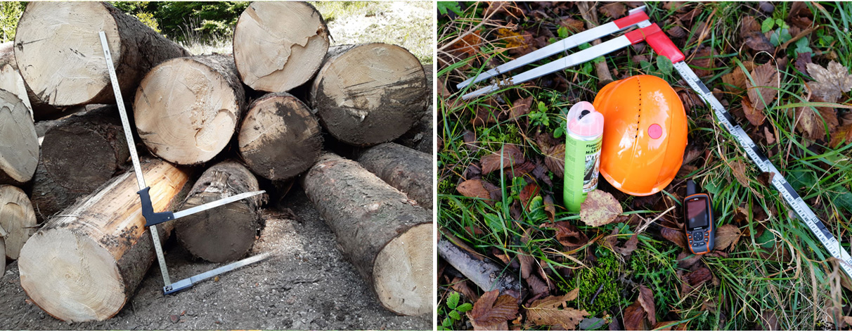
The first solution they reached for was Google Earth Pro. They imported the parcels of the estate (in .kml format). The solution had no mobile version, so in order to see where they were in the forest, they still had to use paper maps. They obtained a device Garmin GPSMAP 64s, uploaded their parcels and all the forestry administrations (division of Slovenian forests in governmental forestry sections).
The GUI of the device was not easy to handle and the display was poor. They were hoping to find an affordable solution that would support their planning, manufacturing and sales processes and would have a mobile phone app.
They also reached out to local GIS manufacturers, especially because they covered Slovenia’s forest services processes. They found a local GIS provider with a substantial solution to automatically import Slovenia forest service documents and refresh parcels data, with a connection to Surveying and Mapping Authority to get fresh parcels data every morning. But as solutions like these are designed for large organizations, the price was unreachable!
They needed an easy and scalable SaaS (Software as Service) solution, so they tried a couple of online solutions with a free trial. They decided to give a chance to Esri, but their solution was not as intuitive as one would expect. The .kml files (estate parcels) did not get imported, so they turned to their support.
That was a show stopper, as the support was less cooperative to say at least. This experience showed me that Esri’s solution was too complex for us and had unpromising support.
Marija Jakopin – CEO of Gozdno Gospodarstvo Les
Their next attempt were Google maps. The .kml file went through well, but there was the limitation of 10 layers and no locking feature for the layers. When they went in the field and tried to zoom in on a mobile phone, all they could get by touching the screen was the attribute table of the parcel they were standing in. There was also no possibility to structure the layers, so they had to scroll down through a couple of hundred parcels to get to the next layer in which they wanted to save some planning data.
The biggest challenge was to find an adequate and affordable solution for sustainable forestry and help them with long and short-term forest management planning!
Transforming the Forestry Operations with GIS Cloud
With the help of GIS Cloud, Marija together with Gozdno gospodarstvo Les transformed numerous daily workflows and operations.
Finally, I found GIS Cloud, which was a relief. My ability to set the working environment and the processes were still a marathon, but the GIS Cloud support was awesome.
Antonija (Key Account Manager at GIS Cloud) helped me through the journey of defining the processes, setting the environment, educating me and my crew about the workflows. Her positive spirit, sense of humor, intelligence, and substantial knowledge about not just GIS Cloud solution, but GIS in general was inspiring and led us through to the point where we don’t even know how we managed to do our business without GIS.
Marija Jakopin – CEO of Gozdno Gospodarstvo Les
First of all, no more paper. They are literally saving the trees!
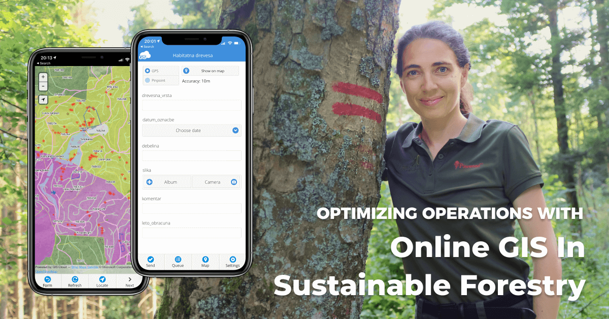
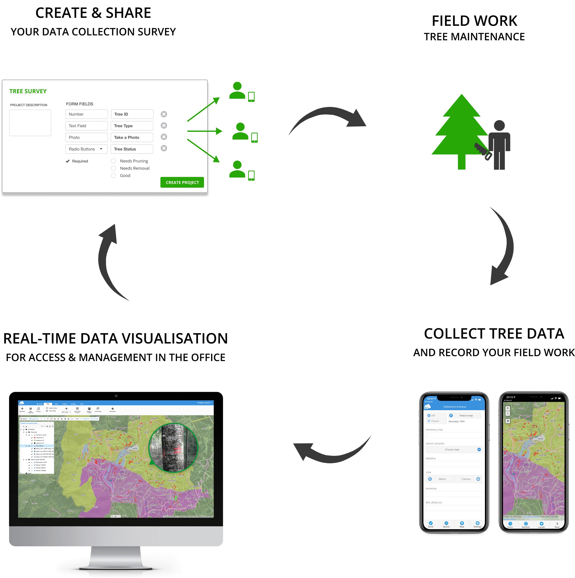
The starting point for their sustainable forest management operations is collecting the data in the field with the Mobile Data Collection (MDC) app. What drew them to the MDC app was the powerful but intuitive and user-friendly interface.
Entering the data in the field in all kinds of weather and terrain conditions needs to be an easy task for the workers. Whether you are a tech guru or just a classic user, the MDC app can be optimized for your needs.
In Mobile Data Collection Portal you can set work orders or surveys for different types of field jobs like foresters, harvesters, farmers, etc.
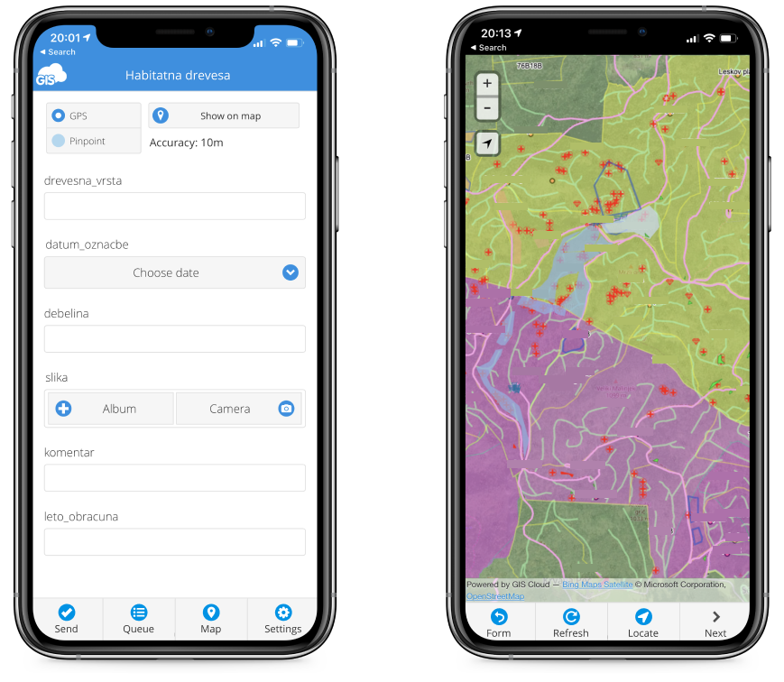
One of the best features that MDC has for any vegetation management business is the offline mode. Vast forest areas aren’t entirely covered with GPS signal, so offline mode really comes in handy.
With MDC you can enter data along the way like walking down the forest and marking a beetle gradation instantly on your mobile devices.
This data is visible to harvesters and district foresters right away in the Map Viewer web or mobile application. It is optimized even for non-professionals and enables you to access maps on any device in real time.
Gozdno gospodarstvo Les even tracked their sales progress with GIS Cloud apps. There is no better way of understanding the data than through an interactive map.
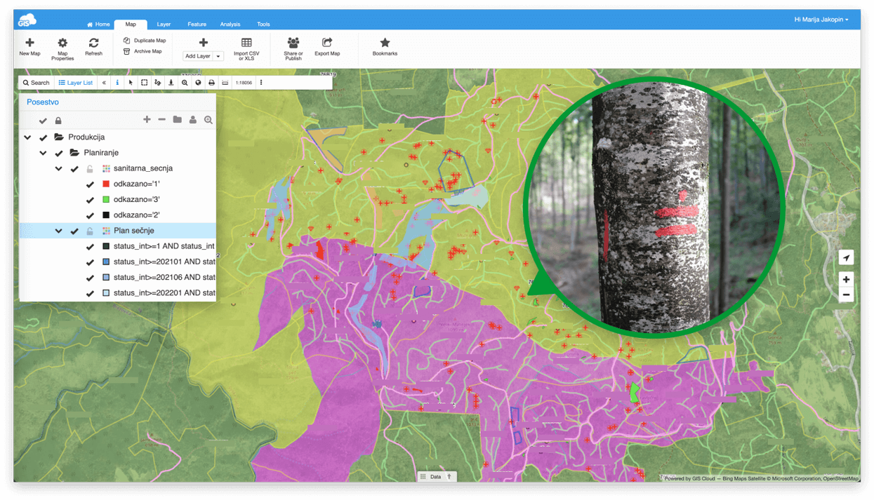
As soon as the truck loaded the logs, the data on the rank of logs and their amount was entered in Map Editor. It supports a number of vector and raster formats, rich GIS symbology with built-in collaboration capabilities.
The apps are connected and always in sync.
For billing and other reports that the company sends to contractors, the data about the work done has to be transparent!
Even the Slovenia forest service has to have traceable information about the removed wood from the forest. All of the data can be easily filtered through Map Editor Datagrid to help you understand it better.
Now they no longer depend on the outdated paper workflow.
I don’t get “lost” in the forest anymore, there are no more situations where we mark the trees to be felled over our borders as now we know where the borders are.
Marija Jakopin – CEO of Gozdno gospodarstvo Les
With GIS Cloud, they have a profound process and support for planning and know the current state of the assets to mitigate any liability and redistribute the work more efficiently!
Gozdno gospodarstvo Les also tracks the data about:
- The forest cultivations (planning and progress)
- Meetings with locations and notes,
- Data about rental contracts of the grasslands,
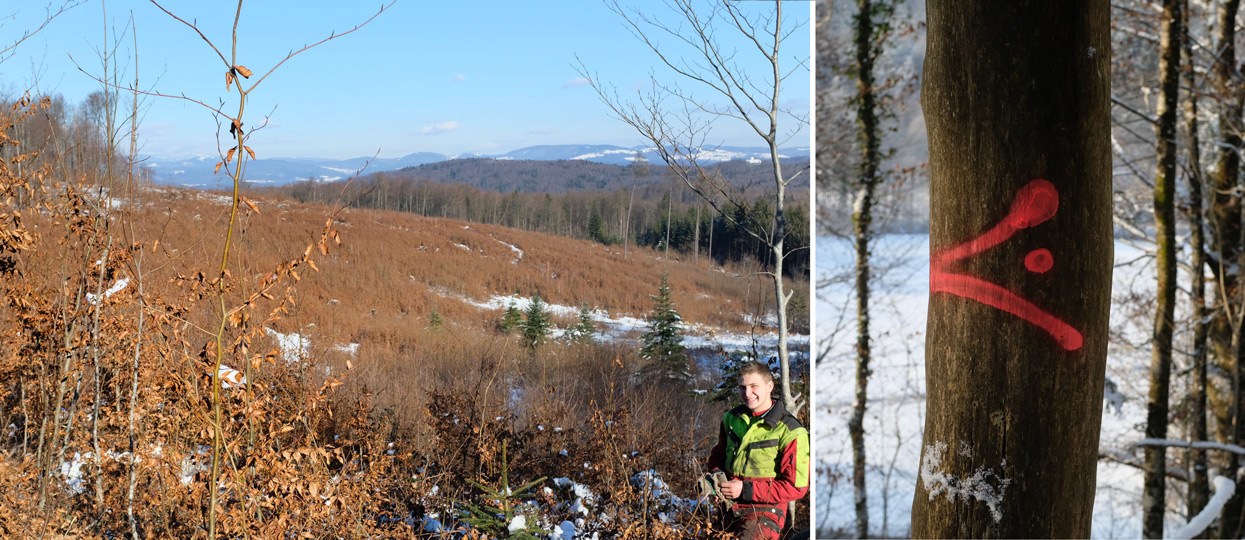
- Border markings
- Candidates for special sales auctions that take place once a year
- Trees dedicated for environmental purposes
- Illegal felling and garbage disposal etc.
Reducing the Costs and Increasing Company’s Incomes
Considerable time saving and more control of what needs to be done is helping the services of Gozdno gospodarstvo Les to reduce their costs and work smarter.
There are fewer phone calls with explanations to harvesters and forest cultivators where and what has to be done. They don’t get lost in the forest anymore and there are no more situations where they mark the trees that need to be felled beyond their borders.
Now they know where all of the forest borders are and they have a profound process and support for sustainable forest management!

They improved their day to day forestry activities and got great measurable results:
- 25 % less time on phone calls (no longer need to explain to the contractors where the harvesting area is)
- 50 % less time for orientation in the forest
- 90 % fewer mistakes when marking trees for harvesting that are out of our boundaries
- 100 % more control over auction trees candidates’ locations and habitat tree’s locations
- existence of short and long-term planning structure
- possibility to show owners of the forest (their clients) where their estates lie
In the future, Gozdno gospodarstvo Les will optimize and digitize all of their processes including automatically importing fresh parcels from Geographical authorities in Slovenia (GURS), and implementing a workflow for their contractors to report their daily progress directly within the GIS Cloud platform.
GIS Cloud brought them a new and exciting visual language where stakeholders and teams improve communication and help prepare a better plan of displaying project progression and results.
Identifying and rightly scheduling all the field and office activities in conjunction with cost optimization and customer reliability is helping with the budget. Using location intelligence to communicate ideas and solve issues in real time gives them a business strategic advantage!
GIS Cloud is fully scalable, a pay-for-what-you-use online platform, with no desktop installation required. You can easily scale your app subscriptions at any time per your project needs, get new subscriptions or downgrade if your project scope changes.
If you are interested in using GIS Cloud for vegetation management projects, Sign up for the free 14-day trial.
You can also contact Antonija, our Key Account Manager that supported Marija Jakopin – the CEO of Gozdno Gospodarstvo LES, to help you set up a desirable, customized GIS Cloud solution for your specific needs and workflow!