

Discover the enduring importance of lines and polygons in GIS through our informative webinar. As we explore the world of mobile data collection, we uncover its important role in today’s data-driven landscape, offering a glimpse into the seamless integration of these fundamental spatial elements with cutting-edge technology.
The Significance of Lines and Polygons in GIS
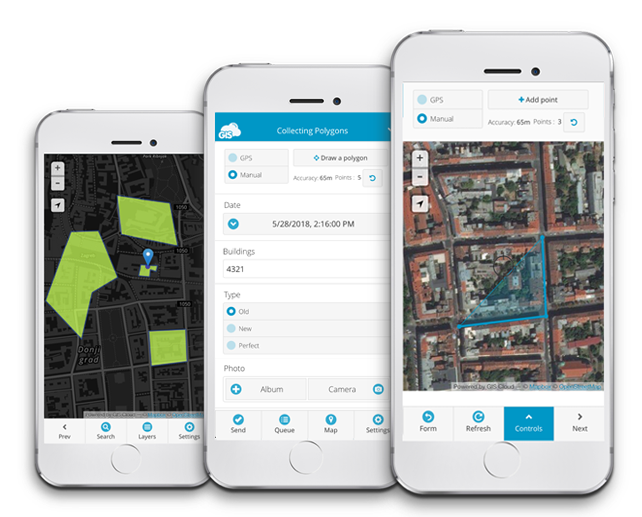
In the world of GIS, lines and polygons are more than just shapes—they are the building blocks for creating accurate maps and models of our physical space. These elements define boundaries, represent infrastructural networks, and outline natural features across diverse industries. From urban planning to environmental conservation, they enable professionals to create detailed maps that inform decision-making and strategic planning. These elements allow for the visualization of complex data, providing a clear path for analysis and planning.
Advancements in Mobile Data Collection
Mobile data collection tools have become increasingly user-friendly and precise, allowing for the swift capture of spatial information. The integration of high-precision GPS, enhanced data processing capabilities, and user-friendly interfaces has transformed how we collect spatial data. Collecting lines and polygons is now more streamlined and precise, reducing errors and increasing efficiency in the field. These technological leaps have empowered professionals to capture complex data with a simple tap on their mobile devices.
Webinar Highlights
Our webinar dives into the innovative features of mobile data collection for lines and polygons. It covers the setup of GIS projects, the assurance of data integrity, and the use of current mobile tools to collect data effectively. The session, led by industry experts, is filled with actionable insights and is an invaluable resource for GIS professionals.
Conclusion
The fundamental techniques for collecting lines and polygons in GIS are as relevant now as they have always been. The webinar provides enduring strategies and insights that continue to be applicable, offering a solid foundation for anyone looking to understand or enhance their spatial data collection skills.
Are you ready to redefine the way you collect GIS data? Contact our Solution Consultants for expert advice on mobile data collection for your GIS needs. Don’t miss out on the opportunity to refine your approach to mapping—get in touch today.