
With the ongoing discussion on the topic of cloud computing phenomena and what it means for the GIS industry, we wanted to give an overview of just how wide the spectra of cloud dimensions is. The big players are well endowed in the Cloud and cloud solutions, but what about the small players and small communities? How to have the best from what the novelty of cloud technology brings but in an affordable yet still high quality way?
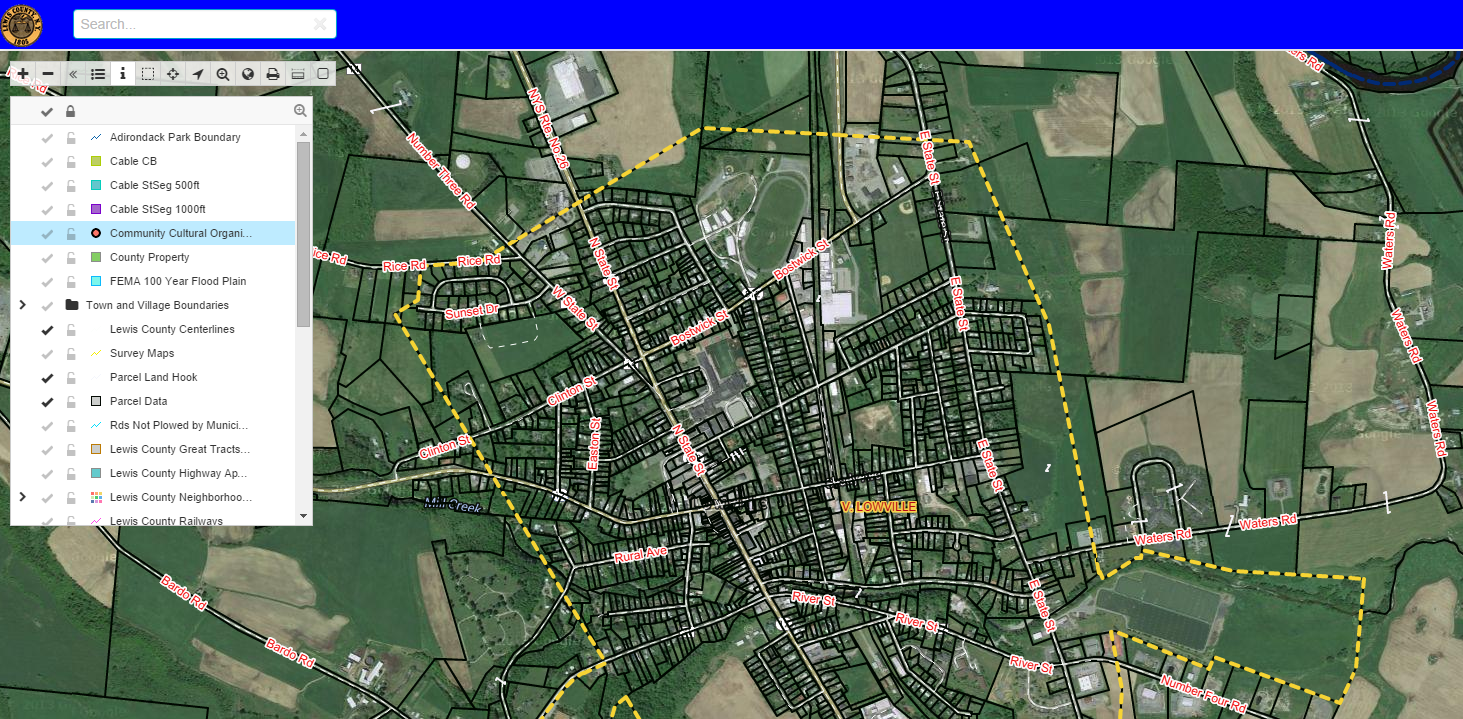
Lewis County is a small budgeted community located in the State of New York. One of the tasks that Lewis County had was to create a mapping system online so that public and businesses can have an easy access to public data for their projects and inquiries. The idea was to try and find a cloud solution that would be both affordable and high quality at the same time. Both of these values they found in GIS Cloud along with the WOW factor for the public who now utilize their online mapping system.
We did a short interview with Lewis County, asking them their take on the cloud solutions and how has their workflow benefited since using GIS Cloud?
GC: What were some challenges that in your opinion you overcame with GIS Cloud apps?
LC: The ability to display and collect data for county employees and ease of public use. For instance we wanted an online map displaying different and multiple layers like zoning, wetlands, mobile railways and so on that you can overlay.
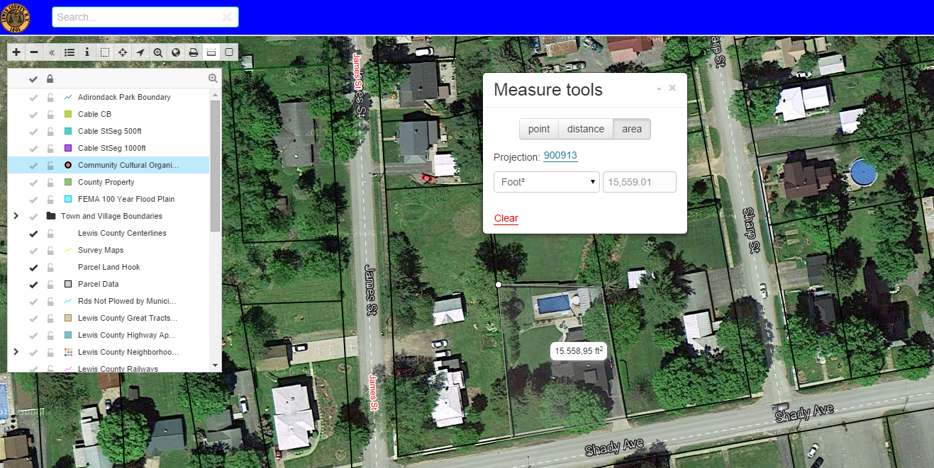
With GIS Cloud Map Portal, public can customize their own maps by a mouse click. County employees can utilize the private maps and data collecting to streamline their daily routines.
We have replicated an outdated mapping software with GIS Cloud and not only does GIS Cloud have up to date aerial imagery and many formats to choose from but you can also bring your own data and in large volume as well.
GC: Is your project workflow more efficient with GIS Cloud apps and how?
LC: We started using the Mobile Data Collection app and data is automatically uploaded into the cloud. This makes it very easy to add data points onsite and provides us with a continuous workflow in the field and office.
Also using the GIS Cloud Publisher extension is an easy way to maintain the Lewis County NY cloud map when editing on other software platforms.
Another great thing is collaborating and sharing private maps in the Map Editor with others before they are published to a public map for everyone to view. It makes it efficient when we don’t have to print out a dozen maps for each person.
GC: What would be 3 key features in your opinion that you would recommend GIS Cloud for?
LC: 1. Streamlining data collection using GIS Cloud Mobile Data Collection app makes it easy to go from data collector to any private or public map.
2. The power to share and collaborate on maps before they are sent to the public, customer or our public map.
3. Displaying map data to the public at no charge. This is important to us because the public expects to have public data at their fingertips. No longer do tax payers have to go to our office and gather data for their property, or pay for a tax map that is not customized for their needs.