Create your first map or collecting project !
Give us some information about your work and get a personalized demo.
Oops! Something went wrong while submitting the form.

Government

GIS Cloud for Local Authorities: Smarter Public Services
A practical guide for Local Authorities, agencies, and partners who need better visibility of their assets and programmes. Why the status quo is under pressure Local services are pulled in two directions at once. Demand climbs while resources stay flat. About 55% of the world’s population already lives in urban areas, and this is...

Real-Time Maps for Construction & Utilities
Adopt real-time maps for construction and utilities to align field and office on one live source of truth. Start small, scale fast, and see ROI with GIS Cloud.

GIS Built for Local Authorities
Local authorities plan across the years. Budgets lock early. Procurement needs clarity. The real risk isn’t maps – it’s uncertainty: variable connector charges, hidden add-ons, and systems that don’t talk. GIS Cloud offers a route you can stand behind in committee: transparent pricing, zero-install rollout, and open integration so you keep what works and...

Geospatial Technology for Building Smarter Cities
Smart cities aren’t built in one big project. They’re delivered day by day: a repaired pipe, a safer junction, a clearer public notice, a faster emergency response. Local authorities and their delivery partners need a GIS that helps work happen, without new complexity or surprise costs. That’s what GIS Cloud is designed to do....
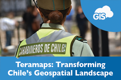
Teramaps – Partner Use Case
Teramaps is a GIS Cloud partner that offers technical solutions for their clients’ geography needs. They integrate QGIS’s desktop applications with GIS Cloud’s online solutions to deliver valuable tools throughout Chile and across South America. Their clients range from a variety of industries, including municipalities, power and gas companies, the Chilean military, universities,...

Transforming Government Work with GIS Cloud
In an era where quick and smart decisions are key, governments at all levels – local, state, and federal – are embracing Geographic Information Systems (GIS) in the cloud. This move is not just about keeping up with technology; it’s about reshaping how government departments work together, make decisions, engage with communities, and plan...

PSD Citywide & GIS Cloud New Integration Partnership
London, Ontario & Zagreb, Croatia – September 21, 2023 – PSD Citywide® is pleased to announce its new integration with GIS Cloud, a leading European provider of GIS mapping working in more than 50 countries worldwide. Fully integrated with Citywide GIS, current and future clients can access a wealth of new public mapping options...

Addressing the Solomon Islands Postal Corporation Challenge
The Solomon Islands Postal Corporation is undertaking a large challenging project. They are embarking on mapping and developing a National Address database for the country. This is a large-scale geospatial project, even for a country of only 700,000 people. There are many challenges in developing such a system, but having the support...

GIS Cloud and Power BI – Infrastructure Management with InfraTrace
GIS is a powerful tool being used worldwide. Maps have become an effective tool for communicating information to people. In recent years, maps have been frequently used to show the widespread pandemic and the impacts of natural disasters. Maps and GIS communicate with minimal losses in translation about what is happening, where it...

Educational Infrastructure Maintenance Management using GIS Cloud
Our partner Global Code Technology from Costa Rica which also operates in other countries of the region successfully finished a field data collection of educational infrastructure for their client, Unidad Gerencial de Mantenimiento (UGM) in Peru. Unidad Gerencial de Mantenimiento (UGM) is a maintenance management unit, part of the Peruvian National Program for...

Managing Recyclable Waste With Online GIS
Our Partners NubiGroup from Greece helped the “GreenPoint – Mob” project collect the data on mobile waste containers in remote areas in different countries and create a spatial database on waste and recycling bins, as well as monitor the status of the “GreenPoint-Mob” containers. This significantly improved waste management, saving the project time and...

Online GIS In Road Work Inspections And Maintenance
GIS technology has been enabling the Road Work Industry since the early beginnings. It is proven that the power of location enhances operational efficiency. Online GIS helps you obtain different data from different systems into a single easy-to-use platform. You will start using smart custom maps to plan, manage and maintain your road infrastructure to...

Mapping Parking Zones, Garages and Free Parking in Zagreb (Croatia)
Each year the number of cars in the city grows, causing traffic jams and lengthening the time spent looking for a parking place. That leads to dissatisfaction and stress among drivers. Marija Milanović, geodesy student at the University of Zagreb, created an interactive Map Portal of parking zones and no fees parking spaces...

Mapping Public Transportation after the Earthquake in Zagreb (Croatia)
Martin Malović, Geography/GIS student at the University of Zagreb, Faculty of Science made an interactive Map Portal with the help of GIS Cloud apps, representing changes in public transportation due to earthquake damages to facilitate daily movements for people in the city. Maps that are created as a part of this project...

Using Crowdsourcing to Restore the Historical City Center of Mantova, Italy (Case Study)
The historical city center in Mantova, Italy, has been deteriorating for some time now. The buildings are not being properly maintained, and some of them are abandoned, despite the fact they are a cultural heritage recognized by UNESCO. But the Municipality of Mantova is trying to fix things with an urban regeneration project, a coordinated...

Mapping Villages in Southern Bangladesh to Improve Healthcare Interventions
The project is a part of a larger initiative that tries to tackle the spread of disease caused by extreme air, water, and soil pollution in Bangladesh. The initiative plans to establish a disease surveillance system and conduct a spatial analysis to determine high-risk areas. This is a pilot project and covers the first...

Collecting all property data in Zarcero Canton in less than 2 months (Case Study from Costa Rica)
The crew from Global Code Technology successfully finished the field data collection of infrastructure, land use and property in less than two months. It was a project for the Zarcero Canton that needed to get their housing census database in order. The housing census enabled the canton to plan infrastructure projects more efficiently, like...

Cutting Administrative Costs With Online Maps for Lewis County (Case Study)
Lewis County is a small community located in the State of New York. Its county officials wanted to create an online mapping system so that the public and businesses get easy access to public data (cadastre, tax maps, utilities, zoning, etc.). The idea was to implement an online solution that would be both affordable...

Firefighters of Chile Used a Dynamic GIS Solution for Strategic Planning and Fieldwork Coordination (Case Study)
Firefighters of Chile are an admirable organization, always investing in education and technology to provide the best possible service to their community. In 2017 they faced massive fires across the country, in many distant locations at the same time. To coordinate teams and respond as quickly as possible, they decided to implement a GIS...

Tram Station Asset Management in the City of Zagreb (Use Case)
When waiting at the tram station, it can be bothersome if you don’t know when the next tram comes. Some tram stations in Zagreb, Croatia have a digital display showing information about arriving trams (their line number, direction and the estimated time of arrival). Geography student Matija Ostović decided to explore which tram...

Traffic Maintenance Using GIS Cloud: Pedestrian and Bicycle Crossings Management (Use Case)
If you are a company in charge of maintaining traffic signalization, taking care of utility management or simply leading a field data collection project, online GIS solution can be of great help for your workflow. Learn how to assign your fieldworkers permissions to collect and update data about asset condition, to efficiently maintain...

Map of Business Structure and Activity in City Districts of Zagreb
This is a case study about mapping business units in the city district of Dubrava in the City of Zagreb. The project was made by a Geography student, Stipica Šarčević, who also wrote this blog report. He explained the process of data collection, visualization, and publishing, done by using GIS Cloud apps. Over the...

Mapping Illegal Landfills in the City of Zagreb (Use Case)
This use case describes the project done by a GIS student Morana Labović, who collected data on the illegal landfills in Zagreb to create an interactive map for raising citizen environmental awareness. Due to the increasing quantity and its harmful effects on the environment, waste is one of the most significant environmental problems of...

Crime Risk Map – Carabineros de Chile (Case Study)
Police departments around the world are increasingly using online GIS for a variety of tasks, including emergency response, analyzing and predicting crime rates, tactical planning and daily coordination, to name a few. Read about Police of Chile (Carabineros de Chile) who choose GIS Cloud to create crime risk maps with real-time information. Police departments...

Importance of Open Data for Local Governments
How can local and federal governments contribute to the digital transformation, citizen engagement and information transparency? Some of these questions were in focus last weekend (4.-6. of March), when CodeAcross and OpenDataDay events were held in Zagreb. Events included different panels focusing on information science curriculums and the importance of open data for governments and...

4 Main Reasons Why Governments Choose Cloud Based GIS
One of recent trends in the process of digitalization within local governments infrastructure such as city councils, governmental agencies and departments is a growing use of cloud-based software solutions which are improving their functionality in many segments. Since most of the paperwork, statistic and public data is now digitized and more easily accessible by both...

Exploring the City of Darwin Map Portal
Geographic information system tools increased popularity in local government projects toward its citizens demonstrates this premise, and City of Darwin took advantage of this insight creating an admirable City Portal for its residents.
City of Darwin map portal, powered by GIS Cloud, was conceived as a web map on which City of Darwin citizens could find the information on city infrastructure and facilities.

GIS Solutions for Government – Data Publishing Case Study
Many governmental departments just recently started to discover how to benefit fully from geospatial technologies. This particularly affects the planning, public works, and services departments that need to have adequate tools for data visualization. Having all of that on a custom map in real time might be a game-changer in terms of creating...

Land Administration And Parcel Management in the State of New York (Case Study)
Data visualization makes our lives easy and simple. It is not a new thing, but the way we do it improves and upgrades daily. Just recently we were still drawing maps, filling forms manually and collecting GPS locations as a single point, with no media associated. With the boom of free data that...

Cloud Solutions for your Local Government GIS
Using GIS in Governments, whether local, State, or Federal, has become a must. It helps departments work together much faster; it improves the decision-making process, engages the community, and improves day-to-day operations and long-term planning. Local Government incorporates a lot of different departments, that all use GIS in a different but also similar way...

Lewis County Case Study: Small Community Cloud Solution
With the ongoing discussion on the topic of cloud computing phenomena and what it means for the GIS industry, we wanted to give an overview of just how wide the spectra of cloud dimensions is. The big players are well endowed in the Cloud and cloud solutions, but what about the small players and small...

Using Maps to Identify Homeless Population in Milwaukee (Case Study)
Over 100 million people around the world have no shelter whatsoever. With the turbulence in the global economy, homelessness is becoming an increasing problem all over the world. The growing rate of the homeless population especially concerns American society. One of the ways to begin resolving this problem is to create a specifically designed...

Data Publishing Solution Case Study: City of Canton
City of Canton is the county seat of Cherokee County, Georgia in Unites States. With the increasing population and development of the city, the need for fast, efficient and affordable GIS solutions have emerged. The majority of spatial data City of Canton has is in the form of ESRI shapefiles, so the idea was to...
Follow GIS Cloud
Products
How it Works
Mobile Data Collection
Map Editor
Map Viewer
Map Portal
Crowdsourcing
Publisher for QGIS
Publisher for ArcMap
Geocoder
Terms of use & Privacy policy © GIS Cloud Ltd