Addresses into
points on a map
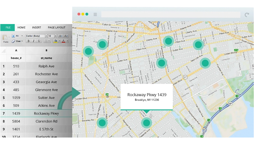
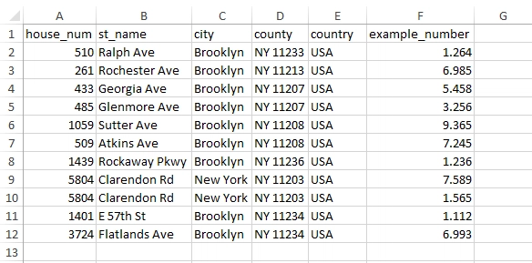
Turn a spreadsheet of addresses into mapped coordinates in bulk. Upload a CSV, geocode thousands of rows, and map the results, with AI that makes sense of messy, inconsistent, real-world addresses.
- Batch geocode CSV and spreadsheet uploads
- Forward and reverse geocoding
- AI parses messy, incomplete addresses
Geocoder
From address list to map, in bulk
Bulk by upload
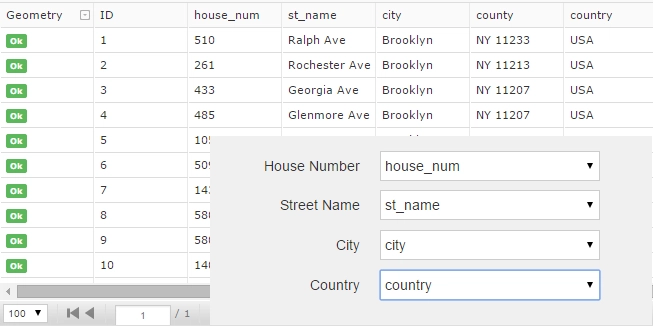
Drop in a CSV or spreadsheet and geocode thousands of addresses at once, with no row-by-row work.
Forward & reverse
Addresses to coordinates, or coordinates back to addresses: both directions, same tool.
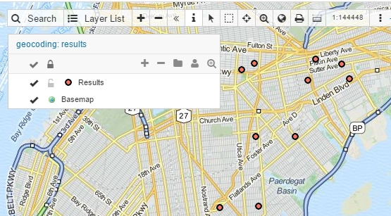
Straight onto the map
Results become a live layer in your project, ready to style, share and analyze.
"I achieved more in 5 minutes with GIS Cloud than I did in about 1.5 years before. A perfect bridge to a mature solution and service."

Upload, geocode, map
Three steps from a raw address list to mapped points you can use.
- CSV, Excel and pasted lists
- Thousands of rows per batch
- Results land as a live map layer
Reverse geocode coordinates
Have coordinates instead? Turn them into readable addresses.
- Coordinates to street addresses
- Append address fields to your data
- Same batch workflow, reversed
Use results across GIS Cloud
Geocoded points flow straight into the rest of your workflow.
- Style and classify in Map Editor
- Share via Viewer or Portal
- Combine with field-collected data
Powered by GIS Cloud AI
AI reads messy addresses
Real-world address lists are inconsistent, with abbreviations, typos and missing parts. AI interprets them, suggests the best match with a confidence score, and flags the ones worth a human check. You confirm.
Explore GIS Cloud AIMap your address
list in minutes
Upload a spreadsheet and geocode your first batch today. No credit card, no setup.