Create your first map or collecting project !
Give us some information about your work and get a personalized demo.
Oops! Something went wrong while submitting the form.

Map Editor
Transform your workflow from paper to digital.
Powerful cloud based solution for building and sharing your maps.
Collect and inspect POINTS, LINES and POLYGONS with a single app.
Carry out your entire project from start to finish and report to stakeholders using one solution, without worrying about piles of paperwork.

Create custom maps in minutes
Share and edit in real time
Manage your team and data
Visualize, share and organize data in real time
Core GIS features
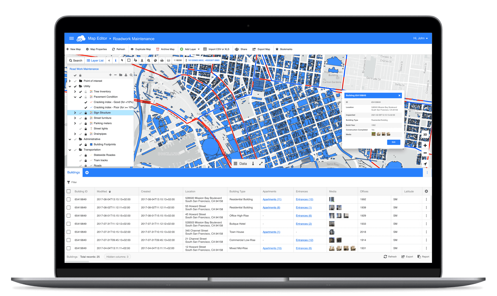
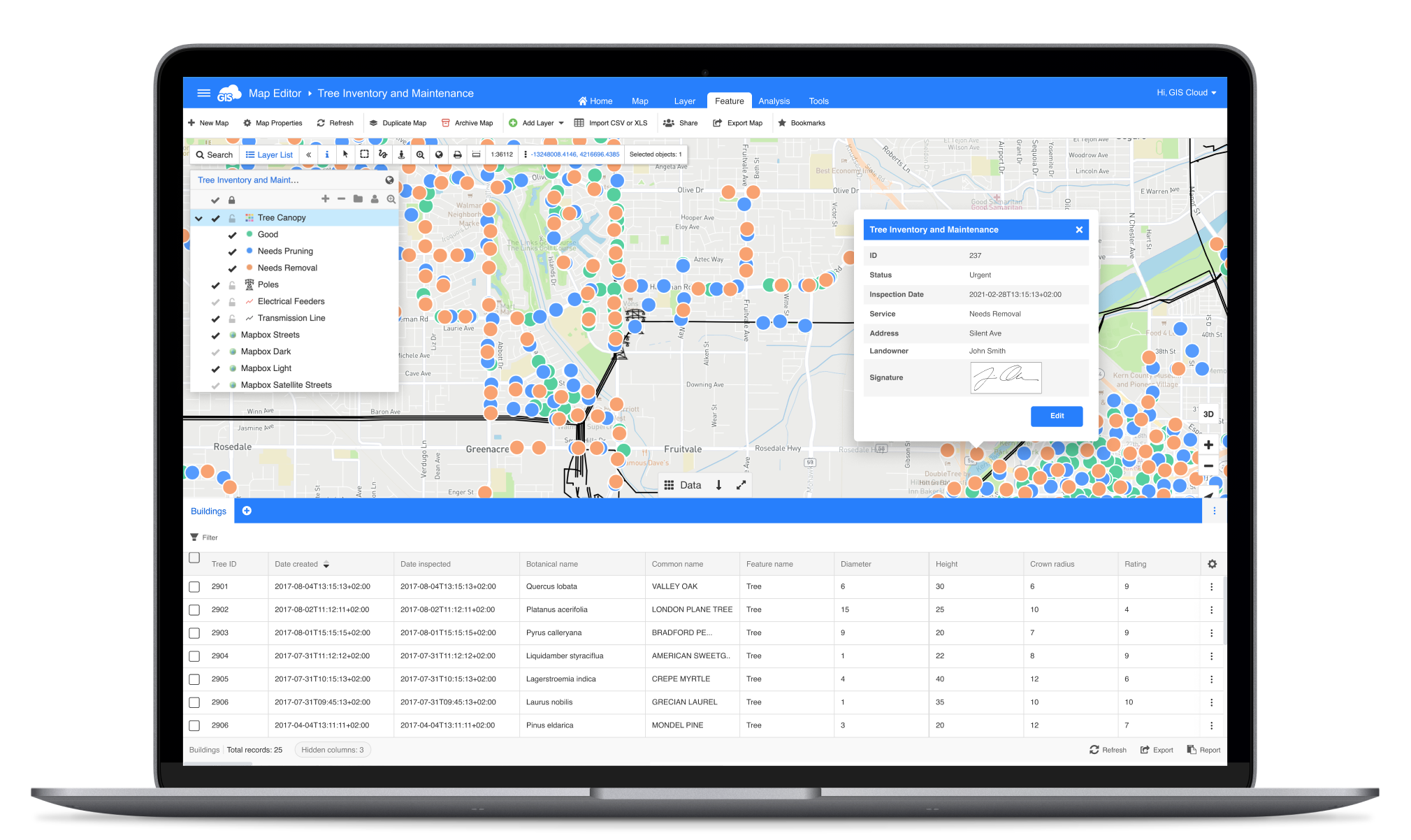
Map Editor supports a number of vector and raster formats, and rich GIS symbology.
Draw points, lines and polygons, use multiple layers and base maps.
Draw points, lines and polygons, use multiple layers and base maps.
Advanced collaboration
With built-in collaboration capabilities, share your maps to edit data and symbology in real time.
Use permissions to control who can view, edit or collect data - individual or entire group.
Use permissions to control who can view, edit or collect data - individual or entire group.
Supporting big amounts of data
Developed using modern web technologies, it supports full vector-based editing and real-time updates to the database.
Powerful map engine can smoothly render large datasets, even millions of records.
Powerful map engine can smoothly render large datasets, even millions of records.
“The easiest GIS platform to get started with, so flexible.
The Map Editor web application acts as a browser-based, full featured GIS interface, with transparent pricing, security compliance, easier customization of interface, and easier to train new users.”

Jonathan Stanger, PhD
Director & Head Solution Architect, Spatial Partners Pty Ltd
Create custom maps online
Create custom maps online
Draw points, lines and polygons, use snapping
Present data with custom symbology, like icons and colors, thematic map wizards, and powerful label management
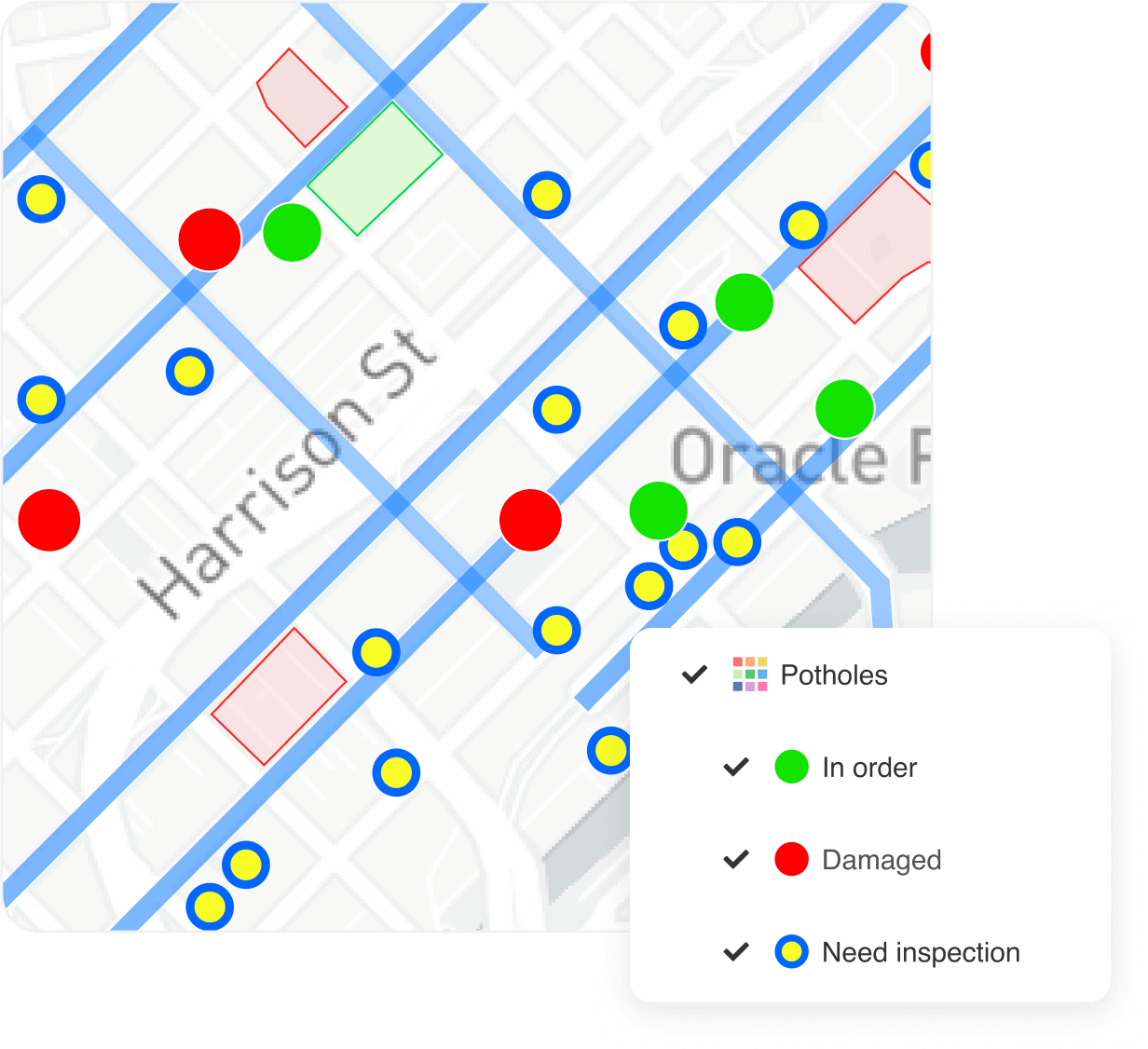
Assign custom rules for data visualization to display real-time data status directly on the map
Visualize data in 3D view with terrain, possibility to configure custom DEM
Supports multiple vector and raster formats: .shp, .kml, .gpx, .tif, .sid, dxf…
Effectively manage data
Upload, organize, edit and share your data from various sources, including database tables, files, images and services
Supporting many datasources: vector & raster files, WMS, WFS, WMTS, PostgreSQL, Oracle, Excel, CSV, Base maps (Bing, OpenStreetMap, Mapbox...)
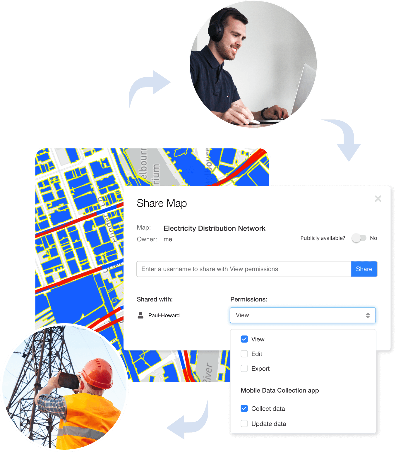
Easily share maps and collaborate
Share maps, data, and specific layers - privately or publicly
Control map and data access with View, Edit, Export, Collect and other permissions, per user or group
Share your private maps with a simple Map Viewer interface
Edit and manage your projects and field data, collected with the Mobile data Collection app
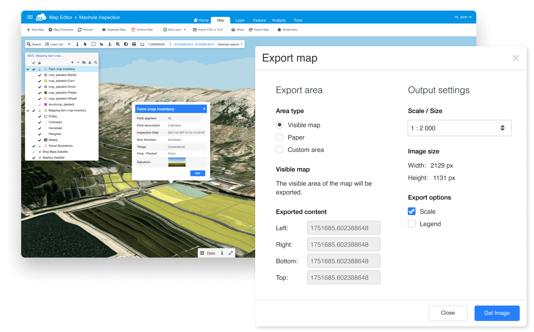
Publish and export maps and data
Easily embed your maps into a website
Publish maps through WMS and WFS
Export maps to high resolution raster images for printing
Export data in vector layers to spatial vector formats (.shp, .mif, .kml…)
Use join wizard, spatial filter, projection wizard, merge wizard, etc. to do more with data
Extend to other GIS Cloud apps and do more with data
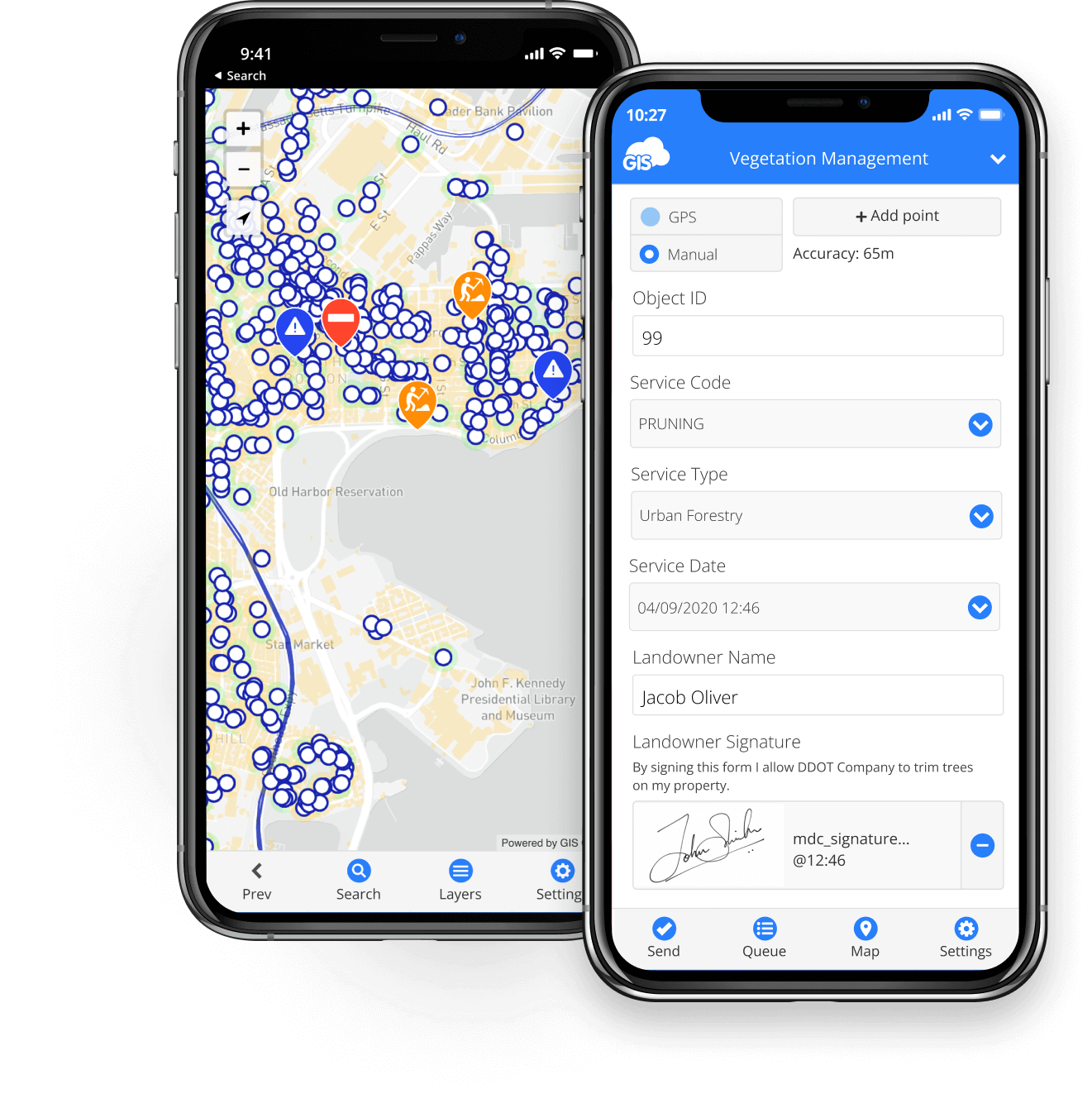
Mobile Data Collection
Build custom survey forms and collect data you need from the field.
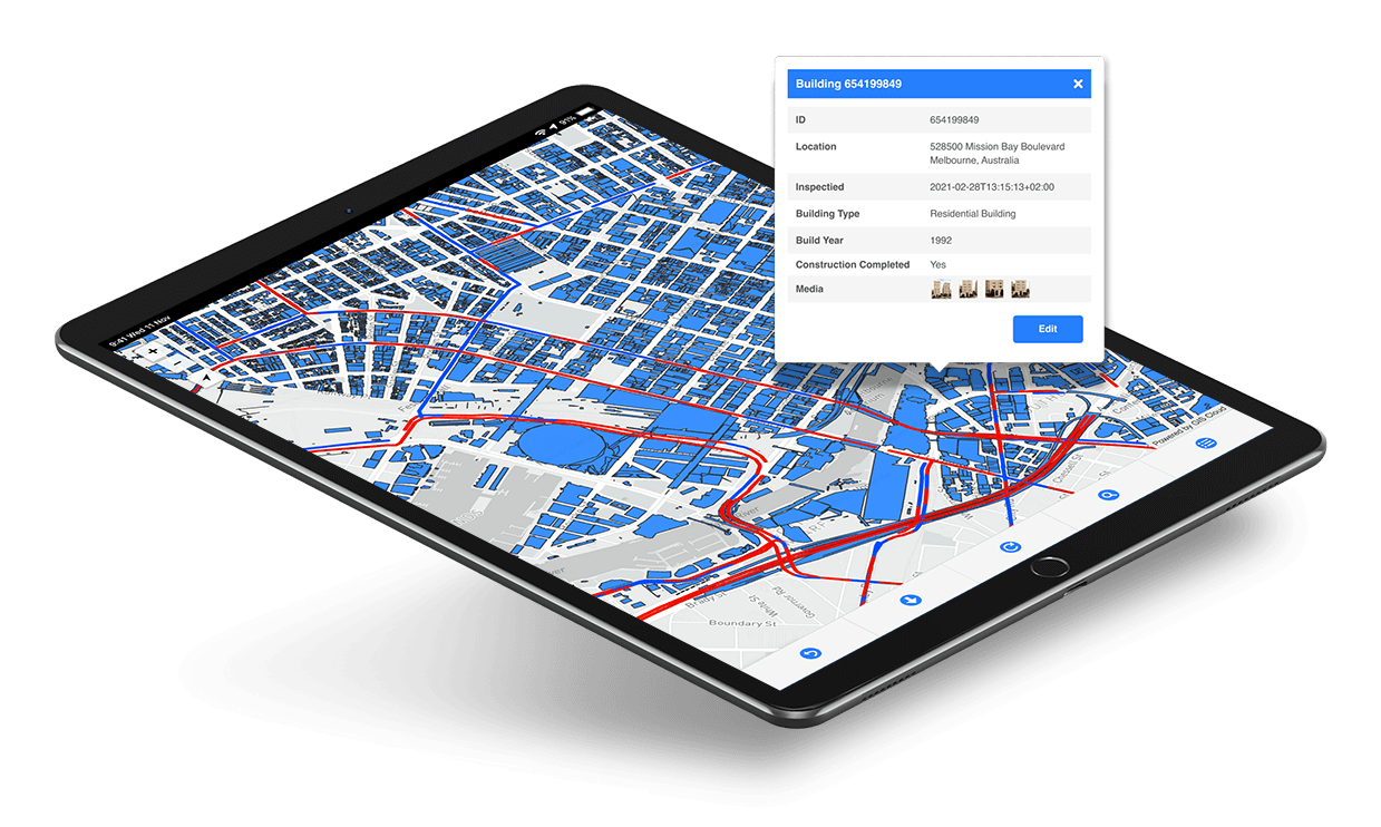
Map Viewer
Stakeholders can access your project privately through Map Viewer.
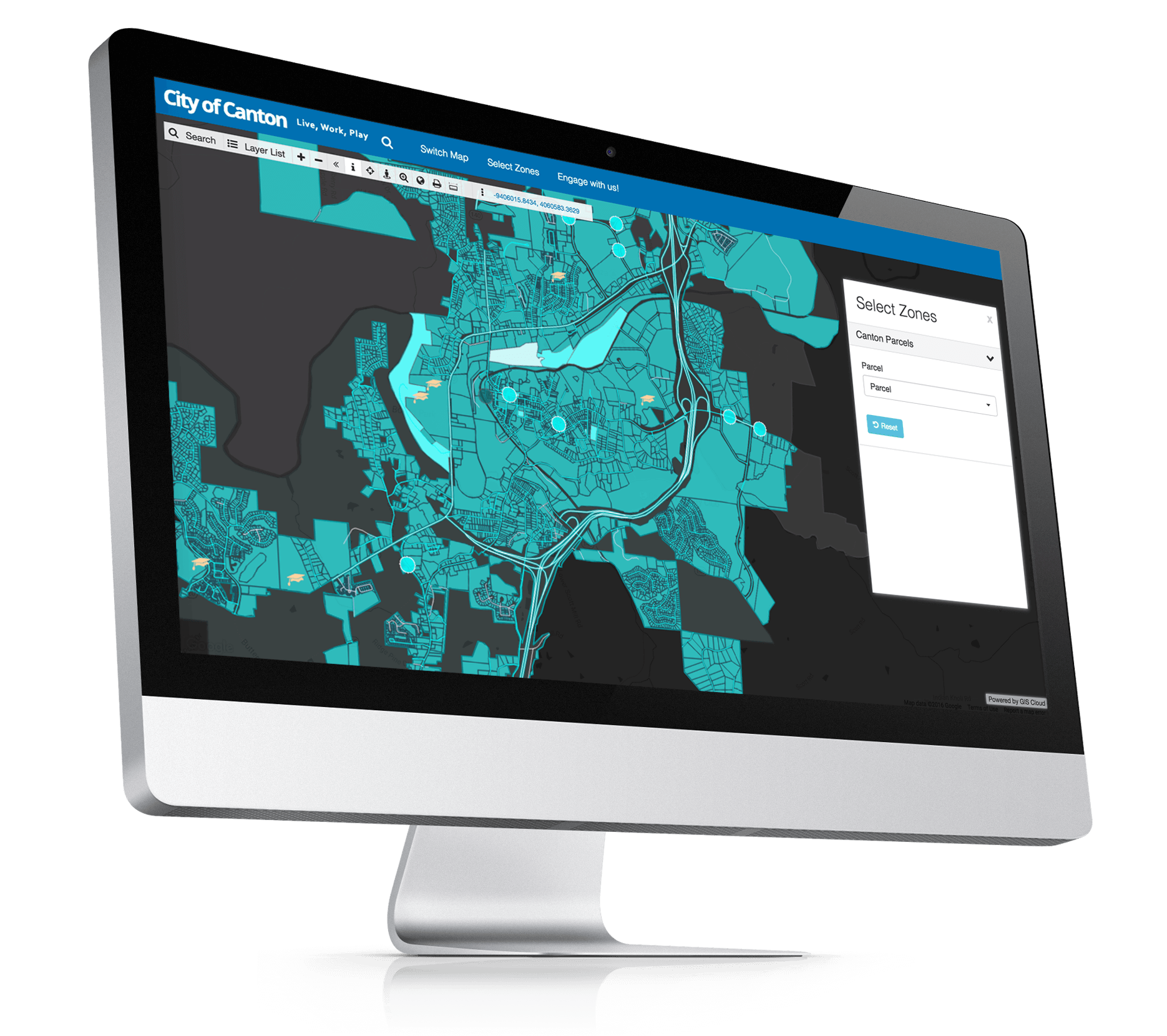
Map Portal
Share data and maps with the public. Create a Map Portal in less than an hour.
Follow GIS Cloud
Products
How it Works
Mobile Data Collection
Map Editor
Map Viewer
Map Portal
Crowdsourcing
Publisher for QGIS
Publisher for ArcMap
Geocoder
Terms of use & Privacy policy © GIS Cloud Ltd