Create your first map or collecting project !
Give us some information about your work and get a personalized demo.
Oops! Something went wrong while submitting the form.

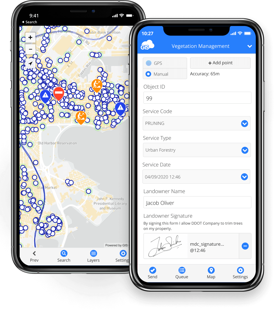
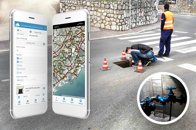
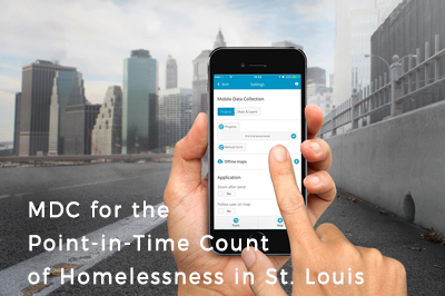
Mobile Data Collection
Transform your workflow from paper to digital.
Transform your workflow from paper to digital with a complete solution for field data collection.
Collect and inspect POINTS, LINES and POLYGONS with a single app.
Carry out your entire project from start to finish and report to stakeholders using one solution, without worrying about piles of paperwork.

Build custom collection forms in minutes
Collect and inspect points, lines and polygons
Track the entire project and manage your team
Report to stakeholders
Real time data collection, visualization and monitoring.

Fast and easy deploy
Most of our users set-up their surveys and train the staff in less than a day.
Simply share your form to deploy projects to teams.
Simply share your form to deploy projects to teams.
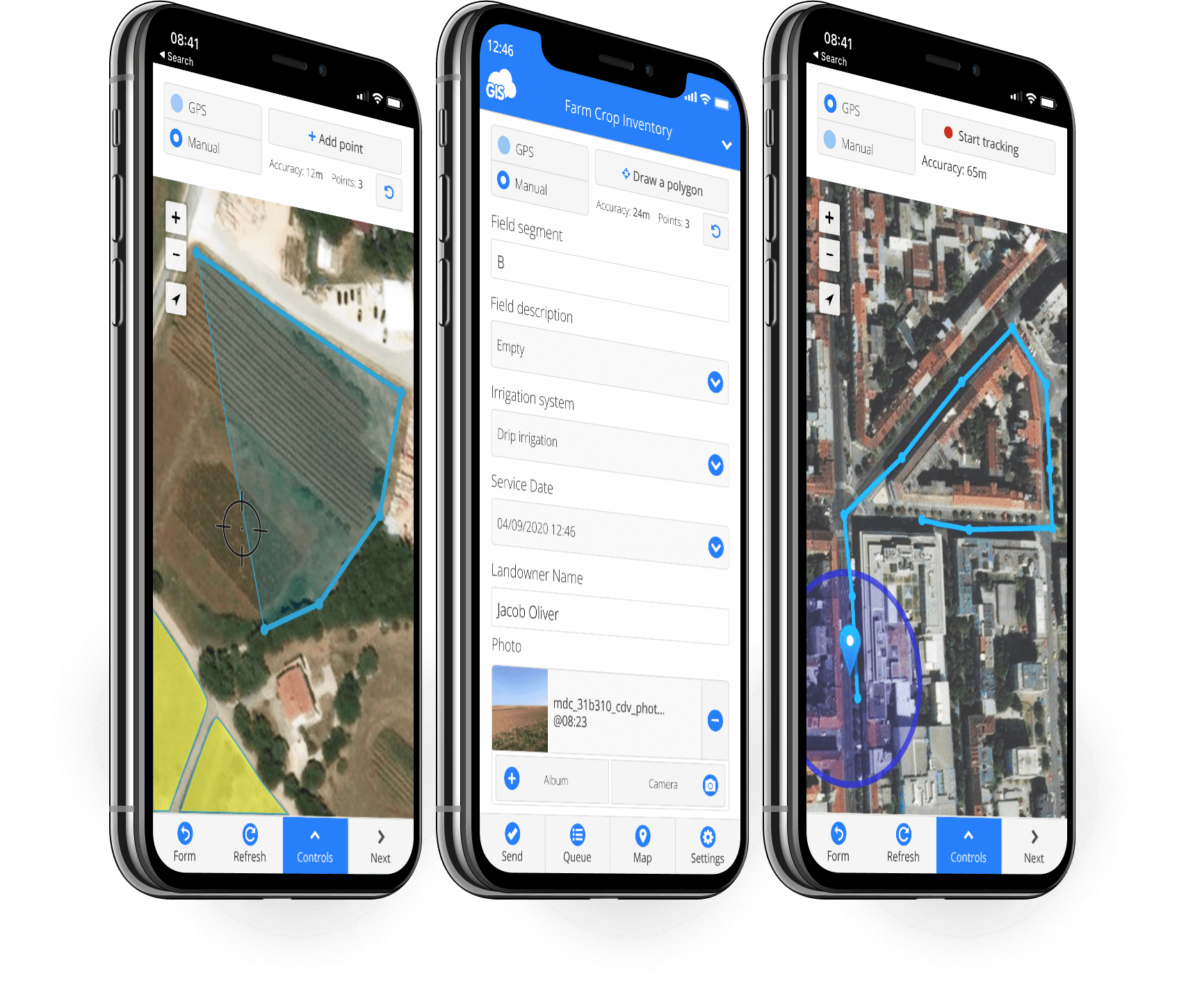
Collect different types of assets
Choose between point, line or polygon project to collect different geometry in the field.
Enrich data with multimedia.
Enrich data with multimedia.
Work online or offline
Download offline maps to access data even without network coverage.
Offline collections are stored on your phone and synced automatically when online.
Offline collections are stored on your phone and synced automatically when online.

Automatic (GPS) or manual collection
Capture data location with GPS, or use a pinpoint tool to manually add points and draw lines.
Connect external GPS to achieve high precision.
Connect external GPS to achieve high precision.

Data quality control
Use form item options like dependencies, required fields, radio buttons and others, to capture complete and accurate data. No coding required.
Cost effective
Scale up and down according to your project size and timeframe.
Easy to learn tools eliminate time and money usually spent on training.
Easy to learn tools eliminate time and money usually spent on training.
"Mobile Data Collection has changed my entire work process. The ease of use, and the power of real time results, even off the cell or internet networks, is so powerful. The ROI an organization receives from this type of technology more than pays for itself.”

Field and office workflow
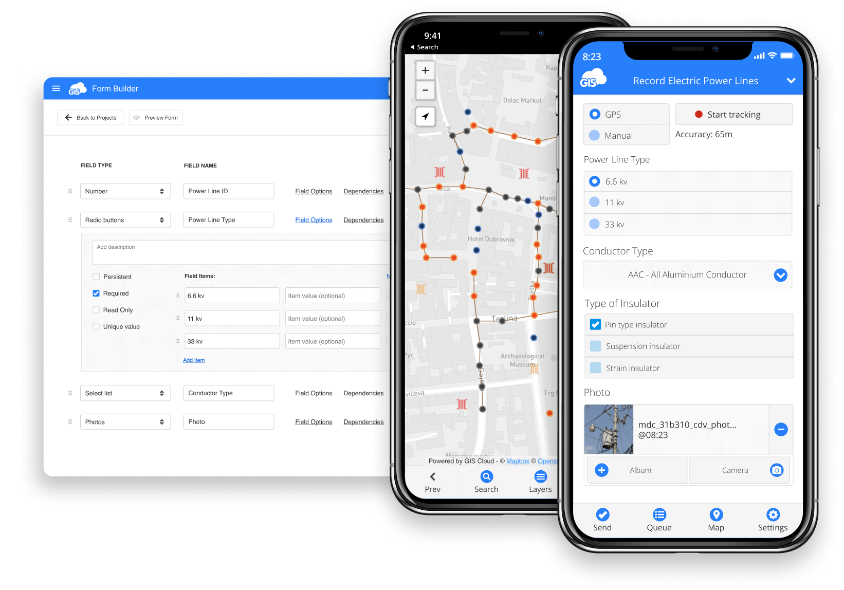
Create custom survey forms
Create a survey directly in your browser and access it on your phone
Choose point, line, or polygon project and customize your form fields (text, number, select list, photo, electronic signature…)
Make your fields required, dependent, persistent or use other form field options to enable fast and accurate data collection
Include photos, audio, QR codes, barcodes, electronic signature and more
Share and deploy projects to your field crew
Deploy survey to mobile users by sharing a form
Share with a team member or a whole group
You control who can collect or update data
Manage team roles (project manager, field crew, analyst, stakeholder…) using permissions
Update form changes on the go (automatic sync across devices and users)
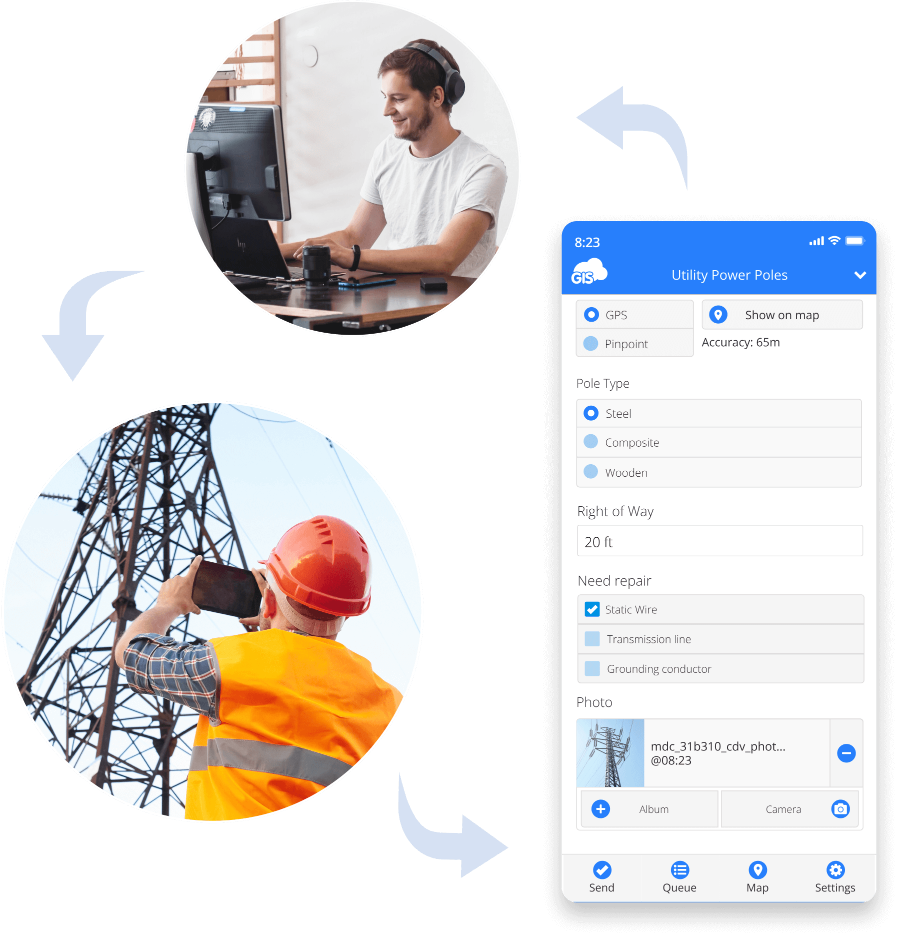
Collect data in the field
Collect, inspect or update data in the field using Android or iOS mobile app
Fill in your survey, walk or drive while data is collected automatically - drawing points, lines and polygons
Work in offline mode - data is stored on your device and synced to cloud when online again
Use "Navigate to feature" option to find assets in the field
Review and edit data attributes directly from the field
Use Mapbox, Open Street Map, Bing or custom basemaps
Track projects in real time and manage teams
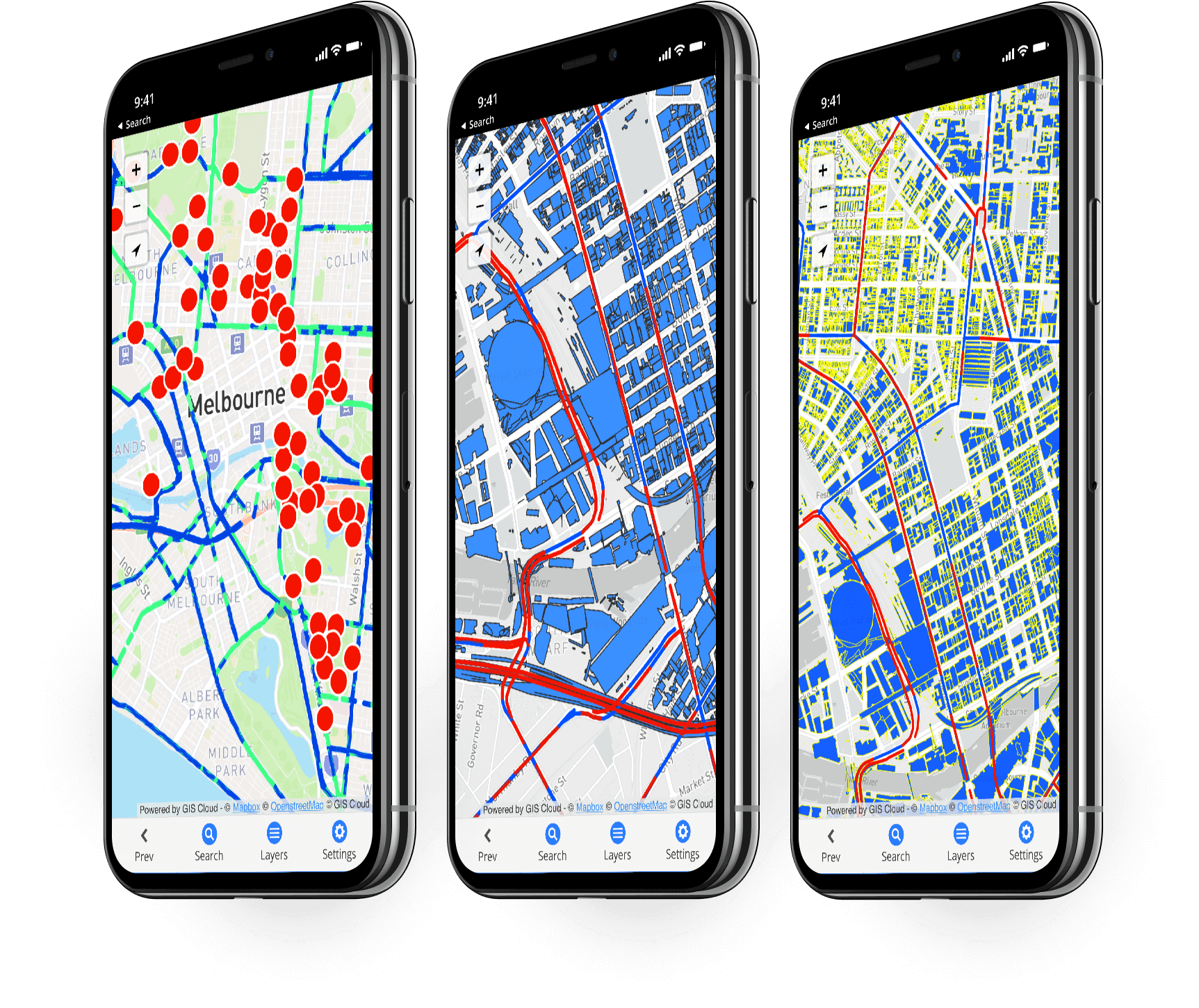
Review collected data in real time and monitor projects
Update form changes on the go (Automatic Sync across devices and users)
Manage teams and jobs, assign tasks and make decisions
Generate reports and export data for stakeholders and funds
Extend to other GIS Cloud apps and do more with data
Once you collected the data, analyze the project status, decide on further actions and assign tasks, or share with others and calculate budgets.
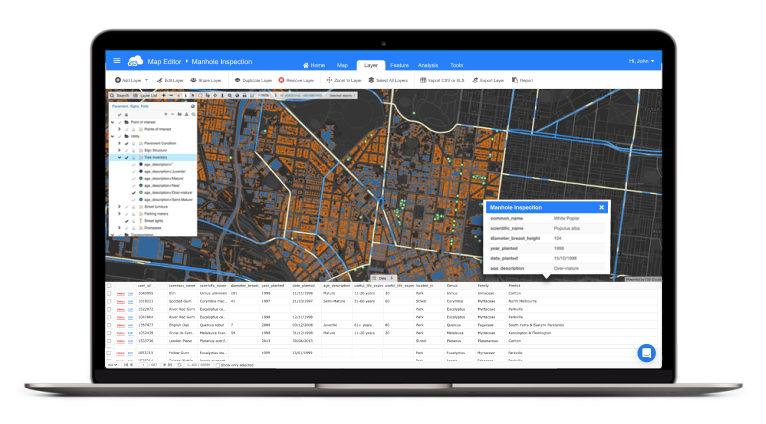
Map Editor
Open your project in Map Editor to style and classify data for easy analysis in real time.
Add collaborators to help you with data editing, assign them different permissions to control access.
Overlay with many layers of data for comprehensive analysis and overview.
Add collaborators to help you with data editing, assign them different permissions to control access.
Overlay with many layers of data for comprehensive analysis and overview.
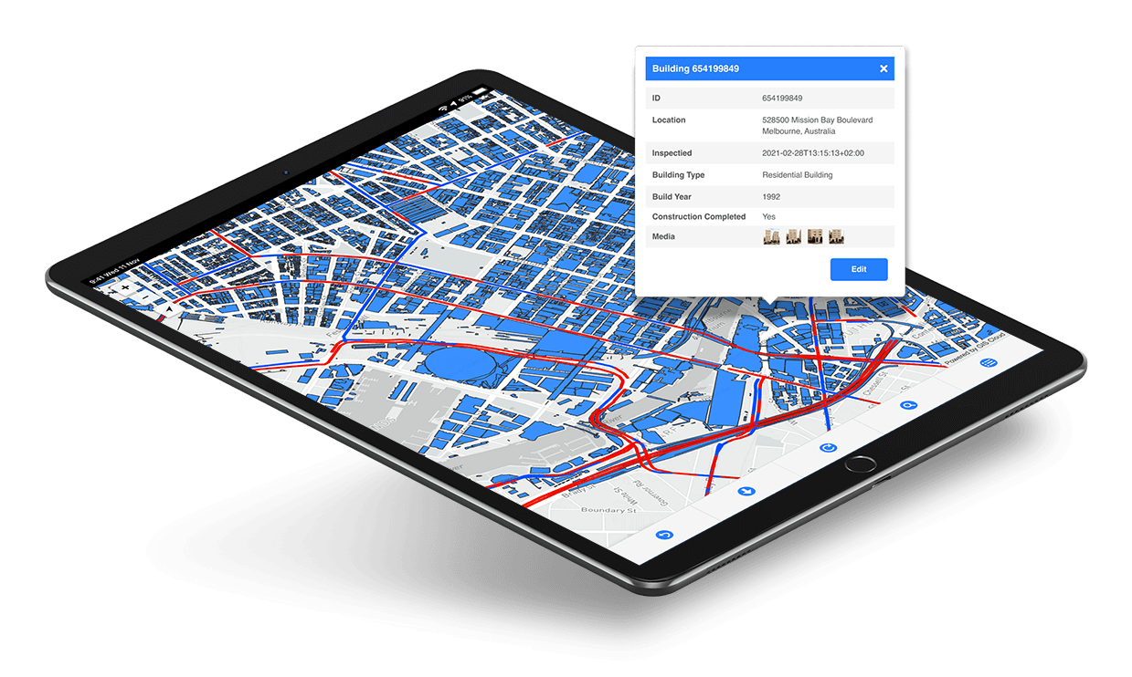
Map Viewer
Stakeholders can access your project privately through Map Viewer.
It is a simple app for project overview, or to track the job progress and make decisions.
Data can be accessed online, or offline once the map is stored on the device.
It is a simple app for project overview, or to track the job progress and make decisions.
Data can be accessed online, or offline once the map is stored on the device.
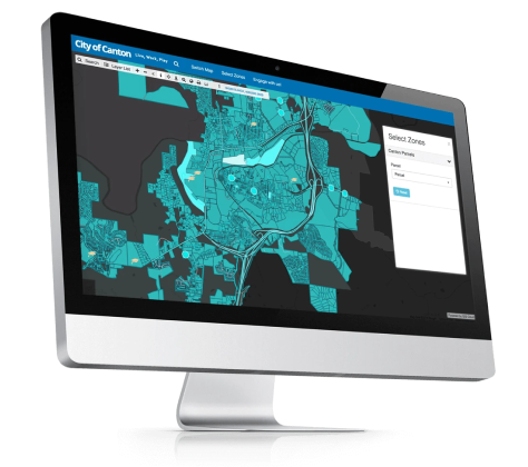
Map Portal
To share data and maps with the public, convert your project into a branded Map Portal in less than 30 minutes.
This allows your community or organization to see which projects are underway, which are planed or completed, and to assess results.
This allows your community or organization to see which projects are underway, which are planed or completed, and to assess results.
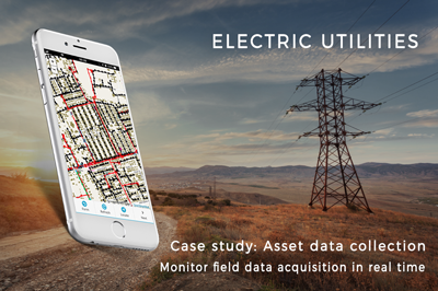
Mobile Data Collection - User Stories


Follow GIS Cloud
Products
How it Works
Mobile Data Collection
Map Editor
Map Viewer
Map Portal
Crowdsourcing
Publisher for QGIS
Publisher for ArcMap
Geocoder
Terms of use & Privacy policy © GIS Cloud Ltd