

If you build, maintain, or modernize critical infrastructure, you need real-time maps for construction and utilities that everyone can trust. When field crews, office teams, and stakeholders work from the same live map, decisions speed up, risks drop, and documentation finally keeps pace with reality. With GIS Cloud, you can start small, scale fast, and realize immediate ROI, often in weeks, not months.
What “real-time” looks like on the ground
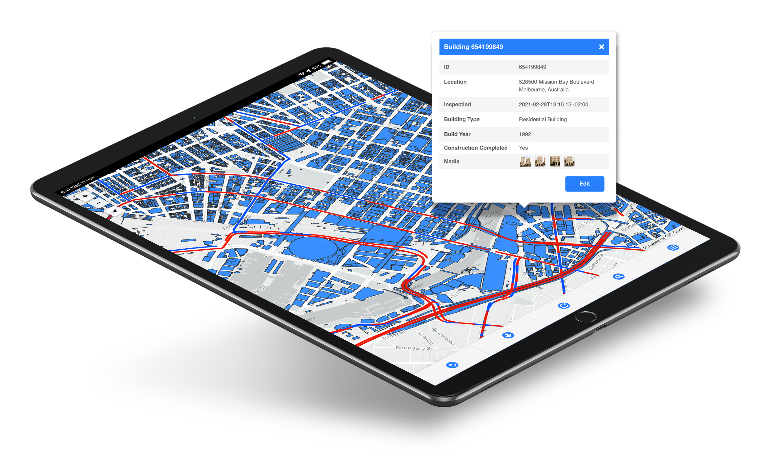
Construction & Civil Engineering
Capture once, use everywhere. Field teams collect photos, GPS points, materials, and inspections on mobile. Office teams validate in minutes. Stakeholders see live status, evidence, and notes on a single map, so close-outs are faster and rework shrinks.
Utilities & Network Operators
For valves, hydrants, poles, meters, and stations, stale data is expensive. Inspectors update assets on-site, conditions, photos, even CCTV links, so dashboards and compliance reports reflect reality without the end-of-quarter scramble. Supervisors can reassign crews from a live view.
Local Government & Agencies
Modernize without heavy IT. Stand up cloud maps for planning, permitting, asset management, and public portals. Share specific views with contractors and citizens to increase transparency and shorten turnaround times.
Developers & Owners
Place constraints and design intent in context. Share interactive maps with partners or investors via a simple link, keeping everyone aligned as conditions change from zoning layers to on-site progress.
Why teams are moving now
Cloud-first geospatial has become the backbone of faster, more connected delivery. GIS Cloud’s open, interoperable platform plugs into the tools you already use, BIM, work management, even IoT, so your data flows from capture → review → decision without friction. As a result, organizations see measurable gains in project speed, operational efficiency, and compliance quality.
The playbook: start small, scale fast
Choose one high-friction workflow. Prove value quickly. Then expand with confidence.
- Digital site inspections Replace paper with mobile forms and geotagged media. Auto-generate supervisor and funding reports from the same source of truth.
- As-built asset capture Record precise locations and attributes once. Navigate back in the field from any device and keep a living record for operations.
- Network maintenance & compliance Standardize inspections (poles, meters, hydrants, manholes), attach evidence, and prioritize work from a live map so reporting becomes a byproduct, not a separate project.
- Partner & public portals Publish curated views to contractors and citizens to reduce email threads, cut FOIA churn, and build trust, without exposing internal layers.

How GIS Cloud fits your stack
- Collect once: Mobile apps capture asset data, photos, and locations with timestamps and user attribution.
- Validate fast: Office review and approvals tighten handoffs and keep projects moving.
- Share securely: Role-based permissions surface the right view to field users, PMs, executives, partners, or the public.
- Integrate openly: APIs and data interoperability connect GIS Cloud with BIM, asset systems, your existing stack, and emerging digital-twin pipelines.
The outcome is simple: one live source of truth that reduces rework, supports sustainability, and keeps everyone aligned from first survey to final sign-off.

Ready to see your own workflow on a live map?
- Start a 14-day free trial to explore GIS Cloud with your data.
- Or request a DEMO with our Solution Consultant for a tailored walkthrough and a practical rollout plan you can run this quarter.
Start on one site. Prove the value. Then scale it across your network. That’s how real-time mapping becomes the easiest part of your build.