
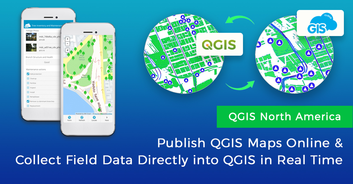
Last year GIS Cloud was happy to participate in the QGIS North America 2020 virtual conference on July 24th. We presented the GIS Cloud Publisher for QGIS, and its possibility to publish QGIS maps online preserving symbology, and how to use WFS to consume and collect data directly into QGIS via GIS Cloud, in real time!
In our 20 minute talk, we presented a perfect QGIS-GIS Cloud workflow, from publishing QGIS maps online and updating published maps using the GIS Cloud Plugin, to using WFS to consume GIS Cloud data in QGIS for more extensive analysis, or even collect data in real time, edit data and more.
Click here to watch the YouTube recording from the conference with comments and Q&A, including the QGIS plugin workflow and WFS functionality of consuming and collecting data into QGIS maps!
We also embedded our own video from YouTube, however, in this version, there are no questions:
Our own, Marta Klarić Ravnić (Product Designer for QGIS plugin), and Igor Farkaš (Head of Growth and GIS specialist) presented GIS Cloud Publisher for QGIS in a talk titled: “Consume your Field Collected Data Directly in QGIS Using a Plugin for Map Publishing”. They showed how the QGIS plugin enables you to upload your maps to the GIS Cloud platform in a matter of minutes. This way you can bridge the gap between the desktop and online GIS solution and publish your maps preserving your symbology.
The plugin also allows users to update changes made to QGIS projects and sync them to the published online map. Online maps in GIS Cloud can then be easily shared privately or publicly via an URL link, and it is also possible to grant different access to the map to different team members. This keeps everyone involved in sync about the progress of the project and facilitates collaboration.
Attendees got an exclusive preview and were able to witness how we enabled consuming the data from GIS Cloud in QGIS via WFS, a feature we released a few months ago! We will be happy to hear your feedback and advice on how we can further improve the plugin.
We also showed how you can use a Mobile Data Collection app to collect any kind of information related to location into GIS Cloud by filling in a simple (custom made) form on mobile devices, consume collected data directly in QGIS, and continue working on your data and perform analysis. You can consume any kind of online data stored in GIS Cloud directly in QGIS.
QGIS US User Group & partners in North America offer this virtual get-together to all QGIS users as a way to share ideas and skills when so many in-person meetings cannot safely happen. Travel and registration costs are not an issue this time. Attending the conference was be free of charge, but there is a donation channel available to support the volunteers that are tirelessly working on improving the QGIS software! Participants and guests from all over the globe are welcomed, but presentation times will focus on the North American audience. Regular presentation sessions will be streamed on YouTube (link is coming soon), with no registration needed, and no limit to the number of attendees.
If you want to try out the plugin yourself, create a GIS Cloud account, find the GIS Cloud Publisher for QGIS among QGIS plugins, and test it out, it’s free!