

Local authorities plan across the years. Budgets lock early. Procurement needs clarity. The real risk isn’t maps – it’s uncertainty: variable connector charges, hidden add-ons, and systems that don’t talk. GIS Cloud offers a route you can stand behind in committee: transparent pricing, zero-install rollout, and open integration so you keep what works and add only what’s needed.
Why predictability matters
Multi-year contracts demand stable costs and simple governance. Surprise “per-connector” fees, usage penalties, or locked ecosystems undermine forward plans. With a single, clear subscription and open APIs, you can forecast spend, defend it, and move faster when priorities shift.
Make operations visible
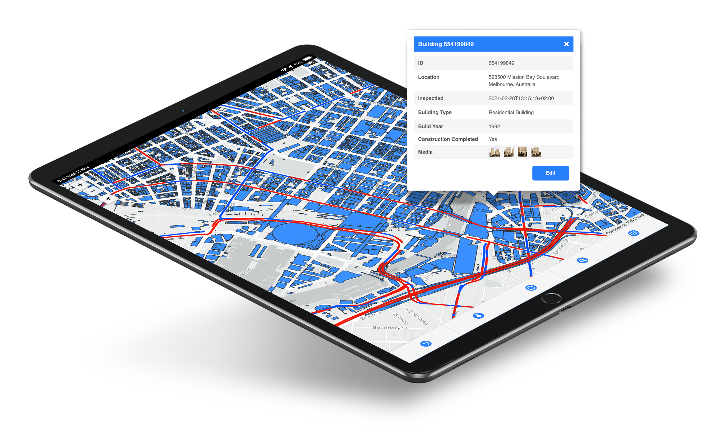
Operations are the heartbeat of council services. Crews capture data offline, sync automatically, and update one live map. Supervisors assign work, track progress, and publish reports without spreadsheet hunts. Photos, timestamps, GPS, and forms create an audit trail that supports internal review, FOI requests, and regulatory reporting. See the workflow end-to-end in our guide to Field Operations & Utilities.

Keep your stack and connect it
Most councils rely on a mixed estate. Keep QGIS for editing. Keep Power BI for dashboards. Keep external databases for authority records. GIS Cloud connects them through standards (WMS/WFS, GeoJSON) and APIs, reducing duplication and manual re-entry. Explore the patterns in GIS Cloud Integrations (Open by Design).
Start small, prove value, scale
Risk is lower when you begin with a narrow workflow, services, parks, highways, or housing. Instrument it. Measure adoption and cycle times. In comparable deployments, authorities cut project data-sharing times dramatically and reduced repeat visits, freeing budget for frontline work. Use Create a GIS Project in 3 Easy Steps to stand up a pilot in minutes.
Bring maps into Microsoft 365
If your organisation is standardised on M365, put maps where staff already work. Embedding GIS Cloud in PowerApps reduces hand-offs and training time while keeping identity, permissions, and records management under one roof. That means fewer context switches and more completed tasks. See PowerApps Integration for examples.

Integration without rip-and-replace
Modernisation should not break live processes. GIS Cloud links desktop GIS, databases, and reporting tools without forcing migrations. No rip-and-replace. No surprise “per-connector” charges. Just predictable spend and cleaner flows across teams, contractors, and partners.
Reporting, scalability, and customization
Leadership needs clear, comparable numbers, work orders closed, SLAs met, costs avoided. Use built-in reports or push data to your BI stack. Scale from one service to many by reusing schemas, forms, and permissions. When you need more, our team can deliver custom dashboards, branded portals, automation, and line-of-business integrations. See GIS Cloud Services for typical engagements and delivery guardrails.

What good looks like
- Data captured once, used everywhere
- Live maps for supervisors, planners, and finance
- Faster inspections and fewer revisits
- Cleaner evidence for audits and committee papers
- Predictable costs you can defend over the term
If a focused walkthrough would help, request a DEMO or speak with our Solution Consultants.