Smart cities aren’t built in one big project. They’re delivered day by day: a repaired pipe, a safer junction, a clearer public notice, a faster emergency response. Local authorities and their delivery partners need a GIS that helps work happen, without new complexity or surprise costs. That’s what GIS Cloud is designed to do.
With zero-install, cloud-first tools that are grations/”>open integration with the stack you already use, GIS Cloud helps you turn plans into outcomes. Field crews work offline. Office teams see updates in minutes. Citizens get the right information at the right time.
Why this matters now
Budgets are tight. Service expectations rise. Compliance windows shrink. The smartest move is often the simplest: get everyone working from the same live map. When engineers, inspectors, contractors, call-centre staff, and comms teams share a single source of truth, handoffs are faster and errors fall away. That is the foundation of a smart city.
GIS Cloud gives you that foundation, without ripping and replacing what already works. Use our tools where they fit best, connect to what you have, and scale when you’re ready.
One live map that lifts public services and utilities
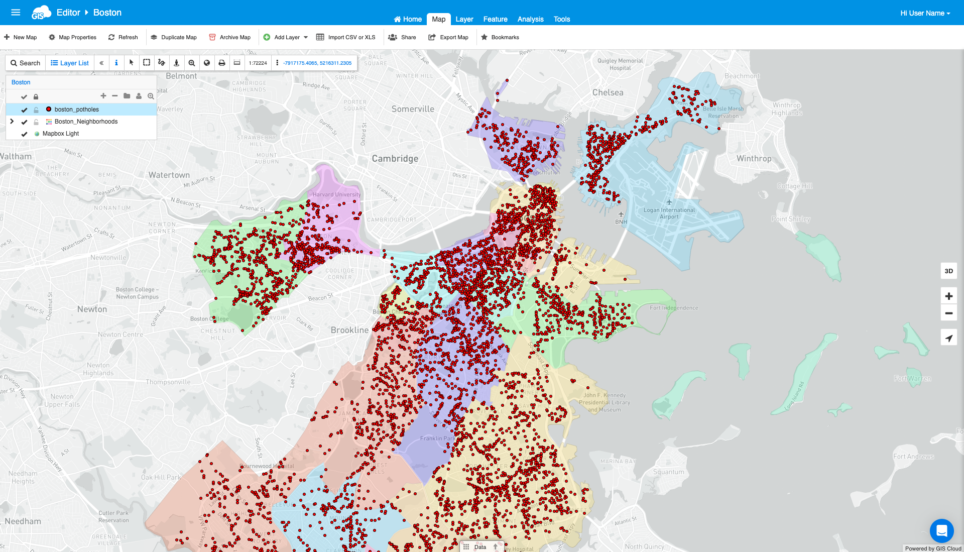
Most delays come from silos: copies of data in different places, different versions of the truth. With GIS Cloud, crews collect data once, and everyone sees it, allowing decisions to move faster.
Inspectors capture assets, defects, photos, and forms offline with Mobile Data Collection. When they sync, the office sees changes in Map Viewer within minutes. Editors can clean and style layers in Map Editor so every team and contractor works from a clear, consistent view.
The result is a quieter email inbox, fewer revisits, and shorter time-to-close. Authorities and contractors tell us they reduce rework and speed up approvals simply by sharing the same map, with the right permissions, all the time.
Mini example: If each inspection saves 10–12 minutes and you run 1,000 inspections a month, that’s roughly 167–200 hours saved. At €45/hour, you’re saving €7,500–€9,000 monthly before counting fewer truck rolls and faster approvals.
Public maps that inform and build trust
A smart city communicates well. Works schedules, road closures, detours, and outage areas are daily realities for residents and businesses. Publishing them clearly reduces inbound calls and raises trust.
With Map Portal, you can publish selected layers to the public while keeping sensitive information internal. Show the status of planned works, highlight diversion routes, share parks maintenance schedules, or gather feedback on consultations. Publish once, and everyone sees the latest version.
Teams like this because it’s simple. Citizens value it because it’s transparent. Leadership appreciates governance that is clear, with defined sources and clear ownership, resulting in less room for confusion.
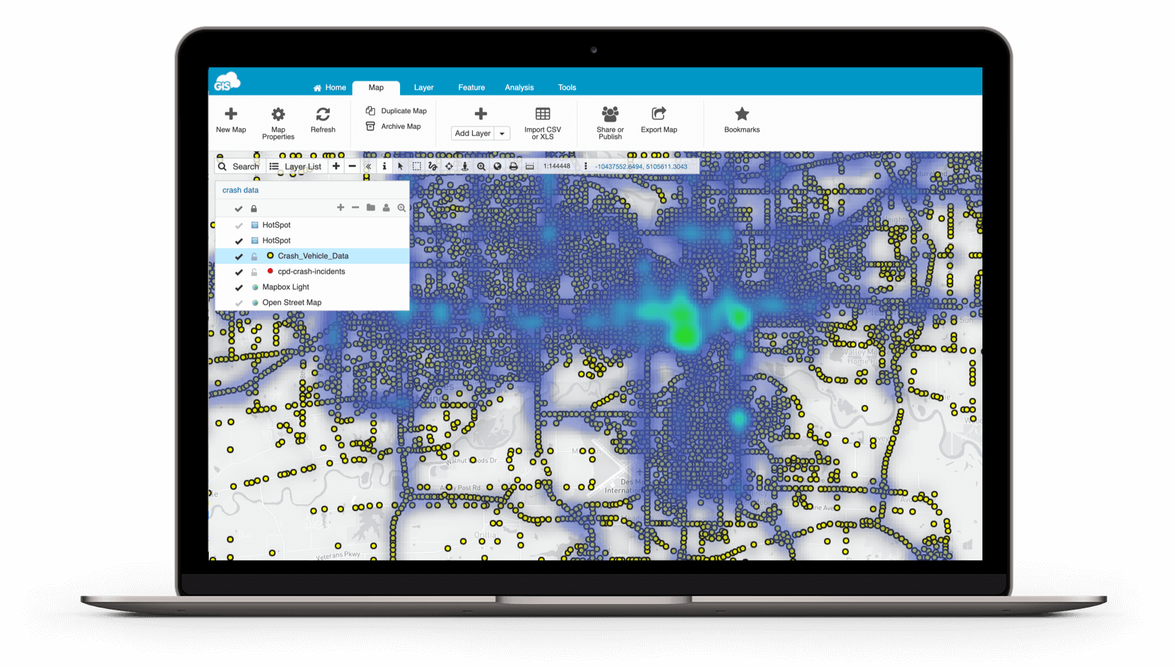
Geospatial that helps emergency response save lives
Emergencies demand a live operational picture, not yesterday’s spreadsheet. On a shared map, responders see incident locations, risk zones, nearby hydrants and valves, vulnerable assets, and safe routes updated as crews report from the field.
Field teams use Mobile Data Collection to capture hazards and status offline. Control rooms and partner services view a trimmed, simple map in Map Viewer with just the layers they need. Because GIS Cloud supports open standards (WMS/WFS/GeoJSON) and open APIs/webhooks, you can feed or consume information from other systems, reducing blind spots when seconds matter.
This is where collaboration turns into safety. When utilities, highways, and emergency services see the same truth, they coordinate faster, and outcomes improve.
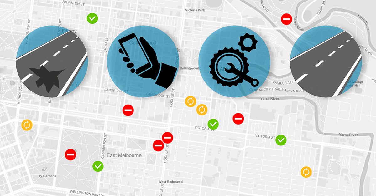
Better commutes and smarter transport decisions
Transport is where residents feel “smart city” every day: bus reliability, safe crossings, cycleways, resurfacing, and roadworks. GIS Cloud helps you see the network as it is today and plan what it needs next.
Survey bus stops, pavements, signs, and crossings with Mobile Data Collection (walking or vehicle-based). Maintain networks and attributes in Map Editor>, then share live routes and closures with contractors through Map Viewer. Publish planned disruptions and detours via the Map Portal so travellers can plan with confidence.
Because everything sits on one live map, you cut clashes between projects, reduce duplicate site visits, and shorten approvals. That means fewer surprises for commuters—and fewer complaints to manage.
See also: Road Work Inspections and Maintenance
Cloud collaboration that moves projects forward
Watershed cleanup events. Landfill remediation. Parks restoration. Multi-party projects succeed when everyone sees the same plan and the same progress.
Use Mobile Data Collection to structure forms, capture photos and geometry, scan barcodes, and work offline. Use Map Editor for QA/QC and versioned updates. Share read/edit access in Map Viewer with clear roles for partners, NGOs, and contractors. When transparency is part of the mandate, publish progress to the public via the Map Portal.
Managers get a reliable status view. Funders get the evidence they need. Regulators get clean reports. And teams lose less time in handoffs because the map is the meeting point.
Open by design and predictable by contract
Smart cities don’t happen in a vacuum. They rely on systems you already run. GIS Cloud is built to fit in:
- Open integration: Connect with ArcGIS/QGIS and Postgres/PostGIS. Use open standards (WMS, WFS, GeoJSON). Automate flows with REST APIs and webhooks to work order, CRM, or BI tools (Power BI/Tableau).
- Transparent pricing: Subscriptions you can defend. No usage-based surprises and no hidden connector/API fees.
- Zero-install rollout: Cloud-first means you’re operational in days, not months. Start small and scale team-by-team, reducing risk while building value.
- Offline for the field: Reliable capture, even when the signal drops.
If you need help mapping data, building integrations, or designing dashboards, our team can support you through Services/Customisation (or /custom-development/).
A simple path to value
Start with one workflow. Streetlight inspections, pothole surveys, and hydrant checks are processes with clear wins. Configure your forms and layers, import a small dataset, set KPIs, and train a small crew (often in an hour or two). You’ll see value quickly.
Roll out by department. Add roles and permissions, migrate layers, and connect to existing systems with APIs or webhooks. Put KPIs in front of managers. Create exportable reports for auditors and regulators.
Adopt authority-wide. Expand to additional services (utilities, drainage, parks, transport). Publish selected information to the public where it helps. Formalise governance: ownership, naming conventions, retention, audit trails.
This steady approach reduces risk, protects budgets, and builds internal confidence one live workflow at a time.
Why authorities standardise on GIS Cloud
Because it works and keeps working. Authorities and contractors need fewer surprises, faster outcomes, and tools their teams actually use. GIS Cloud provides a single, shared map that removes friction between field and office, improves public communication, and supports decisions that save time, money, and at times lives.
Discuss your use case with a Solutions Consultant. If you’d rather test, spin up a 14-day test environment.