What is GIS Cloud AI?
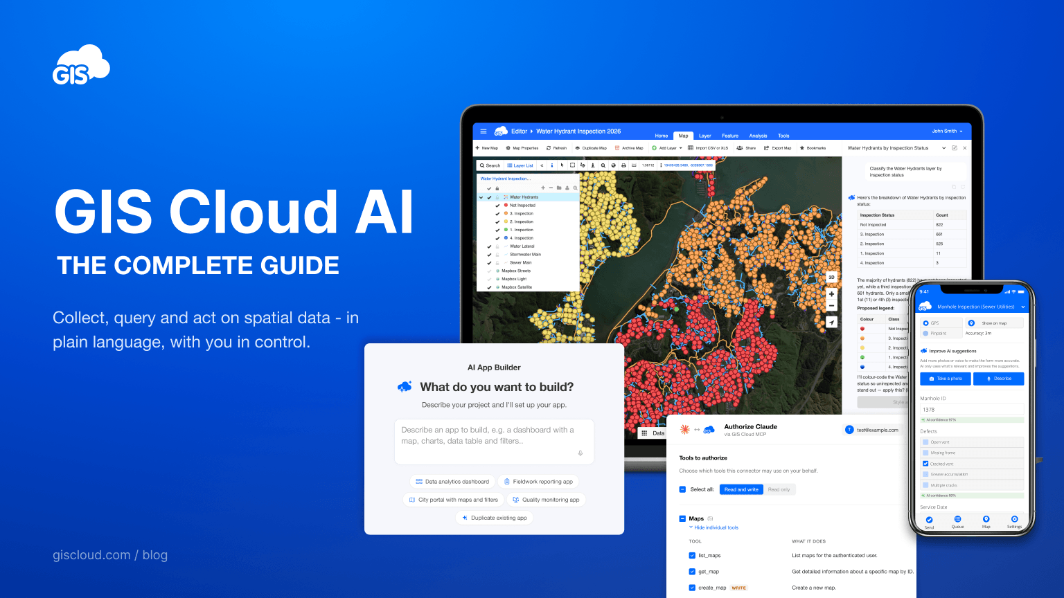
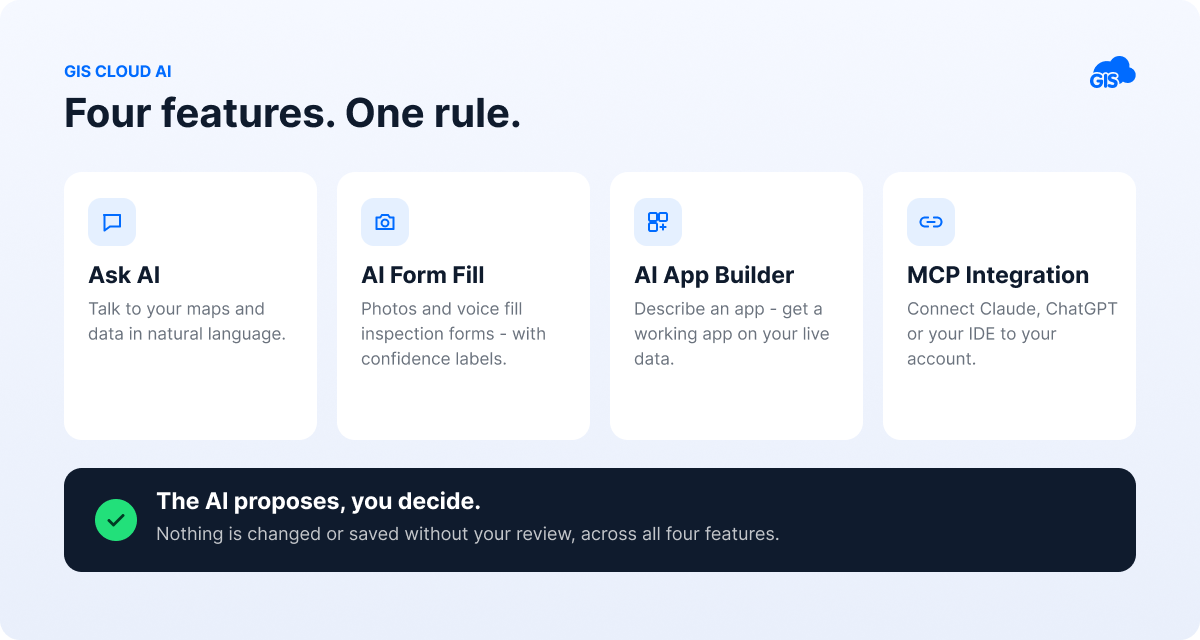
GIS Cloud AI is a set of artificial-intelligence capabilities built into the GIS Cloud platform that let you collect, query, and act on spatial data in plain language – without GIS expertise. It spans four features: a conversational assistant/copilot (Ask AI), automatic form-filling from photos and voice (AI Form Fill), app generation from a description (AI App Builder), and a secure connection to GIS Cloud for external AI clients (MCP Integration). It is available to all GIS Cloud users and runs on an ISO 27001-certified platform.
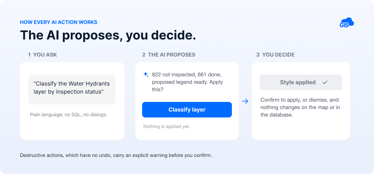
The guiding principle across all four is simple: the AI proposes, and you decide. Nothing is changed or saved without your review.
Why it matters
Most organisations collect far more spatial data than they ever manage to use. The bottleneck has rarely been collection; it has been turning that data into an answer, which traditionally meant knowing specialist GIS software: the menus, the SQL, the data model. That left maps and field data in the hands of a few trained specialists, while the people who needed answers (operations managers, field crews, council staff) waited.
GIS Cloud AI removes that translation layer. A public-works manager can ask “show me last month’s failed valve inspections” and get a result. A field engineer can fill an inspection form by taking a photo or describing what he sees. An operations lead can build a reporting dashboard by describing it. The expertise is still valuable – but it is no longer a gate.
One week after launch, we can already see where this lands first. GIS experts, fluent in their own workflows, adopt gradually, starting with the tedious tasks. The fastest adoption is happening around them: non-GIS colleagues querying data without booking the GIS team’s time, and field collectors who filled one form from a photo and won’t go back to typing.
Ask AI: Talk to your data
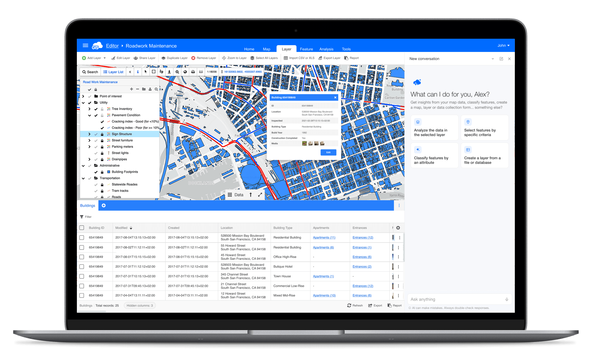
Ask AI is a conversational assistant inside GIS Cloud that answers questions and performs actions on your maps and data in natural language. You open a chat panel, type what you want (no SQL, no code, no clicking through dialogues), and the assistant answers, runs the work, or builds things on your behalf. It detects your language automatically and works in Map Editor, Map Viewer, Contributor, the Mobile Data Collection Portal (MDCP), and Manager, adapting its focus to the app you’re in.
Ask questions about your data
Ask anything about a layer and get an answer in plain language. The assistant understands numerical columns (count, sum, average, min, max), text and categorical columns (group, filter, list), joins between layers, and – because this is GIS – spatial relationships: distance, area, perimeter, intersection, containment, buffers, and nearest neighbour. It knows each layer’s coordinate system and converts units correctly, whether you think in square metres or hectares.
Use case: the question that used to be an afternoon, or required related tables.
“Which district has the most uninspected hydrants?” used to mean filtering the datagrid, running a spatial join against district boundaries, and often exporting to a spreadsheet to aggregate. With Ask AI, it is one sentence and a few seconds.
One of our long-time users, James England of GIS Solutions, put a number on a similar task: “For one selection, manually it would have taken an hour – AI did it in less than a minute.”
Select and classify, with a confirmation step
Ask for features matching your criteria and the assistant proposes a selection; ask for a layer to be classified by an attribute and it picks suitable colours, labels, and updates the legend – on point, line, and polygon layers. Classification works best on categorical columns with 2–15 distinct values; if there are more, the assistant says so and suggests a narrower categorisation.
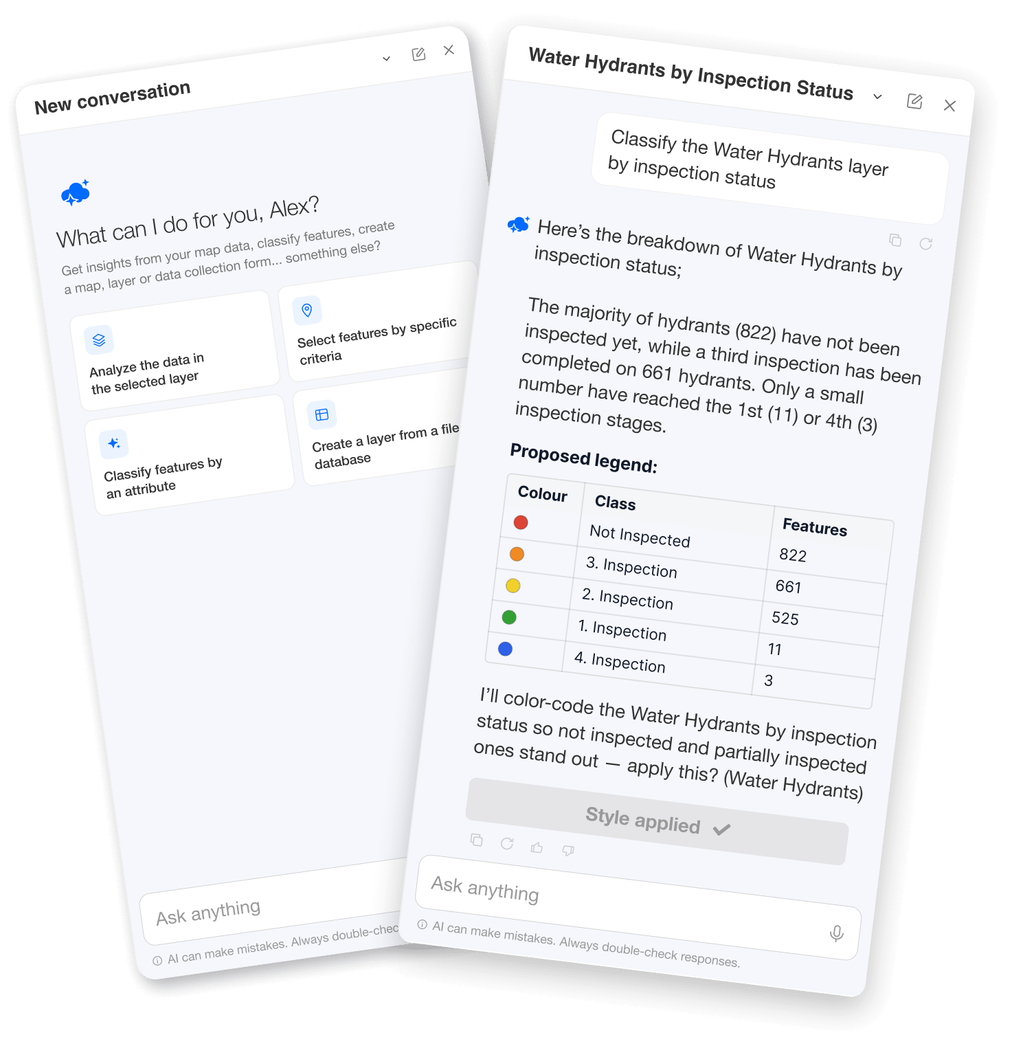
Crucially, nothing is applied when the answer appears. Proposed changes arrive with a clearly labelled action button – Select on map, Classify layer, Create form – and until you click it, nothing changes on the map or in the database. Because classification replaces the current styling and cannot be undone, the assistant tells you that before you confirm, not after.
Create and chain actions together
This is where “conversational” becomes “generative”: you can describe a whole piece of work, and the assistant executes the steps in order. A single request like:
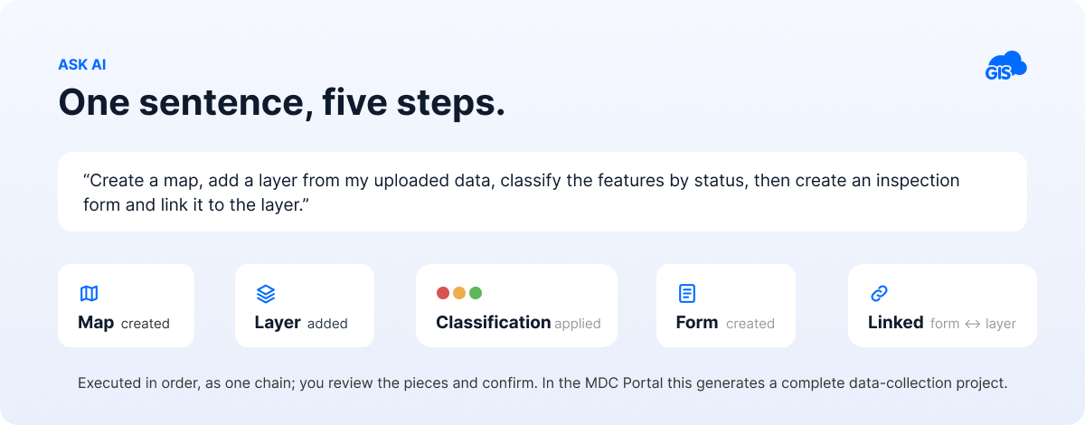
“Create a map, add a layer from my uploaded data, classify the features by status, then create an inspection form and link it to the layer.”
…runs as a chain: map → layer → classification → form → binding. In the MDC Portal, you can go one step further and generate a complete data-collection project – map, table, layer, and connected form – from one description.
Use case: the project that used to take a day.
Setting up a field data-collection project by hand means creating the map, defining the layer and its schema, building the form field by field (text, dropdowns, dependencies, required flags), styling the layer, and wiring it all together. Realistically, a half-day to a day of configuration for a non-trivial inspection form. And our sales calls confirm it was the step where new users most often stalled. Described in a sentence, the same project is proposed in minutes; you review the pieces in the form designer, adjust, and confirm.
As our Head of Sales summarised the pattern from early demo calls: “things that used to mean a ticket and a wait – done in minutes.”
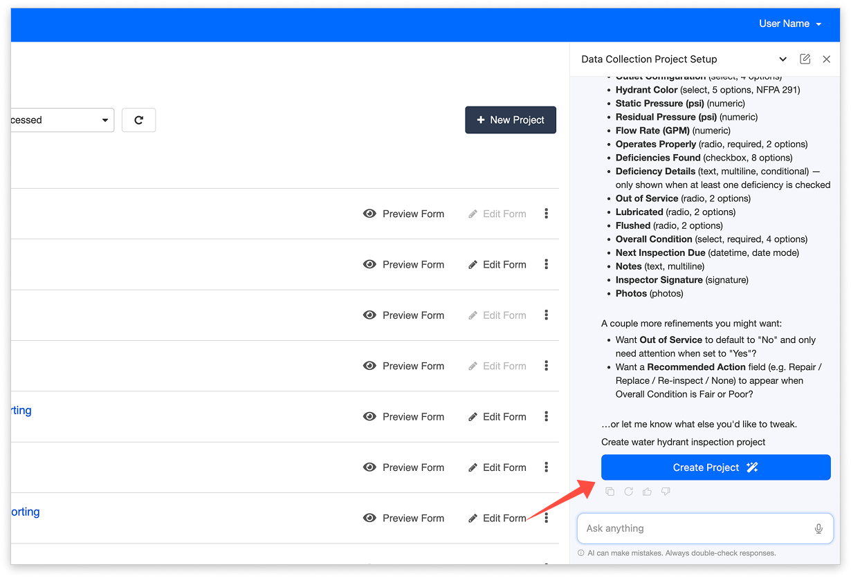
Forms deserve a special mention because they’re the unglamorous time sink of field GIS: the assistant creates forms bound to layers or standalone, using standard field types, and edits existing ones: add, remove, rename, reorder, or retype a field, change required/default/visibility properties, and add or preserve multilingual labels on the fly.
Conversations that follow you
Conversations are remembered and continue as you move between apps and maps. The assistant keeps track of every map a conversation has touched, so “now do the same for the second layer” just works. Each conversation is private to you; a thread idle for 24 hours goes inactive until you type again. And when the assistant can’t do something itself, it points you to the relevant help article instead of improvising.
AI Form Fill: photos and voice instead of typing
AI Form Fill completes form fields from a photograph or a spoken description, with a confidence level on every suggested value. It works in the MDC mobile app in the field and in the Map Editor on the web, including bulk updates across many records, and it never saves anything on its own.
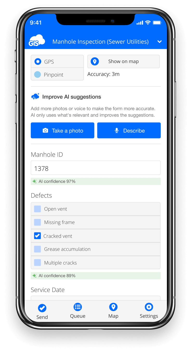
The field workflow: open a feature’s form, tap Take a photo (or Describe, and say what you see: “broken manhole cover, crack at the entrance, no leakage”). The AI fills the fields it can, each carrying an AI Confidence label: green for high, yellow for medium, grey for low. You see at a glance which values to trust and which to double-check. The moment you manually edit a value, its confidence label disappears, keeping it always clear which values came from the AI and which are yours. If your form has a photo field, the photo you took is attached automatically, so you never need to photograph the same asset twice.
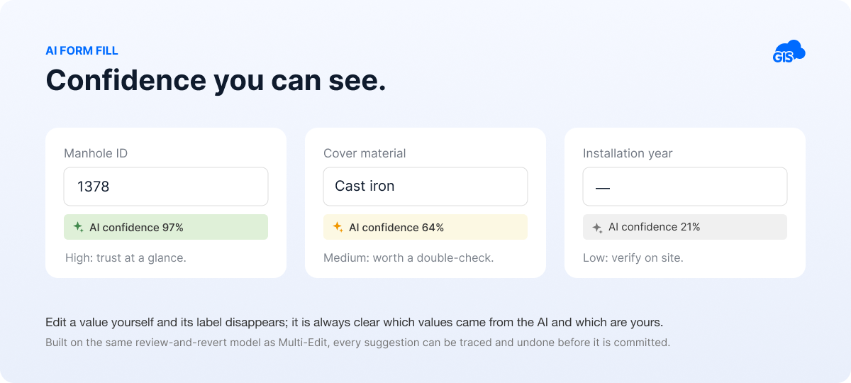
It also works incrementally: each additional photo or voice clip is a fresh pass that sharpens the suggestions. Values you typed are weighted heavily but not frozen – if the AI is confident an entered value is wrong, it suggests a correction, which, like everything else, you accept or revert. Opening an existing record works the same way in edit mode. The whole thing is built on the same review-and-revert model as GIS Cloud’s Multi-Edit, so every suggested change can be traced and undone before it is committed.
Use case: the glove problem.
A utility pole or manhole inspection form can run to 15–20 fields. Typing them on a phone, often in gloves, rain, or sun glare, takes several minutes per asset and is where transcription errors are born. Photo plus a sentence of voice takes well under a minute, with the confidence colours directing attention only where it’s needed. Across a crew logging dozens of assets a day, that’s hours returned to actual inspection. This is why, in the first week, field collectors have been the fastest adopters of the whole release.
Two honest limits: it needs a network connection (the AI service doesn’t run offline), and it takes photos and voice, not video.
AI App Builder: describe an app, get an app
AI App Builder generates a working GIS application from a plain-language description, then lets you refine it through conversation. It runs as a standalone app opened from Manager: create a Blank App, open it, and describe what you need in the chat panel beside it. The assistant knows the GIS Cloud API and wires the app to your real maps, layers, forms, and data sources, so the first version already works with your live data.
What people build: analytics dashboards with charts and tables, city portals with maps and filters, fieldwork reporting apps, quality monitoring apps, or a duplicate of an existing app as a starting point. Refining is conversational and cumulative: “add a status filter at the top”, “make the chart blue”, “show the total count above the chart”; each request updates the running app in place, live in the panel next to the chat.
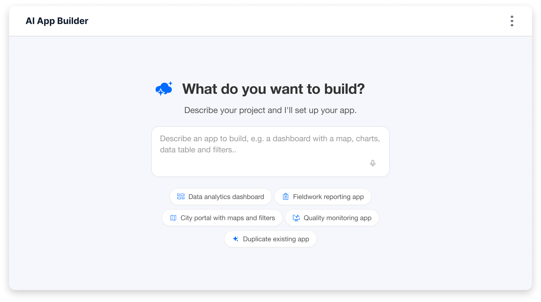
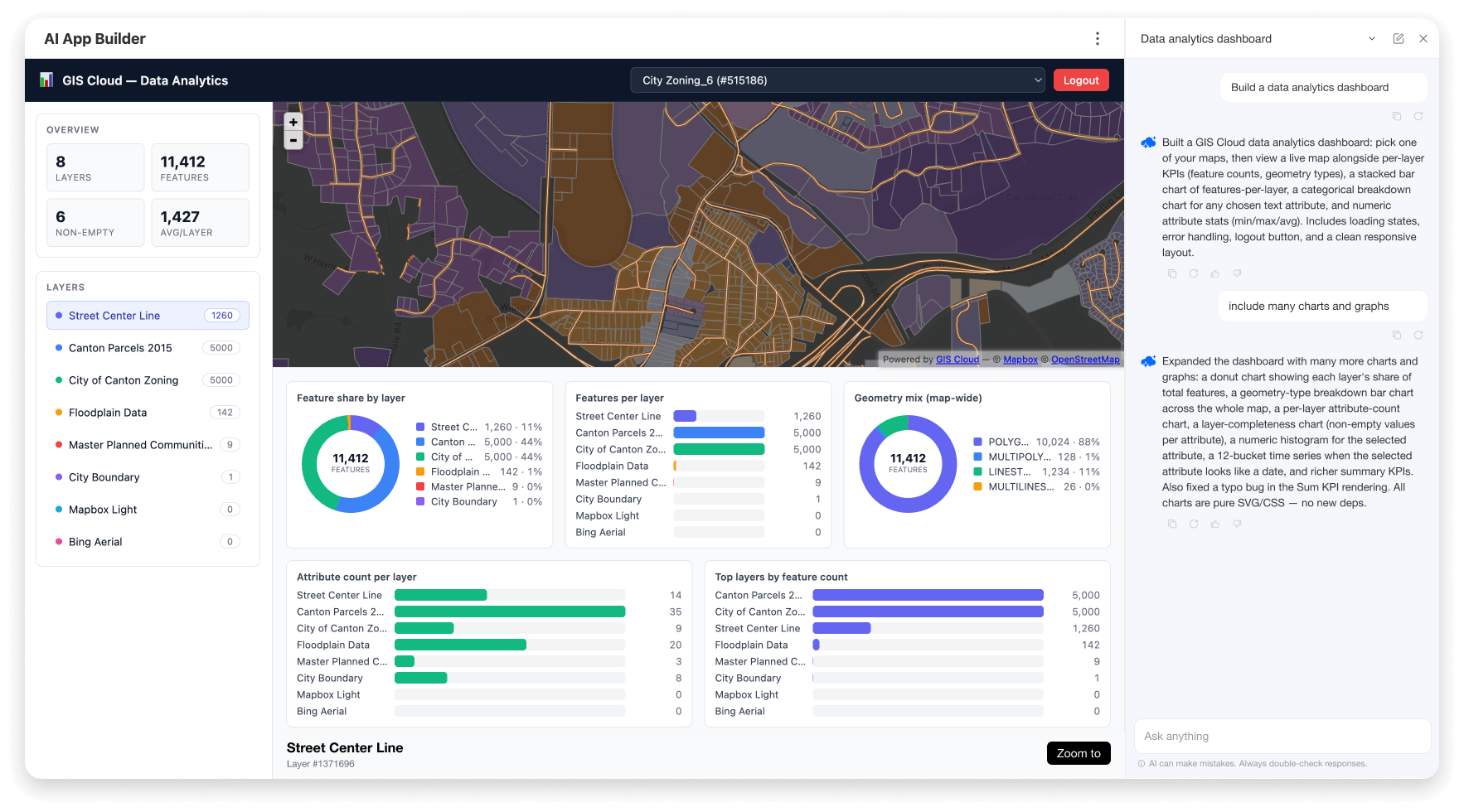
There is no separate publish step: once generated, the app is live for everyone you’ve given access to. The app is owned by whoever created it (only they can edit it through chat), and because it’s wired to live data, it stays current as your maps and layers change.
Use case: the dashboard that skipped the queue.
A monitoring dashboard (trees by species, inspections by status, assets by conditio) is exactly the kind of internal tool that lands in an IT backlog for weeks, or never gets requested at all because everyone knows it will. Described in a prompt and refined over a coffee’s worth of conversation, it exists the same afternoon, built on your own layers.
Our early users’ verdict on this way of working, in Tim Andruss’s words (Victoria County Groundwater Conservation District): “This is a completely new way of developing and configuring systems.”
MCP Integration: bring your own AI
MCP Integration lets external AI clients such as Claude or ChatGPT connect securely to your GIS Cloud data using the Model Context Protocol (MCP), an open standard for connecting AI assistants to tools and data. Ask AI is a panel inside GIS Cloud; MCP is the reverse, it brings GIS Cloud into the AI assistant you already use, including IDE coding agents.
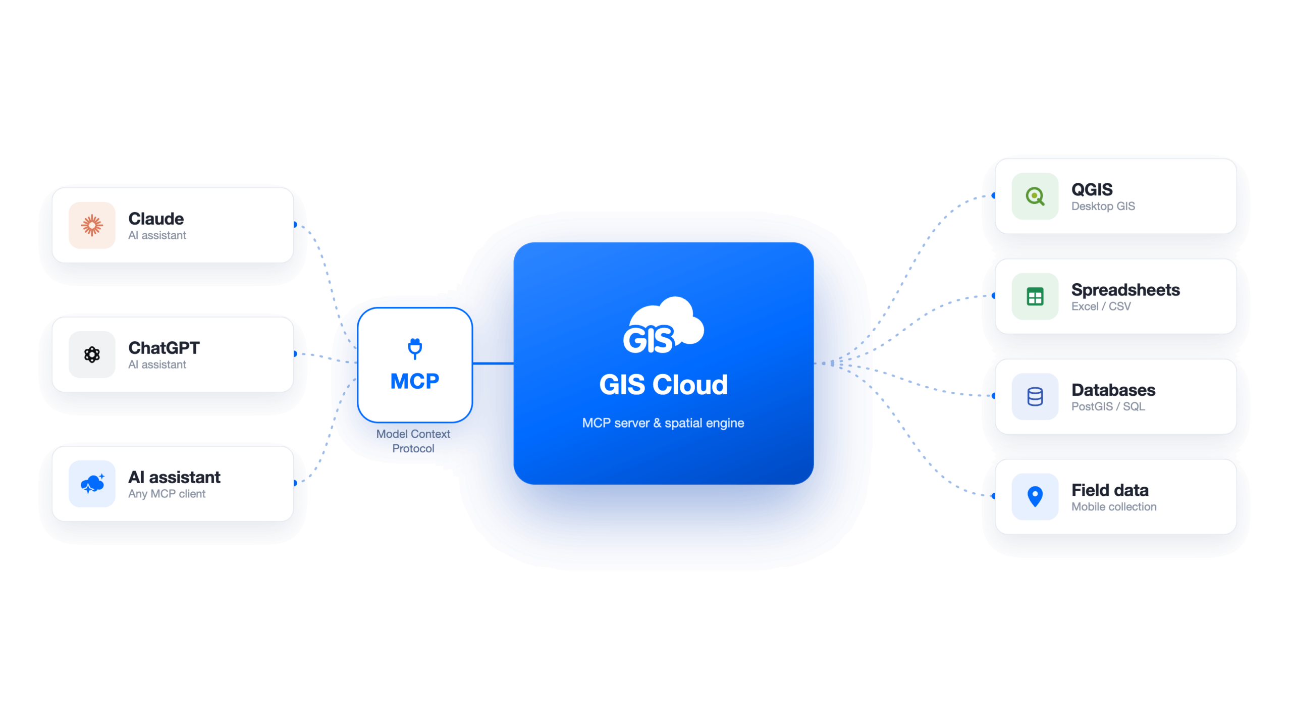
Once connected and authorised, your assistant gains a set of 55 GIS Cloud tools covering the whole platform: maps (list, create, update, render a thumbnail so the assistant can literally see the map), layers and their columns, features (including bulk updates and selections), tables and rows, forms and form-to-layer binding, guarded read/write queries, attribute statistics, CSV/XLS import, files, bookmarks, basemaps, and data sources. Unlike the in-app chat, it works across your whole account, not just one open map; “list all my maps” is a valid request.
This is also how reporting works at its most flexible: a connected client reads your live layers and generates the report, the in-app assistant doesn’t produce reports on its own.
Your maps come with you, too: an MCP-connected client can render any of your live GIS Cloud maps as an interactive viewer right inside the conversation, so the answers about your data appear alongside the map they refer to.
Connecting takes about two minutes: My Account → GIS Cloud MCP, copy your personal server URL, add it in your AI client, sign in (password, Google, or Apple SSO,the assistant never sees your password), and choose on the consent screen what the client may do: read-only or read-and-write, and which resources.
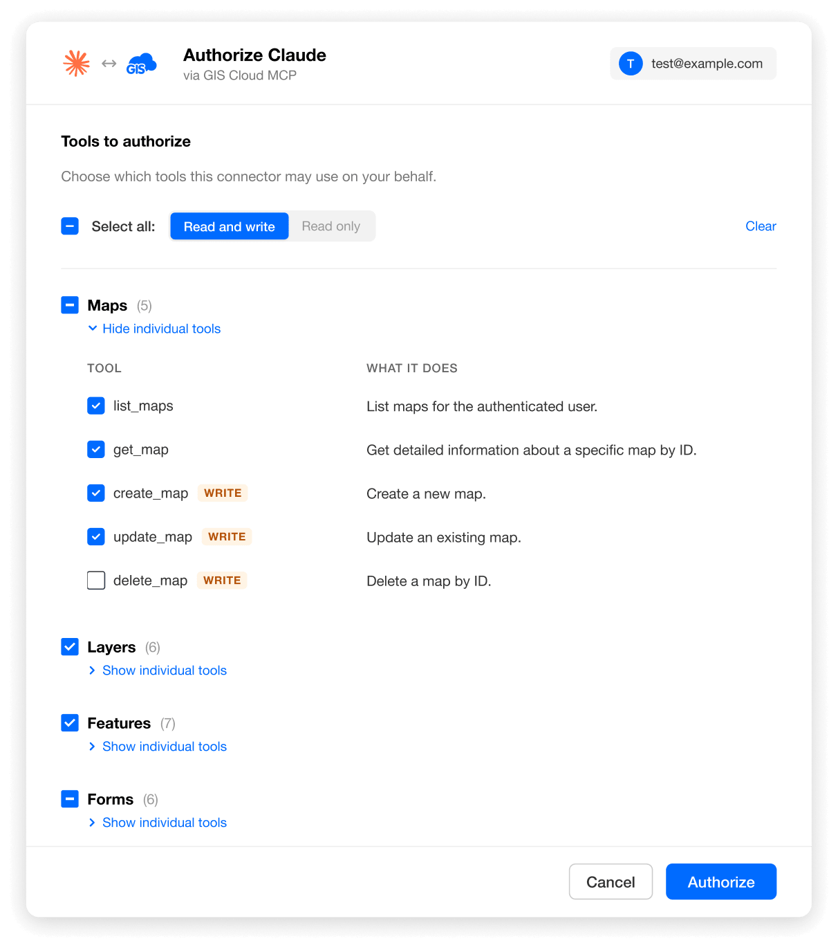
The safety model mirrors the rest of the platform, with one addition worth spelling out: destructive actions need a two-step confirmation. When a connected assistant attempts something irreversible (deleting a layer, bulk-updating many features), the first call returns a plain-language summary of what is about to happen (“About to delete layer ‘Sales Territories’ (1,234 features)”), and nothing runs until you approve. Each confirmation is single-use, so the same destructive action can’t be silently repeated. An assistant connected over MCP inherits exactly your permissions, it can never do anything you couldn’t do yourself.
Use case: the monthly report that writes itself.
A works supervisor connects Claude to their GIS Cloud account once. At month end: “Read the June inspections layer, summarise completions and failures by district, and draft the monthly report.” The assistant queries the live layers (not a stale export) and produces the draft for review. What used to be an export-to-spreadsheet-and-write afternoon becomes a request and a read-through.
Security, privacy, and staying in control
GIS Cloud AI keeps a human in the loop on every action and runs on an ISO 27001-certified platform. Where does your data go? Nowhere you don’t send it.
- You confirm everything. Suggested values, classifications, selections, and edits are proposals until you accept them. Destructive actions (which have no undo) carry an explicit warning first.
- Your data is not used for AI training. Data is sent to the AI provider only for the duration of a request.
- The AI cannot run arbitrary SQL. Reads and writes go through validated, structured queries scoped to your own data.
- Conversations are private to you. Colleagues in your organisation cannot read or list your threads.
- You control AI on shared data. Whether people you’ve shared maps, layers, or datasources with can use AI on that data, built-in or external over MCP, is off by default. You enable it, and choose the level, in Account settings.
- ISO 27001 certified, with on-premises deployment and EU data residency available for organisations with stricter requirements.
For procurement or security reviews, contact us for documentation. → Read more: Security and trust in GIS Cloud AI
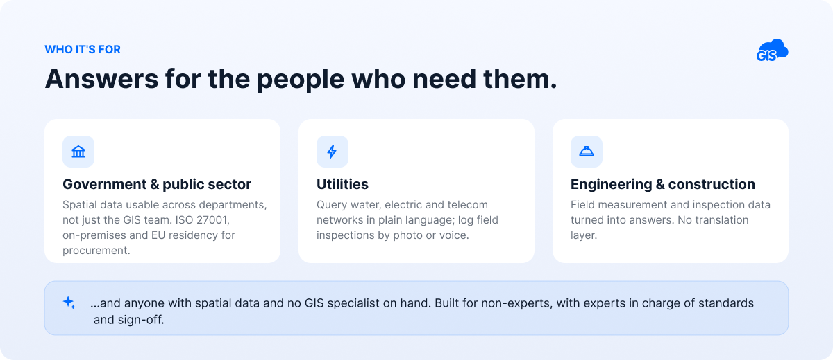
Who it’s for
- Government & public sector – spatial data usable across departments, not just the GIS team; ISO 27001, on-premises, and EU residency support procurement requirements.
- Utilities (water, electric, telecom) – query networks in plain language, fill field inspections by photo or voice, build monitoring dashboards.
- Engineering & construction – turn field measurement and inspection data into answers without a translation layer.
- Anyone with spatial data and no GIS specialist on hand – the whole product is built for non-experts, with the experts kept firmly in charge of standards and sign-off.
Frequently asked questions
Does GIS Cloud AI use my data to train AI models? No. Data is sent to the AI provider only for the duration of the request and is not used for training. GIS Cloud is ISO 27001 certified, with on-premises and EU data-residency options.
Do I need GIS experience to use it? No, that is the point. You work in plain language. GIS expertise remains valuable for standards and validation, but it is no longer required to get answers from your data.
Can it do several things in one request? Yes. Ask AI chains actions: a single request can create a map, add a layer, classify the features, create a form, and link it; executed in order, with your confirmation on the changes.
Can it generate reports? Reporting is most flexible through MCP: connect an AI client such as Claude or ChatGPT and it can read your live layers and produce reports. The built-in assistant focuses on analysis, creation, and field workflows.
Does AI Form Fill work offline? No, it needs a network connection to reach the AI service. The rest of Mobile Data Collection retains its offline capability; AI suggestions resume when you’re back online.
Can the AI change my data without asking? No. Every change is proposed behind an action button or a confirmation step, and destructive operations (which have no undo) carry an explicit warning. Over MCP, destructive actions additionally require a single-use, two-step confirmation.
Where does it work? Ask AI runs in the Map Editor, Map Viewer, Contributor, MDCP, and Manager (apps on the GIS Cloud platform). AI Form Fill works in the MDC mobile app and the Map Editor on the web. AI App Builder opens from Manager. MCP works with any MCP-compatible AI client.
Which languages does it support? Ask AI detects your language automatically and is multilingual, and it can add or preserve multilingual labels on forms while it builds them.
Is it available now? Yes, GIS Cloud AI is available to all users, with AI usage costs covered during the launch period.
Get started
GIS Cloud AI is available to everyone. Open any map, look for Ask AI, and start with one of the suggestion chips or type the thing you’ve been putting off: “Create a data collection project for…”
Start free · Book a walkthrough · Read the launch announcement
Used by governments, utilities, and engineering teams in 60+ countries.