

Smarter public services, built on live data
Connect assets, inspections and works on a single live map, so highways, drainage, housing and parks teams can plan, prove and deliver with confidence.
The challenge
Scattered data, reactive decisions, rising scrutiny
Demand climbs while budgets stay flat. Highways, drainage, parks and housing data sit in different systems with different IDs, and nobody owns the full picture.
Publishing a public map means an IT ticket. Mobile capability is weak, so inspectors work on paper and the office retypes the results. When a councillor asks why a road is still a problem, the honest answer is “we need to pull a few systems together and check.”
How GIS Cloud helps
Assets, inspections and works, finally joined up
One live operational map
Bring highways, drainage, parks and housing layers together so patterns, such as repeat complaints near known constraints, finally show.
Field inspections that stick
Inspectors capture defects, photos and condition on a phone, tied to the right asset, online or offline.
Public & member-ready maps
Publish a controlled view to residents and councillors from the same live data, with no stale PDFs.
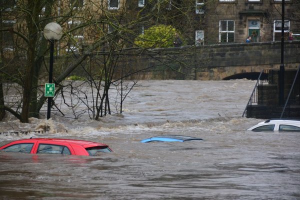
From a flooded B-road to a clear answer
- 1Capture once: crews record gully condition and cleaning status on a mobile form, geotagged and time-stamped.
- 2See the catchment: the office filters gullies not cleaned in a year and overlays repeat flood complaints.
- 3Act with evidence: works are packaged by risk, and members get a clear map instead of a delayed report.
Powered by GIS Cloud AI
Ask your asset base a question
“Which gullies in this catchment haven’t been cleaned in the last year?” GIS Cloud AI reads your layers and answers with the number, the list and the features mapped. You review and confirm before anything changes.
Explore GIS Cloud AIThe toolkit
Apps that power government
Case study
GIS for local authorities
 Government
Cutting administrative costs
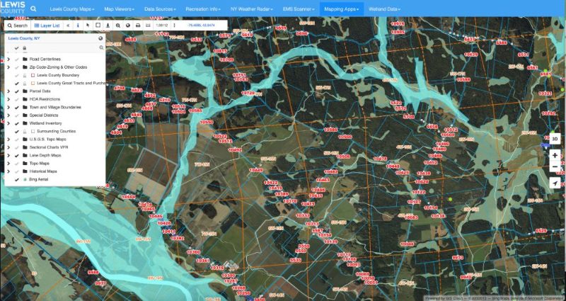
Cutting Administrative Costs With Online Maps: Lewis County
A small New York county replaced outdated mapping software with GIS Cloud — opening cadastre, tax maps, zoning and utilities to the public on one live portal, while field crews collect data straight into the cloud.
Read the story“Collected field data is automatically uploaded into the cloud. It makes it very easy to add data points on site and provides us with a continuous workflow in the field and office.”
“Another great thing is collaborating and sharing private maps in the Map Editor with others before they are published to a public map for everyone to view. It’s efficient because we don’t have to print out a dozen maps for each person.”
Related reading
Government use cases


Pilot one asset group
on a single live map
Start with one corridor, ward or estate and show how working from one map reduces surprises. No credit card, no setup.