
Build, edit, and analyze maps with gen AI
Create maps, layers and tables in plain language, classify and select features by describing them, and surface analysis and insights on demand, all while editing collaboratively in real time, field to office. Online GIS interface, with an AI assistant built in.
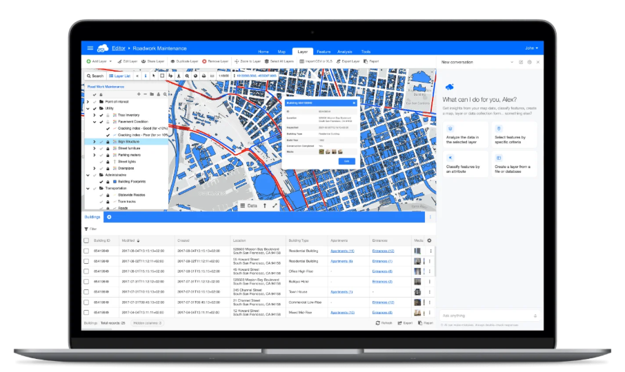
Map Editor
Visualize, share and organize data in real time
Core GIS features
Draw points, lines, and polygons, add multiple layers and basemaps, and style data using rich symbology. Edit features in bulk. A wide range of vector and raster formats is supported.
Advanced collaboration
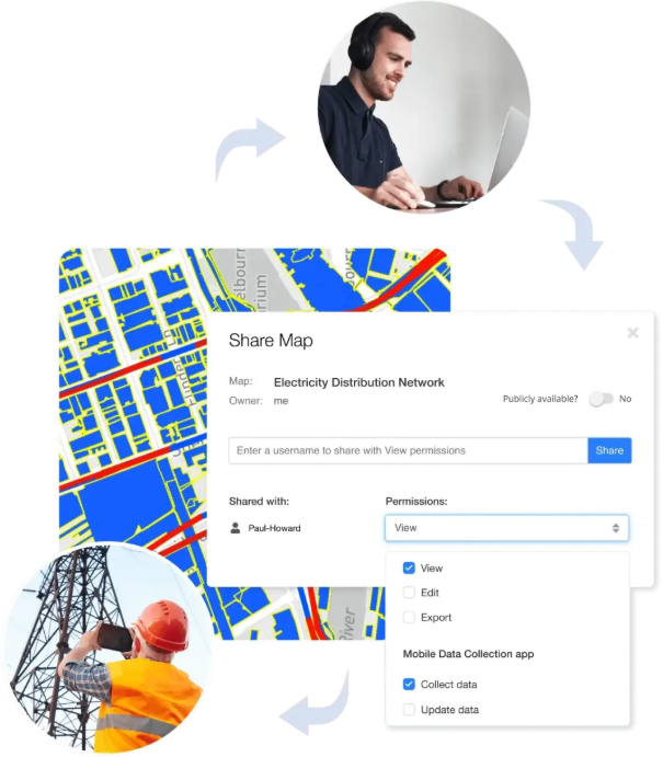
Share your maps to edit data and symbology in real time. Use permissions to control who can view, edit or collect data, whether an individual or an entire group.
Handles big data
Built with modern web technologies for full vector-based editing and real-time database updates. The map engine smoothly renders large datasets, even millions of records.
"With AI in Map Editor I just clicked on the layer and, using my voice, said 'tell me all the ash trees that are semi-mature' and bang, it did it. Even the dictation was quicker than opening ArcGIS. Doing the analysis just by voice worked really well."

Create custom maps online
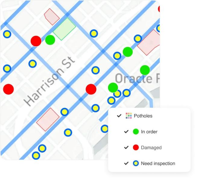
Style your data exactly how you need it, or just describe the look you want and let Ask AI propose it.
- Draw points, lines and polygons with snapping
- Custom symbology: icons, colors, thematic wizards and label management
- Data-driven rules show real-time status on the map
- 3D view with terrain and custom DEM
Effectively manage data
Bring every source into one place: files, databases, images and services, and keep it organized.
- Upload, organize, edit and share data from various sources
- Database tables, files, images and live services
- Ask AI can count, filter and aggregate across layers
Easily share maps and collaborate
Share maps, data and specific layers, privately or publicly, with precise control over who can do what.
- View, Edit, Export and Collect permissions, per user or group
- Share private maps via a simple Map Viewer interface
- Edit field data collected with Mobile Data Collection
Publish and export maps and data
Take your maps anywhere: embed them, serve them as standards, or export for print and analysis.
- Embed maps into a website
- Publish maps through WMS and WFS
- Export high-resolution raster images for printing
- Join, spatial filter, projection and merge wizards
Powered by GIS Cloud AI
Ask AI lives right inside the Editor
Create layers, run buffers and joins, and classify or select features just by describing them. The assistant proposes the change on the canvas. You review and confirm before anything is saved.
Explore GIS Cloud AIDo more with your data
Extend to other GIS Cloud apps
Mobile Data Collection
Build custom survey forms and collect the data you need from the field, powered by AI Form Fill.
Map Viewer
Stakeholders can access your project privately through a simple, always-current viewer.
Map Portal
Share data and maps with the public. Create a branded Map Portal in less than an hour.
Create your first map
in minutes
Start free and build, style and share a map today, with an assistant built in. No credit card, no setup.