
Publish QGIS maps to GIS Cloud,
then just ask
Publish maps, layers and styles from QGIS to GIS Cloud in one click, then continue the work with AI. Run analysis in plain language, build forms, collect field data, create apps and reports, and share live maps your team and stakeholders can see.
- One-click publish from the QGIS plugin
- Layers and styling carried across faithfully
- Keep editing in QGIS, share live in the cloud
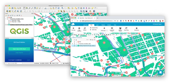
Publisher for QGIS
From desktop QGIS to live web maps
Native QGIS plugin
Install the plugin and publish straight from QGIS, with no export-and-upload busywork.
One-click publish
Push layers and styling to GIS Cloud in a click; your web map mirrors what you see on the desktop.
Hybrid workflow
Keep QGIS for deep editing and analysis; use GIS Cloud for mobile collection and sharing.
"We don't even know how we managed to do our business without GIS. GIS Cloud helped us define the processes and educate our crew about the workflows."

Publish layers and styles together
What you style in QGIS is what your audience sees online.
- Vector and raster layers supported
- Symbology and labels carried across
- Re-publish to push updates any time
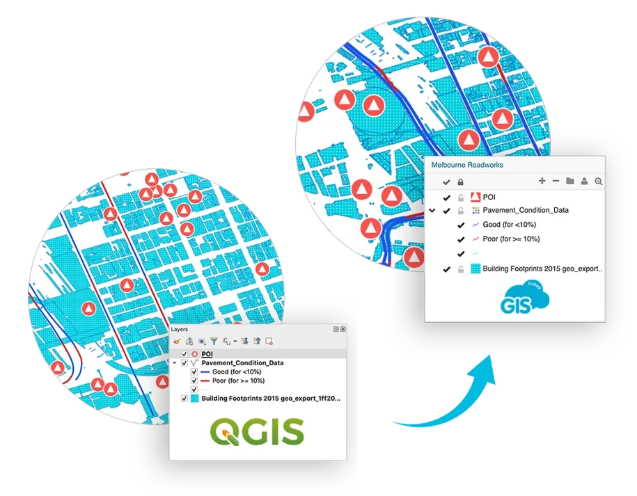
Keep your hybrid workflow
Desktop power where you need it, cloud reach where it counts.
- Analysts stay in QGIS
- Field crews collect with Mobile Data Collection
- Stakeholders view live in the browser
Share the moment you publish
A published map is instantly ready for the rest of GIS Cloud.
- Open in Map Editor for web styling
- Share via Map Viewer or Map Portal
- Control who can view or edit

Powered by GIS Cloud AI
Web-ready maps, AI-ready data
Once published, your QGIS layers live in GIS Cloud, where Ask AI can query them, classify features and build views in plain language. Your desktop work, now conversational online.
Explore GIS Cloud AIDo more with your data
Extend to other GIS Cloud apps
Publish your QGIS
maps to the cloud
Install the plugin and share your first QGIS map online today. No credit card, no setup.