Give us some information about your work and get a personalized demo.

GIS Cloud Publisher for QGIS
Bridge the gap between desktop QGIS and the rest of the world with our QGIS plugin for map publishing!
Your QGIS + GIS Cloud workflow
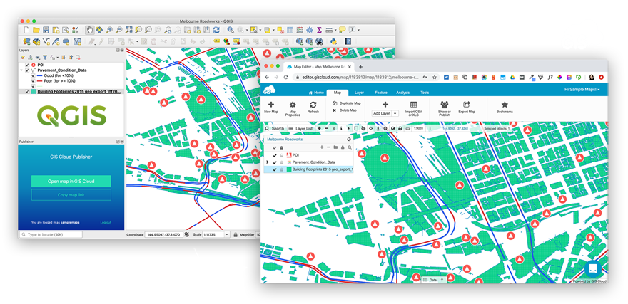
Make your QGIS maps available online. Instantly!
Publisher for QGIS plugin enables you to upload your maps to the GIS Cloud platform in a matter of minutes. Follow these three steps and you’re all set.
- Open your QGIS map and install the plugin
- Publish your map or only specific layers for a fast workflow
- Include photos, audio, QR codes, barcodes and more
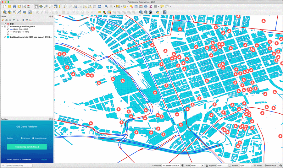
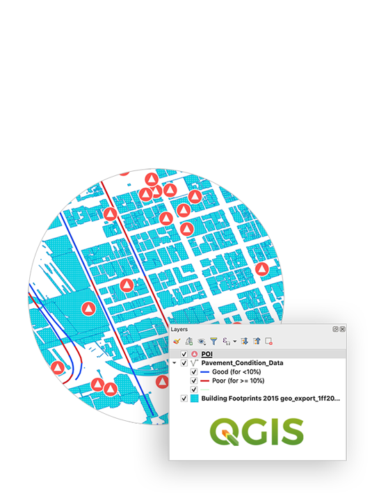
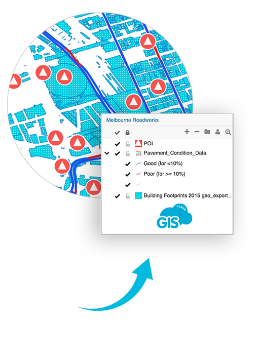
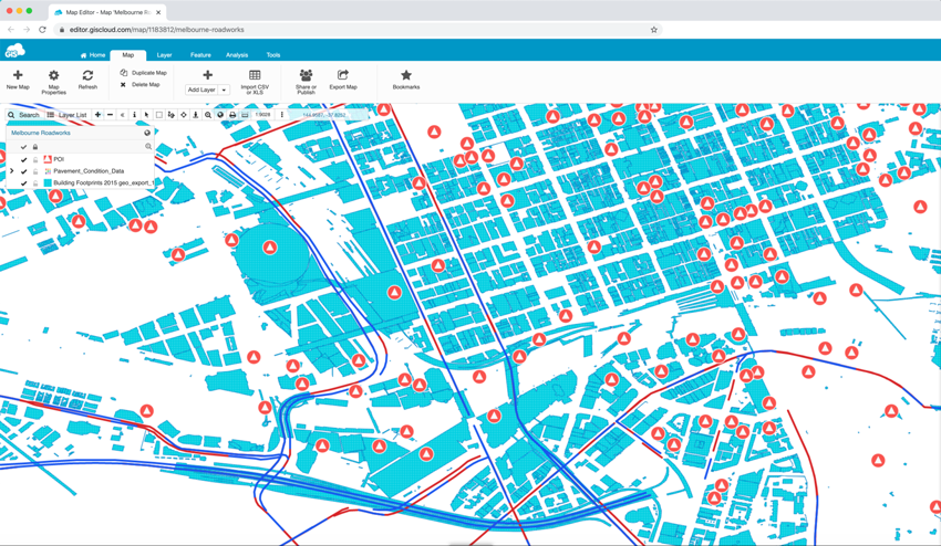
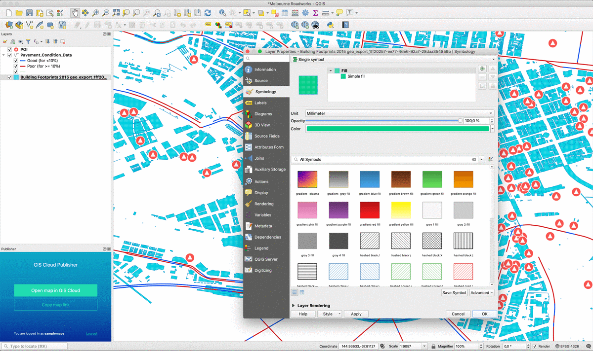
Publish maps from your desktop GIS preserving symbology
QGIS plugin supports a large array of map symbology. Points, lines, polygons, categories and labels are supported completely.
This allows you to seamlessly transfer your QGIS data (vectors, rasters, wms, wfs) and styles.
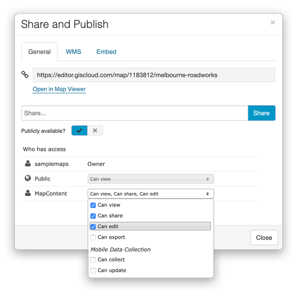
Share your QGIS maps online - publicly or privately
You have complete control over who can access your data and a choice to upload your maps as public or private.
Share your public maps with anyone by simply sending them a map link.
Embed any public map to a website with a highly customizable iframe, or create your own branded Map Portal.
You can share your private maps with collaborators inside GIS Cloud. Just assign them permissions to Edit data and help you with your project, or to only View data an gain insight. It’s up to you.
Update your map or only specific layers
Maps uploaded to GIS Cloud can easily be updated directly from QGIS, using the plugin. Sync all the changes made to your QGIS project as you continue working.
You can also add additional layers into your published GIS Cloud maps by uploading new data or connecting to external databases and services.
Learn all about QGIS plugin possibilities in this tutorial.
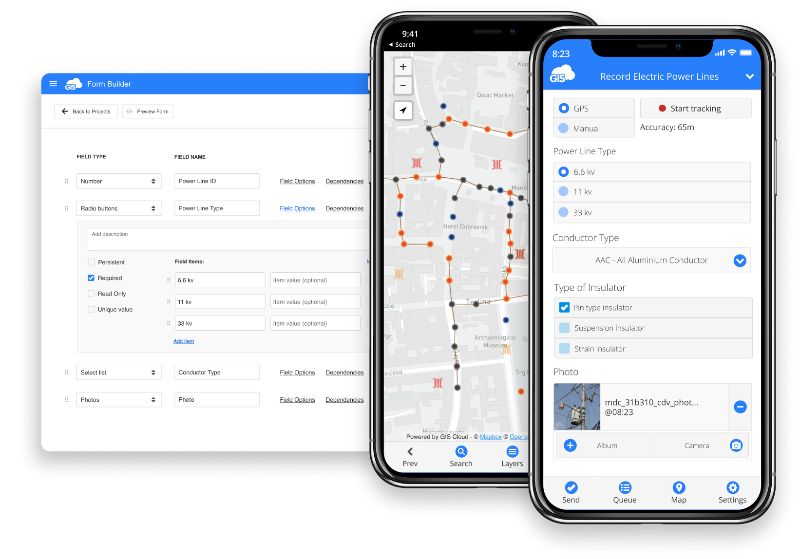
Use your published QGIS maps to collect or inspect data in the field
Once you have published your maps to GIS Cloud, you can use our Mobile Data Collection app to inspect published data or collect data in the field directly into your maps.
Want to share your maps online?
To start publishing maps, create your GIS Cloud account, open QGIS and install the plugin!
Terms of use & Privacy policy © GIS Cloud Ltd