Give us some information about your work and get a personalized demo.

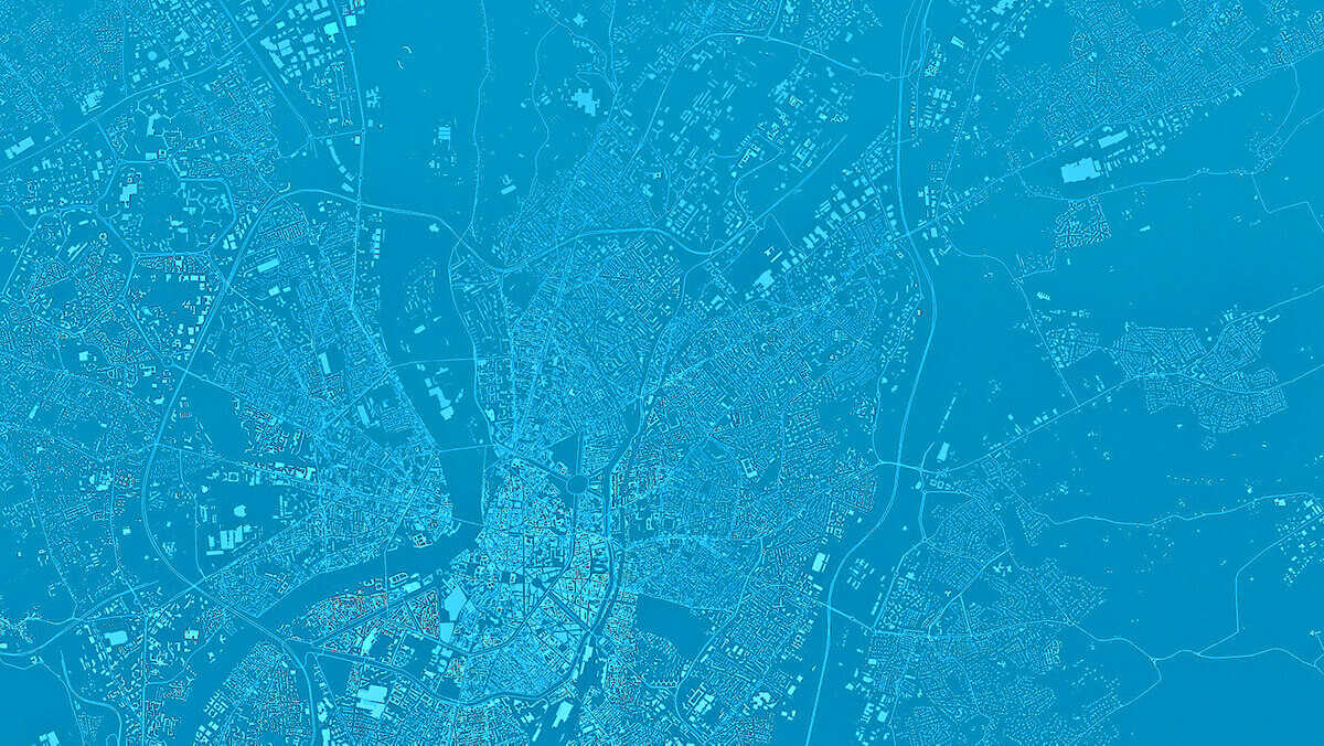
Real-time Mapping
From field to office
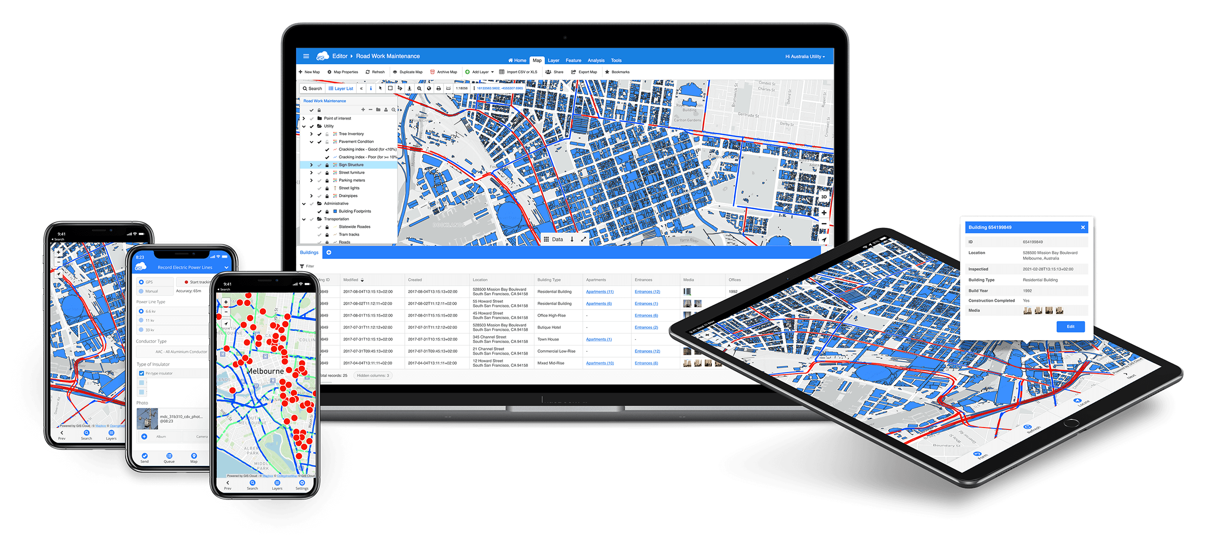
Fast and powerful online GIS for operations management
Work ONLINE, OFFLINE or install the platform ON-PREMISES
Field data collection
Offline collections are stored on your phone and synced automatically when online.
Data and team management
Manage teams and jobs, assign tasks and make informed decisions.
Map editing and sharing
To share data and maps with the public, convert your project into a branded Map Portal in less than 30 minutes.
Collaborative Mapping Solution
▸ Field Data Collection
▸ Data and Team Management
▸ Map Editing and Sharing
Collaborative Mapping Solution
▸ Field Data Collection
▸ Data and Team Management
▸ Map Editing and Sharing
See How it Works →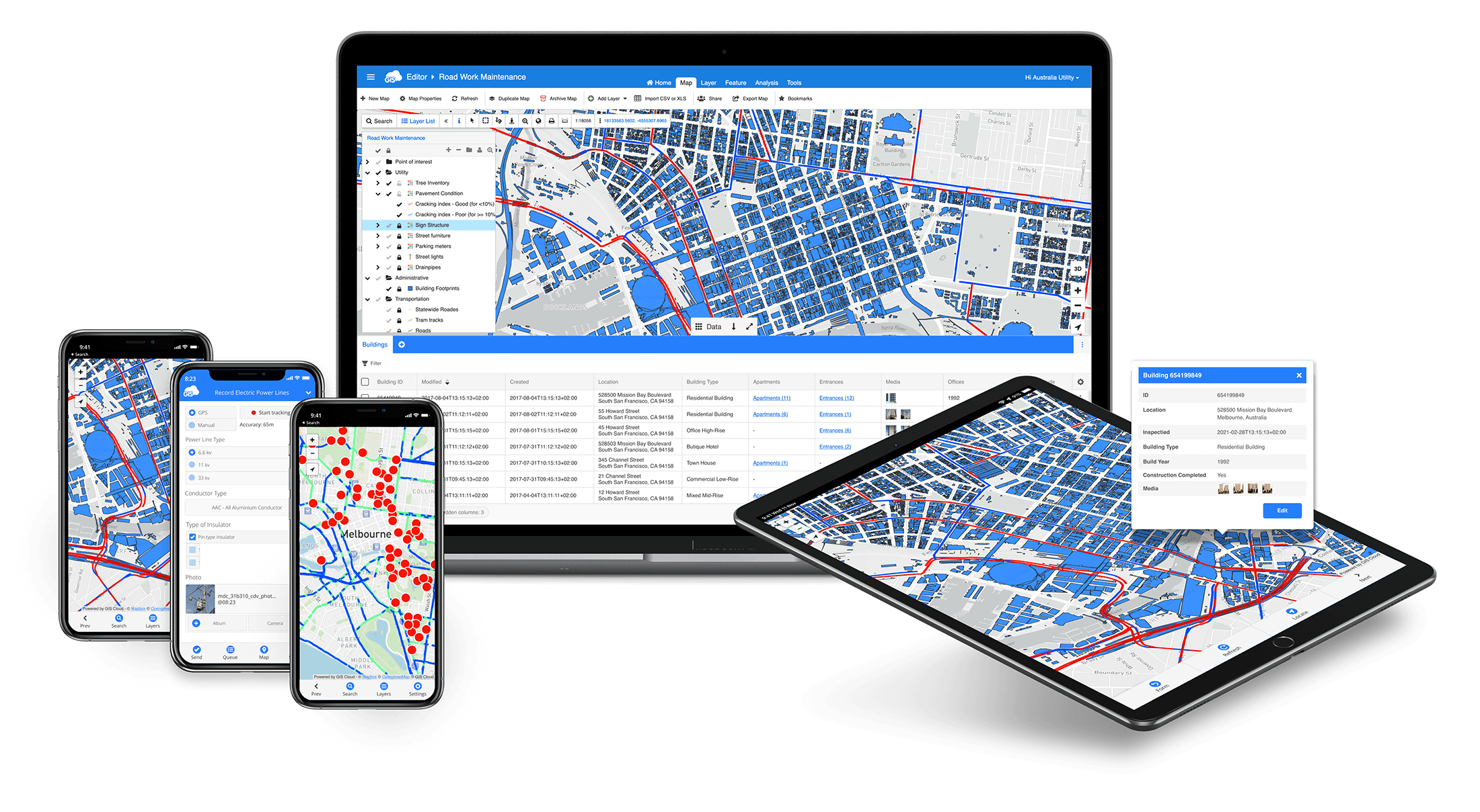
With Mobile Data Collection app collect points, lines and polygons directly in the field


New Product!
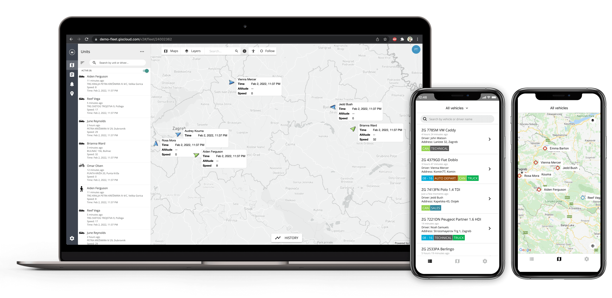
GIS Cloud Track
Visualize people, fleet and assets on a map in real-time.
Track their location and get in-depth reports, charts, and historical data, based on many parameters.


"Every day, we learn more and are increasingly happy with the results!
GIS Cloud has provided a business opportunity that we hadn’t realized before. Our minds are blown away with the potential!"
BRIAN CHILD
Opus International Consultants LTD
"Mobile Data Collection has changed my entire work process. The ease of use, and the power of real time results, even off the cell or internet networks, is so powerful. The ROI an organization receives from this type of technology more than pays for itself.”
DARREL LARSON
International Director for Sawyer
I am a user of ArcGIS and I have achieved more in 5 minutes with GIS Cloud than I did in about 1.5 years before.
User from Bournemouth, UK
You guys are amazing!
Being able to spin up a GIS portal so quickly is fantastic!
TOM SOMMERS
Old Bridge Township
"GIS Cloud has done all the heavy lifting of coding and made a very user friendly solution for me, and it is affordable. I believe there are huge opportunities for other nonprofits to embrace this technology as part of their workflow.
The ease of use, and the power of real time results, even off the cell or internet networks, is so powerful!"
DARREL LARSON
International Director for Sawyer
Many of our map layers have over 500,000 vectors/features, the largest being over 11,000,000. The ability to upload, store and display very large datasets was key to our selection of GIS Cloud as a hosting company.
Technologies Management Inc.
Trusted by organizations around the globe
The ease of use, and the power of real time results, even off the cell or internet networks, is so powerful.
The ROI an organization receives from this type of technology more than pays for itself.”

I used GIS Cloud Map Editor as a collaborative tool with my Students at IPMaia in the context of a course on Geo-Spatial Web and Location Based Systems.
GIS Cloud revealed to be a perfect bridge between the learning needs of my students and a mature market solution and service, thus fostering students' "contextual learning" and preparing them for the future. GIS Cloud team backed up the initiative enthusiastically and gave me great support.

So flexible I hardly feel like I need knowledge of lower level web map libraries for application creation.
The Map Editor web application acts as a browser based full featured GIS interface with transparent pricing, security compliance, easier customization of interface, easier to train new users."

We are solving the problem of field data collection with GIS Cloud MDC. We enjoy the benefit of using an all in one solution for our field data collection activities including assets mapping and customer Enumeration.
No complexity at all. All in one product for field data collection, field activity monitoring & visualization, and seamless data sharing.

GIS Cloud can help local communities to understand GIS as a daily tool for planning and decision making.
It has enough functionalities for professional work with any kind of task in infrastructure planning and documentation. Very good import/export functions for standard GIS-data.

When I joined the company in 2017, there was no adequate digital geographical solution for problems like orientation, planning and locating the borders of the estate parcels.Finally, I found GIS Cloud. Antonija (Key Account Manager) helped me through the journey of defining the processes, setting the environment, educating me and my crew about the workflows.

recent from GIS Cloud
Grounded Innovation: Reflections on GEO Business & Digital Construction Week 2025

By Andrew Loveless, CRO, GIS Cloud It’s been an energising week for the geospatial and construction tech community. With parallel…
We Welcome Andrew Loveless as Our Chief Revenue Officer

Driving Strategic Growth and Expanding Industry Impact With over 300 clients in 60+ countries, we’re entering a new…
Take Your GIS Expertise to New Heights with Our Advanced Courses!

Ready to take your GIS skills to the next level and stand out as a leader in the industry?…
Terms of use & Privacy policy © GIS Cloud Ltd