
Over the years, GIS rapidly changed the Real Estate Industry with advanced and accurate information of assets.
Real estate companies are aware that successful problem solving is connected with a detailed understanding of their spatial information.
GIS provides an accurate and visual representation of properties that real estate professionals or clients wish to invest in or sell.
This particular case study covers a scenario where our clients, the Providence Group, explained how online GIS helped them utilize their everyday workflow. Now, they have a better sense of all of their commercial real estate services, including brokerage, property management, development, and corporate services.
With a primary focus on retail, the company actively represents clients throughout the Carolinas and strives to provide an efficient, dedicated and innovative level of service and support to all of its customers.
Real Estate Spatial Data Challenges
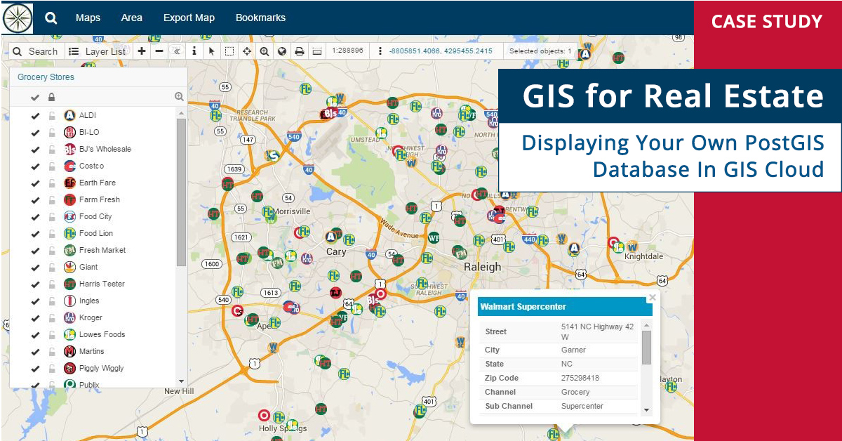
One of the biggest challenges Providence Group had was to display their own PostGIS database and file geodatabase in the cloud.
This helped their clients make the most of their every location with great online mapping power and data research with all of the valuable information and data visualized in one place. GIS and Real Estate business revolves around location, and having that property location accessible in real-time is one of the key aspects of finding land or property for the clients.
Analyzing geographic information and spatial data is an everyday challenge for many real estate agencies. Having a PostGIS database online opens up a strategic potential without any need of connecting hardware or software in-house requirements.
You can even connect an external ORACLE database in GIS Cloud if needed. Also, having Google Maps Tile Map Service (TMS) as a feature was essential for their client’s workflow.
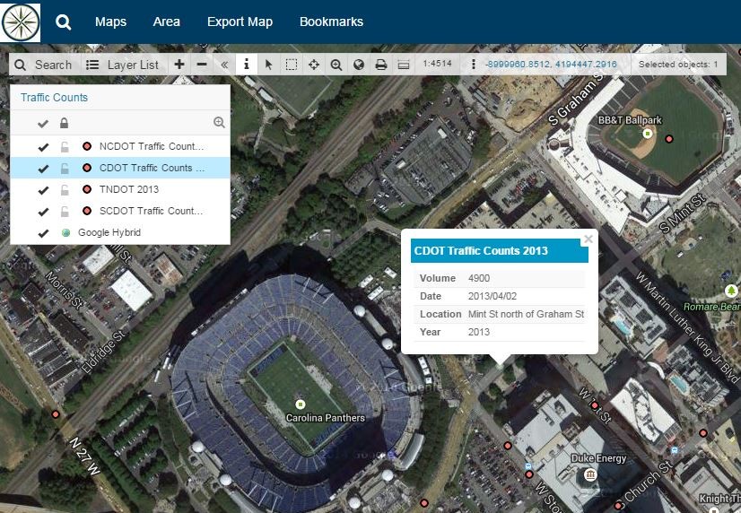
Traffic Count Viewer: showing how many cars pass a given site a day
Implementation of Online GIS Is The Future Of Real Estate
Implementing the GIS Cloud solution helped the Providence Group successfully display their own PostGIS database and file geodatabase they have built over the years.
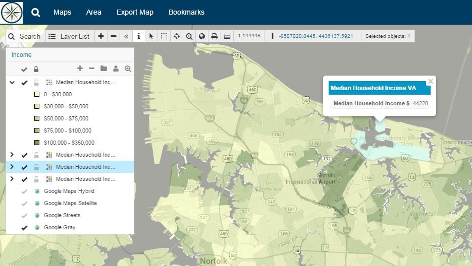
Instead of constantly updating static maps, they can now create their maps with the Map Editor application. Different types of data can be presented in distinguished layers with appropriate custom symbology and color-coding, like:
- Soil type
- Topography
- Land size
- Ownership
- Zoning
- Value
- Flood zones,
- Municipal boundaries,
- Traffic
- and much more
Additionally, competition, demographics, and different data analysis types like buffering, heat maps, trade areas, drive times, etc., are used for site selection and location analytics in commercial real estate.
- Filter your locations by popularity
- Locate new areas of interest and opportunity
- Compare sites that have the best return on capital investments
Using white labelled, branded Map Viewer and Map Portal applications, with a custom interface as a go-to solution for data visualisation and decision making improved many aspects of data sharing and reporting privately and publicly.
With just a couple of clicks, they were able to present crucial data and information to clients, subcontractors and management.
With the GIS Cloud solution for Real Estate, you can develop marketing strategy and plans, develop a deeper understanding of factors that impact property value and optimize your real estate services.
Map Collaboration and Data Understanding Provide Better Opportunities
Providence Group showed us that successful real estate companies know how to utilize online GIS to improve their business model and form a detailed understanding of their assets. GIS Cloud apps are great for any data comparison, analyzing the pros and cons of real estate investments, land evaluation property development or new business decisions.
Key features that helped Providence Group focus more on the property selling value rather than spending hours behind the desk were:
- Fast Database Connectivity
- Numerous Symbology Options
- You can upload your custom icons
- GIS Cloud plugin Publisher for ArcMap saves symbology from your ESRI shapefiles when publishing maps to GIS Cloud
- Tile Map Services (TMS)
Transform your tedious spreadsheets into beautiful data-driven maps with adequate custom reports that will help your clients understand their property’s value.
Improve communication with your clients and team members, quickly utilize market opportunities and capitalize on them.
GIS Cloud is fully scalable, pay for what you use online platform with no desktop installation required. White label GIS apps are enormous opportunities to grow your brand reputation in the market. GIS Cloud can provide you with your personalized custom-tailored white label GIS application!
You can easily scale your app subscriptions at any time per your project needs, get new subscriptions or downgrade if your project scope changes.
If you are interested in using GIS Cloud for real estate projects, Sign up for the free 14-day trial.
You can also contact our Solution Consultants to help you set up a desirable, customized GIS Cloud solution for your specific needs and workflow!