
The City of Amsterdam is one of the most bicycle-friendly large cities in the world and is a center of bicycle culture with a good cyclist infrastructure. Therefore there is a pressing need for a quality maintenance of bike lanes, racks, poles and different types of bike infrastructure on regular basis. Learn how they implemented a GIS solution to track real-time pole statuses directly on a map.
Challenges in maintaining and managing safety bike poles
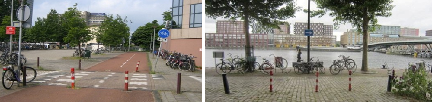
As District East has many bike lanes, in order to prevent cars from entering these lanes, specific poles are used to block access. After a specific time, these poles need to be checked and possibly replaced to conform to the latest standards. The workflow would start by checking the poles manually and assigning a status to them. To do that the City of Amsterdam turned to GIS Cloud and its solutions for asset management.
Key challenges in maintaining bike poles.
- A need to map out many bike poles in the district and assign them a status
- Possibility to display all the bike poles in one map
- Ability to assign monitoring statuses to each of the bike poles
How to map infrastructure assets with real-time data
Mobile Data Collection was an ideal solution for the City of Amsterdam as it provided them an intuitive tool for collecting information on bike poles around the city using mobile devices.
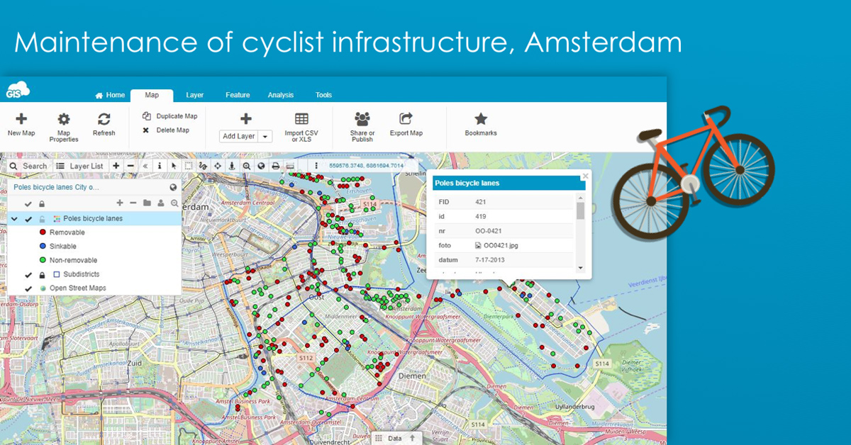
They created an interactive map of bike poles in Map Editor with a map layer that had an associated custom survey form to it. Accessing the mobile app, workers in the field could populate the predefined survey form with required data (including photos) on each pole, making their workflow a simple and user-friendly process. This easy to use solution completely eliminated the need for any unnecessary paper and allowed the monitoring staff to quickly and effectively resolve their tasks.
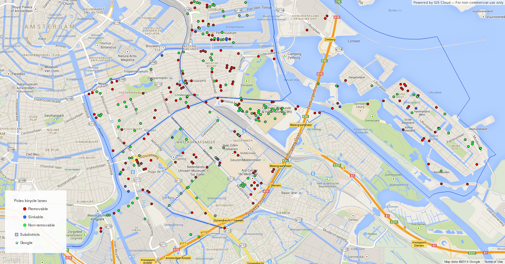
Mapping overview of maintenance work that needs to be done has been classified as: removable (red dots), sinkable (blue dots) and non – removable (green dots) bike poles in Distric East.
Results after mapping of the city infrastructure
Once all the data was collected, the City of Amsterdam managers had an interactive overview of all the bike poles in one map, with the ability to assign (monitoring) statuses to each pole. This enabled them to make decisions on needed repairs and to assign tasks to teams in the field.
A possibility to create custom forms with as many fields as needed (including different types of media like photos and audio) facilitates the data collecting process. As the survey forms can be updated and synced across devices at any moment, workflow and data management was faster and more efficient.
Mapping solution is user friendly and doesn’t require any additional knowledge, thus saving time as well as money usually spent on training staff.
Would you like to try GIS Cloud solution for traffic management? Sign up or contact us and we will help you find the right solution.