
An Interview with Darrel Larson (Give Clean Water Initiative)
Darrel Larson, as a chairman and founder of Give Clean Water Initiative, shared his experiences and daily challenges working with a non-profit initiative. Read about his insights on the game-changing role of GIS in his area of work and how technology is becoming more and more accessible to non-experts. He is currently leading GIS data collection process in Liberia which involves country-wide county surveys, tracking thousands of drilled wells, and tracking the distribution of over 100,000 clean drinking filter systems.
What used to take hours, days, weeks or even months – to share data through handwritten forms, then transferring them to Excel worksheets, now can all be shared in real time using GIS technology. The power of this technology is radically transforming the efficiency by which non profits can deliver life changing interventions around the world.
Introduce yourself, the Give Clean Water Initiative and your mission. How did you come to the idea for the Initiative?
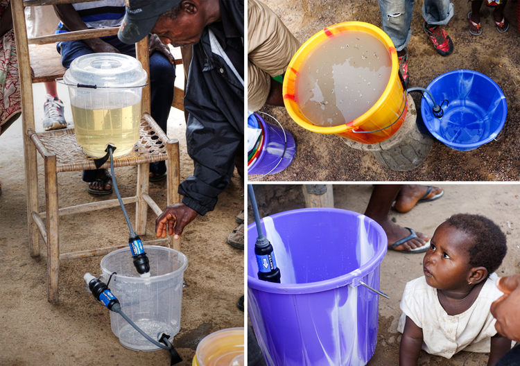
My name is Darrel Larson, and I’m the founder and chairman of the board for Give Clean Water. Since 2008, we’ve been providing a sustainable clean drinking water solution for the people of Fiji in partnership with the Fiji Ministry of Health. I’m also working as a consultant for Sawyer Products, the maker of the Point One water filter system that is used around the world. I’m teaching other non-profits how to use the Sawyer water filter in a sustainable way, while incorporating GIS training to track projects around the world.
In 2008, I was looking for a place to do a clean drinking water project, since contaminated water consumption was one of the biggest problems in the world. I chose Fiji because I had a great relationship and network of people there. Our goal has been to give clean drinking water to everyone in Fiji.
What projects are you currently working on? What are the accomplishments that you are most proud of so far?
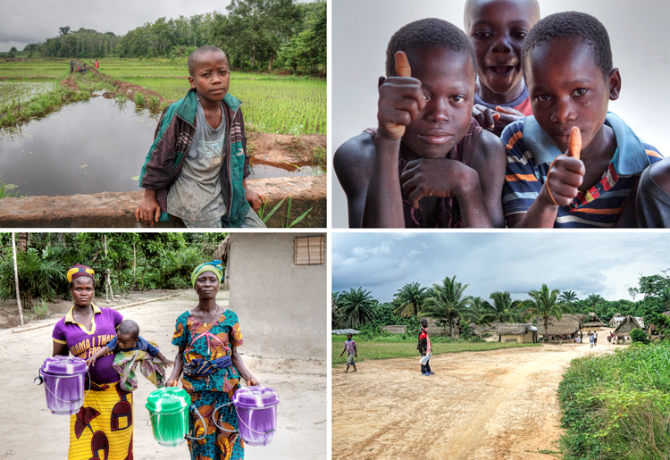
I’m currently working on the clean water project in Fiji, and also a big project in Liberia, Africa. In Fiji, we work directly with the Fiji Ministry of Health to determine the villages that are most vulnerable to contaminated water. Once identified, Give Clean Water uses GIS software to mark village households, collect water source data, and track water related health problems. We follow up with households at the 2 week, 8 week, and 1 year mark to document changes in health and sustainability of the project.
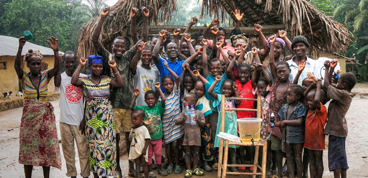
In Liberia, I’m part of an effort to give clean drinking water border to border, in every household, by December of 2020. The opportunity to work on this project was a direct result of the successes we’ve had in Fiji. I’m leading the GIS data collection process in Liberia which involves country-wide county surveys, tracking thousands of drilled wells, and tracking the distribution of over 100,000 clean drinking filter systems.
How does your regular working day look like? Are there any interesting stories from the field you would like to share with us?
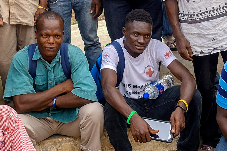
A typical day for me involves developing and fine tuning GIS data forms used to execute the projects in Fiji and Liberia. I also create the training materials for all the non-profit teams that are involved in water filter distribution. I work directly with a non-profit called The Last Well, who is organizing the Liberia effort. I help them to map out progress of that project, and to train and support the teams that are installing the water filter systems. I’m also actively involved in networking all the stakeholders together to ensure this collaborative effort can be achieved. I’m also helping to put together a big study with Johns Hopkins University on the effectiveness of eliminating diarrhea from children 0-5 years old.
What is the most challenging part of your work?
One of the biggest challenges of my work is working with different cultures and the behavior change associated with sustainability. Leading teams from different cultures presents many communication challenges. There are many teams involved in our projects who have limited cell phone coverage and limited internet availability. Language differences present challenges, as well as cultural norms and values.
Another big challenge is working in partnership with some leading universities around the world on this project. We’re involved in a couple of scientific studies showing the efficacy of decreasing cases of diarrhea by using the Sawyer water filters. Working with a bunch of highly educated research doctors definitely keeps me on my toes. I’m always learning new things, which is good.
What is the role of new technologies in the Non-profit sector and initiatives? Do you think that much has changed in the way things are done because of recent technological advancements such as expansion of smartphones?
Technology is rapidly impacting the non-profit world in great ways. What used to take hours, days, and weeks, or months, to share data through handwritten forms, then transferring them to Excel worksheets, now can all be shared in real time using GIS technology. The power of this technology is radically transforming the efficiency by which non profits can deliver life changing interventions around the world.
What is amazing is, even in the poorest countries in the world, everyone has cell phones. Smart phones and tablets are becoming more common and affordable. Because of that, things that would have once been impossible, are now very possible! The world is shrinking all around us. There was a day not that long ago that I could have never communicated with people in other countries. Now, they are my Facebook friends and I can use Messenger, Skype, and other technologies to communicate with people all around the world. It’s truly amazing.
“If I can set up the software, anyone can! That’s the beauty of it. I love the ease and power of this product! I sound like I’m doing a commercial for GIS Cloud, but I’m serious, this is one of the most intuitive products I’ve ever used.”
Using Mobile Data Collection is a part of of your fieldwork. How does this kind of software influence your daily decision-making and coordination with the team? Would you recommend similar approach to others who are working on similar field projects of non-profit initiatives?
Mobile Data Collection has changed my entire work process. What I love is the simple user interface. GIS Cloud has done all the heavy lifting of coding and made a very user friendly solution for me. I don’t write code, so after a lot of researching other GIS products, GIS Cloud Mobile Data Collection became the best solution for me. I believe there are huge opportunities for other non-profits to embrace this technology as part of their workflow. The ease of use, and the power of real time results, even off the cell or internet networks, is so powerful! The ROI a non-profit receives from this type of technology more than pays for itself. Once you use it, you would never want to go back. It would be like returning to the stone age without using GIS. Once non-profits recognize this value, it will become embraced world wide.
As somebody who doesn’t have background in geography and GIS, what is your opinion on the general benefits/importance of mapping technology in working on global initiatives in remote locations?
What I love most about GIS Cloud is that they do all the heavy lifting of the software coding. I am not a software engineer. I’m a project manager who happened to find out about the power of GIS technology. My challenge was, how can I harness the power of this technology without being an engineer. Then I found GIS Cloud. That was a game changer for me. Not only was the software solution perfect for a person like me, but it was affordable.
What I have loved most though is GIS Cloud’s commitment to customer service. They are simply the best at it I’ve ever seen. If I ever have a problem in the field, or while developing a GIS form, I simply contact their premium support department and in less than 24 hours, usually much faster, I have a solution! I am separated by 8 time zones from GIS Cloud headquarters, so naturally there are some minor time constraints, but they are really good at what they do! Good customer service is hard to come by these days, so the GIS Cloud team is a breath of fresh air!
Many influencers in the field claim that one of the most important trends in GIS software adoption is its democratization. Did you have any difficulties in setting up your project without previous experience in the field using cloud GIS technology and do you agree that it is a kind of software that could be used by anyone?
If I can set up the software, anyone can! That’s the beauty of it. I will say that not all personality types will enjoy working with GIS. For example, my wife probably would hate it. Haha! But if you like systems, and actually like getting powerful results with a few easy steps, then GIS Cloud’s solutions are for you. I love the ease and power of this product! I sound like I’m doing a commercial for GIS Cloud, but I’m serious, this is one of the most intuitive products I’ve ever used.
What are your plans for the future?
Right now, we’ve just cleared the first 67,000 clean water filters from customs in Liberia, so that project is about to be in full swing. I’m helping lead a clean water relief effort in Fiji as they’ve just experienced a direct hit from the most powerful cyclone ever recorded a few weeks ago.
Down the road, I hope to take the systems we’ve created in Fiji and Liberia, and pass it along to other non profits around the world so we can see some dramatic life change happen in our lifetime!
Follow Give Clean Water Initiative on Facebook.
Want to try out Mobile Data Collection for yourself? Sign up here.