Why use cloud-based applications in your institutional workflows?

We opened the first part of the discussion on GIS for Academic Purposes with an overview of basic usages of geospatial technologies at institutions primarily engaged in education and research. The merit of interdisciplinary research projects at universities and research centers is a successful collaboration between departments and individual researchers. Collaboration practices improve with the technological development, as supporting tools are becoming faster, easier to use and more accessible. This is especially highlighted within the advancement of geospatial technologies.
The value of efficient collaboration is also known to educators as well as to makers of educational policies. There is a significant number of researchers, educators and policymakers who are using geospatial tools as a supplement to their projects. Most of them, except maybe geographers, are not necessarily experts in managing large amounts of data generated with the help of mapping tools.
Mapping tools are commonly used in the form of desktop-based programs which are dependent on the performance of computers, often not too friendly to end-users and, finally, definitely not the collaboration tool of choice.
So, what’s the alternative, suited for use in research, education and educational policies?
Cloud GIS solutions offer by definition a great collaboration ability.
What is Cloud GIS?
“Cloud GIS is often defined as a next generation on-demand GIS technology that uses a virtual platform and infrastructure in a scalable elastic environment.“
While traditional GIS is installed on your desktop or server, Cloud GIS makes use of the flexibility of the cloud environment for data collection, visualization, analysis, sharing and publishing.
If you upload a great amount of data on the cloud, you have not only solved a problem of relying on one particular desktop computer, but also opened yourself to a real-time collaboration with your colleagues and research partners.
For example, if you are mapping a particular area collecting the data on dangerous pathogens, you can easily access the map from your smartphone or tablet and update it in real time. It is also possible to attach various types of data such as photos, notes, audio records etc. to a specific location on a map, together with the detailed instruction on action to be performed and a list of tasks.

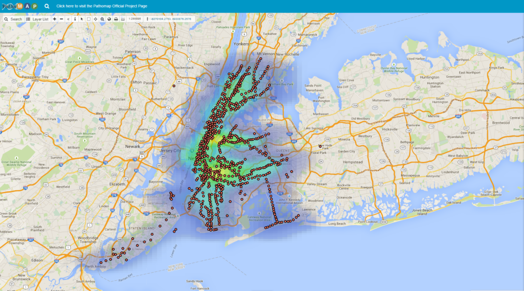
Patho Map – an example from a project coming from Weill Cornell Medical College
You can also manage the data from any location on any device which allows you to browse the internet, while the map performance depends solely on the application, and not the device you are using.
More and more people are relying on the cloud-based solutions essential for their workflows and efficient project execution. Cloud based solutions are not only cost-efficient, but also more functional when it comes to projects which include many people. Work conditions at universities, schools and research centers are highly collaborative and this is the reason why cloud-based software is perfect in academic environment. Project managers often have to rely on tight budgets reserved primarily for expensive equipment. This doesn’t have to be the case with the software tools which support the workflow efficiency.
Cloud GIS solutions are reliable, easy to use on any device and also cost efficient in comparison with desktop solutions, which complicate the workflow mainly in the aspect of sharing large data sets, and in case when fieldwork is required, investing in field devices can be quite expensive.
Also, if a project requires some kind of community engagement, the easiest way to create publicly available information is having it already settled on a cloud. Public maps in this instance are just few clicks away and a matter of assigning a licence.
Let’s summarize some of the benefits of working in the cloud environment, applicable to work conditions in science, education and educational planning:
- The best environment for data sharing and real time collaboration with other users who can create, edit, manage and update the maps
- It enables managing large volumes of data, application management and geospatial analytic tools
- Managed services prevent data and work loss from frequent outages, minimizing financial risks, while increasing efficiency
- Offers a competitive advantage – it is faster to share and publish maps, with always on always available maps


