GIS Cloud Track

Tracking fleet, people and assets

Track for web and mobile.

Real-time tracking, visualization, alerting and reporting.

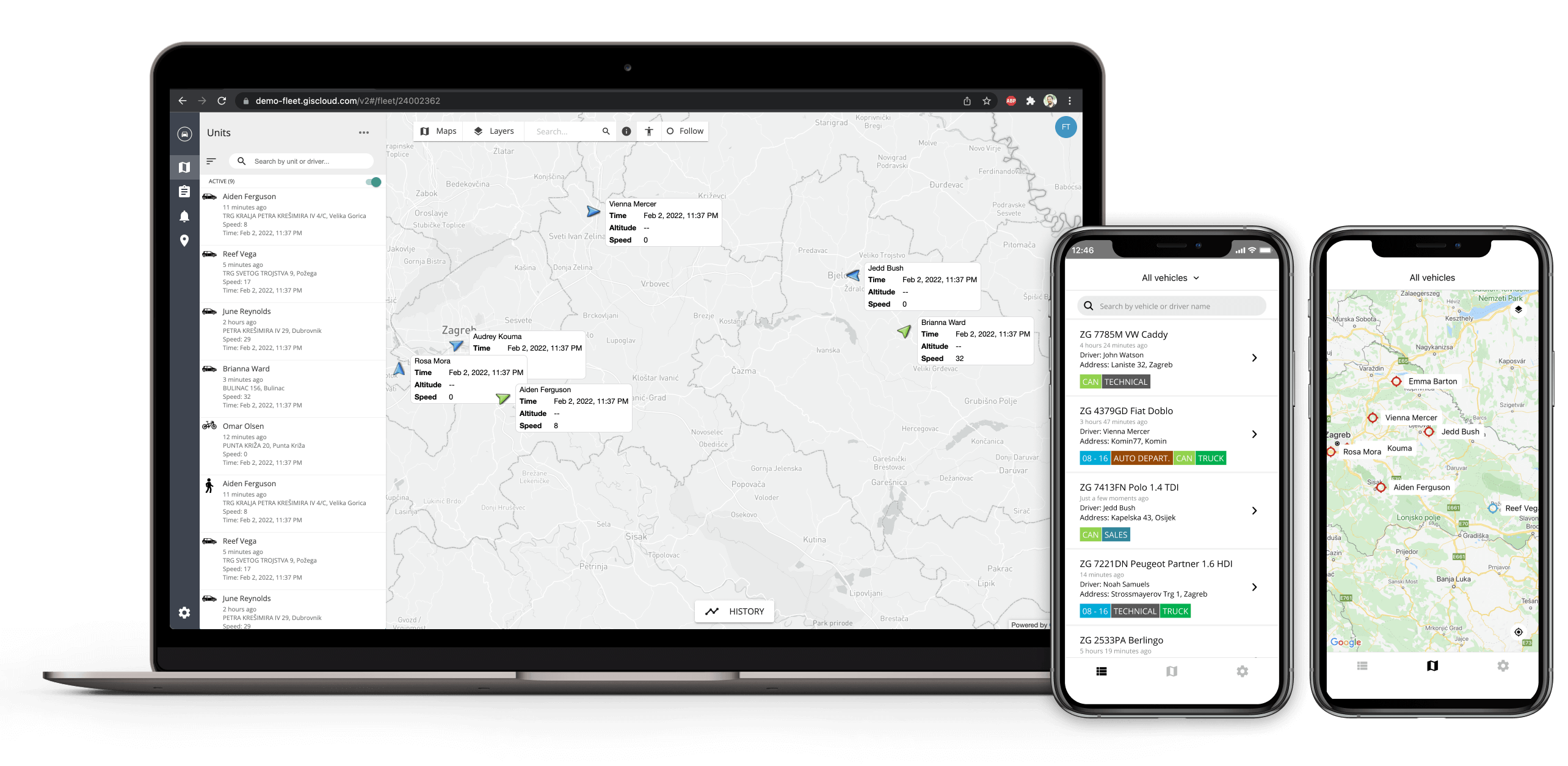
Insights into the real-time location of people, vehicles, fixed assets, and IoT!

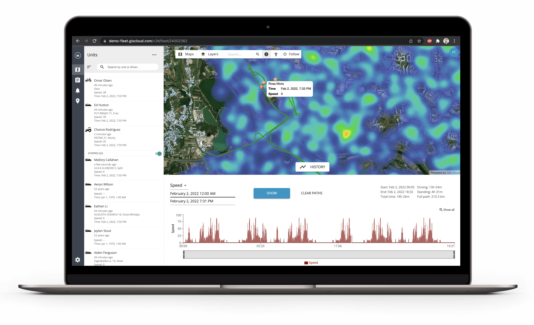
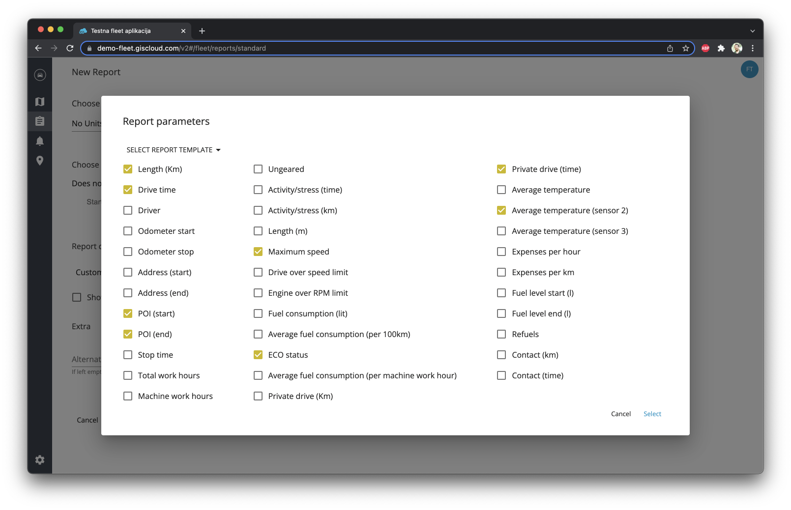
GIS Cloud Track enables dynamic visualization of assets in real-time, getting in-depth reports, charts, and historical data.

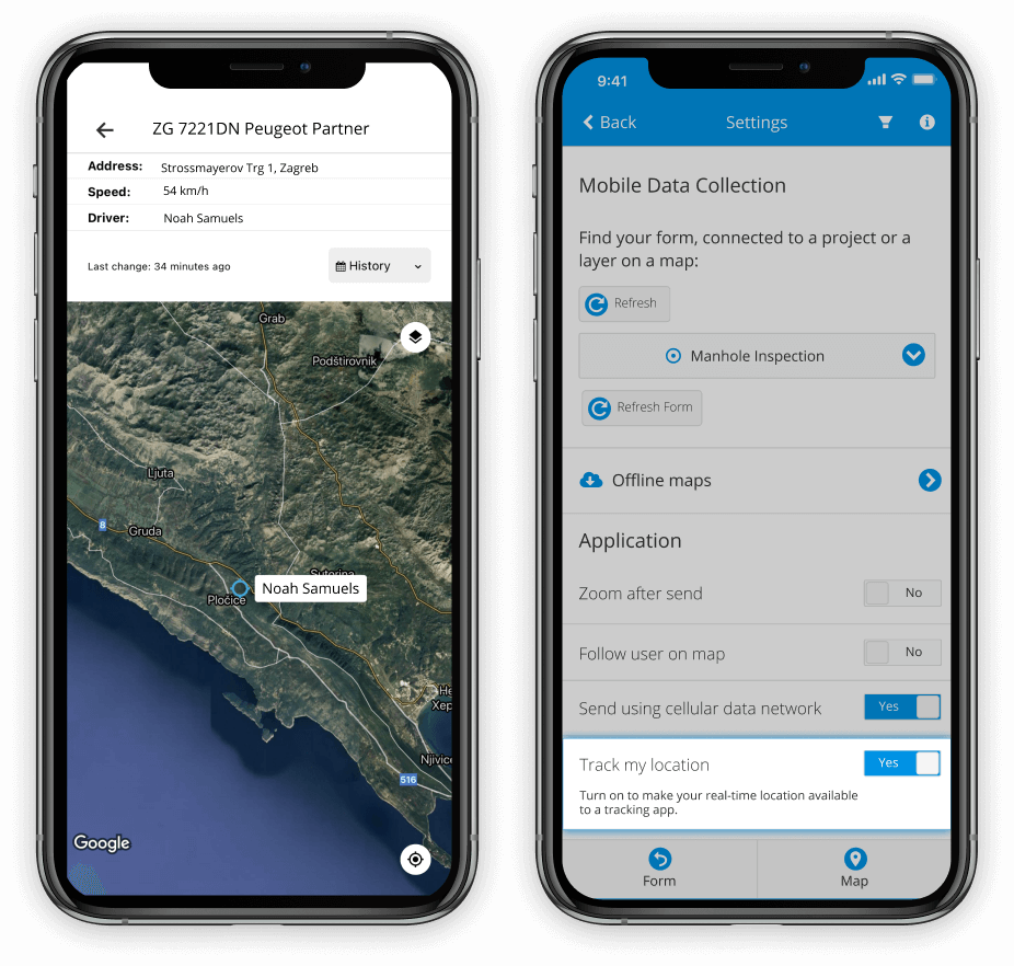
The solution is fully integrated with the entire GIS Cloud platform! Maps created in Map Editor and data collected with Mobile Data Collection can serve as basemaps in Track.

Try It Free - Contact Us

Tracking meets GIS.

Track anything.

Track Anything in Real-time

  • iOS and Android Devices
  • Vehicles
  • Sensors
  • IoT
  • Anything with API
Instant visibility of teams and assets.

Instant Location Visibility of Teams and Assets

Location information and parameters like time, speed, altitude, etc., are displayed on a map with a few seconds refresh interval.

Ensure safety and optimize workflows.

Ensure Safety and Optimize Workflows

Be aware of your teams and assets status at any point in time. 
Analyze and optimize work & performance.
Charts and reports.

In-depth Reporting & Alerting

Get daily, monthly, annual, or custom reports on traveled distance, geo-fencing, speed and various other attributes.

Historical data.

Insight into Historical Data

Get historical traces of tracked locations and charts visualizing information like speed, time and other sensor information.

Full GIS integration.

Fully Integrated with GIS

Bring in your data and track assets on top of custom-built maps.
Choose a map you built in Map Editor and open it in Track.

Your Data in Real-time.

Enable tracking on mobile devices.

You can track:

  • iOS and Android devices
    Integrated with the Mobile Data Collection app for iOS and Android

    Tracking can be turned on/off at any time using one button
  • GPS Devices
    Connect a built-in GPS device directly with our system

    Contact us for compatibility
  • IoT / Sensors / Anything
    Use the Track API to send and track any location/data in real-time

Access and Visualize

  • Available on Web and Mobile
  • Location of tracked assets is visible on a map in real-time, in the context of other data and layers
  • Assets can be visualized with different colors according to their status
  • Get insights into real-time data or historical information
  • Label/Group and organize tracked items
Visualize on custom built maps.
Get reports using many parameters.

Generate Reports

  • Choose daily, weekly, monthly, annual, or custom reports
  • Pick and choose which attributes and information you want to retrieve
  • Setup recurring period for automated reporting
  • Enter email address for report delivery

Setup Instant Alerts

  • Get alert if tracked assets enter a geofenced zone
  • Get alert if the asset sensor, i.e., parameter, changes its value
Setup alerting.
Follow GIS Cloud 

Terms of use & Privacy policy  © GIS Cloud Ltd